Creag Dhubh Coille a' Bhun

Hill, Mountain in Ross-shire

Scotland

Creag Dhubh Coille a' Bhun

The Dundonnell River Flowing past Creag Dhubh Coille a' Bhun.
The Dundonnell River Credit: Peter Jeffery

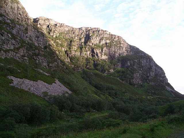
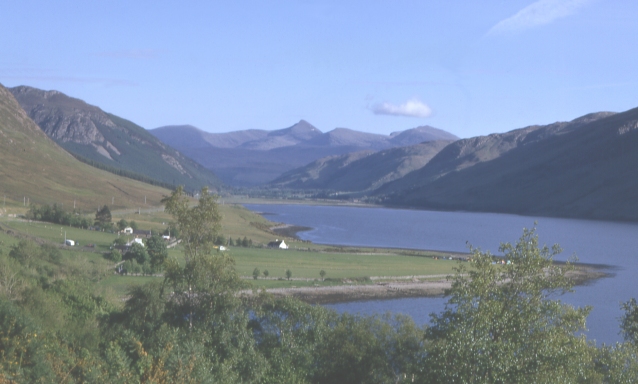
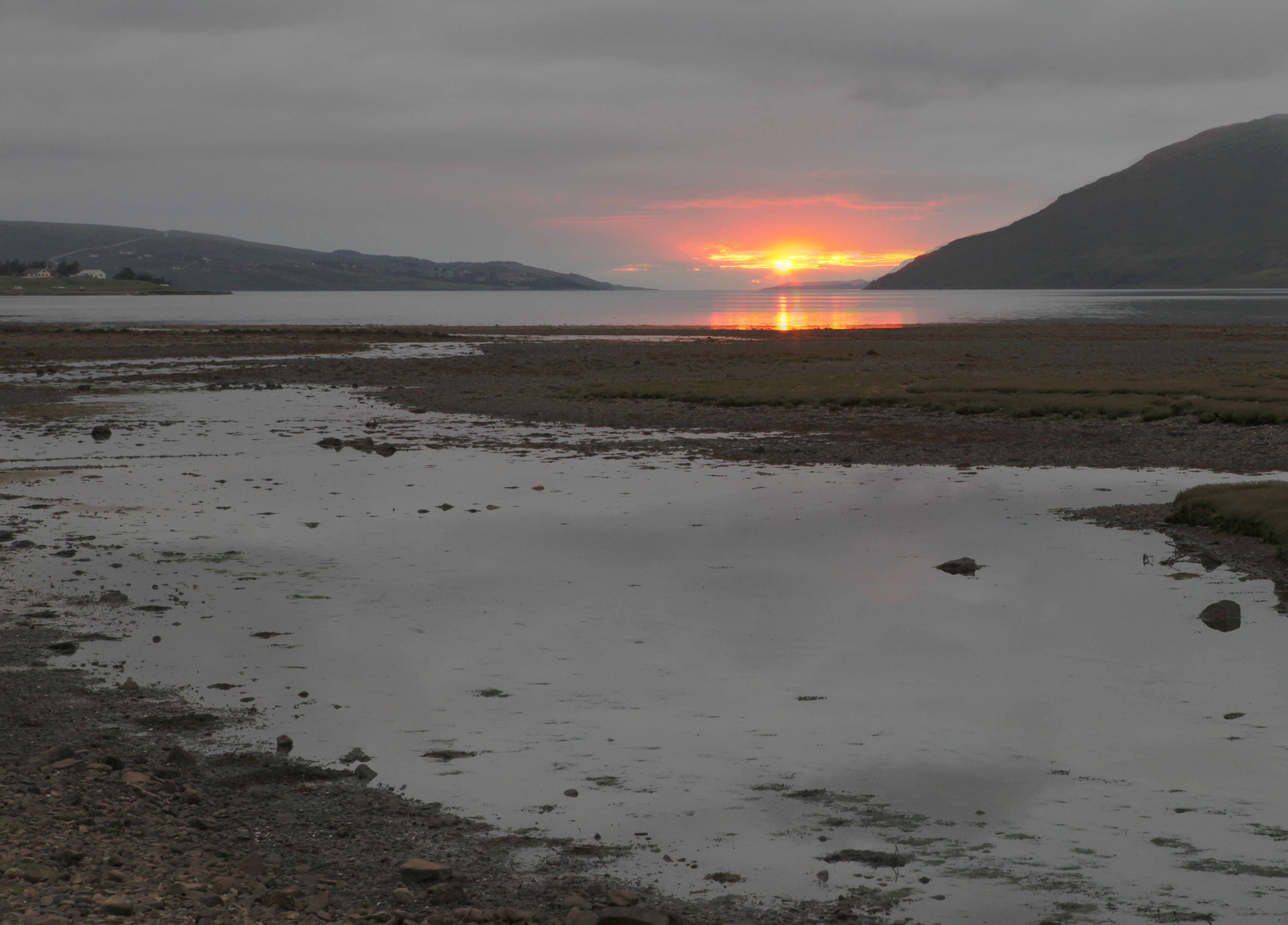
Creag Dhubh Coille a' Bhun is a prominent hill located in Ross-shire, Scotland. With an elevation of approximately 354 meters (1,161 feet), it offers breathtaking panoramic views of the surrounding landscape. The hill is part of the larger Ben Wyvis range and is situated in the heart of the Scottish Highlands.

Creag Dhubh Coille a' Bhun is characterized by its rugged and rocky terrain, making it a popular destination for outdoor enthusiasts and hikers. The hill is covered in heather and scattered with boulders, adding to its wild and untamed beauty. The ascent to the summit can be challenging but rewarding, as it offers stunning vistas of the nearby lochs and glens.

The hill is home to a variety of wildlife, including red deer, mountain hares, and various bird species such as golden eagles and peregrine falcons. It is also known for its rich flora, with a diverse range of plant species, including wildflowers and mosses.

Creag Dhubh Coille a' Bhun is easily accessible from the nearby town of Dingwall, with various paths and trails leading to the summit. The hill attracts both experienced hikers and casual walkers, offering a range of routes suitable for different levels of fitness and expertise.

Overall, Creag Dhubh Coille a' Bhun is a stunning natural landmark in Ross-shire, providing visitors with a chance to immerse themselves in the untouched beauty of the Scottish Highlands.

If you have any feedback on the listing, please let us know in the comments section below.

Creag Dhubh Coille a' Bhun Images

Images are sourced within 2km of 57.806076/-5.1383469 or Grid Reference NH1383. Thanks to Geograph Open Source API. All images are credited.

The Dundonnell River Flowing past Creag Dhubh Coille a' Bhun.
The Dundonnell River
Flowing past Creag Dhubh Coille a' Bhun.
A832  toward  Dundonnell The Dundonnell River is below on the right having dropped over a number of waterfalls since passing under Fain Bridge
A832 toward Dundonnell
The Dundonnell River is below on the right having dropped over a number of waterfalls since passing under Fain Bridge
Looking  back  up  the  pass The Dundonnell River bottom left, A832 top right
Looking back up the pass
The Dundonnell River bottom left, A832 top right
Road (A832) in the shadow of Creag Dhubh Coille a' Bhun Looking north-eastward.
Road (A832) in the shadow of Creag Dhubh Coille a' Bhun
Looking north-eastward.
Road (A832) between Airigh Ghoirid and Dundonnell River Looking north-westward from a small parking area.
Road (A832) between Airigh Ghoirid and Dundonnell River
Looking north-westward from a small parking area.
A832 The A832 runs 127 miles from the Black Isle to Braemore Junction <a href="https://www.geograph.org.uk/photo/7232275">NH2077 : Braemore Junction</a>.
<span class="nowrap"><a title="https://www.sabre-roads.org.uk/wiki/index.php?title=A832" rel="nofollow ugc noopener" href="https://www.sabre-roads.org.uk/wiki/index.php?title=A832">Link</a><img style="margin-left:2px;" alt="External link" title="External link - shift click to open in new window" src="https://s1.geograph.org.uk/img/external.png" width="10" height="10"/></span>
A832
The A832 runs 127 miles from the Black Isle to Braemore Junction NH2077 : Braemore Junction. LinkExternal link
NC500 The A832 runs 127 miles from the Black Isle to Braemore Junction <a href="https://www.geograph.org.uk/photo/7232275">NH2077 : Braemore Junction</a>.
<span class="nowrap"><a title="https://www.sabre-roads.org.uk/wiki/index.php?title=A832" rel="nofollow ugc noopener" href="https://www.sabre-roads.org.uk/wiki/index.php?title=A832">Link</a><img style="margin-left:2px;" alt="External link" title="External link - shift click to open in new window" src="https://s1.geograph.org.uk/img/external.png" width="10" height="10"/></span>
NC500
The A832 runs 127 miles from the Black Isle to Braemore Junction NH2077 : Braemore Junction. LinkExternal link
A832 The North Coast 500 is a 516 mile scenic route around the north coast of Scotland, starting and ending at Inverness Castle. The route is also known as the NC500 and was launched in 2015, linking many features in the north Highlands of Scotland in one touring route.
The route has increased visitor numbers to parts of the north of Scotland, which has brought economic benefits to some areas. The increase in traffic has also led to more instances of bad and dangerous driving, as well as damage to the roads and concerns about the environmental impact. 
Apparently the route was amended in 2022 with detours etc being removed.
Wikipedia: <span class="nowrap"><a title="https://en.wikipedia.org/wiki/North_Coast_500" rel="nofollow ugc noopener" href="https://en.wikipedia.org/wiki/North_Coast_500">Link</a><img style="margin-left:2px;" alt="External link" title="External link - shift click to open in new window" src="https://s1.geograph.org.uk/img/external.png" width="10" height="10"/></span> 
Original route map: <span class="nowrap"><a title="https://en.wikipedia.org/wiki/North_Coast_500#/media/File:North_Coast_500,_Scotland.svg" rel="nofollow ugc noopener" href="https://en.wikipedia.org/wiki/North_Coast_500#/media/File:North_Coast_500,_Scotland.svg">Link</a><img style="margin-left:2px;" alt="External link" title="External link - shift click to open in new window" src="https://s1.geograph.org.uk/img/external.png" width="10" height="10"/></span> 
Latest route map: <span class="nowrap"><a title="https://www.northcoast500.com/explore-the-route/" rel="nofollow ugc noopener" href="https://www.northcoast500.com/explore-the-route/">Link</a><img style="margin-left:2px;" alt="External link" title="External link - shift click to open in new window" src="https://s1.geograph.org.uk/img/external.png" width="10" height="10"/></span>
A832
The North Coast 500 is a 516 mile scenic route around the north coast of Scotland, starting and ending at Inverness Castle. The route is also known as the NC500 and was launched in 2015, linking many features in the north Highlands of Scotland in one touring route. The route has increased visitor numbers to parts of the north of Scotland, which has brought economic benefits to some areas. The increase in traffic has also led to more instances of bad and dangerous driving, as well as damage to the roads and concerns about the environmental impact. Apparently the route was amended in 2022 with detours etc being removed. Wikipedia: LinkExternal link Original route map: LinkExternal link Latest route map: LinkExternal link
A832 The A832 runs 127 miles from the Black Isle to Braemore Junction <a href="https://www.geograph.org.uk/photo/7232275">NH2077 : Braemore Junction</a>.
<span class="nowrap"><a title="https://www.sabre-roads.org.uk/wiki/index.php?title=A832" rel="nofollow ugc noopener" href="https://www.sabre-roads.org.uk/wiki/index.php?title=A832">Link</a><img style="margin-left:2px;" alt="External link" title="External link - shift click to open in new window" src="https://s1.geograph.org.uk/img/external.png" width="10" height="10"/></span>
A832
The A832 runs 127 miles from the Black Isle to Braemore Junction NH2077 : Braemore Junction. LinkExternal link
Replanted forestry Cleared and replanted.
Replanted forestry
Cleared and replanted.
A832 by Dundonnell River
A832 through Dundonnell Forest An Teallach behind.
A832 through Dundonnell Forest
An Teallach behind.
Crags, Dundonnell River Part of the long high escarpment on the other side of the Dundonnell River from the A832.
Crags, Dundonnell River
Part of the long high escarpment on the other side of the Dundonnell River from the A832.
Crags, Dundonnell River The final stretch of crags shadowing the A832 going S from Dundonnell
Crags, Dundonnell River
The final stretch of crags shadowing the A832 going S from Dundonnell
Burn, Allt a Chairn Looking WSW towards An Teallach
Burn, Allt a Chairn
Looking WSW towards An Teallach
NW ridge, Carn a Bhiorain Looking SW across the Allt a Chairn
NW ridge, Carn a Bhiorain
Looking SW across the Allt a Chairn
Icy path, Allt a Chairn Looking WNW along the path connecting Strath Beag and Strath More
Icy path, Allt a Chairn
Looking WNW along the path connecting Strath Beag and Strath More
Show me another place!

Creag Dhubh Coille a' Bhun is located at Grid Ref: NH1383 (Lat: 57.806076, Lng: -5.1383469)

Unitary Authority: Highland

Police Authority: Highlands and Islands

What 3 Words

///conqueror.crucially.tips. Near Ullapool, Highland

Related Wikis

Letters, Wester Ross

Letters (Scottish Gaelic: An Leitir) is a village on the south west shore of Loch Broom, in Garve, Ross-shire, Scottish Highlands and is in the Scottish...

Ardindrean

Ardindrean (Scottish Gaelic: Àird an Dreaghainn) is a small hamlet, located on the west shore of Loch Broom in Garve, Ross-shire and is within the Highland...

Inverlael

Inverlael is a hamlet on the southern tip of Loch Broom in Ross-shire in the Highland council area in Scotland. It is located on the A835 main road 6 miles...

Ardcharnich

Ardcharnich (; Scottish Gaelic: Àird Cheatharnaich) is a crofting township in the parish of Loch Broom, Wester Ross in the Highland, within the Scottish...

Dundonnell

Dundonnell (Gaelic: Achadh Dà Dhòmhnaill) is a village in Ross and Cromarty, Scotland, on the south side of Little Loch Broom and at the foot of An Teallach...

Blarnalearoch

Blarnalearoch is a remote crofting township situated on the west shore of Loch Broom in Garve, Ross-shire, Scottish Highlands and is in the Scottish council...

Rhiroy

Rhiroy is a remote crofting township situated on the west shore of Loch Broom in Garve, Ross-shire, Scottish Highlands and is in the Scottish council area...

Auchindrean

Auchindrean (Scottish Gaelic: Achadh an Dreaghainn) is a small settlement close to the southern end of Loch Broom in Wester Ross, in the Highland council...

Nearby Amenities

Located within 500m of 57.806076,-5.1383469
Carn a Bhiorain
Ele: 506
Natural: peak
Lat/Long: 57.8040468/-5.1318116
The data included in this document is from www.openstreetmap.org. The data is made available under ODbL.

Have you been to Creag Dhubh Coille a' Bhun?

Leave your review of Creag Dhubh Coille a' Bhun below (or comments, questions and feedback).