An Riabhachan

Hill, Mountain in Ross-shire

Scotland

An Riabhachan

Bealach Toll an Lochain
Bealach Toll an Lochain Credit: Alan Reid

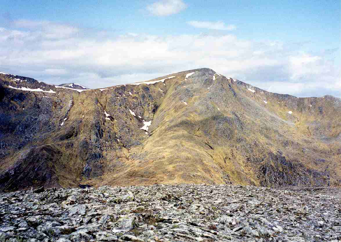
An Riabhachan is a prominent hill located in Ross-shire, Scotland. Standing at an elevation of 1,129 meters (3,704 feet), it is considered one of the Munros, which are mountains in Scotland with a height of at least 3,000 feet.

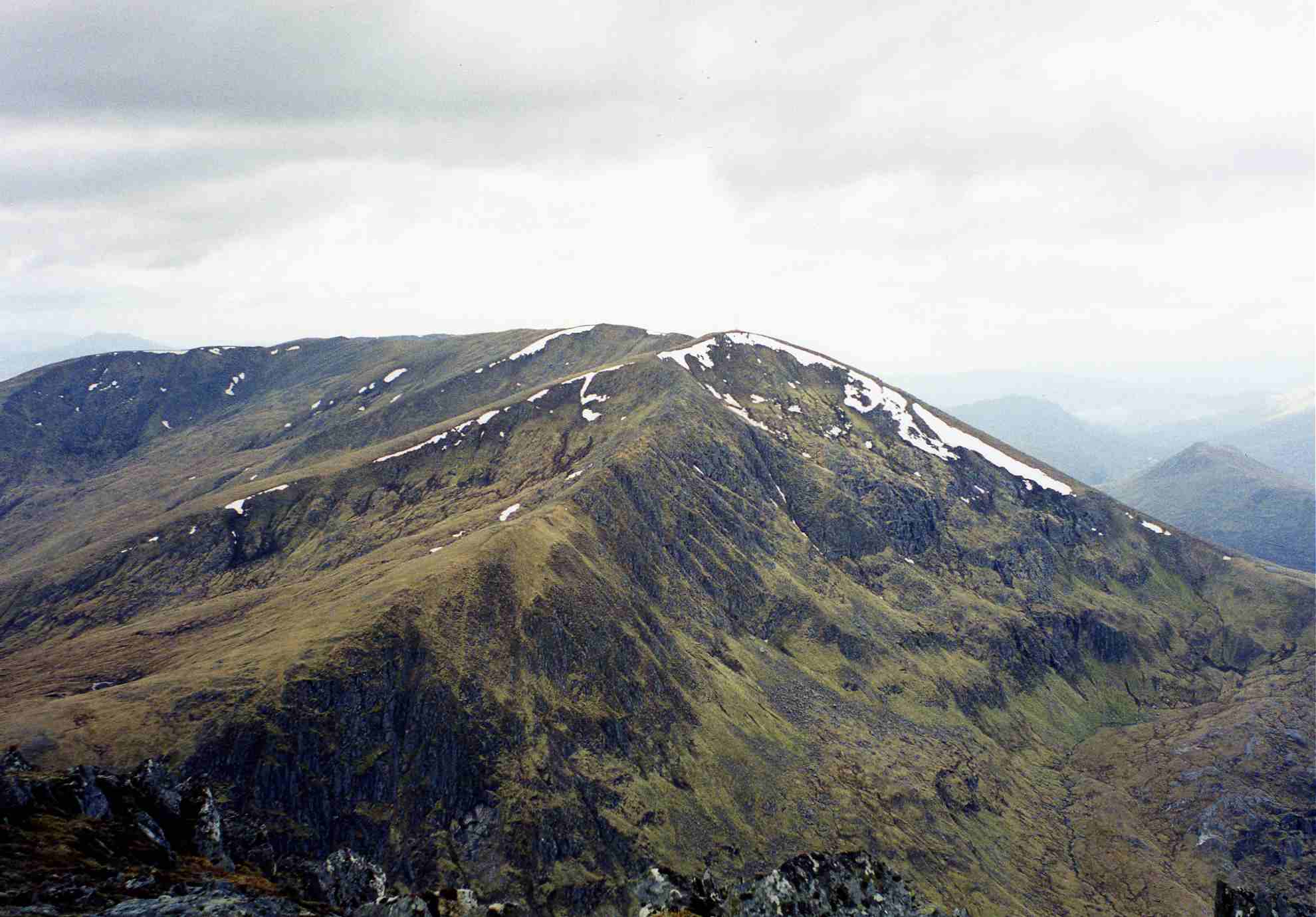
This majestic peak is part of the vast mountain range of the Scottish Highlands, known for its rugged and dramatic landscapes. An Riabhachan is situated in a remote and wild area, surrounded by other peaks such as Sgurr na Lapaich and Carn nan Gobhar.

The mountain is characterized by its steep slopes and rocky terrain, offering a challenging ascent for experienced hikers and mountaineers. The route to the summit is often described as a demanding and strenuous climb, requiring a good level of fitness and navigation skills.

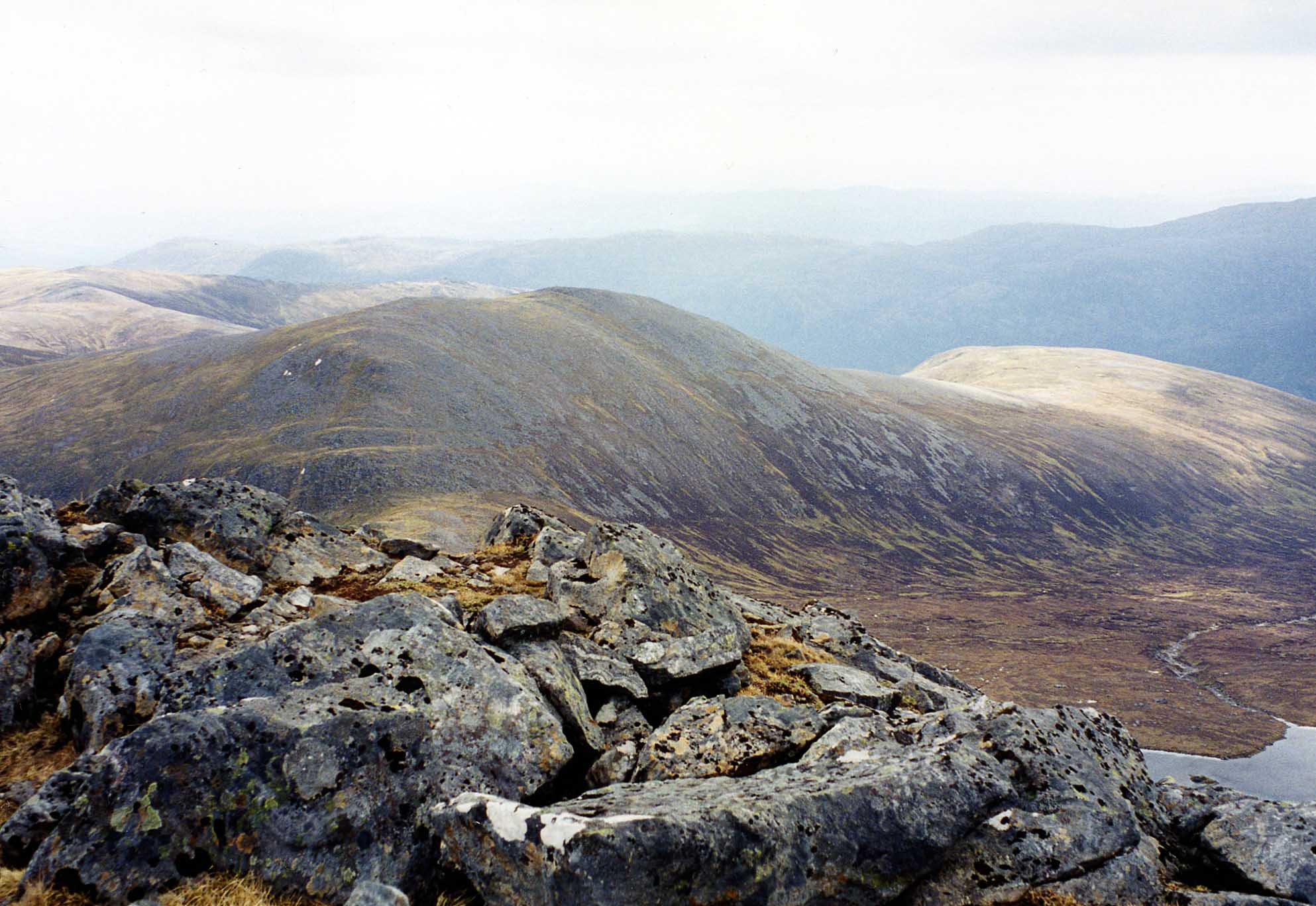
From the top of An Riabhachan, hikers are rewarded with breathtaking panoramic views of the surrounding wilderness. On a clear day, one can admire the vast expanse of the Scottish Highlands, with its rolling hills, deep valleys, and shimmering lochs.

Due to its remote location, An Riabhachan is less frequented by tourists compared to some other Munros. This makes it an ideal destination for those seeking solitude and a true wilderness experience. However, it is crucial for visitors to come well-prepared, as the weather conditions in the Scottish Highlands can be unpredictable, with sudden changes in temperature and visibility.

In conclusion, An Riabhachan is a challenging and awe-inspiring mountain in Ross-shire, Scotland. It offers a rewarding adventure for experienced hikers, showcasing the raw beauty of the Scottish Highlands.

If you have any feedback on the listing, please let us know in the comments section below.

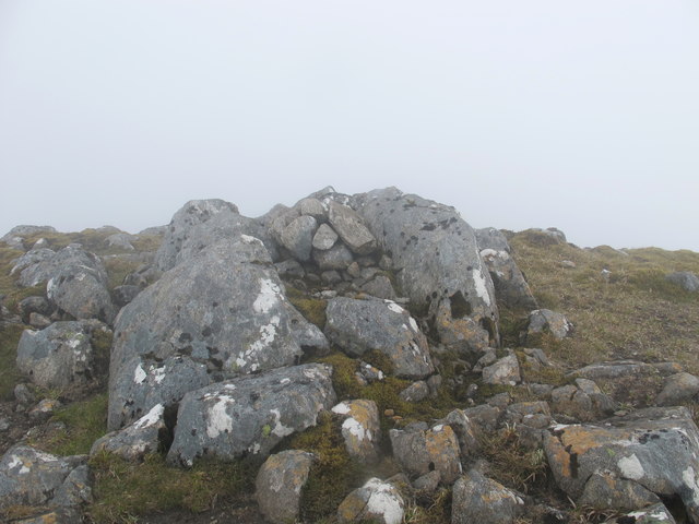
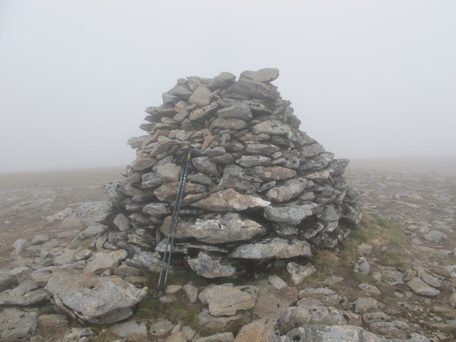
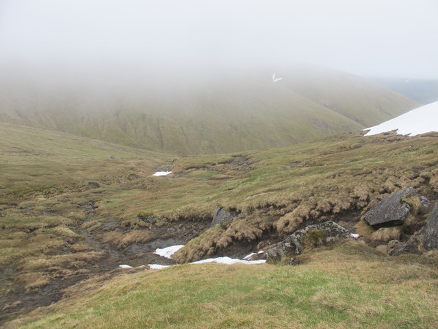
An Riabhachan Images

Images are sourced within 2km of 57.362423/-5.1046503 or Grid Reference NH1334. Thanks to Geograph Open Source API. All images are credited.

Bealach Toll an Lochain
Fuaran Riabhachain A spring line on the gentle north side of An Riabhachan.  I had just escaped the wind blasted summit ridge with bruising and a wrecked pack from being lifted and dumped by the wind.  I needed at one point to ice axe break on flat ground as I was being blown around like tumbleweed.  Down here was a different world.

View over Pait Lodge and Strath More with the "tide line" on Loch Monar.
Fuaran Riabhachain
A spring line on the gentle north side of An Riabhachan. I had just escaped the wind blasted summit ridge with bruising and a wrecked pack from being lifted and dumped by the wind. I needed at one point to ice axe break on flat ground as I was being blown around like tumbleweed. Down here was a different world. View over Pait Lodge and Strath More with the "tide line" on Loch Monar.
An Riabhachan - West Top This small pile of stones marks the summit of the listed Munro satellite top to the West of the main summit of An Riabhachan.
An Riabhachan - West Top
This small pile of stones marks the summit of the listed Munro satellite top to the West of the main summit of An Riabhachan.
An Riabhachan - South West Top This small cairn marks the summit of the listed Munro satellite top to the South West of the main summit of An Riabhachan
An Riabhachan - South West Top
This small cairn marks the summit of the listed Munro satellite top to the South West of the main summit of An Riabhachan
Summit Cairn on An Riabhachan
Summit Ridge to the East of An Riabhachan Not much to see, but I submitted this to show the near white out conditions experienced on 23-June. The ridge was covered in moderately hard snow and there were cornices to the left of the picture. At one point the line between land and sky could not be determined. Need to be careful!
Summit Ridge to the East of An Riabhachan
Not much to see, but I submitted this to show the near white out conditions experienced on 23-June. The ridge was covered in moderately hard snow and there were cornices to the left of the picture. At one point the line between land and sky could not be determined. Need to be careful!
Looking Into An Garbh-choire On the descent back to Loch Mullardoch. This was the first half decent view since rising above the low cloud South-West of An Socach earlier in the day.
Looking Into An Garbh-choire
On the descent back to Loch Mullardoch. This was the first half decent view since rising above the low cloud South-West of An Socach earlier in the day.
Coire Socrach and Allt Socrach Seen from below the ridge of An Riabhachan.
Coire Socrach and Allt Socrach
Seen from below the ridge of An Riabhachan.
Toll na Feurstaig With the spur of Sron na Frithe above.
Toll na Feurstaig
With the spur of Sron na Frithe above.
Looking Down Coire Socrach A small corner of Loch Mullardoch can just be seen left of centre of the photo.
Looking Down Coire Socrach
A small corner of Loch Mullardoch can just be seen left of centre of the photo.
Bridge Over Allt Socrach This bridge makes crossing this fast flowing river a lot easier. The cloud topped mountain in the centre distance is Beinn Fhionnlaidh.
Bridge Over Allt Socrach
This bridge makes crossing this fast flowing river a lot easier. The cloud topped mountain in the centre distance is Beinn Fhionnlaidh.
A Fast Flowing Allt Socrach Even this far up in the coire it would be difficult to cross.
A Fast Flowing Allt Socrach
Even this far up in the coire it would be difficult to cross.
Allt Socrach Running From Coire Socrach Even for late June there is still a lot of snow melt making this a fast flowing river, almost impossible to cross. However, there is a bridge upstream - see <a href="https://www.geograph.org.uk/photo/4541123">NH1432 : Bridge Over Allt Socrach</a>. The cloud topped ridge above is An Riabhachan.
Allt Socrach Running From Coire Socrach
Even for late June there is still a lot of snow melt making this a fast flowing river, almost impossible to cross. However, there is a bridge upstream - see NH1432 : Bridge Over Allt Socrach. The cloud topped ridge above is An Riabhachan.
Sron na Frithe From the track to Coire Socrach.
Sron na Frithe
From the track to Coire Socrach.
Waterfall on Allt Socrach With Sron na Frithe above.
Waterfall on Allt Socrach
With Sron na Frithe above.
An Riabhachan From the summit, looking along the east ridge, with Sgurr na Lapaich behind.
An Riabhachan
From the summit, looking along the east ridge, with Sgurr na Lapaich behind.
An Riabhachan The western ridges of An Riabhachan are shaped (on the map) like an ice-axe. This shows the north-western end of the hammerhead and the ridge continuing from there to An Socach.
An Riabhachan
The western ridges of An Riabhachan are shaped (on the map) like an ice-axe. This shows the north-western end of the hammerhead and the ridge continuing from there to An Socach.
An Riabhachan The ridge continuing to the summit from the top at the southwest end of the summit ridge.
An Riabhachan
The ridge continuing to the summit from the top at the southwest end of the summit ridge.
Show me another place!

An Riabhachan is located at Grid Ref: NH1334 (Lat: 57.362423, Lng: -5.1046503)

Unitary Authority: Highland

Police Authority: Highlands and Islands

What 3 Words

///puns.butlers.clattered. Near Cannich, Highland

Nearby Locations

An Riabhachan

Related Wikis

An Riabhachan

An Riabhachan is a Scottish mountain in the Skye and Lochalsh district of the Highland council area. It is situated 35 kilometres east of Kyle of Lochalsh...

Sgùrr na Lapaich

Sgurr na Lapaich is a mountain in the Northwest Highlands of Scotland, situated north of Loch Mullardoch in the high ground that separates Glen Cannich...

An Socach (Glen Cannich)

An Socach is a mountain at the head of Glen Cannich, in the Highlands of Scotland. It is situated between Loch Mullardoch in Glen Cannich, and Loch Monar...

Càrn nan Gobhar (Mullardoch)

Càrn nan Gobhar is a mountain rising to 993 metres (3,258 ft) in the Northwest Highlands of Scotland. It stands on the northern side of Loch Mullardoch...

Nearby Amenities

Located within 500m of 57.362423,-5.1046503
An Riabhachan
Description: The brindled greyish one
Ele: 1129
Marilyn: yes
Munro: yes
Munro Number: M029
Natural: peak
Prominence: 301
Source: NPE
Wikidata: Q1811755
Wikipedia: en:An Riabhachan
Lat/Long: 57.362434/-5.1047124
The data included in this document is from www.openstreetmap.org. The data is made available under ODbL.

Have you been to An Riabhachan?

Leave your review of An Riabhachan below (or comments, questions and feedback).