White Hill

Hill, Mountain in Ayrshire

Scotland

White Hill

Looking Over The Main Water of Luce Dalnigap Farm on the other side.
Looking Over The Main Water of Luce Credit: Jon Alexander

White Hill is a prominent hill located in Ayrshire, Scotland. It stands at an elevation of 481 meters (1,578 feet) and is part of the Carrick Hills range. The hill is situated approximately 7 kilometers (4 miles) southeast of the town of Ayr and overlooks the surrounding landscape.

White Hill is characterized by its gently sloping terrain and grassy slopes, making it a popular destination for hikers and nature enthusiasts. The hill offers panoramic views of the surrounding countryside, including the nearby towns and villages, as well as the coastline of the Firth of Clyde.

The hill is covered in a mixture of grasses and heather, creating a diverse habitat for various plant and animal species. It is home to a range of bird species, including buzzards, kestrels, and peregrine falcons, which can often be spotted soaring above the hill. Additionally, the hill is known for its rich archaeological heritage, with various prehistoric sites and burial mounds scattered across its slopes.

White Hill is easily accessible via several footpaths and trails that lead up to its summit. These paths are well-maintained, offering visitors a relatively easy hike to the top. On a clear day, the summit provides breathtaking views of the surrounding countryside, making it a popular spot for picnics and photography.

Overall, White Hill is a picturesque and historically significant landmark in Ayrshire, offering visitors a chance to experience the natural beauty and cultural heritage of the region.

If you have any feedback on the listing, please let us know in the comments section below.
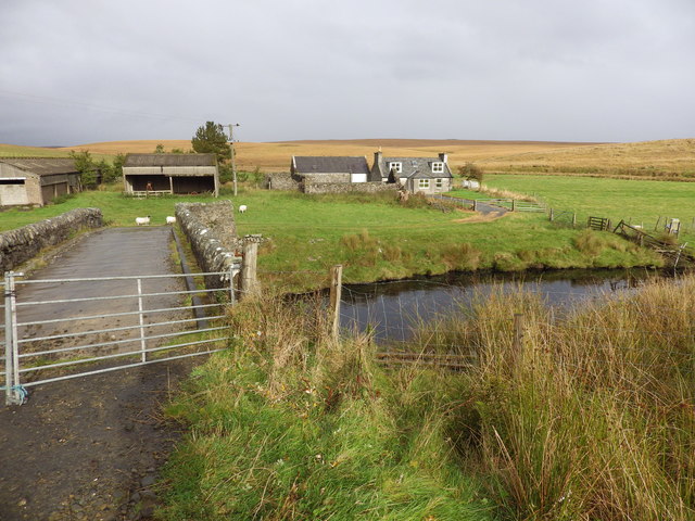
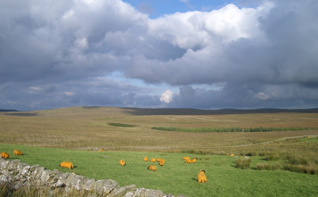
White Hill Images

Images are sourced within 2km of 55.011452/-4.9241497 or Grid Reference NX1372. Thanks to Geograph Open Source API. All images are credited.

Looking Over The Main Water of Luce Dalnigap Farm on the other side.
Looking Over The Main Water of Luce
Dalnigap Farm on the other side.
High Mark, near Stranraer This former farmhouse is now a holiday cottage.
High Mark, near Stranraer
This former farmhouse is now a holiday cottage.
Dalnigap Farm, near Stranraer
Sheepfold at Laganabeastie The notice on this small bridge reads 'Private Road. No vehicles beyond this point'
Sheepfold at Laganabeastie
The notice on this small bridge reads 'Private Road. No vehicles beyond this point'
Stone Bridge, Laganabeastie The bridge appears to have been restored recently.
Stone Bridge, Laganabeastie
The bridge appears to have been restored recently.
Sheepfold at Laganabeastie Part of extensive stone walls to do with sheep. In the background by the trees is Barnvannoch farm.
Sheepfold at Laganabeastie
Part of extensive stone walls to do with sheep. In the background by the trees is Barnvannoch farm.
Main Water of Luce - the 'Dungeon' pool
Sheep at Barnvannoch Farm Unusual livestock on the road to Lagafater Lodge
Sheep at Barnvannoch Farm
Unusual livestock on the road to Lagafater Lodge
Forest road with brussels sprouts Lying on the side of this forest track was a scattering of brussels sprouts. Their reason for being there may be connected to the well hidden deer shooting platform just visible to the right of centre - presumably they are deer bait.
Forest road with brussels sprouts
Lying on the side of this forest track was a scattering of brussels sprouts. Their reason for being there may be connected to the well hidden deer shooting platform just visible to the right of centre - presumably they are deer bait.
Lichen fruiting body Lots of these colourful stalks were growing in patches in the middle of the road.
Lichen fruiting body
Lots of these colourful stalks were growing in patches in the middle of the road.
Esker near Shennas The snaking ridge is an esker, a cast of a water channel formed within a glacier by deposited sediment . This one is a few hundred yards long and originates to the north of Shennas farm, which actually sits on it. It continues as the green lump to the lower right hand side of the picture.
Esker near Shennas
The snaking ridge is an esker, a cast of a water channel formed within a glacier by deposited sediment . This one is a few hundred yards long and originates to the north of Shennas farm, which actually sits on it. It continues as the green lump to the lower right hand side of the picture.
Moorland near Barnvannoch Looking southeast over the course of the Bungsie Burn towards Grey Hill.
Moorland near Barnvannoch
Looking southeast over the course of the Bungsie Burn towards Grey Hill.
Barnvannoch
Barnvannoch
The Laganabeastie Burn Laganabeastie means either the hollow of the snake, or of the beast.
The Laganabeastie Burn
Laganabeastie means either the hollow of the snake, or of the beast.
High Mark The place name "Mark" can either mean a march (or boundary), or can be derived from "merkland", being the value (one merk) of the property, paid to the feudal superior. The farm name Half Mark is a variation.
High Mark
The place name "Mark" can either mean a march (or boundary), or can be derived from "merkland", being the value (one merk) of the property, paid to the feudal superior. The farm name Half Mark is a variation.
Moorland Wood Very small lonely wood with sheep fold
Moorland Wood
Very small lonely wood with sheep fold
Bridge on New Luce Trail Bridge crosses over the main water of luce.
Bridge on New Luce Trail
Bridge crosses over the main water of luce.
Main Water of Luce Main water of luce as it passes under the new luce trail.
Main Water of Luce
Main water of luce as it passes under the new luce trail.
Show me another place!

White Hill is located at Grid Ref: NX1372 (Lat: 55.011452, Lng: -4.9241497)

Unitary Authority: Dumfries and Galloway

Police Authority: Dumfries and Galloway

What 3 Words

///handlebar.paramedic.cheerily. Near Cairnryan, Dumfries & Galloway

Related Wikis

Loups of Dalnigap

Loups of Dalnigap is a waterfall of Scotland. It sits below Dalnigap House, in the South of the Lagafater Estate. == See also == Waterfalls of Scotland...

Penwhirn Reservoir

Penwhirn Reservoir, is a reservoir in Dumfries and Galloway, Scotland, approximately 3.5 miles (6 km) east of Cairnryan. The reservoir was built in the...

The Lagafater Estate

Lagafater is a 7000-acre (2832.8 ha) former sporting estate near New Luce in Dumfries and Galloway, Scotland. Since 1910 it has been in the family of its...

Glenwhilly railway station

Glenwhilly railway station served the area of Glenwhilly, Dumfries and Galloway, Scotland from 1887 to 1965 on the Girvan and Portpatrick Junction Railway...

Nearby Amenities

Located within 500m of 55.011452,-4.9241497
Power: pole
Lat/Long: 55.0090919/-4.9306226
Power: pole
Lat/Long: 55.0097873/-4.9298876
Power: pole
Lat/Long: 55.0105149/-4.9291186
Power: pole
Lat/Long: 55.0110619/-4.9285405
Power: pole
Lat/Long: 55.0116065/-4.9279649
Power: pole
Lat/Long: 55.0123034/-4.9272284
Power: pole
Lat/Long: 55.0128495/-4.9266512
Power: pole
Lat/Long: 55.0135464/-4.9259146
Power: pole
Lat/Long: 55.0142476/-4.9251736
Power: pole
Lat/Long: 55.0148341/-4.9245538
Power: pole
Lat/Long: 55.0153401/-4.924019
The data included in this document is from www.openstreetmap.org. The data is made available under ODbL.

Have you been to White Hill?

Leave your review of White Hill below (or comments, questions and feedback).