An Liathanach

Hill, Mountain in Ross-shire

Scotland

An Liathanach

A890 towards Ledgowan The A890 is a non-primary cross-country route in sparsely populated, mountainous terrain from Lochalsh and Skye on the west coast of the Highlands to Achnasheen where it joins the A832 to Inverness. Like many Highland roads, the A890 was entirely single track until the 1960s, but road improvements in recent years (along with improvements on the A832) have made it increasingly popular as an alternative route between Inverness and the Isle of Skye, avoiding the A82 along Loch Ness. It is also an important route for residents of the Lochalsh, Applecross and Strathcarron areas, connecting them to the services of  Kyle of Lochalsh , as well as the High School in Plockton.
A890 towards Ledgowan Credit: David Dixon

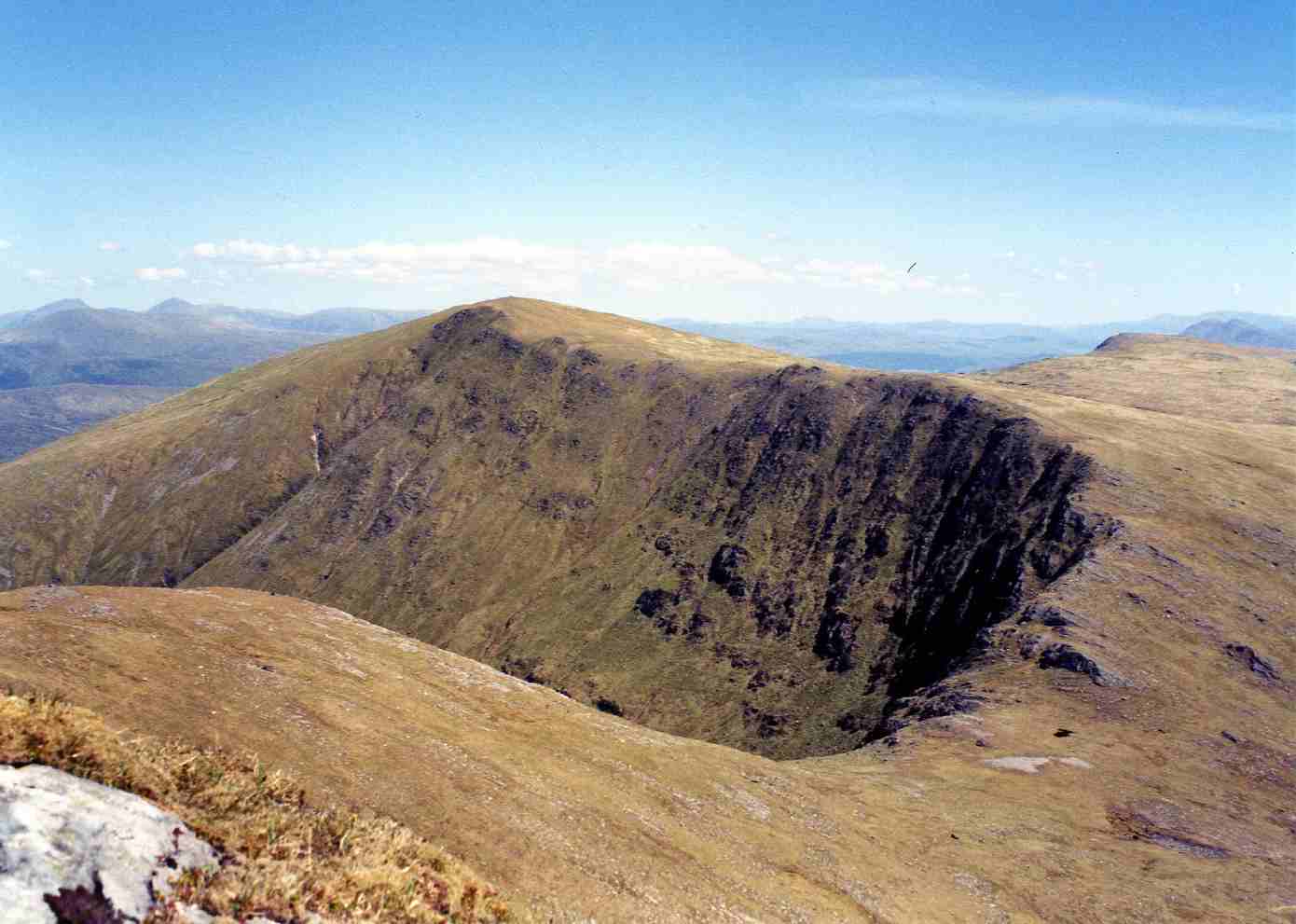
An Liathanach is a prominent hill located in Ross-shire, Scotland. With an elevation of approximately 550 meters (1804 feet), it offers breathtaking views of the surrounding landscape and is a popular destination for hikers and outdoor enthusiasts.

Situated in the Northwest Highlands, An Liathanach is part of the Torridon mountain range. Its distinct shape and rugged terrain make it easily recognizable from a distance. The hill is characterized by its steep slopes, rocky outcrops, and a prominent summit ridge.

The ascent to the summit of An Liathanach is challenging but rewarding. The hill offers a variety of hiking routes, catering to different levels of experience and fitness. As hikers climb higher, they are treated to panoramic views of the surrounding mountains, lochs, and glens. On a clear day, it is even possible to catch a glimpse of the nearby Isle of Skye.

The hill is home to a diverse range of flora and fauna. Visitors can expect to see heather, bracken, and wildflowers carpeting the lower slopes, while higher up, hardier plants such as mosses and lichens thrive in the harsher conditions. Birdwatchers may spot golden eagles and peregrine falcons soaring through the skies.

An Liathanach is not only a natural wonder but also holds historical and cultural significance. The area is steeped in Gaelic mythology and folklore, adding an extra layer of intrigue to the hill and its surroundings.

Overall, An Liathanach is a must-visit destination for nature lovers and adventurers looking to immerse themselves in the beauty of the Scottish Highlands.

If you have any feedback on the listing, please let us know in the comments section below.

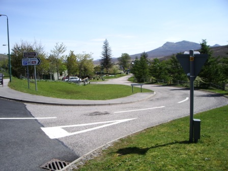
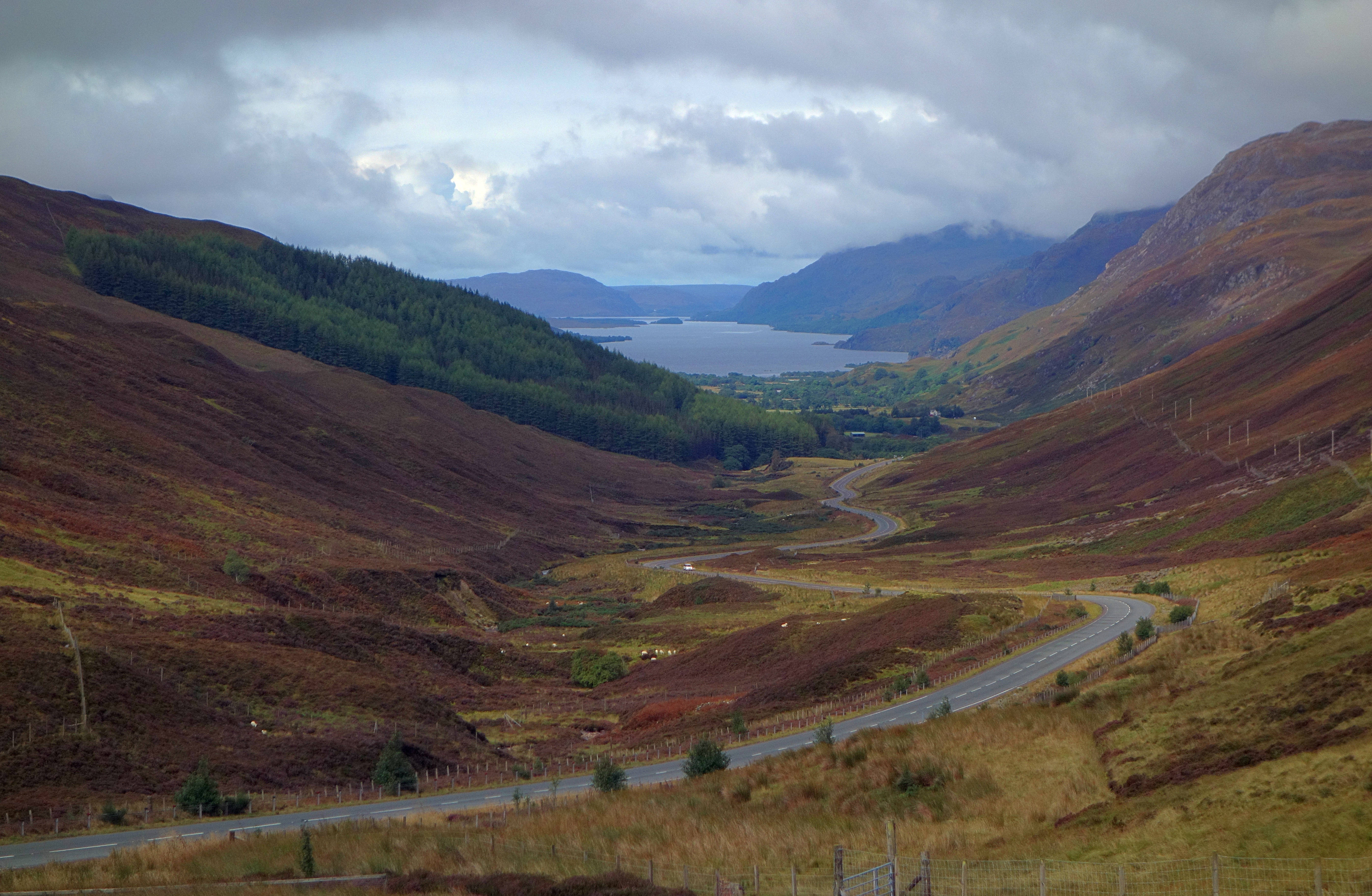
An Liathanach Images

Images are sourced within 2km of 57.562467/-5.1379118 or Grid Reference NH1256. Thanks to Geograph Open Source API. All images are credited.

A890 towards Ledgowan The A890 is a non-primary cross-country route in sparsely populated, mountainous terrain from Lochalsh and Skye on the west coast of the Highlands to Achnasheen where it joins the A832 to Inverness. Like many Highland roads, the A890 was entirely single track until the 1960s, but road improvements in recent years (along with improvements on the A832) have made it increasingly popular as an alternative route between Inverness and the Isle of Skye, avoiding the A82 along Loch Ness. It is also an important route for residents of the Lochalsh, Applecross and Strathcarron areas, connecting them to the services of  Kyle of Lochalsh , as well as the High School in Plockton.
A890 towards Ledgowan
The A890 is a non-primary cross-country route in sparsely populated, mountainous terrain from Lochalsh and Skye on the west coast of the Highlands to Achnasheen where it joins the A832 to Inverness. Like many Highland roads, the A890 was entirely single track until the 1960s, but road improvements in recent years (along with improvements on the A832) have made it increasingly popular as an alternative route between Inverness and the Isle of Skye, avoiding the A82 along Loch Ness. It is also an important route for residents of the Lochalsh, Applecross and Strathcarron areas, connecting them to the services of Kyle of Lochalsh , as well as the High School in Plockton.
A832, eastbound The A832 runs 127 miles from the Black Isle to Braemore Junction <a href="https://www.geograph.org.uk/photo/7232275">NH2077 : Braemore Junction</a>.
<span class="nowrap"><a title="https://www.sabre-roads.org.uk/wiki/index.php?title=A832" rel="nofollow ugc noopener" href="https://www.sabre-roads.org.uk/wiki/index.php?title=A832">Link</a><img style="margin-left:2px;" alt="External link" title="External link - shift click to open in new window" src="https://s1.geograph.org.uk/img/external.png" width="10" height="10"/></span>
A832, eastbound
The A832 runs 127 miles from the Black Isle to Braemore Junction NH2077 : Braemore Junction. LinkExternal link
A890, Ledgowan The A890 runs 32 miles from Achnasheen to Auchtertyre.
<span class="nowrap"><a title="https://www.sabre-roads.org.uk/wiki/index.php?title=A890" rel="nofollow ugc noopener" href="https://www.sabre-roads.org.uk/wiki/index.php?title=A890">Link</a><img style="margin-left:2px;" alt="External link" title="External link - shift click to open in new window" src="https://s1.geograph.org.uk/img/external.png" width="10" height="10"/></span>
A890, Ledgowan
The A890 runs 32 miles from Achnasheen to Auchtertyre. LinkExternal link
Farm building at Ledgowan
A832 towards Kinlochewe
Old boundary wall at Leanach What was once a substantial wall around an enclosure at Leanach is now largely broken down.
Old boundary wall at Leanach
What was once a substantial wall around an enclosure at Leanach is now largely broken down.
Loch a' Chroisg
Loch a' Chroisg
Looking east along the A832
The old A890 and the ruin at Ledgowan
Looking across Loch a' Chroisg
Old alignment, A890 A single track bend, cut off when the new road was built in the 1980s.
Old alignment, A890
A single track bend, cut off when the new road was built in the 1980s.
Allt Gharagain flood plain Shingle banks near the Strath Braan - Glen Carron watershed with the Kyle Line in the background.  Lumps of peat have been left by previous floods.
Allt Gharagain flood plain
Shingle banks near the Strath Braan - Glen Carron watershed with the Kyle Line in the background. Lumps of peat have been left by previous floods.
A890 near the watershed Approaching the East-West watershed of Scotland with the Allt Gharagain heading for Strath Bran and the Cromarty Firth.  Moruisg fills the background.  This bit of road cut a big corner off the previous single track alignment.
A890 near the watershed
Approaching the East-West watershed of Scotland with the Allt Gharagain heading for Strath Bran and the Cromarty Firth. Moruisg fills the background. This bit of road cut a big corner off the previous single track alignment.
Road (A890) heading towards Ledgowan Looking north-eastward.
Road (A890) heading towards Ledgowan
Looking north-eastward.
Fence-lined road (A832) beside Loch a' Chroisg Looking westward.
Fence-lined road (A832) beside Loch a' Chroisg
Looking westward.
A wall-lined section of road (A832) beside Loch a' Chroisg Looking eastward.
A wall-lined section of road (A832) beside Loch a' Chroisg
Looking eastward.
Lambs at Ledgowan Sheep and their new lambs between the lines of the old and the new A890.
Lambs at Ledgowan
Sheep and their new lambs between the lines of the old and the new A890.
Show me another place!

An Liathanach is located at Grid Ref: NH1256 (Lat: 57.562467, Lng: -5.1379118)

Unitary Authority: Highland

Police Authority: Highlands and Islands

What 3 Words

///culminate.dean.bookings. Near Achnasheen, Highland

Nearby Locations

An Liathanach

Related Wikis

Ledgowan Forest

Ledgowan Forest is a deer forest in the Northwest Highlands of Scotland. It stands in Wester Ross to the southwest of Achnasheen. Ledgowan Forest is the...

Achnasheen railway station

Achnasheen railway station is a remote railway station on the Kyle of Lochalsh Line, serving the village of Achnasheen in the north of Scotland. The station...

Achnasheen

Achnasheen (Gaelic Achadh na Sìne) is a small village in Ross-shire in the Highland council area of Scotland. The village is situated on the River Bran...

Loch Scaven

Loch Scaven (Gaelic: Loch Sgamhain) is a small freshwater loch at the head of Glen Carron near the source of the River Carron, Wester Ross, Scotland. It...

Fionn Bheinn

Fionn Bheinn is a Scottish mountain located south of Loch Fannich in the north western highlands. It has a height of 933 m (3061 ft) and is listed as...

Mòruisg

Mòruisg is a Scottish mountain situated in the Glencarron and Glenuig Forest, 10 kilometres south west of the village of Achnasheen in the Highland council...

Glen Docherty

Glen Docherty (Scottish Gaelic: Gleann Dochartaich) is a glen in Wester Ross in Scotland, between Loch Maree and Kinlochewe to the west and Loch a'Chroisg...

Glencarron Estate

The Glencarron Estate is a 12,000 acre highland estate in Wester Ross. It provides sports facilities for fishing (river and loch) and grouse shooting....

Have you been to An Liathanach?

Leave your review of An Liathanach below (or comments, questions and feedback).