Achafour Hill

Hill, Mountain in Argyllshire

Scotland

Achafour Hill

Gatehouse and gated entrance to Knockdow House
Gatehouse and gated entrance to Knockdow House Credit: Steven Brown

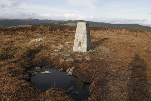
Achafour Hill is a prominent mountain located in Argyllshire, Scotland. It lies in the southern part of the county, near the village of Kilchrenan. With an elevation of 687 meters (2,254 feet), it is considered a Corbett, a term used to describe Scottish mountains between 2,500 and 3,000 feet in height.

The hill is characterized by its rugged terrain and steep slopes, making it a challenging but rewarding climb for outdoor enthusiasts. Its summit offers breathtaking panoramic views of the surrounding landscape, including Loch Awe, one of Scotland's largest freshwater lakes, and the nearby peaks of the Grampian Mountains.

Achafour Hill is covered in heather and grasses, with scattered patches of woodland dotting its lower slopes. The area is known for its rich biodiversity, with various species of flora and fauna calling it home. Hikers may encounter red deer, mountain hares, and numerous bird species as they make their way up the hill.

The ascent to Achafour Hill is often undertaken from the village of Kilchrenan, following a well-defined path that gradually rises through the hillside. The hike typically takes several hours to complete, and proper hiking gear and navigation skills are recommended due to the challenging terrain.

Overall, Achafour Hill offers a rewarding outdoor experience for adventurers seeking stunning views, diverse wildlife, and a taste of Scotland's natural beauty.

If you have any feedback on the listing, please let us know in the comments section below.

Achafour Hill Images

Images are sourced within 2km of 55.895631/-5.0046605 or Grid Reference NS1271. Thanks to Geograph Open Source API. All images are credited.

Gatehouse and gated entrance to Knockdow House
Old milestone This stone was spotted east of the metal milepost, before the woods and the road taking a sharp right-hand bend.   On the pre 1890 OS 6" there is an MS marked in this area.  The wall surrounds the Knockdow Estate.   An inscribed 10 has either eroded away or this set of stones had the numbers painted on, but most probably inscribed.   Within less than ½ mile this road reaches Port Lamont, perhaps an important landing place for vessels with visitors to Knockdow sailing from Bute.
Old milestone
This stone was spotted east of the metal milepost, before the woods and the road taking a sharp right-hand bend. On the pre 1890 OS 6" there is an MS marked in this area. The wall surrounds the Knockdow Estate. An inscribed 10 has either eroded away or this set of stones had the numbers painted on, but most probably inscribed. Within less than ½ mile this road reaches Port Lamont, perhaps an important landing place for vessels with visitors to Knockdow sailing from Bute.
Old milestone The road rises from Port Lamont along the edge of the Knockdow Estate.   The wall may have been built or rebuilt round the stone after it had been set up in the late 19C.
Old milestone
The road rises from Port Lamont along the edge of the Knockdow Estate. The wall may have been built or rebuilt round the stone after it had been set up in the late 19C.
Road towards Inverchaolain
Old milepost In 2007 this milemarker was slightly rusty.  It is opposite the entrance to Killellan Farm with Blairanboich Cottage just to the north behind it.   Vegetation had to be cleared so that a photograph could be taken.
Old milepost
In 2007 this milemarker was slightly rusty. It is opposite the entrance to Killellan Farm with Blairanboich Cottage just to the north behind it. Vegetation had to be cleared so that a photograph could be taken.
Blairanboich Farm
Blairanboich Farm
Achafour Farm
Achafour Farm
Knockdow Estate
Knockdow Estate
Road over Ardyne Burn bridge The road down to Loch Striven
Road over Ardyne Burn bridge
The road down to Loch Striven
Glen Fyne, Track Going towards Goatsford Woods
Glen Fyne, Track
Going towards Goatsford Woods
Glen Fyne, track in Goatsford Wood
Glen Fyne, unnamed burn in Goatsford Wood A better view of the burn
Glen Fyne, unnamed burn in Goatsford Wood
A better view of the burn
Glen Fyne, old ruins in Glen Fyne Wood
Glen Fyne, Track A new culvert over a Burn
Glen Fyne, Track
A new culvert over a Burn
On the forestry road between Innellan and Auchafour
Near the ruins at Corlarach
Forestry gate near Linne Mhor, Glen Fyne
Trig point on Buachailean, north of Toward
Show me another place!

Achafour Hill is located at Grid Ref: NS1271 (Lat: 55.895631, Lng: -5.0046605)

Unitary Authority: Argyll and Bute

Police Authority: Argyll and West Dunbartonshire

What 3 Words

///commuted.basin.cherub. Near Port Bannatyne, Argyll & Bute

Nearby Locations

Achafour Hill Toward Hill

Related Wikis

Innellan

Innellan is a village in Argyll and Bute, Scotland, on the western shore of the Firth of Clyde. It is four miles south of Dunoon. == History == The origin...
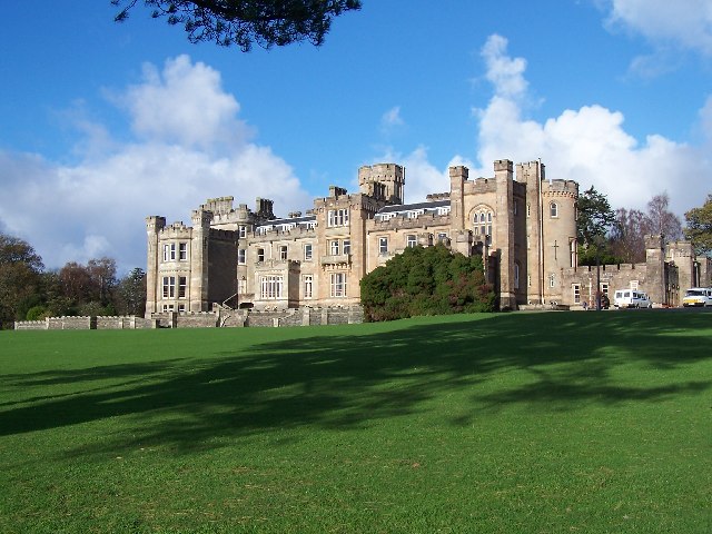
Castle Toward

Castle Toward (Scottish Gaelic: Caisteal an Toll Àird) is a nineteenth-century country house in Argyll and Bute, Scotland. Built in 1820 by Glasgow merchant...
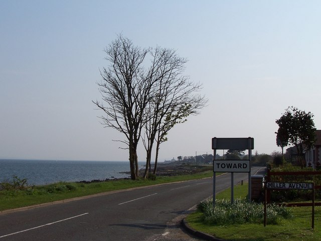
Toward

Toward; (Scottish Gaelic: Tollard) is a village near Dunoon, Scotland, at the southern tip of the Cowal peninsula. During the Second World War, the Toward...

Toward Point Lighthouse

Toward Point Lighthouse is on the southern extremity of the Cowal Peninsula, near the village of Toward, Argyll and Bute, Scotland. There has been a lighthouse...

Ardhallow Battery

Ardhallow Battery a Palmerston Fort on the slopes of Corlarach Hill on the Cowal peninsula, around 3km south of Dunoon, on the west coast of the Firth...

Inverchaolain Church

Inverchaolain Church is a former Church of Scotland church building in Inverchaolain, Argyll and Bute, Scotland. Located on the eastern shores of Loch...
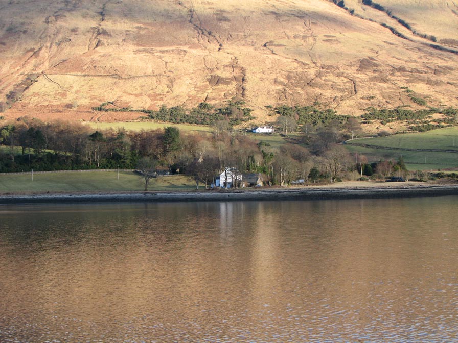
Inverchaolain

Inverchaolain is a hamlet on the Cowal peninsula, Argyll and Bute, Scotland. It lies on the east shore of Loch Striven, to the south of Glenstriven and...

Loch Striven

Loch Striven (Scottish Gaelic: Loch Sroigheann) is a sea loch extending off the Firth of Clyde, and forms part of the Cowal peninsula coast, in Argyll...

Nearby Amenities

Located within 500m of 55.895631,-5.0046605
Achafour Hill
Ele: 329
Natural: peak
Source: NPE
Lat/Long: 55.8950387/-5.0051046
Power: pole
Lat/Long: 55.8932413/-4.9983206
Power: pole
Lat/Long: 55.8933346/-4.9997315
Power: pole
Lat/Long: 55.8933902/-5.0008902
Power: pole
Lat/Long: 55.8931285/-4.9981409
Power: pole
Lat/Long: 55.8931721/-4.9991199
Power: pole
Lat/Long: 55.8932443/-5.0001392
Power: pole
Lat/Long: 55.8932909/-5.001094
Power: pole
Lat/Long: 55.8933541/-5.0024378
Power: pole
Lat/Long: 55.8934263/-5.0036931
Power: pole
Lat/Long: 55.8934895/-5.0050932
Power: pole
Lat/Long: 55.8935286/-5.0061929
Power: pole
Lat/Long: 55.8930924/-5.0073999
Power: pole
Lat/Long: 55.8927615/-5.0083816
Power: pole
Lat/Long: 55.8923863/-5.009433
Power: pole
Lat/Long: 55.8934624/-5.0023466
Power: pole
Lat/Long: 55.8935376/-5.0037038
Power: pole
Lat/Long: 55.8936113/-5.0052005
Power: pole
Lat/Long: 55.8936594/-5.0062358
Power: pole
Lat/Long: 55.8934278/-5.0068286
Power: pole
Lat/Long: 55.8928412/-5.0084621
Power: pole
Lat/Long: 55.8924667/-5.0094411
The data included in this document is from www.openstreetmap.org. The data is made available under ODbL.

Have you been to Achafour Hill?

Leave your review of Achafour Hill below (or comments, questions and feedback).