Bere Hill

Hill, Mountain in Wigtownshire

Scotland

Bere Hill

Southbound on the Rhins of Galloway Rockhopping on the way into the mouth of Clanyard bay
Southbound on the Rhins of Galloway Credit: Tony Page

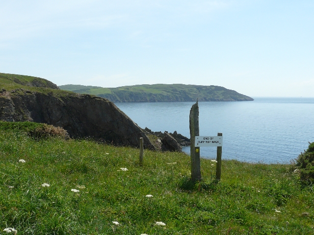
Bere Hill is a prominent hill located in Wigtownshire, a historical county in the southwestern region of Scotland. Rising to an elevation of approximately 240 meters (790 feet), it stands as a notable feature in the scenic landscape of the area. The hill is situated around 5 kilometers (3 miles) northeast of the town of Whithorn and approximately 10 kilometers (6 miles) west of Wigtown.

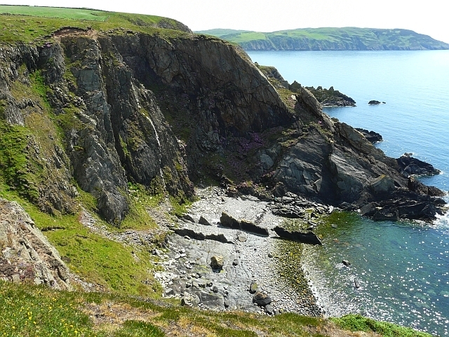
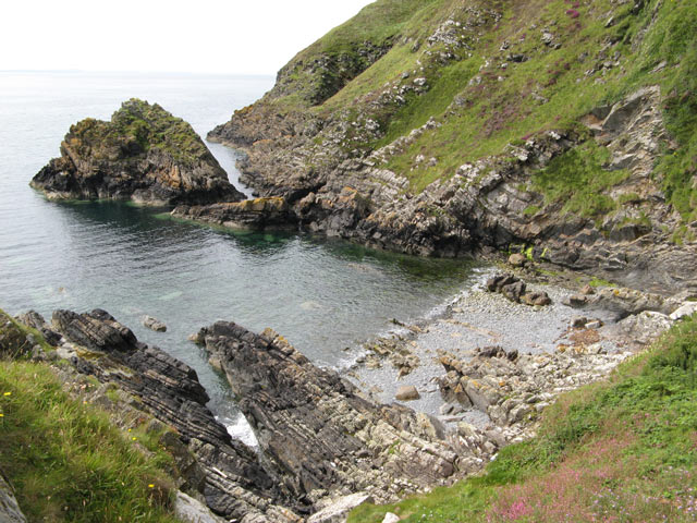
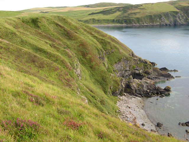
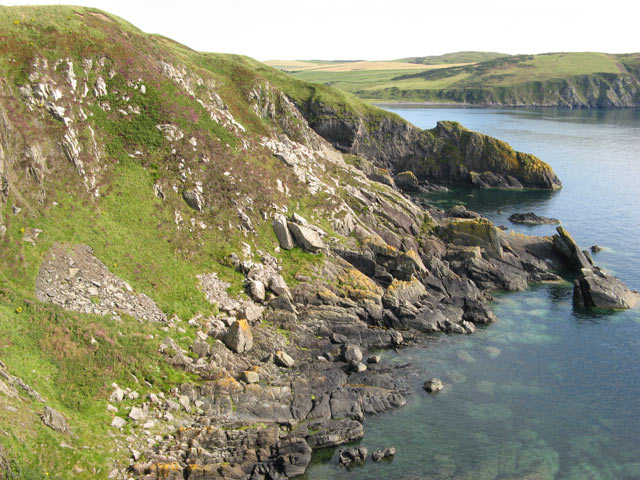
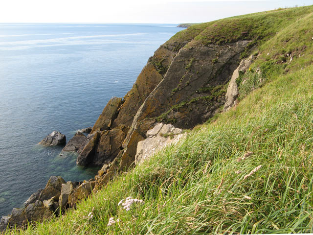
Bere Hill offers breathtaking views of the surrounding countryside, with its rolling green fields and picturesque valleys. Its location near the coast adds to its charm, as visitors can enjoy glimpses of the nearby Irish Sea on clear days.

The hill is a popular destination for outdoor enthusiasts, attracting hikers, walkers, and nature lovers. Several well-marked trails lead up and around the hill, providing opportunities for exploration and exercise. The diverse flora and fauna found in the area make it an ideal spot for birdwatching and wildlife spotting.

Bere Hill holds historical significance as well, with traces of ancient settlements and archaeological remains discovered in the vicinity. These remnants offer insights into the rich heritage of the region and its early inhabitants.

Overall, Bere Hill in Wigtownshire is a captivating natural landmark that combines stunning views, recreational activities, and historical intrigue. Whether one seeks a peaceful walk in nature, a glimpse into the past, or simply a place to appreciate the beauty of the Scottish countryside, Bere Hill is a destination that offers something for everyone.

If you have any feedback on the listing, please let us know in the comments section below.
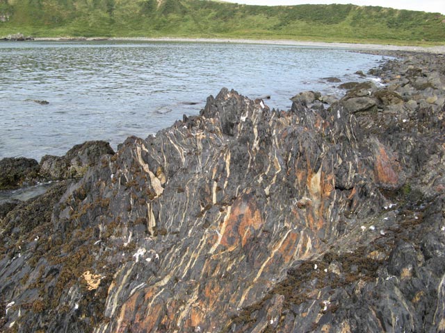
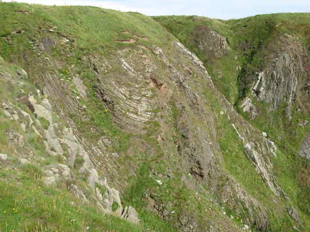
Bere Hill Images

Images are sourced within 2km of 54.709918/-4.9341162 or Grid Reference NX1138. Thanks to Geograph Open Source API. All images are credited.

Southbound on the Rhins of Galloway Rockhopping on the way into the mouth of Clanyard bay
Southbound on the Rhins of Galloway
Rockhopping on the way into the mouth of Clanyard bay
End of Clifftop Walk from Port Logan It is rare to see a yellow waymarker pointing straight down.  This one means 'turn back'.
There is no easy way beyond this point.
End of Clifftop Walk from Port Logan
It is rare to see a yellow waymarker pointing straight down. This one means 'turn back'. There is no easy way beyond this point.
Cliffs overlooking Slate Heugh Bay The rock is greywacke of Early Silurian age.
Cliffs overlooking Slate Heugh Bay
The rock is greywacke of Early Silurian age.
Slate Heugh Bay The cliffs here are composed of greywacke, a sedimentary rock, laid down in the Early Silurian period. In the bay a jagged line of upstanding rock crosses the shore from the sea, and appears to continue as a white line all the way up the cliff. This is a later intrusion of hard igneous rock, and is mentioned in the British Geological Survey's excursion guide to the area <span class="nowrap"><a title="http://shop.bgs.ac.uk/Bookshop/product.cfm?p_id=GSWS" rel="nofollow ugc noopener" href="http://shop.bgs.ac.uk/Bookshop/product.cfm?p_id=GSWS">Link</a><img style="margin-left:2px;" alt="External link" title="External link - shift click to open in new window" src="https://s1.geograph.org.uk/img/external.png" width="10" height="10"/></span> as "a cross-cutting, Tertiary dolerite dyke".
Slate Heugh Bay
The cliffs here are composed of greywacke, a sedimentary rock, laid down in the Early Silurian period. In the bay a jagged line of upstanding rock crosses the shore from the sea, and appears to continue as a white line all the way up the cliff. This is a later intrusion of hard igneous rock, and is mentioned in the British Geological Survey's excursion guide to the area LinkExternal link as "a cross-cutting, Tertiary dolerite dyke".
Carlin House Bay A small bay eroded along the strike of the rather deformed rocks of the turbiditic greywackes of the Clanyard Bay Formation (Gala Group, Silurian). Much interest attaches to the deformation style and stratigraphy of this area, but I did not climb down from the grassy col between the larger and smaller bays.
Carlin House Bay
A small bay eroded along the strike of the rather deformed rocks of the turbiditic greywackes of the Clanyard Bay Formation (Gala Group, Silurian). Much interest attaches to the deformation style and stratigraphy of this area, but I did not climb down from the grassy col between the larger and smaller bays.
Farm quarry A convenient source of easily-worked stone. This band of slatey rock, part of the Silurian Gala Group of greywackes, runs across the Rhins and is worked in several places. See <a href="https://www.geograph.org.uk/photo/3141425">NX1139 : Quarry lakes</a> for another. In this image the bedding of the rocks is very clear, steep and northerly, and that is a regional trend reflecting the collision of continents in the Caledonian orogeny.
Farm quarry
A convenient source of easily-worked stone. This band of slatey rock, part of the Silurian Gala Group of greywackes, runs across the Rhins and is worked in several places. See NX1139 : Quarry lakes for another. In this image the bedding of the rocks is very clear, steep and northerly, and that is a regional trend reflecting the collision of continents in the Caledonian orogeny.
Please shut the gate An excellent reminder in colloqial Scots that closing the gate behind you is important under all circumstances. The animals that occasion the reminder are clustered on the hill overlooking Port Logan.
Please shut the gate
An excellent reminder in colloqial Scots that closing the gate behind you is important under all circumstances. The animals that occasion the reminder are clustered on the hill overlooking Port Logan.
Junction of the tracks The way-marked track from Port Logan comes in from the left here, and is signposted towards Cowans. Behind the camera stretches the route to Clanyard and Inshanks, which is the old road.
Junction of the tracks
The way-marked track from Port Logan comes in from the left here, and is signposted towards Cowans. Behind the camera stretches the route to Clanyard and Inshanks, which is the old road.
Track to Clanyard Beyond the limit of fields belonging to Cowans, the track sees little use, but it is a fine walking route. Barncorkrie Moor and Cairn Fell make the far horizon.
Track to Clanyard
Beyond the limit of fields belonging to Cowans, the track sees little use, but it is a fine walking route. Barncorkrie Moor and Cairn Fell make the far horizon.
Track to Port Logan Looking towards Port Logan on the waymarked track that is the old road from Inshanks and Clanyard. Here it just clips the corner of another square as it makes its lonely way through the fields.
Track to Port Logan
Looking towards Port Logan on the waymarked track that is the old road from Inshanks and Clanyard. Here it just clips the corner of another square as it makes its lonely way through the fields.
Deformed rocks An outcrop of highly deformed greywacke which is intruded by felsite dykes. These rugged rocks drop steeply to the sea from a pronounced feature known as Carlin House.
Deformed rocks
An outcrop of highly deformed greywacke which is intruded by felsite dykes. These rugged rocks drop steeply to the sea from a pronounced feature known as Carlin House.
Raised  beach The west coast of the Rhins only has isolated lengths of raised beach, and this is a quite spectacular section. Another fine length is at Ardwell bay, <a href="https://www.geograph.org.uk/photo/3128116">NX0745 : Raised beach</a>. The great antiquity of the formation is indicated by the prolific growth of lichen on the cobbles, which shows that it is never moved by wave action. It is distressing to see that this very special formation is being dug for hardcore and destroyed.
Raised beach
The west coast of the Rhins only has isolated lengths of raised beach, and this is a quite spectacular section. Another fine length is at Ardwell bay, NX0745 : Raised beach. The great antiquity of the formation is indicated by the prolific growth of lichen on the cobbles, which shows that it is never moved by wave action. It is distressing to see that this very special formation is being dug for hardcore and destroyed.
Moffat shales Between the major blocks of tilted strata it is common to find outcrops of the Moffat Shales, of Silurian age as are the adjoining Gala and Cairnharrow Group greywackes. It appears that these weak rocks formed detachment surfaces along which there was severe deformation and transport of kilometre-scale blocks of strata. Clanyard Bay was formed by erosion of shattered rock adjacent to one of these major faults, and the striped appearance of this shale outcrop is due to intense deformation and injection of quartz veins into fractures which run parallel to the main fault.
Moffat shales
Between the major blocks of tilted strata it is common to find outcrops of the Moffat Shales, of Silurian age as are the adjoining Gala and Cairnharrow Group greywackes. It appears that these weak rocks formed detachment surfaces along which there was severe deformation and transport of kilometre-scale blocks of strata. Clanyard Bay was formed by erosion of shattered rock adjacent to one of these major faults, and the striped appearance of this shale outcrop is due to intense deformation and injection of quartz veins into fractures which run parallel to the main fault.
Calliedown Bay Looking southwards into this unapproachable bay, with Clanyard Bay behind. Streams are eroding gullies into the soft, glacial deposits above the bedrock.
Calliedown Bay
Looking southwards into this unapproachable bay, with Clanyard Bay behind. Streams are eroding gullies into the soft, glacial deposits above the bedrock.
Heathery slope A wonderful patchwork of colours, with heather blooming among dead bracken fronds and dried grasses.
Heathery slope
A wonderful patchwork of colours, with heather blooming among dead bracken fronds and dried grasses.
Strones Bay Patches of rockfall, scree and huge boulders of probable glacial origin make a superb rocky ensemble, with Clanyard Bay to the south.
Strones Bay
Patches of rockfall, scree and huge boulders of probable glacial origin make a superb rocky ensemble, with Clanyard Bay to the south.
Folded strata Within the Silurian Gala Group greywackes there are some sections of thinly-bedded strata which show very clearly the pervasive and severe deformation experienced during the Caledonian orogeny. The cliffs here show how tight folding has resulted in detachment and faulting of these incompetent strata. Deep gullies have been eroded by streams descending from the undulating terrain above the cliffs.
Folded strata
Within the Silurian Gala Group greywackes there are some sections of thinly-bedded strata which show very clearly the pervasive and severe deformation experienced during the Caledonian orogeny. The cliffs here show how tight folding has resulted in detachment and faulting of these incompetent strata. Deep gullies have been eroded by streams descending from the undulating terrain above the cliffs.
Tilted strata In contrast with the folding demonstrated by the section above Strones Bay (<a href="https://www.geograph.org.uk/photo/3153076">NX0938 : Folded strata</a>) The Lennans demonstrate competent strata that are steeply tilted, but flat. Complete beds have simply spalled away to leave clean bedding surfaces, and gaps between the flat slabs give rise to the caves marked on the map, but not visible from above.
Tilted strata
In contrast with the folding demonstrated by the section above Strones Bay (NX0938 : Folded strata) The Lennans demonstrate competent strata that are steeply tilted, but flat. Complete beds have simply spalled away to leave clean bedding surfaces, and gaps between the flat slabs give rise to the caves marked on the map, but not visible from above.
Show me another place!

Bere Hill is located at Grid Ref: NX1138 (Lat: 54.709918, Lng: -4.9341162)

Unitary Authority: Dumfries and Galloway

Police Authority: Dumfries and Galloway

What 3 Words

///lectured.lawns.cheek. Near Drummore, Dumfries & Galloway

Related Wikis

Port Logan

Port Logan, formerly Port Nessock, is a small village in the parish of Kirkmaiden in the Rhins of Galloway in Wigtownshire. The Gaelic name is Port Neasaig...

Kirkmaiden

Kirkmaiden is a parish in the Rhins of Galloway, the most southerly in Scotland; the present Church of Scotland parish has the same name as and is approximately...

Kirkmaiden (village)

Kirkmaiden (sometimes Maidenkirk; Scottish Gaelic: Cill M'Eudan) is a small settlement in Galloway, Scotland, located approximately 17 miles (27 km) south...

Drummore

Drummore (drum-ORE; (from Gaelic An Druim Mòr meaning "the great ridge") is the southernmost village in Scotland, located at the southern end of the Rhins...

Logan Botanic Garden

Logan Botanic Garden is a botanical garden near Port Logan on the Rhins of Galloway, at the south-western tip of Scotland. The Botanic Garden was established...

Ardwell

Ardwell (from Gaelic Àrd Bhaile meaning "high town", pronounced as "Ardwell") is a village in the Scottish unitary council area of Dumfries and Galloway...

Cairngaan

Cairngaan, Wigtownshire, is the southmost settlement in Scotland. The hamlet of Cairngaan lies just north of the Mull of Galloway (which contains Scotland...

Doon Castle Broch

Doon Castle Broch is an iron-age broch located in Dumfries and Galloway, Scotland (grid reference NX 06702 44683). == Location == The Broch is located...

Nearby Amenities

Located within 500m of 54.709918,-4.9341162
Power: pole
Lat/Long: 54.7078689/-4.9272861
Power: pole
Lat/Long: 54.7074777/-4.9285239
Power: pole
Lat/Long: 54.7070753/-4.9297792
Power: pole
Lat/Long: 54.7066661/-4.9310384
Power: pole
Lat/Long: 54.706628/-4.9315448
Power: pole
Lat/Long: 54.7065619/-4.932317
The data included in this document is from www.openstreetmap.org. The data is made available under ODbL.

Have you been to Bere Hill?

Leave your review of Bere Hill below (or comments, questions and feedback).