Loch Doon Hill
Hill, Mountain in Wigtownshire
Scotland
Loch Doon Hill

Loch Doon Hill is a prominent landmark located in Wigtownshire, Scotland. Situated west of Dalmellington and overlooking Loch Doon, this natural formation offers breathtaking views of the surrounding countryside. With an elevation of approximately 564 meters (1,850 feet), it is considered a hill rather than a mountain.
Loch Doon Hill is characterized by its distinctive conical shape and lush vegetation covering its slopes. The hill is composed mainly of granite, which gives it a rugged and weathered appearance. Its summit is relatively flat and offers ample space for visitors to explore and take in the panoramic vistas.
The hill is a popular destination for outdoor enthusiasts, hikers, and nature lovers. Several well-marked trails lead to the summit, allowing visitors to enjoy a moderate to challenging hike. Along the way, one can encounter a variety of flora and fauna, including heather, wildflowers, and perhaps even sightings of local bird species.
From the top of Loch Doon Hill, visitors are rewarded with breathtaking views of Loch Doon and the surrounding Galloway Forest Park. The shimmering waters of the loch, surrounded by rolling hills and dense forests, create a picturesque scene that captures the essence of the Scottish countryside.
Additionally, Loch Doon Hill holds historical significance. The ruins of a medieval castle, known as Loch Doon Castle, can be seen on the eastern shore of Loch Doon. This castle played a significant role in Scottish history and adds to the charm and intrigue of the area.
Overall, Loch Doon Hill is a stunning natural landmark, offering visitors a chance to immerse themselves in the beauty and tranquility of the Scottish countryside.
If you have any feedback on the listing, please let us know in the comments section below.
Loch Doon Hill Images
Images are sourced within 2km of 54.977184/-4.9604357 or Grid Reference NX1068. Thanks to Geograph Open Source API. All images are credited.
Loch Doon Hill is located at Grid Ref: NX1068 (Lat: 54.977184, Lng: -4.9604357)
Unitary Authority: Dumfries and Galloway
Police Authority: Dumfries and Galloway
What 3 Words
///decoder.boring.trickled. Near Cairnryan, Dumfries & Galloway
Nearby Locations
Related Wikis
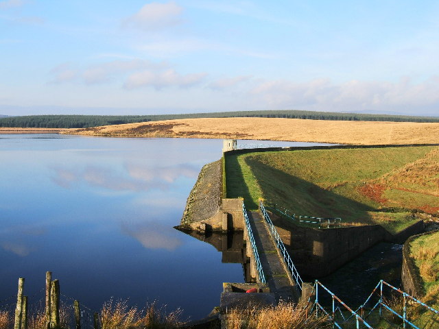
Penwhirn Reservoir
Penwhirn Reservoir, is a reservoir in Dumfries and Galloway, Scotland, approximately 3.5 miles (6 km) east of Cairnryan. The reservoir was built in the...
Inch, Dumfries and Galloway
Inch is a civil parish in Dumfries and Galloway, southwest Scotland. It lies on the shore of Loch Ryan, in the traditional county of Wigtownshire.The...
Loups of Dalnigap
Loups of Dalnigap is a waterfall of Scotland. It sits below Dalnigap House, in the South of the Lagafater Estate. == See also == Waterfalls of Scotland...
Cairnryan
Cairnryan (Scots: The Cairn; Scottish Gaelic: Càrn Rìoghain or Machair an Sgithich) is a village in the historical county of Wigtownshire, Dumfries and...
Cairnryan Harbour
Cairnryan Harbour is a roll-on ferry terminal on Loch Ryan in south west Scotland north of Stranraer. In World War II it was developed as an emergency...
Loch Ryan
Loch Ryan (Scottish Gaelic: Loch Rìoghaine, pronounced [l̪ˠɔx ˈrˠiː.ɛɲə]) is a Scottish sea loch that acts as an important natural harbour for shipping...
Glenwhilly railway station
Glenwhilly railway station served the area of Glenwhilly, Dumfries and Galloway, Scotland from 1887 to 1965 on the Girvan and Portpatrick Junction Railway...
RAF Wig Bay
Royal Air Force Wig Bay, or more simply RAF Wig Bay, is a former Royal Air Force station near Stranraer, Dumfries and Galloway, Scotland The following...
Have you been to Loch Doon Hill?
Leave your review of Loch Doon Hill below (or comments, questions and feedback).


![Cattle grid on Braid Fell The summit in the distance is Berneraird [<a href="https://www.geograph.org.uk/gridref/NX1378">NX1378</a>]](https://s2.geograph.org.uk/photos/31/31/313182_403d3499.jpg)


