Creagan an Eich

Hill, Mountain in Argyllshire

Scotland

Creagan an Eich

Overgrown forestry track near Strachur
Overgrown forestry track near Strachur Credit: Steven Brown

Creagan an Eich, located in Argyllshire, Scotland, is a stunning hill/mountain that offers breathtaking views and a challenging hiking experience. Standing at an elevation of approximately 800 meters, it is a popular destination for outdoor enthusiasts and nature lovers.

The name Creagan an Eich translates to "rock of the horse" in Gaelic, which perfectly describes its rugged and rocky terrain. The hill/mountain is composed of granite and provides a unique opportunity for rock climbers to test their skills.

The ascent to the summit of Creagan an Eich is a challenging but rewarding adventure. Hikers can choose from various routes, each offering different levels of difficulty. The paths are well-marked and maintained, ensuring a safe and enjoyable hike.

Once at the top, visitors are rewarded with breathtaking panoramic views of the surrounding landscape. On a clear day, the vista stretches far and wide, encompassing the rolling hills, sparkling lochs, and distant mountains. It is a perfect spot for photographers and nature enthusiasts to capture the beauty of the Scottish Highlands.

Creagan an Eich is also home to a diverse range of flora and fauna. The hill/mountain is dotted with heather, ferns, and wildflowers, providing a colorful display throughout the seasons. Wildlife such as red deer, mountain hares, and golden eagles can often be spotted in the area.

Overall, Creagan an Eich offers a challenging yet rewarding experience for hikers and climbers, with its stunning views, unique rock formations, and abundant wildlife. It is a must-visit destination for those seeking adventure and natural beauty in Argyllshire.

If you have any feedback on the listing, please let us know in the comments section below.

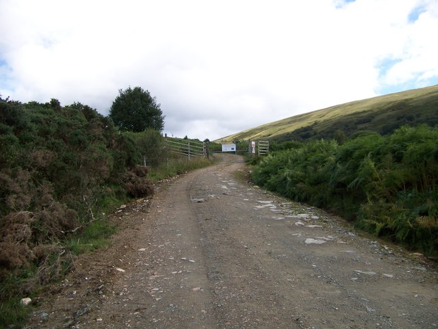
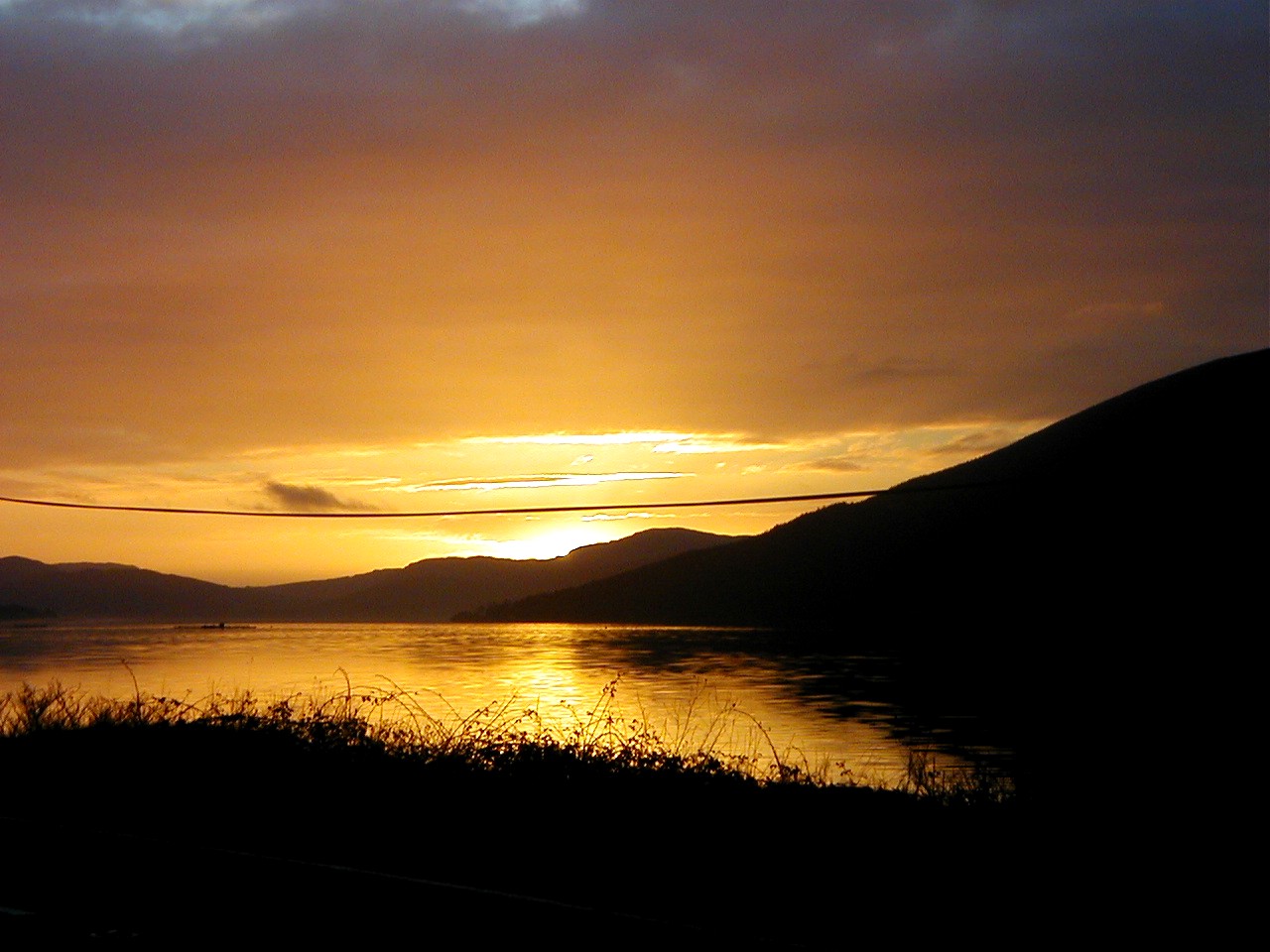
Creagan an Eich Images

Images are sourced within 2km of 56.18572/-5.05576 or Grid Reference NN1003. Thanks to Geograph Open Source API. All images are credited.

Overgrown forestry track near Strachur
A815 north of Creggans
A815 towards Cairndow
A815 towards Strachur
Trig pillar on Creagan an Eich Loch Fyne stretches below.
Trig pillar on Creagan an Eich
Loch Fyne stretches below.
Grassy moor on Creagan an Eich
Catchment of Eas Dubh
Forest edge above Ardchyline Snowy summits of Cruachan beyond.
Forest edge above Ardchyline
Snowy summits of Cruachan beyond.
The track to the radio masts
A815 Beside Loch Fyne between Strachur and St Catherines.
A815
Beside Loch Fyne between Strachur and St Catherines.
Old alignment of the A815 Now an access route to houses along Loch Fyne.
Old alignment of the A815
Now an access route to houses along Loch Fyne.
Hill road climbing for aerial installation The masts, three of them, probably serving a variety of purposes, are on the slope below the feature, Creagan an Eich, which is above the settlement at Clachan at Strachur.
Hill road climbing for aerial installation
The masts, three of them, probably serving a variety of purposes, are on the slope below the feature, Creagan an Eich, which is above the settlement at Clachan at Strachur.
Broad hill ridge north-east from Creagan an Eich Creagan an Eich is a hill location north of Strachur; there's a trig point but not at the hill's highest point. The view here is from beyond the 'summit', along an atrociously wet ridge with the valley of the Eas Dubh below to the right.
Broad hill ridge north-east from Creagan an Eich
Creagan an Eich is a hill location north of Strachur; there's a trig point but not at the hill's highest point. The view here is from beyond the 'summit', along an atrociously wet ridge with the valley of the Eas Dubh below to the right.
Appallingly wet moorland ridge The ridge to the north-east of the vague location Creagan an Eich was atrociously wet at the time the image was recorded. Considering the virtually zero gradient of the land it's unsurprising that in wet times - or even at any time - water fails to drain away.
Appallingly wet moorland ridge
The ridge to the north-east of the vague location Creagan an Eich was atrociously wet at the time the image was recorded. Considering the virtually zero gradient of the land it's unsurprising that in wet times - or even at any time - water fails to drain away.
Hill walkers at fence junction west of Creag Dhubh The fence junction is along the broad ridge north-east from Creagan an Eich. That ridge merges with another in the vicinity of Creag Dhubh which is on the right side skyline.
Hill walkers at fence junction west of Creag Dhubh
The fence junction is along the broad ridge north-east from Creagan an Eich. That ridge merges with another in the vicinity of Creag Dhubh which is on the right side skyline.
Broad moorland ridge beyond Creagan an Eich Creagan an Eich is an upland location above Strachur of no particular distinction and only just a local high point. It does have a trig point however with the flush bracket number S8766.
Broad moorland ridge beyond Creagan an Eich
Creagan an Eich is an upland location above Strachur of no particular distinction and only just a local high point. It does have a trig point however with the flush bracket number S8766.
Show me another place!

Creagan an Eich is located at Grid Ref: NN1003 (Lat: 56.18572, Lng: -5.05576)

Unitary Authority: Argyll and Bute

Police Authority: Argyll and West Dunbartonshire

What 3 Words

///jumpy.swerving.driveway. Near Inveraray, Argyll & Bute

Nearby Locations

Creagan an Eich

Related Wikis

Strachur

Strachur (Scottish Gaelic: Srath Chura) and Strathlachlan (Scottish Gaelic: Srath Lachlainn) are united parishes located on the Cowal peninsula, in Argyll...
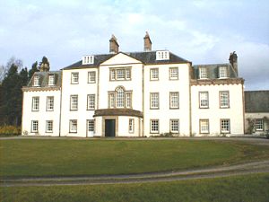
Strachur House

Strachur House is a Category B listed building in Strachur, Argyll and Bute, Scotland. It dates from around 1770, and is a three-storey building, built...

Strachur Bay

Strachur Bay is a coastal embayment, on a 114° orientation, on the eastern coast of the longest sea loch in Scotland, Loch Fyne located in Argyll and Bute...

Loch Fyne

Loch Fyne (Scottish Gaelic: Loch Fìne, pronounced [l̪ˠɔx ˈfiːnə]; meaning "Loch of the Vine/Wine"), is a sea loch off the Firth of Clyde and forms part...

Nearby Amenities

Located within 500m of 56.18572,-5.05576
Creagan an Eich
Ele: 332
Natural: peak
Lat/Long: 56.1858844/-5.0555978
Trig point of Creagan an Eich
Man Made: survey_point
Ref: S8766
Survey Point Purpose: both
Survey Point Structure: pillar
Lat/Long: 56.184356/-5.0592208
The data included in this document is from www.openstreetmap.org. The data is made available under ODbL.

Have you been to Creagan an Eich?

Leave your review of Creagan an Eich below (or comments, questions and feedback).