An Socach

Hill, Mountain in Inverness-shire

Scotland

An Socach

Upper Glen Affric near Alltbeithe Youth Hostel A view from a laborious climb of An Socach which involved step cutting in hard snow and wading deep soft!
Upper Glen Affric near Alltbeithe Youth Hostel Credit: Julian Paren

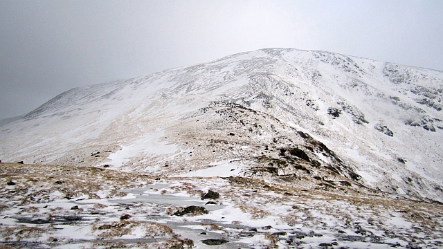
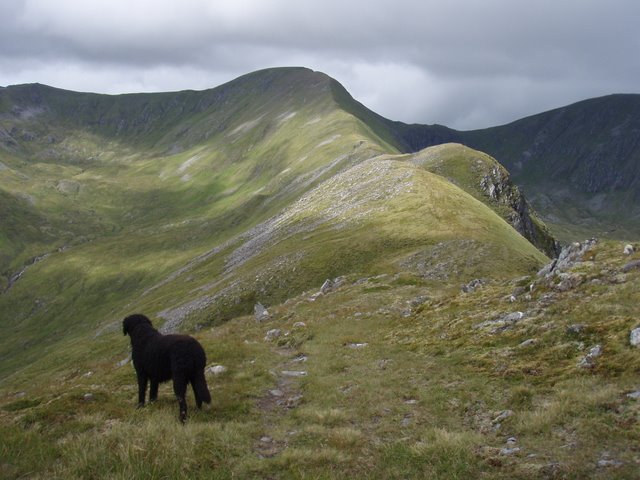
An Socach is a prominent hill located in Inverness-shire, Scotland. It is part of the Grampian Mountains and stands at an elevation of 1,066 meters (3,497 feet). The hill is situated in the Cairngorms National Park, an area renowned for its stunning landscapes and abundant wildlife.

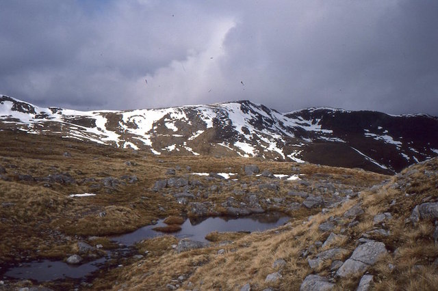
An Socach offers breathtaking panoramic views of the surrounding area, including the nearby Munros of the Cairngorms, such as Ben Macdui and Cairn Gorm. On a clear day, it is possible to see as far as the Moray Firth and the North Sea to the north, and the rugged peaks of the Scottish Highlands to the south.

The ascent of An Socach can be challenging at times, with steep and rocky terrain, but the reward is well worth the effort. The hill is popular among hikers and mountaineers, who often combine it with climbs of other nearby peaks. There are various routes to reach the summit, each offering a different level of difficulty and scenery.

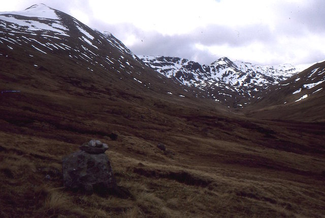
The area surrounding An Socach is rich in biodiversity, with a variety of plant and animal species. It is home to several species of birds, including ptarmigan and golden eagles, as well as mammals like red deer and mountain hares. The hillside is adorned with heather and wildflowers in the summer months, creating a vibrant and colorful landscape.

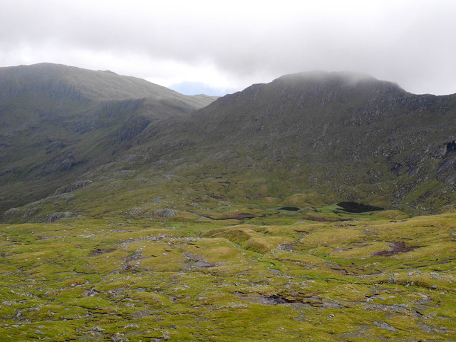
Overall, An Socach is a stunning natural landmark in Inverness-shire, offering both a challenging adventure for outdoor enthusiasts and a peaceful retreat for those seeking tranquility in the heart of the Scottish Highlands.

If you have any feedback on the listing, please let us know in the comments section below.

An Socach Images

Images are sourced within 2km of 57.257573/-5.1712673 or Grid Reference NH0822. Thanks to Geograph Open Source API. All images are credited.

Upper Glen Affric near Alltbeithe Youth Hostel A view from a laborious climb of An Socach which involved step cutting in hard snow and wading deep soft!
Upper Glen Affric near Alltbeithe Youth Hostel
A view from a laborious climb of An Socach which involved step cutting in hard snow and wading deep soft!
Coire na Coiche Stob Coire na Cioche is the high point of the view. The view was taken on a laborious climb of An Sochach. With step cutting and wading through deep soft snow it took all day just to climb the one hill from Alltbeithe Youth Hostel.
Coire na Coiche
Stob Coire na Cioche is the high point of the view. The view was taken on a laborious climb of An Sochach. With step cutting and wading through deep soft snow it took all day just to climb the one hill from Alltbeithe Youth Hostel.
On a climb of An Socach This was hard work.  Deep soft snow.  The exact location of the image is lost but it was taken on a climb of An Socach.
On a climb of An Socach
This was hard work. Deep soft snow. The exact location of the image is lost but it was taken on a climb of An Socach.
Looking to An Socath From just above the Bealach Coire Ghaidheil looking southwest to the nearby Munro of An Socath and the distant hills on the north side of Glen Shiel.
Looking to An Socath
From just above the Bealach Coire Ghaidheil looking southwest to the nearby Munro of An Socath and the distant hills on the north side of Glen Shiel.
Path, Coire Ghàidheil The path runs up the eastern side of Coire Ghàidheil. The steeper sections have been eroded by running water after the drainage culverts became blocked with bog vegetation. It is still an easy way to the ridge.
Path, Coire Ghàidheil
The path runs up the eastern side of Coire Ghàidheil. The steeper sections have been eroded by running water after the drainage culverts became blocked with bog vegetation. It is still an easy way to the ridge.
Path, Bealach Coire Ghàidheil A path, water worn in places crosses the ridge between Glen Cannich and Glen Affric.
Path, Bealach Coire Ghàidheil
A path, water worn in places crosses the ridge between Glen Cannich and Glen Affric.
Coire Ghàidheil The flat floor of the corrie, a hanging valley above Glen Affric.
Coire Ghàidheil
The flat floor of the corrie, a hanging valley above Glen Affric.
Bealach Coire Ghàidheil A path crosses the ridge between what was Loch Lungard, now the hydro Loch Mullardoch and spared Glen Affric. The weather was dry despite the darkness over Glen Affric, but the wind was ferocious.
Bealach Coire Ghàidheil
A path crosses the ridge between what was Loch Lungard, now the hydro Loch Mullardoch and spared Glen Affric. The weather was dry despite the darkness over Glen Affric, but the wind was ferocious.
Bealach Coire Ghàidheil Looking along the ridge towards Màm Sodhail
Bealach Coire Ghàidheil
Looking along the ridge towards Màm Sodhail
Bealach Coire Ghàidheil A pass between upper Glen Cannich and Glen Affric.  It is more widely used as a route onto Màm Sodhail or An Socach.
Bealach Coire Ghàidheil
A pass between upper Glen Cannich and Glen Affric. It is more widely used as a route onto Màm Sodhail or An Socach.
Under An Socach View up Gleann a' Choilich towards Sgùrr nan Ceathramhnan.  An Socah on the left.
Under An Socach
View up Gleann a' Choilich towards Sgùrr nan Ceathramhnan. An Socah on the left.
Allt na Faing and Mullach Fraoch-choire Looking down the usual ascent route of Sgùrr nan Ceathreamhnan, a fine pony path above Alltbeithe.  The big steep hill opposite is Mullach Fraoch-choire which I crossed the previous day.    Taken on the way to Sgùrr Gaorsaic via Sgùrr nan Ceathreamhnan.
Allt na Faing and Mullach Fraoch-choire
Looking down the usual ascent route of Sgùrr nan Ceathreamhnan, a fine pony path above Alltbeithe. The big steep hill opposite is Mullach Fraoch-choire which I crossed the previous day. Taken on the way to Sgùrr Gaorsaic via Sgùrr nan Ceathreamhnan.
Allt na Faing and Glen Affric View down to the buildings at Alltbeithe, an iron lodge and now youth hostel from the fine path up to the east ridge of Sgùrr nan Ceathreamhnan.
Allt na Faing and Glen Affric
View down to the buildings at Alltbeithe, an iron lodge and now youth hostel from the fine path up to the east ridge of Sgùrr nan Ceathreamhnan.
Stob Choire na Cloiche A top of Sgùrr nan Ceathreamhnan above Alltbeithe.
Stob Choire na Cloiche
A top of Sgùrr nan Ceathreamhnan above Alltbeithe.
Carnach Mòr A broken crag on the north side of Glen Affric.  There is also a new native tree plantation here, the fenced enclosure has made it on to the Ordnance Survey map, but not the tree symbols.
Carnach Mòr
A broken crag on the north side of Glen Affric. There is also a new native tree plantation here, the fenced enclosure has made it on to the Ordnance Survey map, but not the tree symbols.
An Socach The north east ridge of An Socach leading to a minor 906m top (in the next square).  Carn Eige and Màm Sodhail can be seen in the distance.
An Socach
The north east ridge of An Socach leading to a minor 906m top (in the next square). Carn Eige and Màm Sodhail can be seen in the distance.
Stob coire na Cloiche from low on Ceathreamhnan north east ridge I've submitted this supplemental to help walkers considering the short-cut across Coire nan Dearcag from Mullach na Dheiragain to the bealach at the top of Coire na Cloiche. On the map,it looks difficult, but we found it easier than expected, as shown in this photograph. We cut across the rocky ground to the left of the lochans and took a slanting line up leftwards between rock outcrops to the bealach which can be seen above a deep gully.
Stob coire na Cloiche from low on Ceathreamhnan north east ridge
I've submitted this supplemental to help walkers considering the short-cut across Coire nan Dearcag from Mullach na Dheiragain to the bealach at the top of Coire na Cloiche. On the map,it looks difficult, but we found it easier than expected, as shown in this photograph. We cut across the rocky ground to the left of the lochans and took a slanting line up leftwards between rock outcrops to the bealach which can be seen above a deep gully.
Lochan Coire Ghàidheil A view into the inner corrie under An Socach from the path over the Bealach Coire Ghàidheil.
Lochan Coire Ghàidheil
A view into the inner corrie under An Socach from the path over the Bealach Coire Ghàidheil.
Show me another place!

An Socach is located at Grid Ref: NH0822 (Lat: 57.257573, Lng: -5.1712673)

Unitary Authority: Highland

Police Authority: Highlands and Islands

What 3 Words

///timer.bloom.valley. Near Lochcarron, Highland

Nearby Locations

Coire na Cloiche An Socach

Related Wikis

Glen Affric

Glen Affric (Scottish Gaelic: Gleann Afraig) is a glen south-west of the village of Cannich in the Highland region of Scotland, some 15 miles (25 kilometres...

Sgùrr nan Ceathramhnan

Sgùrr nan Ceathreamhnan (Scottish Gaelic for 'peak of the quarters') is a mountain in the Northwest Highlands of Scotland. It lies between Glen Affric...

Mam Sodhail

Mam Sodhail, or Màm Sabhail in Gaelic (meaning "rounded mountain of barns"), sometimes anglicised "Mam Soul", is a mountain with a height of 1,181 metres...

Càrn Eighe

Carn Eighe (Scottish Gaelic: Càrn Èite) is a mountain in the Northwest Highlands of Scotland. Rising to 1,183 metres (3,881 ft) above sea level, it is...

Nearby Amenities

Located within 500m of 57.257573,-5.1712673
An Socach
Description: The snout
Ele: 921
Munro: yes
Munro Number: M269
Natural: peak
Source: NPE
Wikidata: Q20577872
Wikipedia: cy:An Socach
Wikipedia De: An Socach (Glen Affric)
Lat/Long: 57.2575322/-5.1712947
The data included in this document is from www.openstreetmap.org. The data is made available under ODbL.

Have you been to An Socach?

Leave your review of An Socach below (or comments, questions and feedback).