Aonach Cas

Hill, Mountain in Ross-shire

Scotland

Aonach Cas

General view NH0534 Loch na Maoile Buidhe in foreground.
General view NH0534 Credit: D Riddell

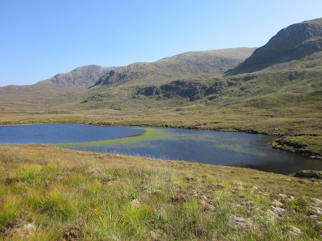
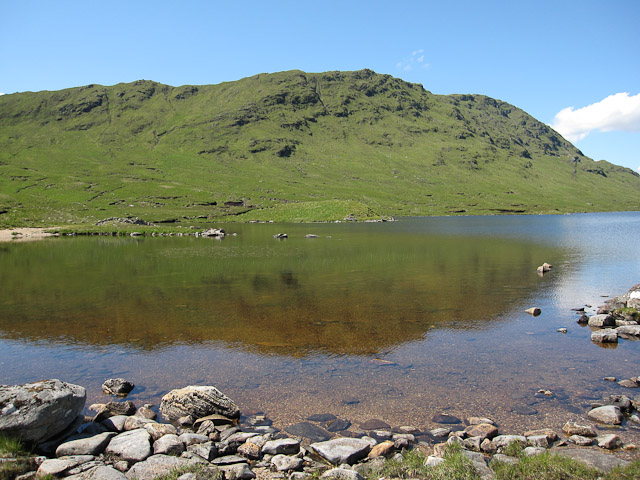
Aonach Cas is a prominent hill located in Ross-shire, Scotland. Situated near the small village of Garve, it forms part of the scenic landscape of the Scottish Highlands. With an elevation of 826 meters (2,710 feet), it is classified as a Corbett, a term used in Scotland to describe a hill between 2,500 and 3,000 feet in height.

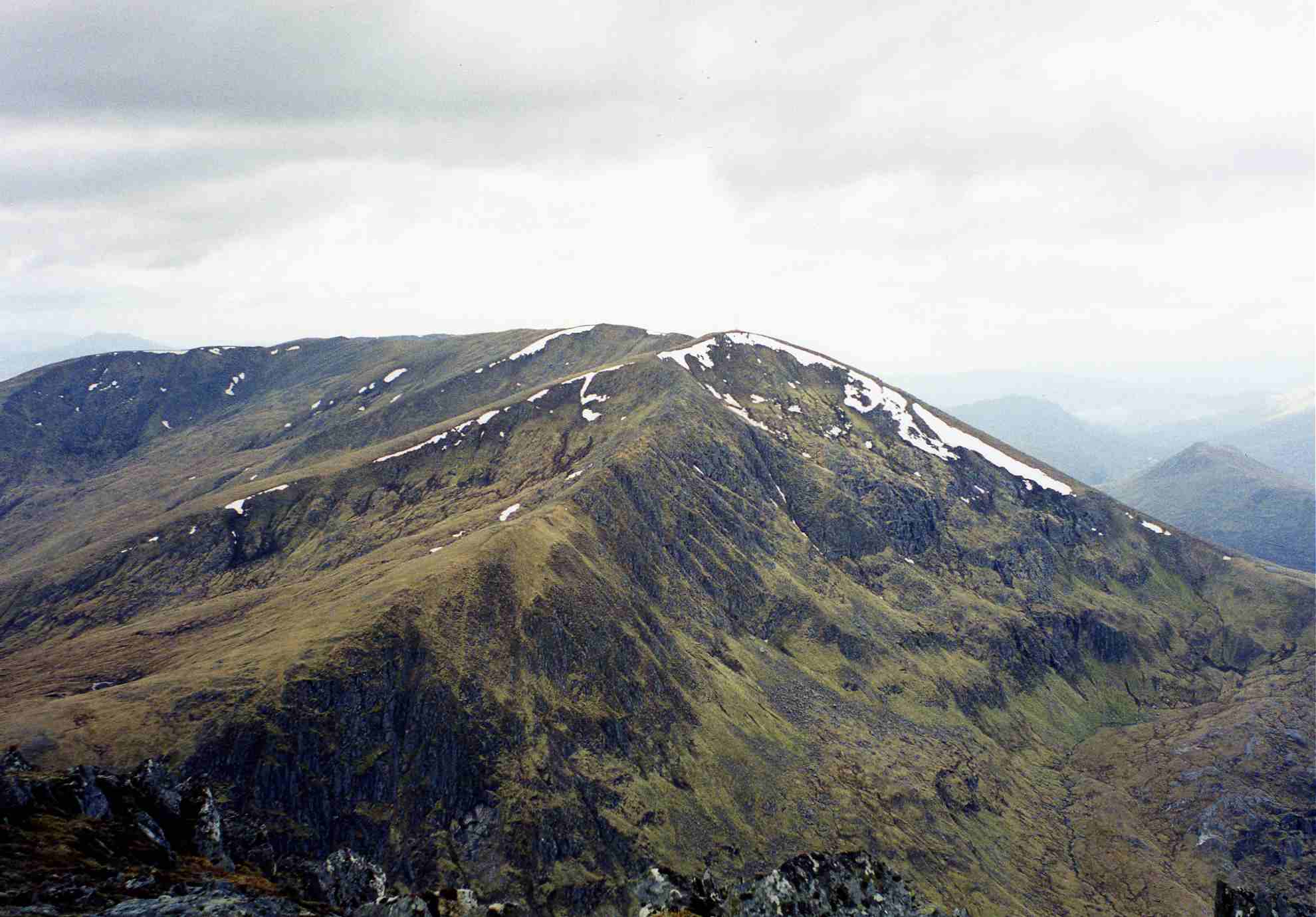
The hill offers breathtaking views of the surrounding area, with its steep slopes and rugged terrain adding to its aesthetic appeal. Aonach Cas is known for its distinctive shape, featuring a long ridge that stretches for approximately 4 kilometers (2.5 miles). This ridge is marked by several rocky outcrops, providing an interesting challenge for climbers and hikers.

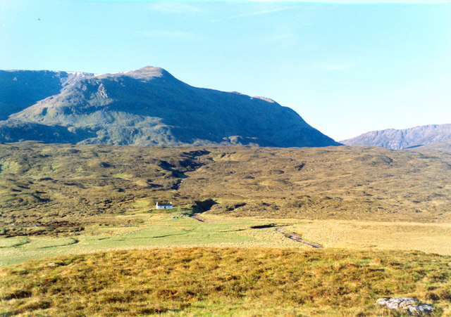
Access to Aonach Cas is relatively straightforward, with several paths leading to the summit. The most common starting point is from Garbat, a small hamlet located to the north of the hill. From there, walkers can follow a clearly defined path that gradually ascends the slopes. As they climb higher, they are rewarded with stunning panoramic views of the surrounding mountains, including the nearby Beinn Dearg and Fannichs.

Aonach Cas is a popular destination for outdoor enthusiasts, offering a range of activities such as hiking, hillwalking, and mountaineering. Its proximity to other notable mountains and its challenging terrain make it an attractive option for experienced climbers looking to explore the Scottish Highlands. Additionally, the hill's remote location ensures a sense of wilderness, allowing visitors to immerse themselves in the natural beauty of the area.

If you have any feedback on the listing, please let us know in the comments section below.

Aonach Cas Images

Images are sourced within 2km of 57.355825/-5.2032602 or Grid Reference NH0734. Thanks to Geograph Open Source API. All images are credited.

General view NH0534 Loch na Maoile Buidhe in foreground.
General view NH0534
Loch na Maoile Buidhe in foreground.
West side of An Cruachan The river changes its name somewhere just here from the Allt Coire nan Each to the Allt an Loin-fhiodha as it moves from one glen to another. It later ends up as the River Ling.
West side of An Cruachan
The river changes its name somewhere just here from the Allt Coire nan Each to the Allt an Loin-fhiodha as it moves from one glen to another. It later ends up as the River Ling.
Ridge north of Bealach na Ceud Eilde in Inverinate Forest, West Highlands Loch Calavie nestled in the background among remote Munros.
Ridge north of Bealach na Ceud Eilde in Inverinate Forest, West Highlands
Loch Calavie nestled in the background among remote Munros.
On Bealach na Ceud Eilde in Inverinate Forest, West Highlands Very walker-unfriendly snow at least at 600 m but it would have skied nicely. Would love to have known what it was like at 1000m but as it was, was happy to manage to hold to mainly hard bare ground on my route.
On Bealach na Ceud Eilde in Inverinate Forest, West Highlands
Very walker-unfriendly snow at least at 600 m but it would have skied nicely. Would love to have known what it was like at 1000m but as it was, was happy to manage to hold to mainly hard bare ground on my route.
Wintry moorland north of Aonach Cas in Inverinate Forest, West Highland
The cold and complicated heart of Aonach Buidhe in Inverinate Forest, West Highlands Looking into one of a series of little-visited but dramatic corries sculpted into the bulk of this hill in a complex pattern. Yet its reputation amongst hill-walkers is as a boring lump based on its dull but easy south-west approach used by guide-books.
The cold and complicated heart of Aonach Buidhe in Inverinate Forest, West Highlands
Looking into one of a series of little-visited but dramatic corries sculpted into the bulk of this hill in a complex pattern. Yet its reputation amongst hill-walkers is as a boring lump based on its dull but easy south-west approach used by guide-books.
A steep pitch of drifted snow on Aonach Cas in Inverinate Forest, West Highlands
Creag Dubh in Inverinate Forest, West Highlands
Ridge east of Allt na Creige Duibhe near Maol Buidhe bothy in Inverinate Forest, West Highlands
Moorland west of Allt na Creige Duibhe in Inverinate Forest, West Highlands
Small bealach at the foot of the ridge east of Allt na Creige Duibhe in Inverinate Forest, West Highlands
Allt na Creige Duibhe in Inverinate Forest, West Highlands
Deep pool on Allt na Creige Duibhe in Inverinate Forest, West Highlands
Allt na Creige Duibhe in Inverinate Forest, West Highlands Beinn Dronaig in the background.
Allt na Creige Duibhe in Inverinate Forest, West Highlands
Beinn Dronaig in the background.
High point on ridge leading to Aonach Buidhe in Inverinate Forest, West Highlands
Grassy flat in the course of Allt na Creige Duibhe in Inverinate Forest, West Highlands The allt is a series of plunges through rock bands into flat or boggy areas before the next plunge. The flats are fertile and attract deer with richer grazing than the surrounding moors.
Grassy flat in the course of Allt na Creige Duibhe in Inverinate Forest, West Highlands
The allt is a series of plunges through rock bands into flat or boggy areas before the next plunge. The flats are fertile and attract deer with richer grazing than the surrounding moors.
Flat area on Allt na Creige Duibhe in Inverinate Forest, West Highlands
Allt na Creige Duibhe breaking through a rock and morraine band below Aonach Buidhe in Inverinate Forest, West Highlands
Show me another place!

Aonach Cas is located at Grid Ref: NH0734 (Lat: 57.355825, Lng: -5.2032602)

Unitary Authority: Highland

Police Authority: Highlands and Islands

What 3 Words

///defensive.summaries.magnitude. Near Lochcarron, Highland

Nearby Locations

Aonach Cas

Related Wikis

Aonach Buidhe

Aonach Buidhe (899 m) is a remote mountain in the Northwest Highlands of Ross and Cromarty in northwest Scotland. The nearest village is Dornie. The usual...

An Socach (Glen Cannich)

An Socach is a mountain at the head of Glen Cannich, in the Highlands of Scotland. It is situated between Loch Mullardoch in Glen Cannich, and Loch Monar...

Beinn Dronaig

Beinn Dronaig (797 m) is a mountain in the Northwest Highlands of Wester Ross, Scotland. A remote peak northeast of the village of Dornie, it is located...

An Riabhachan

An Riabhachan is a Scottish mountain in the Skye and Lochalsh district of the Highland council area. It is situated 35 kilometres east of Kyle of Lochalsh...

Have you been to Aonach Cas?

Leave your review of Aonach Cas below (or comments, questions and feedback).