Càrn na Breabaig

Hill, Mountain in Ross-shire

Scotland

Càrn na Breabaig

Loch Mhoicean View from a pass at the head of Coire Breabeag.  Was out quite late and ended up stumbling about in the dark after my head torch failed.  On the way down from Beinn Fhionnlaidh which was visited while walking from Ceannacroc Bridge to Dornie.
Loch Mhoicean Credit: Richard Webb

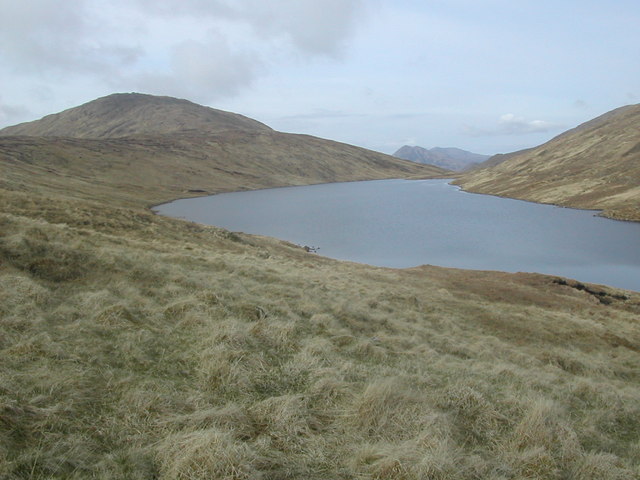
Càrn na Breabaig is a prominent hill located in Ross-shire, within the Scottish Highlands. With an elevation of 852 meters (2,795 feet), it is classified as a Corbett, which is a term used for a Scottish hill between 2,500 and 3,000 feet high with a prominence of at least 500 feet.

Situated near the village of Achnasheen, Càrn na Breabaig offers stunning panoramic views of the surrounding landscape. Its distinctive shape and position make it a popular destination for hikers and mountaineers, providing a challenging yet rewarding ascent.

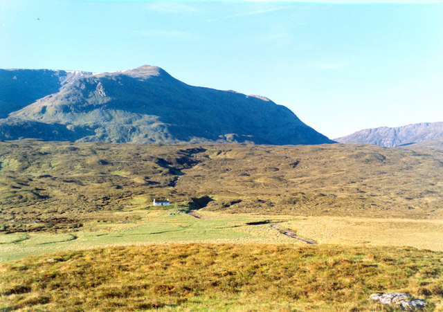
The hill is known for its rugged terrain, characterized by steep slopes and rocky outcrops. The ascent typically starts from the A832 road, where a path leads up through a mixture of heather, grasses, and boggy sections. As climbers ascend, they may encounter some scrambling, particularly near the summit, which adds an element of adventure to the experience.

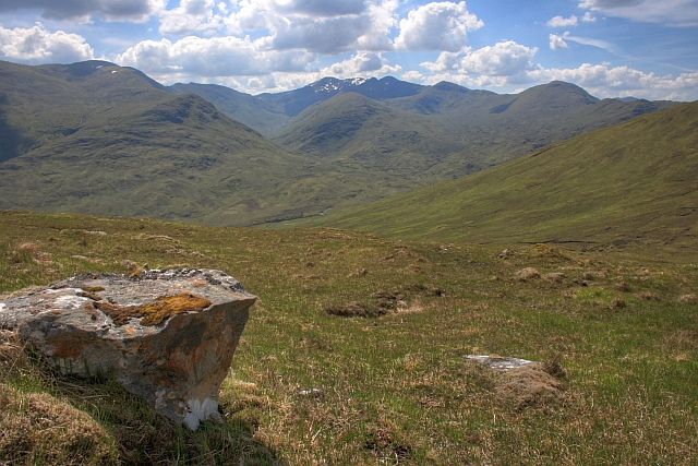
Upon reaching the top, visitors are rewarded with breathtaking views of the surrounding mountains, including the Torridon Hills and the Fannichs. On clear days, it is even possible to see as far as the Isle of Skye and the Outer Hebrides.

Càrn na Breabaig is also home to a variety of wildlife, including red deer, golden eagles, and ptarmigans. The hill is protected as part of the Beinn Eighe National Nature Reserve, ensuring the preservation of its natural beauty and biodiversity.

Overall, Càrn na Breabaig offers outdoor enthusiasts a challenging and rewarding hike, coupled with stunning scenery and the chance to immerse themselves in the unspoiled wilderness of the Scottish Highlands.

If you have any feedback on the listing, please let us know in the comments section below.

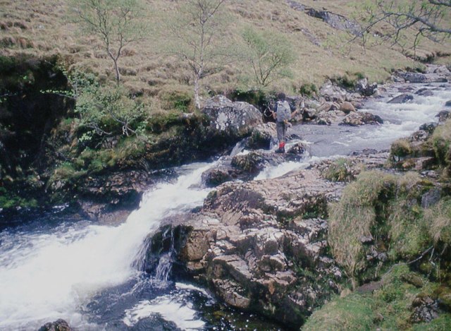
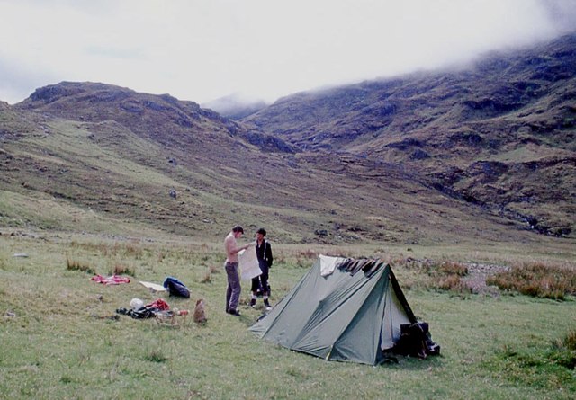
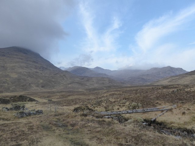
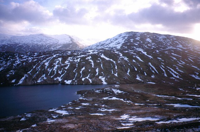
Càrn na Breabaig Images

Images are sourced within 2km of 57.320901/-5.2125467 or Grid Reference NH0630. Thanks to Geograph Open Source API. All images are credited.

Loch Mhoicean View from a pass at the head of Coire Breabeag.  Was out quite late and ended up stumbling about in the dark after my head torch failed.  On the way down from Beinn Fhionnlaidh which was visited while walking from Ceannacroc Bridge to Dornie.
Loch Mhoicean
View from a pass at the head of Coire Breabeag. Was out quite late and ended up stumbling about in the dark after my head torch failed. On the way down from Beinn Fhionnlaidh which was visited while walking from Ceannacroc Bridge to Dornie.
Stalkers' path to Mullardoch
Fording Allt an Fhraoich-choire
Camping in Killilan
Camping in Killilan
Bridge over the Allt na Criche This is what remains of the bridge over the Allt na Criche that is marked on the OS 1:25k map. To the left is the ruin of the stone building also marked on the OS 1:25k map.
Bridge over the Allt na Criche
This is what remains of the bridge over the Allt na Criche that is marked on the OS 1:25k map. To the left is the ruin of the stone building also marked on the OS 1:25k map.
Loch Mhoichean Taken from the slopes of Aonach Buidhe, this loch dominates the square. It is near the top of a pass, and the OS show it to have an outflow at either end, this is not the case on the ground (perhaps in times of flood?).
Loch Mhoichean
Taken from the slopes of Aonach Buidhe, this loch dominates the square. It is near the top of a pass, and the OS show it to have an outflow at either end, this is not the case on the ground (perhaps in times of flood?).
Winter dusk on Carn na Breabeag Looking eastwards as it gets dark (mid afternoon) towards Glen Cannich and the combined lochs of Mullardoch and Lungard.
Winter dusk on Carn na Breabeag
Looking eastwards as it gets dark (mid afternoon) towards Glen Cannich and the combined lochs of Mullardoch and Lungard.
Loch Mhoicean
Loch Mhoicean
Hillside gulleys on footpath from Iron Lodge to Loch Mhoicean Interesting patterns on the hillside
Hillside gulleys on footpath from Iron Lodge to Loch Mhoicean
Interesting patterns on the hillside
Campsite at west end of Loch Mhoicean A remote spot and surprisingly midge free in July
Campsite at west end of Loch Mhoicean
A remote spot and surprisingly midge free in July
Coire na Breabaig Looking towards the mountains of the Kintail Forest.
Coire na Breabaig
Looking towards the mountains of the Kintail Forest.
Boulder, Footpath to Loch Mullardoch View towards Cadha Bàn (NH0330) a spur on the south east ridge of Faochaig.
Boulder, Footpath to Loch Mullardoch
View towards Cadha Bàn (NH0330) a spur on the south east ridge of Faochaig.
Srath Duilleach and Loch na Leitreach from the Footpath to Loch Mullardoch The dominant peak just right of centre is the 729m Carnan Cruithneachd (NG9925).
Srath Duilleach and Loch na Leitreach from the Footpath to Loch Mullardoch
The dominant peak just right of centre is the 729m Carnan Cruithneachd (NG9925).
Allt na Doire Gairbhe
Allt an Fliuch-choire Flowing into Loch Mhoicean.
Allt an Fliuch-choire
Flowing into Loch Mhoicean.
Boulder with Metal Structure, Coire na Breabaig Almost at the bealach. I have no idea of its former use. Perhaps some sort of survey point?
Boulder with Metal Structure, Coire na Breabaig
Almost at the bealach. I have no idea of its former use. Perhaps some sort of survey point?
Loch Mhoicean
Loch Mhoicean
Loch Mhoicean A yellowish suspension which formed on the downwind edge of the loch. Not sure what it is. My first thoughts are algae growth but someone suggested pollen.
Loch Mhoicean
A yellowish suspension which formed on the downwind edge of the loch. Not sure what it is. My first thoughts are algae growth but someone suggested pollen.
Show me another place!

Càrn na Breabaig is located at Grid Ref: NH0630 (Lat: 57.320901, Lng: -5.2125467)

Unitary Authority: Highland

Police Authority: Highlands and Islands

What 3 Words

///animated.allow.ribcage. Near Lochcarron, Highland

Nearby Locations

Càrn na Breabaig

Related Wikis

Aonach Buidhe

Aonach Buidhe (899 m) is a remote mountain in the Northwest Highlands of Ross and Cromarty in northwest Scotland. The nearest village is Dornie. The usual...

An Socach (Glen Cannich)

An Socach is a mountain at the head of Glen Cannich, in the Highlands of Scotland. It is situated between Loch Mullardoch in Glen Cannich, and Loch Monar...

Beinn Fhionnlaidh (Mullardoch)

Beinn Fhionnlaidh is a mountain in the Highlands of Scotland. It is situated on the south side of Loch Mullardoch, at the end of Glen Cannich, about 60...

Falls of Glomach

The Falls of Glomach, in Ross-shire, Scotland, is one of the tallest waterfalls in Britain, with a drop of 113 m (370 ft). The falls border Kintail, donated...

Nearby Amenities

Located within 500m of 57.320901,-5.2125467
Càrn na Breabaig
Corbett: no
Ele: 678
Graham: yes
Marilyn: yes
Munro: no
Natural: peak
Prominence: 176
Wikidata: Q13126661
Lat/Long: 57.3209594/-5.2113743
The data included in this document is from www.openstreetmap.org. The data is made available under ODbL.

Have you been to Càrn na Breabaig?

Leave your review of Càrn na Breabaig below (or comments, questions and feedback).