Cnoc a' Mhuilinn

Hill, Mountain in Sutherland

Scotland

Cnoc a' Mhuilinn

Clashnessie Bay Looking towards the Stoer peninsula.
Clashnessie Bay Credit: Russel Wills

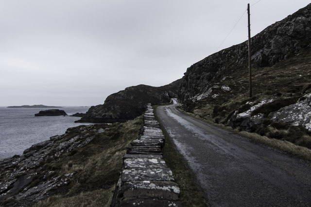
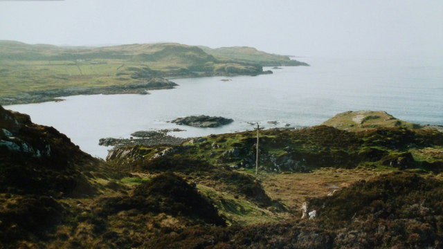
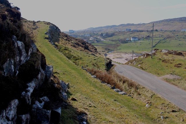
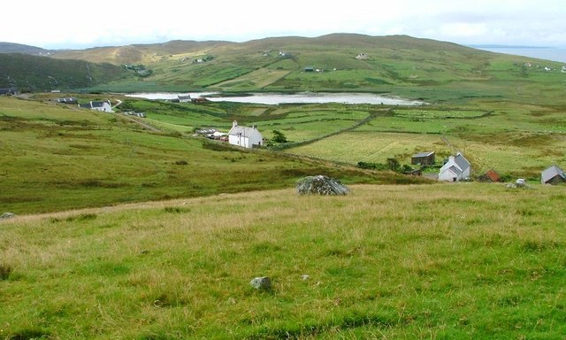
Cnoc a' Mhuilinn is a prominent hill located in the county of Sutherland in the northern Highlands of Scotland. It stands at an elevation of approximately 450 meters (1476 feet) above sea level, offering breathtaking panoramic views of the surrounding landscape. The hill is situated near the village of Rogart and is easily accessible by foot or by a short drive.

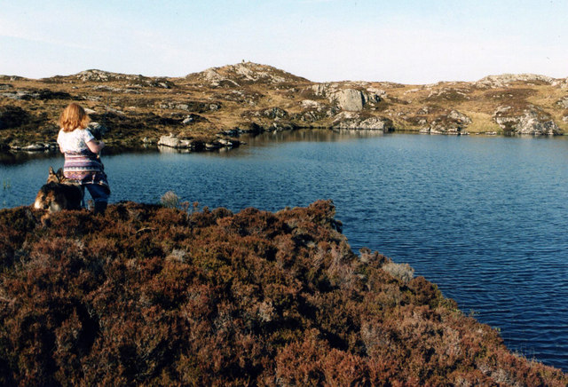
The name "Cnoc a' Mhuilinn" translates to "Hill of the Mill" in Scottish Gaelic, possibly indicating a historical association with milling activities in the area. The hill features a rugged terrain characterized by rocky outcrops, heather-covered slopes, and patches of woodland, providing a diverse habitat for various flora and fauna.

Cnoc a' Mhuilinn is a popular destination for outdoor enthusiasts and hikers due to its accessibility and the stunning vistas it offers. The hill provides a relatively moderate ascent, making it suitable for individuals of various fitness levels. From the summit, visitors can admire the picturesque landscapes of the Scottish Highlands, with rolling hills, lochs, and distant mountains stretching as far as the eye can see.

The area surrounding Cnoc a' Mhuilinn is rich in history and heritage, with numerous archaeological sites and ancient ruins scattered throughout. These include standing stones, burial cairns, and remnants of settlements, offering a glimpse into the region's past.

Overall, Cnoc a' Mhuilinn is a remarkable hill in Sutherland, Scotland, providing a captivating blend of natural beauty, outdoor activities, and cultural heritage for visitors to explore and appreciate.

If you have any feedback on the listing, please let us know in the comments section below.

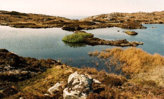
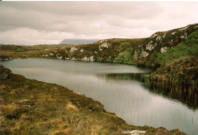
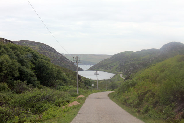
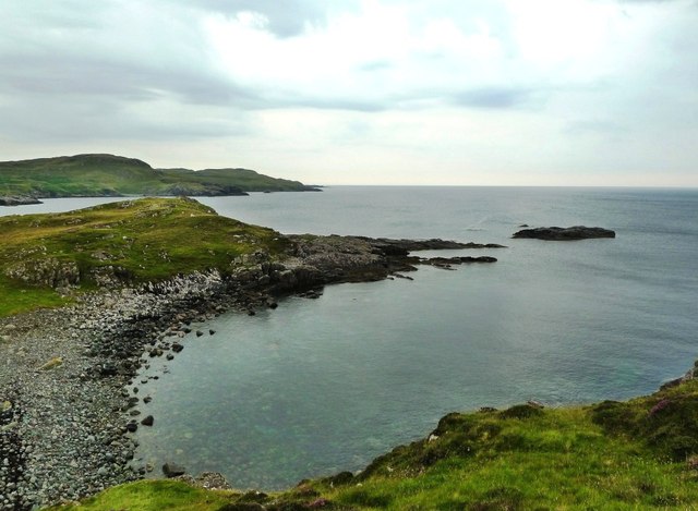
Cnoc a' Mhuilinn Images

Images are sourced within 2km of 58.221113/-5.3065395 or Grid Reference NC0530. Thanks to Geograph Open Source API. All images are credited.

Clashnessie Bay Looking towards the Stoer peninsula.
Clashnessie Bay
Looking towards the Stoer peninsula.
New cottage overlooking Clashnessie Bay A recently constructed modern cottage designed by Dualchas Architects.
Uses black corrugated sheets, but in a modern interpretation.
New cottage overlooking Clashnessie Bay
A recently constructed modern cottage designed by Dualchas Architects. Uses black corrugated sheets, but in a modern interpretation.
Sustainably Powered School Stoer Primary School and its controversial wind turbine. Local feeling about it is mixed, according to articles in the local newspapers.
Sustainably Powered School
Stoer Primary School and its controversial wind turbine. Local feeling about it is mixed, according to articles in the local newspapers.
Loch Neil Bhain Maybe if I'd gone to school in such a beautiful spot, I'd have enjoyed it more!
Loch Neil Bhain
Maybe if I'd gone to school in such a beautiful spot, I'd have enjoyed it more!
Shallow lochan above Imirfada
Small Lochan near Loch nan Lub The shallow cliff on the right was the highest point in the area.
Small Lochan near Loch nan Lub
The shallow cliff on the right was the highest point in the area.
Loch na Bruthaich B869 down to Loch na Bruthaich and in the distance Clashnessie Bay.
Loch na Bruthaich
B869 down to Loch na Bruthaich and in the distance Clashnessie Bay.
Imirfada and Clashnessie Bay B869 to Imirfada by Clashnessie Bay.
Imirfada and Clashnessie Bay
B869 to Imirfada by Clashnessie Bay.
Park House A well maintained cottage under a big sky at Clashmore.
Park House
A well maintained cottage under a big sky at Clashmore.
Former Youth Hostel at Stoer I can recall staying a few nights at Stoer School in the 1960s when it was used as a Youth Hostel during the summer holidays. Ah, those were the days...!
Former Youth Hostel at Stoer
I can recall staying a few nights at Stoer School in the 1960s when it was used as a Youth Hostel during the summer holidays. Ah, those were the days...!
Cùl Phuirte This is part of Clashnessie Bay, viewed on a disappointingly dull day that did no justice to the beauty of the scenery.
Cùl Phuirte
This is part of Clashnessie Bay, viewed on a disappointingly dull day that did no justice to the beauty of the scenery.
Road by Clashnessie Bay
Rough Ground above Imirfada From an old print.
Rough Ground above Imirfada
From an old print.
Unnamed Lochan above Imirfada
Imirfada, Clashnessie Cottage by the Atlantic.
Imirfada, Clashnessie
Cottage by the Atlantic.
Clashnessie Bay
Clashnessie Bay
Path to the moor, Clashnessie
Grass road to the moor, Clashnessie
Show me another place!

Cnoc a' Mhuilinn is located at Grid Ref: NC0530 (Lat: 58.221113, Lng: -5.3065395)

Unitary Authority: Highland

Police Authority: Highlands and Islands

What 3 Words

///crumples.upholding.resorting. Near Clachtoll, Highland

Related Wikis

Clashnessie

Clashnessie (Scottish Gaelic: Clais an Easaidh) is a small crofting community on the North-West coast of Scotland; specifically in the Assynt area of Sutherland...

Achnacarnin

Achnacarnin (Scottish Gaelic: Achadh nan Càrnan) is a village on the headland of Point of Stoer in Lairg, Sutherland, within the Scottish local authority...

Balchladich

Balchladich (Scottish Gaelic: Baile a' Chladaich) is a remote township in the Assynt district of Sutherland, Scottish Highlands and is in the Scottish...

Clashmore, Assynt

Clashmore (Scottish Gaelic: An Clais Mór) is a scattered township in Assynt, in Sutherland, in the Highland council area of Scotland. It is situated on...

Nearby Amenities

Located within 500m of 58.221113,-5.3065395
Source: PGS
Lat/Long: 58.2253456/-5.3059967
Post Box
Operator: Royal Mail
Post Box Type: lamp
Royal Cypher: scottish_crown
Lat/Long: 58.2226114/-5.3145399
Telephone
Booth: K6
Covered: booth
Operator: BT
Lat/Long: 58.2229233/-5.313145
Clashnessie
Name Gd: Clais an Easaidh
Place: hamlet
Lat/Long: 58.2228567/-5.3128096
Bus Stop
Telephone Box
Local Ref: AT
Naptan AtcoCode: 6700712508
Naptan Bearing: W
Naptan CommonName: Telephone Box
Naptan Indicator: at
Naptan Landmark: Telephone Box
Naptan NaptanCode: 45327873
Naptan Street: B869
Naptan Verified: no
Source: naptan_import
Lat/Long: 58.2229222/-5.3130759
Power: pole
Lat/Long: 58.2228854/-5.3135675
Power: pole
Lat/Long: 58.2222905/-5.3123727
Power: pole
Lat/Long: 58.2225007/-5.3130385
Power: pole
Lat/Long: 58.2220588/-5.3137782
Power: pole
Lat/Long: 58.2215626/-5.3148158
Power: pole
Lat/Long: 58.2229846/-5.3121332
Power: pole
Lat/Long: 58.2224945/-5.3106323
Power: pole
Lat/Long: 58.2214458/-5.3137568
Power: pole
Lat/Long: 58.2216652/-5.3125615
Power: pole
Lat/Long: 58.2218907/-5.3113876
Power: pole
Lat/Long: 58.2221839/-5.3110178
Power: pole
Lat/Long: 58.2229077/-5.3095402
Power: pole
Lat/Long: 58.223246/-5.3086369
Power: pole
Lat/Long: 58.2235576/-5.3078115
Power: pole
Lat/Long: 58.2238611/-5.3070094
Power: pole
Lat/Long: 58.2242835/-5.3058492
Power: pole
Lat/Long: 58.2247109/-5.3046597
Power: pole
Lat/Long: 58.2250246/-5.3037973
The data included in this document is from www.openstreetmap.org. The data is made available under ODbL.

Have you been to Cnoc a' Mhuilinn?

Leave your review of Cnoc a' Mhuilinn below (or comments, questions and feedback).