Aonach Dubh

Hill, Mountain in Ross-shire

Scotland

Aonach Dubh

River Carron near Glen Carron Lodge Seen from the train and with the A890 road cutting the hillside behind.
River Carron near Glen Carron Lodge Credit: Julian Paren

Aonach Dubh is a prominent hill located in Ross-shire, Scotland. It is part of the picturesque Scottish Highlands and stands at an elevation of 818 meters (2,684 feet). The name "Aonach Dubh" translates to "black ridge" in English, which aptly describes its appearance.

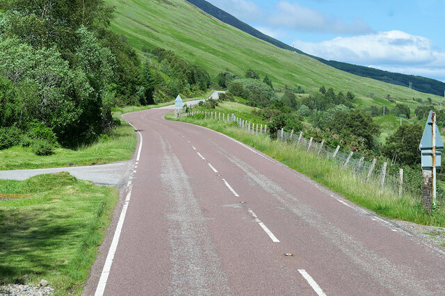
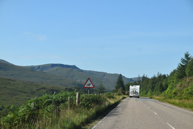
Situated near the small village of Contin, Aonach Dubh is a popular destination for hikers and outdoor enthusiasts. The hill offers breathtaking panoramic views of the surrounding countryside, including the nearby River Blackwater and the towering peaks of the Munro Mountains.

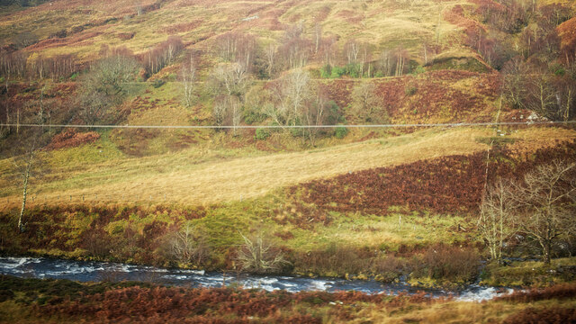
The terrain of Aonach Dubh is characterized by steep slopes and rocky outcrops, making it a moderate to challenging climb. However, the effort is rewarded with stunning vistas and a sense of serenity that comes with being immersed in nature.

The hill is home to a variety of flora and fauna, including heather, mosses, and wildflowers. Birdwatchers may spot species such as golden eagles, peregrine falcons, and ptarmigans, which are known to inhabit the area.

Aonach Dubh is also steeped in history and folklore. Legends tell of ancient battles fought on its slopes, and the hill is said to have mystical qualities. Local folklore suggests that fairies and other supernatural beings roam the area, adding an air of enchantment to the already captivating landscape.

Overall, Aonach Dubh is a must-visit destination for nature lovers and those seeking an adventurous experience in the heart of the Scottish Highlands.

If you have any feedback on the listing, please let us know in the comments section below.

Aonach Dubh Images

Images are sourced within 2km of 57.514891/-5.2539178 or Grid Reference NH0551. Thanks to Geograph Open Source API. All images are credited.

River Carron near Glen Carron Lodge Seen from the train and with the A890 road cutting the hillside behind.
River Carron near Glen Carron Lodge
Seen from the train and with the A890 road cutting the hillside behind.
A890 in Glen Carron The A890 is a non-primary cross-country route in sparsely populated, mountainous terrain from Lochalsh and Skye on the west coast of the Highlands to Achnasheen where it joins the A832 to Inverness. Like many Highland roads, the A890 was entirely single track until the 1960s, but road improvements in recent years (along with improvements on the A832) have made it increasingly popular as an alternative route between Inverness and the Isle of Skye, avoiding the A82 along Loch Ness. It is also an important route for residents of the Lochalsh, Applecross and Strathcarron areas, connecting them to the services of  Kyle of Lochalsh , as well as the High School in Plockton.
A890 in Glen Carron
The A890 is a non-primary cross-country route in sparsely populated, mountainous terrain from Lochalsh and Skye on the west coast of the Highlands to Achnasheen where it joins the A832 to Inverness. Like many Highland roads, the A890 was entirely single track until the 1960s, but road improvements in recent years (along with improvements on the A832) have made it increasingly popular as an alternative route between Inverness and the Isle of Skye, avoiding the A82 along Loch Ness. It is also an important route for residents of the Lochalsh, Applecross and Strathcarron areas, connecting them to the services of Kyle of Lochalsh , as well as the High School in Plockton.
A890 near Glencarron Lodge The A890 is a non-primary cross-country route in sparsely populated, mountainous terrain from Lochalsh and Skye on the west coast of the Highlands to Achnasheen where it joins the A832 to Inverness. Like many Highland roads, the A890 was entirely single track until the 1960s, but road improvements in recent years (along with improvements on the A832) have made it increasingly popular as an alternative route between Inverness and the Isle of Skye, avoiding the A82 along Loch Ness. It is also an important route for residents of the Lochalsh, Applecross and Strathcarron areas, connecting them to the services of  Kyle of Lochalsh , as well as the High School in Plockton.
A890 near Glencarron Lodge
The A890 is a non-primary cross-country route in sparsely populated, mountainous terrain from Lochalsh and Skye on the west coast of the Highlands to Achnasheen where it joins the A832 to Inverness. Like many Highland roads, the A890 was entirely single track until the 1960s, but road improvements in recent years (along with improvements on the A832) have made it increasingly popular as an alternative route between Inverness and the Isle of Skye, avoiding the A82 along Loch Ness. It is also an important route for residents of the Lochalsh, Applecross and Strathcarron areas, connecting them to the services of Kyle of Lochalsh , as well as the High School in Plockton.
A890, Glen Carron The A890 runs 32 miles from Achnasheen to Auchtertyre.
<span class="nowrap"><a title="https://www.sabre-roads.org.uk/wiki/index.php?title=A890" rel="nofollow ugc noopener" href="https://www.sabre-roads.org.uk/wiki/index.php?title=A890">Link</a><img style="margin-left:2px;" alt="External link" title="External link - shift click to open in new window" src="https://s1.geograph.org.uk/img/external.png" width="10" height="10"/></span>
A890, Glen Carron
The A890 runs 32 miles from Achnasheen to Auchtertyre. LinkExternal link
A890 in Glencarron
A890 in Glencarron
Coire Dubh-riabhach Erosion gullies above Glencarron Lodge. Appears to be an area of soft rock.
Coire Dubh-riabhach
Erosion gullies above Glencarron Lodge. Appears to be an area of soft rock.
Carn Breac Southeastern slopes of Carn Breac.  Rather uniform, but the reward at the top is worth the effort.
Carn Breac
Southeastern slopes of Carn Breac. Rather uniform, but the reward at the top is worth the effort.
Summit of Carn Breac Looking over to the Coulin Forest, the stone built trig fits snugly in a shelter. Carn Breac is an amazing view point for Torridon.
Summit of Carn Breac
Looking over to the Coulin Forest, the stone built trig fits snugly in a shelter. Carn Breac is an amazing view point for Torridon.
Glen Torridon from Carn Breac That view!  Liathach, Sgurr Dubh, Beinn Dearg and Beinn Eighe.
Glen Torridon from Carn Breac
That view! Liathach, Sgurr Dubh, Beinn Dearg and Beinn Eighe.
Bridge on the Allt Coire Dubh-riabhach The now overgrown bridge that carried the old A890 over the burn.
Bridge on the Allt Coire Dubh-riabhach
The now overgrown bridge that carried the old A890 over the burn.
Glen Carron Track A track leading to the railway near Glencarron Lodge. There was once a train halt here.
Glen Carron Track
A track leading to the railway near Glencarron Lodge. There was once a train halt here.
Glencarron Farm Building Part of the home farm serving Glencarron Lodge. Cattle are still indoors at night here in early May.
Glencarron Farm Building
Part of the home farm serving Glencarron Lodge. Cattle are still indoors at night here in early May.
Scots Pine in Glen Carron On the northwestern slopes of Meall an Fhliuchaird.
Scots Pine in Glen Carron
On the northwestern slopes of Meall an Fhliuchaird.
Grassy Spur Prominent spur overlooking Glen Carron to the South, and with beautifully-cropped grass making it an easy descent from the moorland above.
Grassy Spur
Prominent spur overlooking Glen Carron to the South, and with beautifully-cropped grass making it an easy descent from the moorland above.
Forest road above the Allt Dearg The forest track climbs steeply above the gorge of the burn.
Forest road above the Allt Dearg
The forest track climbs steeply above the gorge of the burn.
Forest road above Glen Carron Looking down the track that leads to the A890, which runs through Glen Carron.
Forest road above Glen Carron
Looking down the track that leads to the A890, which runs through Glen Carron.
High moorland A view taken across the slopes of Carn Breac, which forms the headwall of the broad Coire Crubaidh.
High moorland
A view taken across the slopes of Carn Breac, which forms the headwall of the broad Coire Crubaidh.
Roadblock in Glencarron This World War II road block sits close to Glencarron Lodge on the A890. The road block is located on the old bridge that once carried the road across the deep gorge of the Allt Coire Dubh-riabhach. It consists of this cube of concrete with three slots for barriers, with only the base for the corresponding block visible on the other side of the road.
Roadblock in Glencarron
This World War II road block sits close to Glencarron Lodge on the A890. The road block is located on the old bridge that once carried the road across the deep gorge of the Allt Coire Dubh-riabhach. It consists of this cube of concrete with three slots for barriers, with only the base for the corresponding block visible on the other side of the road.
Show me another place!

Aonach Dubh is located at Grid Ref: NH0551 (Lat: 57.514891, Lng: -5.2539178)

Unitary Authority: Highland

Police Authority: Highlands and Islands

What 3 Words

///proudest.discusses.number. Near Kinlochewe, Highland

Related Wikis

Glencarron Estate

The Glencarron Estate is a 12,000 acre highland estate in Wester Ross. It provides sports facilities for fishing (river and loch) and grouse shooting....

Glencarron Platform railway station

Glencarron Platform was an intermediate halt on the Dingwall and Skye Railway between Achnashellach and Achnasheen. It was 36 miles 19 chains (58.3 km...

Achnashellach Forest

Achnashellach Forest (Scottish Gaelic: Ach nan Seileach field of the willows) is a large area of the Scottish Highlands lying between Glen Carron and Loch...

Loch Scaven

Loch Scaven (Scottish Gaelic: Loch Sgamhain) is a small freshwater loch at the head of Glen Carron near the source of the River Carron, Wester Ross, Scotland...

Have you been to Aonach Dubh?

Leave your review of Aonach Dubh below (or comments, questions and feedback).