Carn Clust-y-ci

Hill, Mountain in Pembrokeshire

Wales

Carn Clust-y-ci

Pont Ceunant: Newport Sea mist fills Newport Bay. In the foreground are the fields of the abandoned settlement of Pont Ceunant, one of half a dozen smallholdings that occupied this hillside in the nineteenth century. The nearest settlement now is Pen-lan-ceunant, left of centre.
Pont Ceunant: Newport Credit: Dylan Moore

The requested URL returned error: 429 Too Many Requests

If you have any feedback on the listing, please let us know in the comments section below.

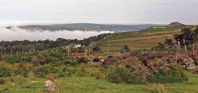
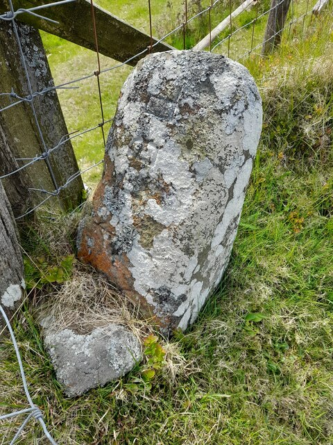
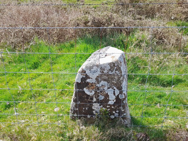
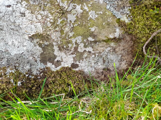
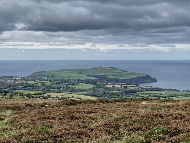
Carn Clust-y-ci Images

Images are sourced within 2km of 51.99623/-4.8542113 or Grid Reference SN0436. Thanks to Geograph Open Source API. All images are credited.

Pont Ceunant: Newport Sea mist fills Newport Bay. In the foreground are the fields of the abandoned settlement of Pont Ceunant, one of half a dozen smallholdings that occupied this hillside in the nineteenth century. The nearest settlement now is Pen-lan-ceunant, left of centre.
Pont Ceunant: Newport
Sea mist fills Newport Bay. In the foreground are the fields of the abandoned settlement of Pont Ceunant, one of half a dozen smallholdings that occupied this hillside in the nineteenth century. The nearest settlement now is Pen-lan-ceunant, left of centre.
Ordnance Survey Rivet This OS rivet can be found on a stone NW side of the road. It marks a point 239.765m above mean sea level.
Ordnance Survey Rivet
This OS rivet can be found on a stone NW side of the road. It marks a point 239.765m above mean sea level.
Boundary Stone Boundary Stone next to the cattle grid.
Boundary Stone
Boundary Stone next to the cattle grid.
Boundary Stone
Boundary Stone
Ordnance Survey Cut Mark This OS cut mark can be found on a stone in the old bank. It marks a point 966.6ft above mean sea level.
Ordnance Survey Cut Mark
This OS cut mark can be found on a stone in the old bank. It marks a point 966.6ft above mean sea level.
Golygfa o Ffordd Bedd Morris View from the road towards the coast and Dinas Head.
Golygfa o Ffordd Bedd Morris
View from the road towards the coast and Dinas Head.
Stone Stile, Newport, nr Fishguard On Pembroke footpath PP72 34/1 about 100m NW of Ffordd Bedd Morris looking SW . The view back is <a href="https://www.geograph.org.uk/photo/7610772">SN0438 : Stone Stile, Newport, nr Fishguard</a>.
Stone Stile, Newport, nr Fishguard
On Pembroke footpath PP72 34/1 about 100m NW of Ffordd Bedd Morris looking SW . The view back is SN0438 : Stone Stile, Newport, nr Fishguard.
Stone Stile, Newport, nr Fishguard On Pembroke footpath PP72 34/1 about 100m NW of Ffordd Bedd Morris looking NE . The view back is <a href="https://www.geograph.org.uk/photo/7610771">SN0438 : Stone Stile, Newport, nr Fishguard</a>.
Stone Stile, Newport, nr Fishguard
On Pembroke footpath PP72 34/1 about 100m NW of Ffordd Bedd Morris looking NE . The view back is SN0438 : Stone Stile, Newport, nr Fishguard.
Stone Stile near Fishguard Off Ffordd Bedd Norris (road) heading in a NW direction on Pembroke footpath PP72 34/1.
Stone Stile near Fishguard
Off Ffordd Bedd Norris (road) heading in a NW direction on Pembroke footpath PP72 34/1.
About Sychpant
About Sychpant
Carn Edward These 'twin' tors are both referred to in the name I presume, though the one on the right with its distinctive conical peak may well be the named one. A suitable point for a rest, a well earned brew and some scran while admiring the western end of the Preseli ridge over the valley of Cwm Gwaun.
Carn Edward
These 'twin' tors are both referred to in the name I presume, though the one on the right with its distinctive conical peak may well be the named one. A suitable point for a rest, a well earned brew and some scran while admiring the western end of the Preseli ridge over the valley of Cwm Gwaun.
Ponies graze on Mynydd Caregog These two ponies graze happily together a little detached from a larger herd grazing about 100 metres away.
Ponies graze on Mynydd Caregog
These two ponies graze happily together a little detached from a larger herd grazing about 100 metres away.
Bedd Morris standing stone Sitting beside an old routeway across the hills to and from the coast.
Bedd Morris standing stone
Sitting beside an old routeway across the hills to and from the coast.
Track towards Penlanisaf Farm The lambs ahead have squeezed under a gate to get at lush grass alongside the track and have been caught out by my arrival on the scene. They ran ahead and eventually ran out of track and had to sprint back past me, leaping, kicking and bucking.
Track towards Penlanisaf Farm
The lambs ahead have squeezed under a gate to get at lush grass alongside the track and have been caught out by my arrival on the scene. They ran ahead and eventually ran out of track and had to sprint back past me, leaping, kicking and bucking.
Old railway wagons as sheds at Penlanisaf You don't see as many old railway wagons on farms as you used to. They were common when I was a lad but, like these two examples, are aging fast and being replaced by more purpose designed storage. The old implement is of even greater vintage.
Old railway wagons as sheds at Penlanisaf
You don't see as many old railway wagons on farms as you used to. They were common when I was a lad but, like these two examples, are aging fast and being replaced by more purpose designed storage. The old implement is of even greater vintage.
Ffald-y-Brenin A Christian retreat centre with a superb setting above the Gwaun Valley.
Ffald-y-Brenin
A Christian retreat centre with a superb setting above the Gwaun Valley.
Hillside overlooking the Gwaun Valley This is from the driveway leading to Ffald-y-Brenin. Mynydd Cilciffeth stands behind.
Hillside overlooking the Gwaun Valley
This is from the driveway leading to Ffald-y-Brenin. Mynydd Cilciffeth stands behind.
Hillside above Cwm Bâch Ahead is Penlanisaf with Mynydd Cilciffeth beyond.
Hillside above Cwm Bâch
Ahead is Penlanisaf with Mynydd Cilciffeth beyond.
Show me another place!

Carn Clust-y-ci is located at Grid Ref: SN0436 (Lat: 51.99623, Lng: -4.8542113)

Unitary Authority: Pembrokeshire

Police Authority: Dyfed Powys

What 3 Words

///available.softest.crinkled. Near Newport, Pembrokeshire

Related Wikis

Carn Ingli

Carn Ingli (Welsh: [karn ˈɪŋli]) is a Site of Special Scientific Interest (SSSI) in the Preseli Hills, Pembrokeshire, Wales. It was designated a SSSI in...

Cwm Bach, Sychpant

Cwm Bach, Sychpant is a Site of Special Scientific Interest (or "SSSI") in Pembrokeshire, South Wales. It has been designated as a Site of Special Scientific...

Mynydd Carningli

Mynydd Carningli is a mountain in the Preseli Hills near the town of Newport, Pembrokeshire, Wales. It has both prehistoric and historic remains. ��2...

Dyffryn Gwaun

Dyffryn Gwaun is a Site of Special Scientific Interest (SSSI) in Pembrokeshire, South Wales. It has been designated as a Site of Special Scientific Interest...

Nearby Amenities

Located within 500m of 51.99623,-4.8542113
Mynydd Caregog
Ele: 311
Natural: peak
Lat/Long: 51.992794/-4.850121
Place: locality
Lat/Long: 51.9960291/-4.8474715
Carn Clust-y-ci
Natural: peak
Lat/Long: 51.9969927/-4.8534756
The data included in this document is from www.openstreetmap.org. The data is made available under ODbL.

Have you been to Carn Clust-y-ci?

Leave your review of Carn Clust-y-ci below (or comments, questions and feedback).