Auchten Hill

Hill, Mountain in Wigtownshire

Scotland

Auchten Hill

Standing stone at Knock and Maize One of many megaliths in Wigtownshire. For more photos see <span class="nowrap"><a title="http://www.megalithic.co.uk/article.php?sid=6575" rel="nofollow ugc noopener" href="http://www.megalithic.co.uk/article.php?sid=6575">Link</a><img style="margin-left:2px;" alt="External link" title="External link - shift click to open in new window" src="https://s1.geograph.org.uk/img/external.png" width="10" height="10"/></span>
Standing stone at Knock and Maize Credit: Oliver Dixon

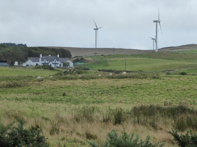
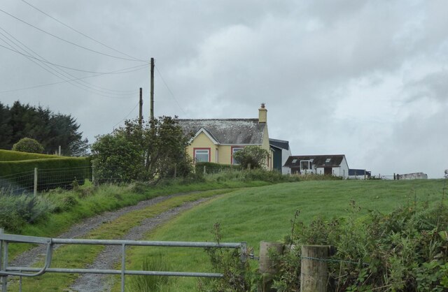
Auchten Hill is a prominent hill located in Wigtownshire, a historic county in southwestern Scotland. Situated near the village of Kirkcowan, this hill is a notable feature of the local landscape. Rising to an elevation of approximately 1,053 feet (321 meters), Auchten Hill offers commanding views of the surrounding countryside.

The hill is primarily composed of sedimentary rocks, including sandstone and shale, which were formed during the Carboniferous period. These rocks provide a glimpse into the geological history of the area and contribute to the unique character of Auchten Hill.

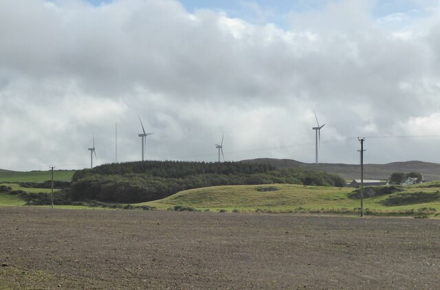
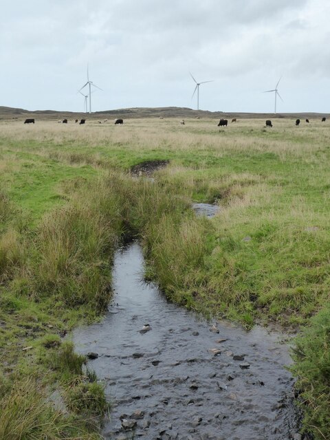
The hill is covered in a mixture of grassland and heath, with scattered trees dotting the landscape. It serves as a habitat for various plant and animal species, including heather, gorse, and different species of birds. The diversity of flora and fauna found on Auchten Hill adds to its natural beauty and ecological significance.

Auchten Hill is a popular destination for outdoor enthusiasts, offering opportunities for hiking, walking, and nature exploration. Several trails wind their way up the hill, providing access to the summit and its breathtaking views. The hill's location in a relatively rural area makes it an ideal spot for those seeking tranquility and solitude.

Overall, Auchten Hill is a distinctive feature of Wigtownshire, showcasing the region's natural beauty and providing a recreational haven for both locals and visitors.

If you have any feedback on the listing, please let us know in the comments section below.

Auchten Hill Images

Images are sourced within 2km of 54.88001/-5.0933276 or Grid Reference NX0158. Thanks to Geograph Open Source API. All images are credited.

Standing stone at Knock and Maize One of many megaliths in Wigtownshire. For more photos see <span class="nowrap"><a title="http://www.megalithic.co.uk/article.php?sid=6575" rel="nofollow ugc noopener" href="http://www.megalithic.co.uk/article.php?sid=6575">Link</a><img style="margin-left:2px;" alt="External link" title="External link - shift click to open in new window" src="https://s1.geograph.org.uk/img/external.png" width="10" height="10"/></span>
Standing stone at Knock and Maize
One of many megaliths in Wigtownshire. For more photos see LinkExternal link
New shed being erected
Suffolk Tup with his girls The tup (ram) is wearing a harness marker the colours are changed regularly so that the shepherd can split the flock into lambing bands when the time comes.The colour when the photo was taken was blue.
Suffolk Tup with his girls
The tup (ram) is wearing a harness marker the colours are changed regularly so that the shepherd can split the flock into lambing bands when the time comes.The colour when the photo was taken was blue.
Farm at Knock and Maize Looks like they are building the shed before renovating the house.
Farm at Knock and Maize
Looks like they are building the shed before renovating the house.
Road junction With Southern Upland Way signpost.
Road junction
With Southern Upland Way signpost.
2 Signposts 1 for Killantringan Lighthouse and The Southern Upland Way
2 Signposts
1 for Killantringan Lighthouse and The Southern Upland Way
Three signs at a junction. These signs are at the junction of an unclassified road and the B738. The single-track road leads from Killantringan Lighthouse to the "B" road.
Three signs at a junction.
These signs are at the junction of an unclassified road and the B738. The single-track road leads from Killantringan Lighthouse to the "B" road.
Cattle grid This cattle grid is at the end of the track to Killantringan.  The B738 passes at the end.  Craigenlee wind farm looks like large, prehistoric birds, hovering over the trees.
Cattle grid
This cattle grid is at the end of the track to Killantringan. The B738 passes at the end. Craigenlee wind farm looks like large, prehistoric birds, hovering over the trees.
Farmland at Moorcroft With view to the Windfarm on Craigenlee Fell. Viewed from the B738 near Craigslave.
Farmland at Moorcroft
With view to the Windfarm on Craigenlee Fell. Viewed from the B738 near Craigslave.
Craigslave Farm Viewed from the B738.
Craigslave Farm
Viewed from the B738.
Sheep in rough pasture  Near Low Auchenree with the wind farm on Craigenlee Fell in the distance.
Sheep in rough pasture
Near Low Auchenree with the wind farm on Craigenlee Fell in the distance.
Track to Moorcroft Pasture leading up to Moorcroft Moss in the distance.
Track to Moorcroft
Pasture leading up to Moorcroft Moss in the distance.
Low Auchenree on the right With the North Rhins Wind Farm on Craigenlee Fell in the background.
Low Auchenree on the right
With the North Rhins Wind Farm on Craigenlee Fell in the background.
Sheep and cattle on Craigslave Moss North Rhins Wind Farm on the horizon.
Sheep and cattle on Craigslave Moss
North Rhins Wind Farm on the horizon.
Rawer Get your free range eggs, free range pork and prime lamb here!
Rawer
Get your free range eggs, free range pork and prime lamb here!
Pinminnoch Burn With North Rhins Wind Farm on the horizon and cattle on the eastern slopes of Craigenlee Fell.
Pinminnoch Burn
With North Rhins Wind Farm on the horizon and cattle on the eastern slopes of Craigenlee Fell.
Knockglass Croft South of Crailloch Hill.
Knockglass Croft
South of Crailloch Hill.
The Southern Upland Way near Knock and Maize
Show me another place!

Auchten Hill is located at Grid Ref: NX0158 (Lat: 54.88001, Lng: -5.0933276)

Unitary Authority: Dumfries and Galloway

Police Authority: Dumfries and Galloway

What 3 Words

///inventors.either.coins. Near Stranraer, Dumfries & Galloway

Nearby Locations

Auchten Hill

Related Wikis

Rhins of Galloway

The Rhins of Galloway, otherwise known as the Rhins of Wigtownshire (or as The Rhins, also spelled The Rhinns; Scottish Gaelic: Na Rannaibh), is a hammer...

MV Craigantlet

MV Craigantlet was a German-owned, Cyprus-registered container ship operated on time-charter by Cawoods Containers Ltd of Belfast. She ran aground on 26...

Killantringan Lighthouse

Killantringan Lighthouse is a lighthouse located near Portpatrick in Dumfries and Galloway, south-west Scotland. The light came into operation in 1900...

Portpatrick railway station

Portpatrick railway station was a railway station serving the village of Portpatrick, Dumfries & Galloway, Scotland. Opened in 1862 the station served...

Colfin railway station

Colfin railway station, located in Wigtownshire, Scotland, between Portpatrick and Stranraer, was a station on the Portpatrick and Wigtownshire Joint Railway...

Portpatrick

Portpatrick is a village and civil parish in the historical county of Wigtownshire, Dumfries and Galloway, Scotland. It is located on the west coast of...

Dunskey

Dunskey Estate (also known as Portree Estate) is north of Portpatrick on the west coast of Scotland. The B-listed mansion dates from the start of the twentieth...

Stranraer

Stranraer (UK: stran-RAR, in Scotland also strən-; Scottish Gaelic: An t-Sròn Reamhar [ən̪ˠ t̪ʰɾɔːn ˈɾãũ.əɾ]), also known as The Toon, is a town in Dumfries...

Nearby Amenities

Located within 500m of 54.88001,-5.0933276
North Rhins
Generator Method: wind_turbine
Generator Source: wind
Generator Type: horizontal_axis
Power: generator
Lat/Long: 54.8803223/-5.0901252
North Rhins
Generator Method: wind_turbine
Generator Source: wind
Generator Type: horizontal_axis
Power: generator
Lat/Long: 54.8762059/-5.0937408
North Rhins
Generator Method: wind_turbine
Generator Source: wind
Generator Type: horizontal_axis
Power: generator
Lat/Long: 54.8780636/-5.0878507
The data included in this document is from www.openstreetmap.org. The data is made available under ODbL.

Have you been to Auchten Hill?

Leave your review of Auchten Hill below (or comments, questions and feedback).