Brough Hill

Hill, Mountain in Wigtownshire

Scotland

Brough Hill

Damhouse Farm, The Rhins
Damhouse Farm, The Rhins Credit: wfmillar

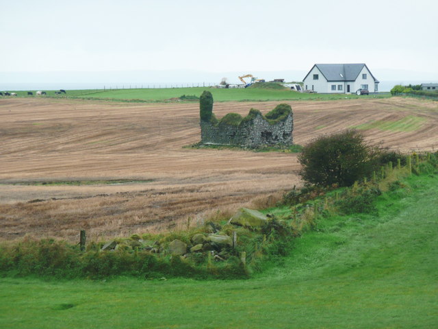
Brough Hill is a prominent hill located in Wigtownshire, Scotland. It rises to an elevation of 220 meters (722 feet) above sea level, offering stunning panoramic views of the surrounding countryside and coastline. The hill is located near the town of Wigtown and is easily accessible by foot.

Brough Hill is known for its rugged terrain, featuring rocky outcrops and grassy slopes. The hill is popular with hikers and outdoor enthusiasts who come to enjoy the challenging terrain and breathtaking views. The summit of Brough Hill offers a perfect vantage point to take in the scenic beauty of the surrounding area, with views stretching out to the Irish Sea and the Isle of Man on clear days.

The hill is also home to a variety of wildlife, including birds of prey such as buzzards and kestrels, as well as sheep and other grazing animals. Brough Hill is a popular destination for nature lovers and photographers looking to capture the beauty of the Scottish countryside.

If you have any feedback on the listing, please let us know in the comments section below.

Brough Hill Images

Images are sourced within 2km of 54.990036/-5.1275139 or Grid Reference NX0070. Thanks to Geograph Open Source API. All images are credited.

Damhouse Farm, The Rhins
Pigs and Arks Barnhills Farm.
Pigs and Arks
Barnhills Farm.
Knockneen Farm, The Rhins
Kirkbryde, The Rhins
Cairnside Farm, The Rhins Ireland on the horizon.
Cairnside Farm, The Rhins
Ireland on the horizon.
Cairnside Farm, The Rhins Kintyre on the horizon.
Cairnside Farm, The Rhins
Kintyre on the horizon.
Remains of Corsewall Castle Picturesque 15th century ruin.
Remains of Corsewall Castle
Picturesque 15th century ruin.
Cattle at Cairnside These cattle were in their winter quarters and came out to meet me as I approached their roadside shed.  Maybe they thought I was going to feed them - or maybe they were just plain bored.
Cattle at Cairnside
These cattle were in their winter quarters and came out to meet me as I approached their roadside shed. Maybe they thought I was going to feed them - or maybe they were just plain bored.
St Columba's Well? The Explorer map shows St Columba's Well here, which I think could be this very wet patch in the tiny burn that flows into Port Mullin, near Corsewall Point. Viewed in mid-February, in winter colours.
St Columba's Well?
The Explorer map shows St Columba's Well here, which I think could be this very wet patch in the tiny burn that flows into Port Mullin, near Corsewall Point. Viewed in mid-February, in winter colours.
Corsewall Castle This 15th century tower was recorded as a ruin in 1684. It had been a substantial house in its day.  (Source: "The Castles of South-West Scotland", by Mike Salter).  Three roe deer are grazing on the winter barley to the left of the castle.
Corsewall Castle
This 15th century tower was recorded as a ruin in 1684. It had been a substantial house in its day. (Source: "The Castles of South-West Scotland", by Mike Salter). Three roe deer are grazing on the winter barley to the left of the castle.
Cattle dogs, West Kirkbryde The houses are at North Kirkbryde.
Cattle dogs, West Kirkbryde
The houses are at North Kirkbryde.
Cairnside Farm The farm house and buildings from the public road.
Cairnside Farm
The farm house and buildings from the public road.
Cottages at Cairnside A couple of white cottages, probably originally for farm workers at Cairnside. The farm on top of the hill is Knockneen.
Cottages at Cairnside
A couple of white cottages, probably originally for farm workers at Cairnside. The farm on top of the hill is Knockneen.
Knockneen Farm Birds gather on the wires beside the warm wine-coloured farm house at Knockneen.
Knockneen Farm
Birds gather on the wires beside the warm wine-coloured farm house at Knockneen.
West Kirkbryde A large cluster of buildings at West Kirkbryde, on the northern slope of Brough Hill.
West Kirkbryde
A large cluster of buildings at West Kirkbryde, on the northern slope of Brough Hill.
Corsewall Point Road This is on the way back from the point, just beside the road to North Park.
Corsewall Point Road
This is on the way back from the point, just beside the road to North Park.
Corsewall Castle Unfortunately I ran out of time and was unable to find a suitable parking spot, so this was the closest I got to the ruins of Corsewall Castle. The zoom lens makes it look very close to the modern house at Old Blackhills, but it is in fact several hundred metres away.
Corsewall Castle
Unfortunately I ran out of time and was unable to find a suitable parking spot, so this was the closest I got to the ruins of Corsewall Castle. The zoom lens makes it look very close to the modern house at Old Blackhills, but it is in fact several hundred metres away.
Corsewall Castle A Ruined 15C tower house.
Corsewall Castle
A Ruined 15C tower house.
Show me another place!

Brough Hill is located at Grid Ref: NX0070 (Lat: 54.990036, Lng: -5.1275139)

Unitary Authority: Dumfries and Galloway

Police Authority: Dumfries and Galloway

What 3 Words

///snatched.brownish.invest. Near Cairnryan, Dumfries & Galloway

Nearby Locations

Brough Hill

Related Wikis

Ervie

Ervie is a small village in Dumfries and Galloway, Scotland, in the Rhins of Galloway, just outside Stranraer.

Corsewall Point

Corsewall Point, or Corsill Point, is a headland at the northern end of the Rhins of Galloway in Scotland. A lighthouse, Corsewall Lighthouse, was placed...

Kirkcolm

Kirkcolm (Scots: Kirkcoam) is a village and civil parish on the northern tip of the Rhinns of Galloway peninsula, south-west Scotland. It is in Dumfries...

RAF Wig Bay

Royal Air Force Wig Bay, or more simply RAF Wig Bay, is a former Royal Air Force station near Stranraer, Dumfries and Galloway, Scotland The following...

Nearby Amenities

Located within 500m of 54.990036,-5.1275139
Power: pole
Lat/Long: 54.9878118/-5.1211846
Power: pole
Lat/Long: 54.9879042/-5.1225606
Power: pole
Lat/Long: 54.987636/-5.1236633
Power: pole
Lat/Long: 54.9872578/-5.125173
Power: pole
Lat/Long: 54.9869408/-5.1264283
Power: pole
Lat/Long: 54.9865884/-5.1273966
Power: pole
Lat/Long: 54.986239/-5.1283273
Power: pole
Lat/Long: 54.9857866/-5.1295853
Power: pole
Lat/Long: 54.9864601/-5.1260086
Power: pole
Lat/Long: 54.9857367/-5.1253184
Power: pole
Lat/Long: 54.9914867/-5.1275533
Power: pole
Lat/Long: 54.9919272/-5.1273021
Power: pole
Lat/Long: 54.9924403/-5.1270345
Power: pole
Lat/Long: 54.9929763/-5.1267504
Power: pole
Lat/Long: 54.993383/-5.1269054
Power: pole
Lat/Long: 54.9940658/-5.1272153
Power: pole
Lat/Long: 54.9912941/-5.1264711
Power: pole
Lat/Long: 54.9906733/-5.1256658
Power: pole
Lat/Long: 54.9900321/-5.1248113
Power: pole
Lat/Long: 54.9894207/-5.1240366
Power: pole
Lat/Long: 54.9885317/-5.1238183
Power: pole
Lat/Long: 54.9879902/-5.1237267
The data included in this document is from www.openstreetmap.org. The data is made available under ODbL.

Have you been to Brough Hill?

Leave your review of Brough Hill below (or comments, questions and feedback).