Am Bàthaich

Hill, Mountain in Inverness-shire

Scotland

Am Bàthaich

Path from the summit of Sgurr Coire nan Eiricheallach
Path from the summit of Sgurr Coire nan Eiricheallach Credit: Steven Brown

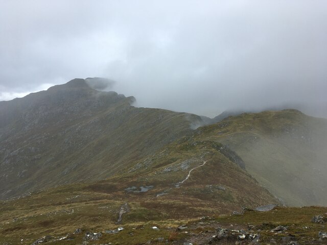
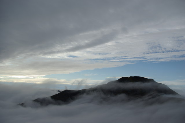
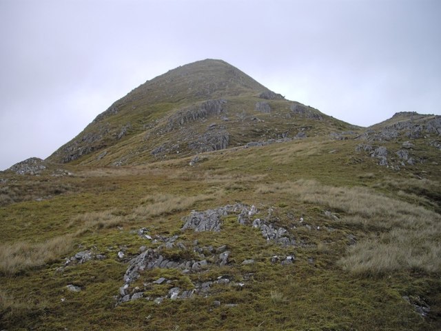
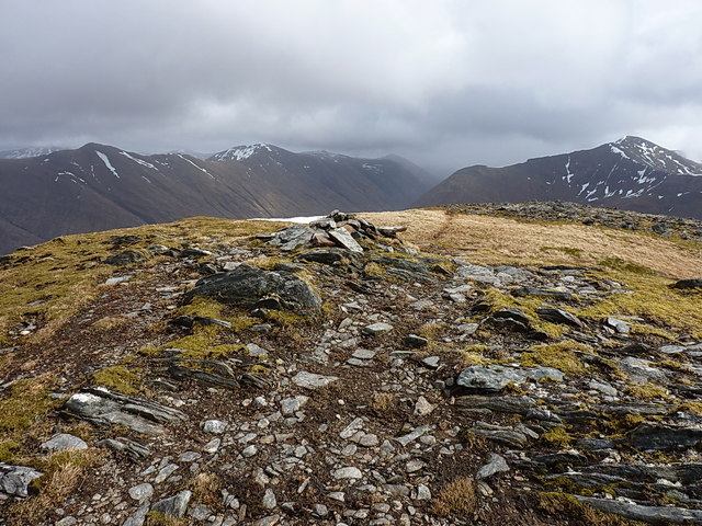
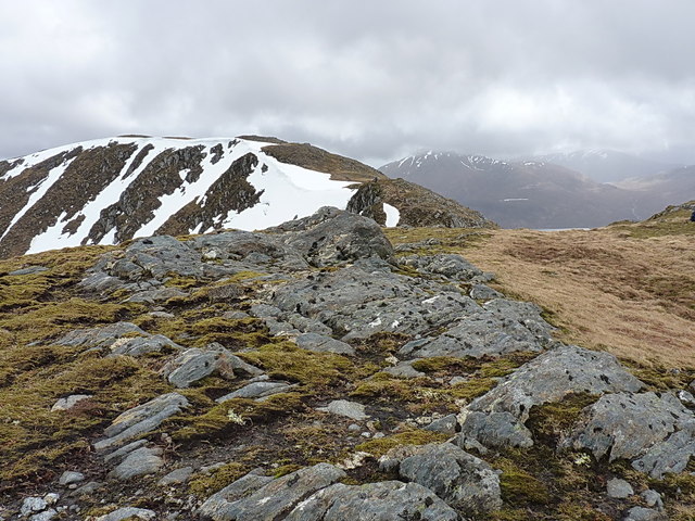
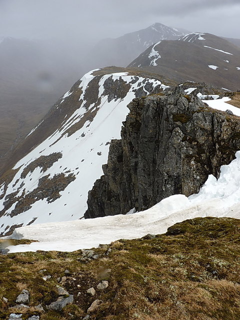
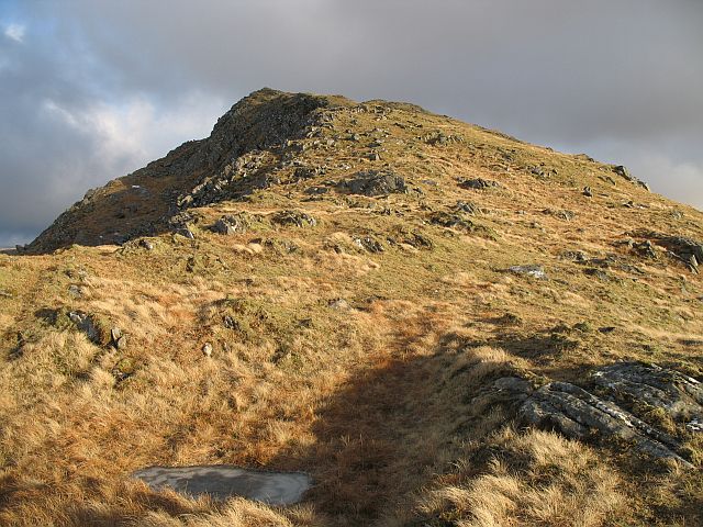
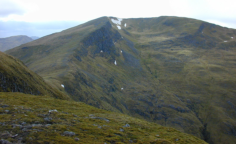
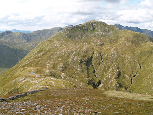
Am Bàthaich is a prominent hill located in Inverness-shire, Scotland. It is part of the Scottish Highlands and stands at an impressive height of 722 meters (2,369 feet) above sea level. The hill is known for its rugged terrain and stunning panoramic views of the surrounding landscape.

Am Bàthaich is a popular destination for hikers and outdoor enthusiasts looking to challenge themselves with a steep ascent and rewarding views at the summit. The hill offers a variety of routes for different skill levels, with some paths leading through heather-covered slopes and rocky outcrops.

The surrounding area of Am Bàthaich is rich in wildlife, with sightings of red deer, golden eagles, and other native species commonly reported by visitors. The hill is also steeped in history, with ancient ruins and archaeological sites scattered throughout the landscape.

Overall, Am Bàthaich is a must-visit location for those seeking a challenging outdoor adventure and a chance to experience the natural beauty and history of the Scottish Highlands.

If you have any feedback on the listing, please let us know in the comments section below.

Am Bàthaich Images

Images are sourced within 2km of 57.11479/-5.3241237 or Grid Reference NG9807. Thanks to Geograph Open Source API. All images are credited.

Path from the summit of Sgurr Coire nan Eiricheallach
Summit cairn on Sgurr a' Mhaoraich
View over the Kinlochhourn Forest With Beinn Sgritheall in the middle distance and Skye on the horizon.
View over the Kinlochhourn Forest
With Beinn Sgritheall in the middle distance and Skye on the horizon.
Sgurr a' Mhaoraich Looking west towards Sgurr a' Mhaoraich from NG996063 on NW top of Sgurr Coire nan-Eiricheallach
Sgurr a' Mhaoraich
Looking west towards Sgurr a' Mhaoraich from NG996063 on NW top of Sgurr Coire nan-Eiricheallach
Sgùrr Thionail, south ridge Cropped vegetation gives relatively easy walking on the south ridge of Sgùrr Thionail.
Sgùrr Thionail, south ridge
Cropped vegetation gives relatively easy walking on the south ridge of Sgùrr Thionail.
Stalkers' Path Nearing the top of the mapped section of path.  Like many of the paths in this area this one has been quite well engineered, although lack of use has led to it becoming hard to follow on the ground in places.
Stalkers' Path
Nearing the top of the mapped section of path. Like many of the paths in this area this one has been quite well engineered, although lack of use has led to it becoming hard to follow on the ground in places.
Wet ground Barely enough water here to justify the small mapped pool, even after a wet summer.
This small valley forms a small break in Sgùrr Thionail's steep west slopes.
Wet ground
Barely enough water here to justify the small mapped pool, even after a wet summer. This small valley forms a small break in Sgùrr Thionail's steep west slopes.
Sgùrr Thionail, south ridge Undulating, rocky ground providing fairly pleasant walking between Sgùrr Thionail and Bealach Coire a' Chaorainn.
Sgùrr Thionail, south ridge
Undulating, rocky ground providing fairly pleasant walking between Sgùrr Thionail and Bealach Coire a' Chaorainn.
Small lochan A small lochan lying just to the west of Am Bàthaich.
Small lochan
A small lochan lying just to the west of Am Bàthaich.
View to Loch Hourn On the Bealach Coire a' Chaorainn, looking west towards the fjord-like Loch Hourn.
View to Loch Hourn
On the Bealach Coire a' Chaorainn, looking west towards the fjord-like Loch Hourn.
Snowpatch on Sgùrr Coire nan Eiricheallach One of several small snowdrifts on the upper parts of the hill; the view from here is back towards the Munro of Gleouraich on the far side of Glen Quoich.
Snowpatch on Sgùrr Coire nan Eiricheallach
One of several small snowdrifts on the upper parts of the hill; the view from here is back towards the Munro of Gleouraich on the far side of Glen Quoich.
Summit cairn - Sgùrr Coire nan Eiricheallach A little-visited summit - the path to the main Munro lies maybe 50 yards to the south, and most people skirt by this one. Which is a shame, as it gives good views to Gleouraich and other surrounding hills.
Summit cairn - Sgùrr Coire nan Eiricheallach
A little-visited summit - the path to the main Munro lies maybe 50 yards to the south, and most people skirt by this one. Which is a shame, as it gives good views to Gleouraich and other surrounding hills.
Sgurr a'  Mhaoraich from Sgùrr Coire nan Eiricheallach The first decent view of the day's destination, Sgurr a'  Mhaoraich, which still retained a fair amount of the winter's snow.
Sgurr a' Mhaoraich from Sgùrr Coire nan Eiricheallach
The first decent view of the day's destination, Sgurr a' Mhaoraich, which still retained a fair amount of the winter's snow.
Sgùrr Coire nan Eiricheallach from the west This eastern ridge of Sgùrr a' Mhaoraich is a long high spur, nearly at 3000', consisting of Sgùrr Coire nan Eiricheallach and Bac nan Canaichean which leads down to Loch Quoich. The whole ridge encloses much of Coire nan Eiricheallach, a grassy coire to the south, whilst the northern side drops off in some quite substantial cliffs into Coire a' Chaorainn.
Sgùrr Coire nan Eiricheallach from the west
This eastern ridge of Sgùrr a' Mhaoraich is a long high spur, nearly at 3000', consisting of Sgùrr Coire nan Eiricheallach and Bac nan Canaichean which leads down to Loch Quoich. The whole ridge encloses much of Coire nan Eiricheallach, a grassy coire to the south, whilst the northern side drops off in some quite substantial cliffs into Coire a' Chaorainn.
Sgùrr Coire nan Eiricheallach - the western portion The upper part of this hill is (almost) level, and there are a number of subsidiary summits and viewpoints. As you walk westwards, it drops down to a small pass, then climbs up onto Sgùrr a' Mhaoraich, passing a series of steep cliffs on the north side.
Sgùrr Coire nan Eiricheallach - the western portion
The upper part of this hill is (almost) level, and there are a number of subsidiary summits and viewpoints. As you walk westwards, it drops down to a small pass, then climbs up onto Sgùrr a' Mhaoraich, passing a series of steep cliffs on the north side.
Last climb of the day The last stretch of uphill work to reach Sgùrr a' Mhaoraich, across a series of snowpatches and rocky scrambles up the fine eastern ridge.
Last climb of the day
The last stretch of uphill work to reach Sgùrr a' Mhaoraich, across a series of snowpatches and rocky scrambles up the fine eastern ridge.
Drystane dyke on Sgùrr Coire nan Eiricheallach This must have been made as a means of keeping estate workers occupied outside the stalking season - it appears to serve little real purpose apart from a deterrent to try and prevent sheep falling off the north side of the hill, and peters out a little further west along the ridge.
Drystane dyke on Sgùrr Coire nan Eiricheallach
This must have been made as a means of keeping estate workers occupied outside the stalking season - it appears to serve little real purpose apart from a deterrent to try and prevent sheep falling off the north side of the hill, and peters out a little further west along the ridge.
Cliffs east of Sgùrr a' Mhaoraich The eastern ridge of the Munro provides a sporting scramble up rocky steps and craglets, but don't fall off to the right as you come up, as there's a long way to go before bouncing.
Cliffs east of Sgùrr a' Mhaoraich
The eastern ridge of the Munro provides a sporting scramble up rocky steps and craglets, but don't fall off to the right as you come up, as there's a long way to go before bouncing.
Show me another place!

Am Bàthaich is located at Grid Ref: NG9807 (Lat: 57.11479, Lng: -5.3241237)

Unitary Authority: Highland

Police Authority: Highlands and Islands

What 3 Words

///workflow.control.speakers. Near Glenelg, Highland

Nearby Locations

Am Bàthaich

Related Wikis

Sgùrr a' Mhaoraich

Sgùrr a' Mhaoraich is a Scottish mountain located to the north of Loch Quoich in the northwestern highlands. It has a height of 1027 m (3369 ft) and is...

Buidhe Bheinn

Buidhe Bheinn (886 m) is a mountain in the Northwest Highlands of Scotland. It lies between Glen Shiel and Loch Hourn. A rugged mountain, it can either...

Sgurr an Doire Leathain

Sgurr an Doire Lethain (1,010 m) is a mountain in the Northwest Highlands of Scotland. It is located south of Glen Shiel in the Kintail area. One of seven...

Creag nan Damh

Creag nan Damh (Scottish Gaelic for 'rocky hill of the stag') is a mountain with a height of 918 metres (3,012 ft) in the Northwest Highlands of Scotland...

Nearby Amenities

Located within 500m of 57.11479,-5.3241237
Am Bathaich
Ele: 892
Natural: peak
Lat/Long: 57.1159567/-5.3199389
Bealach Coire a' Chaorainn
Natural: saddle
Lat/Long: 57.1124883/-5.3297558
The data included in this document is from www.openstreetmap.org. The data is made available under ODbL.

Have you been to Am Bàthaich?

Leave your review of Am Bàthaich below (or comments, questions and feedback).