Aonach Beag
Hill, Mountain in Ross-shire
Scotland
Aonach Beag

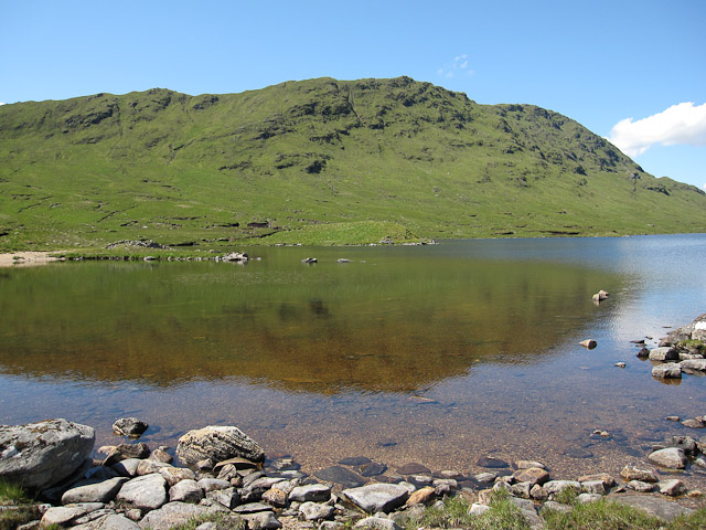
Aonach Beag is a prominent hill located in Ross-shire, Scotland. It is part of the wider Aonach Eagach mountain range, which is renowned for its stunning scenery and challenging terrain. Standing at an elevation of approximately 3,000 feet (914 meters), Aonach Beag offers breathtaking panoramic views of the surrounding landscape.
The hill is characterized by its rugged and rocky terrain, making it a popular destination for avid hikers and mountaineers. The ascent to the summit is considered moderately difficult, requiring a certain level of fitness and experience. However, the reward is well worth the effort, as the summit provides a stunning vantage point to admire the vast expanse of the Highlands.
The area surrounding Aonach Beag is also rich in biodiversity, boasting a diverse range of flora and fauna. It is home to various species of birds, such as golden eagles and ptarmigans, as well as rare alpine plants that thrive in the mountainous environment.
Aonach Beag is a popular destination for outdoor enthusiasts, attracting visitors from near and far. The hill offers various routes for exploration, and many choose to combine a hike up Aonach Beag with visits to nearby attractions, such as the picturesque Loch Maree or the charming village of Gairloch.
Overall, Aonach Beag in Ross-shire is a captivating natural landmark that showcases the beauty and ruggedness of the Scottish Highlands. Its challenging terrain and stunning views make it a must-visit destination for those seeking adventure and natural beauty in equal measure.
If you have any feedback on the listing, please let us know in the comments section below.
Aonach Beag Images
Images are sourced within 2km of 57.350664/-5.3623657 or Grid Reference NG9733. Thanks to Geograph Open Source API. All images are credited.


Aonach Beag is located at Grid Ref: NG9733 (Lat: 57.350664, Lng: -5.3623657)
Unitary Authority: Highland
Police Authority: Highlands and Islands
What 3 Words
///crust.ejects.mend. Near Lochcarron, Highland
Nearby Locations
Related Wikis

Sguman Coinntich
Sguman Coinntich (879 m) is a mountain in the Northwest Highlands, Scotland, east of the village of Dornie in Ross-shire. Sguman Coinntich is the highest...

Killilan
Killilan (Scottish Gaelic: Cill Fhaolain) is a remote hamlet, at the base of Ben Killilan, at the east end of Loch Long, in Lochalsh in the Highlands of...
Camas Luinie
Camas Luinie (Scottish Gaelic: Camas Luinge) is a hamlet in Lochalsh, Scottish Highlands and is in the council area of Highland. It is the start of the...

Attadale, Scotland
Attadale (Gaelic: Attadal ) is a settlement and estate in Wester Ross, in the Highland council area of Scotland. It is on the southern shore of Loch Carron...
Beinn Dronaig
Beinn Dronaig (797 m) is a mountain in the Northwest Highlands of Wester Ross, Scotland. A remote peak northeast of the village of Dornie, it is located...

Loch Long, Highlands
Loch Long is a sea loch situated on the western coast of Scotland, in the Highlands. It is a popular destination for tourists and fishers. The nearby...
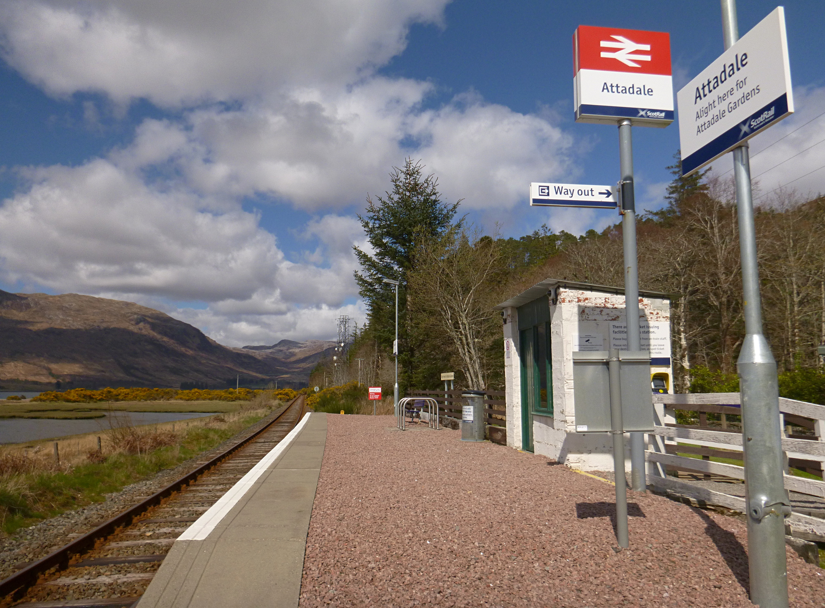
Attadale railway station
Attadale railway station is a remote railway station on the Kyle of Lochalsh Line, serving the village of Attadale on Loch Carron in the Highlands, northern...

Sallachy
Sallachy (Scottish Gaelic: Salachaidh) is a hamlet on the north shore of Loch Long in the district of Skye and Lochalsh in the Scottish Highlands and is...
Nearby Amenities
Located within 500m of 57.350664,-5.3623657Have you been to Aonach Beag?
Leave your review of Aonach Beag below (or comments, questions and feedback).