Kiln Hill

Hill, Mountain in Wigtownshire

Scotland

Kiln Hill

Fodder crop at West Glengyre Or perhaps it will be ploughed in; possibly a brassica. With Gorse on the hilltop.
Fodder crop at West Glengyre Credit: M J Richardson

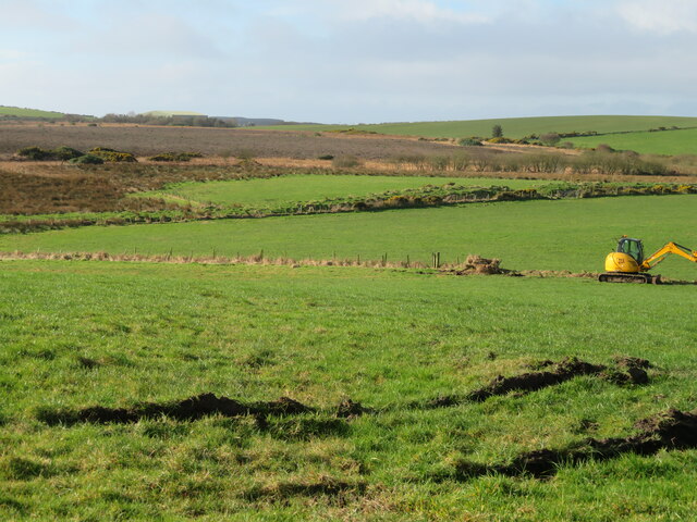
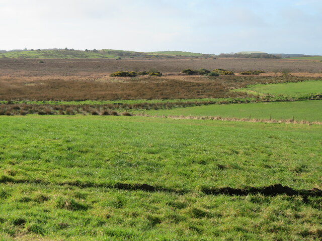
Kiln Hill is a prominent hill located in Wigtownshire, Scotland. Standing at an elevation of approximately 345 meters (1,132 feet), it offers stunning panoramic views of the surrounding countryside and coastline.

The hill is part of the Rhinns of Galloway range, known for its rugged and picturesque landscape. Kiln Hill is covered in lush green vegetation, including grasses, heather, and wildflowers, making it a haven for wildlife and nature enthusiasts.

Visitors to Kiln Hill can enjoy a variety of outdoor activities, such as hiking, birdwatching, and photography. The hill is a popular destination for locals and tourists alike, offering a peaceful retreat from the hustle and bustle of everyday life.

At the summit of Kiln Hill, there is a trig point that marks the highest point of the hill, providing a sense of accomplishment for those who reach it. On a clear day, the views from the top are truly breathtaking, with the sparkling waters of the Irish Sea visible in the distance.

Overall, Kiln Hill is a must-visit destination for those seeking natural beauty and tranquility in the heart of Wigtownshire.

If you have any feedback on the listing, please let us know in the comments section below.

Kiln Hill Images

Images are sourced within 2km of 54.934103/-5.1605336 or Grid Reference NW9764. Thanks to Geograph Open Source API. All images are credited.

Fodder crop at West Glengyre Or perhaps it will be ploughed in; possibly a brassica. With Gorse on the hilltop.
Fodder crop at West Glengyre
Or perhaps it will be ploughed in; possibly a brassica. With Gorse on the hilltop.
West Glengyre A farm west of Leswalt.
West Glengyre
A farm west of Leswalt.
Pasture at West Glengyre Somewhat 'poached' in places.
Pasture at West Glengyre
Somewhat 'poached' in places.
Roadside Gorse on Dogstone Hill With Hawthorn beyond. On a minor road between the B738 and B7043 crossing The Rhinns.
Roadside Gorse on Dogstone Hill
With Hawthorn beyond. On a minor road between the B738 and B7043 crossing The Rhinns.
Gorse on Dogstone Hill A close-up from <a href="https://www.geograph.org.uk/photo/7419439">NW9865 : Roadside Gorse on Dogstone Hill</a>.
Gorse on Dogstone Hill
Pasture on Dogstone Hill And a drainage ditch by the roadside with an ScV marker.
Pasture on Dogstone Hill
And a drainage ditch by the roadside with an ScV marker.
Fence line at Dhuloch Separating good pasture from less improved and rough grassland, with wind-formed Hawthorns.
Fence line at Dhuloch
Separating good pasture from less improved and rough grassland, with wind-formed Hawthorns.
Garchrie Moss Here mosses are bogs, and this is probably a raised bog. Looking southwest from High Weirston.
Garchrie Moss
Here mosses are bogs, and this is probably a raised bog. Looking southwest from High Weirston.
Garchrie Moss Here mosses are bogs, and this is probably a raised bog. Looking southwest from High Weirston.
Garchrie Moss
Here mosses are bogs, and this is probably a raised bog. Looking southwest from High Weirston.
Farm buildings at Glengyre And signpost - Leswalt 2.
Farm buildings at Glengyre
And signpost - Leswalt 2.
Flying the flag at Glenerskay The Saltire flutters at Glengyre.
Flying the flag at Glenerskay
The Saltire flutters at Glengyre.
Old stone building at Meikle Glengyre With an industrial look, and much modified. It is not recorded on Canmore, but on  the gb1900 website there is an aqueduct nearby, so could it have been a mill?
Old stone building at Meikle Glengyre
With an industrial look, and much modified. It is not recorded on Canmore, but on the gb1900 website there is an aqueduct nearby, so could it have been a mill?
Bends on the B738
Bends on the B738
Approaching a junction on the B738
A junction on the B738 The turning to the left is a minor road to Leswalt.
A junction on the B738
The turning to the left is a minor road to Leswalt.
A straight stretch on the B738
The turning to Mains of Cairnbrock
The turning to Cairnbrock Cottages
Show me another place!

Kiln Hill is located at Grid Ref: NW9764 (Lat: 54.934103, Lng: -5.1605336)

Unitary Authority: Dumfries and Galloway

Police Authority: Dumfries and Galloway

What 3 Words

///chat.mascot.shadowing. Near Stranraer, Dumfries & Galloway

Nearby Locations

Kiln Hill

Related Wikis

Galdenoch Castle

Galdenoch Castle is a tower house near the Scottish village of Leswalt in the Council Area Dumfries and Galloway . The ruin is listed as a Scheduled Monument...

Ervie

Ervie is a small village in Dumfries and Galloway, Scotland, in the Rhins of Galloway, just outside Stranraer.

Leswalt

Leswalt (Scottish Gaelic: Lios Uillt) is a village and civil parish in Dumfries and Galloway, south-west Scotland. It lies between Portpatrick and Stranraer...

Kirkcolm

Kirkcolm (Scots: Kirkcoam) is a village and civil parish on the northern tip of the Rhinns of Galloway peninsula, south-west Scotland. It is in Dumfries...

Nearby Amenities

Located within 500m of 54.934103,-5.1605336
High Mark
Naptan AtcoCode: 680000854222
Naptan Bearing: S
Naptan BusStopType: CUS
Naptan CommonName: High Mark
Naptan Indicator: farm
Naptan Landmark: High Mark
Naptan NaptanCode: 34234793
Naptan Notes: none
Naptan Street: B738
Naptan Verified: no
Source: naptan_import
Lat/Long: 54.9368895/-5.1646675
Knocknain
Place: farm
Lat/Long: 54.9321953/-5.1644111
Power: pole
Lat/Long: 54.931592/-5.1670048
Power: pole
Lat/Long: 54.9312444/-5.1658407
Power: pole
Lat/Long: 54.9309686/-5.1649502
Power: pole
Lat/Long: 54.9308299/-5.1635662
Power: pole
Lat/Long: 54.9307051/-5.1623592
Power: pole
Lat/Long: 54.9305633/-5.1609108
Power: pole
Lat/Long: 54.930423/-5.1596421
Power: pole
Lat/Long: 54.9303105/-5.1584888
Power: pole
Lat/Long: 54.9301595/-5.1570994
Cairn Hill
Natural: peak
Lat/Long: 54.933754/-5.1594787
Power: pole
Lat/Long: 54.9325489/-5.1677404
Power: pole
Lat/Long: 54.9324559/-5.1669117
Power: pole
Lat/Long: 54.9323655/-5.1660759
Power: pole
Lat/Long: 54.9322697/-5.1651557
Power: pole
Lat/Long: 54.9320627/-5.1645465
The data included in this document is from www.openstreetmap.org. The data is made available under ODbL.

Have you been to Kiln Hill?

Leave your review of Kiln Hill below (or comments, questions and feedback).