An Croman

Hill, Mountain in Argyllshire

Scotland

An Croman

Rough ground within enclosure beside hill road The enclosure is bounded by a rickety-looking wall.
The hill rising beyond is Beinn Ghlas.
Rough ground within enclosure beside hill road Credit: Trevor Littlewood

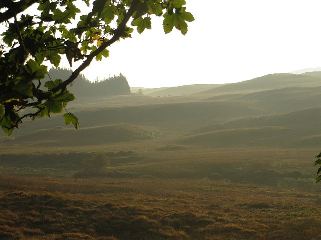
An Croman is a prominent hill located in Argyllshire, Scotland. It is part of the Argyll Forest Park and is situated in the Loch Lomond and The Trossachs National Park. The hill is known for its stunning views, diverse flora and fauna, and its significance in local history.

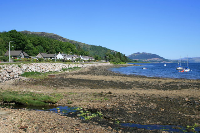
Standing at an elevation of approximately 415 meters (1,362 feet), An Croman offers breathtaking panoramic views of the surrounding landscape. On a clear day, visitors can enjoy vistas of Loch Goil and Loch Long, as well as the nearby hills and mountains.

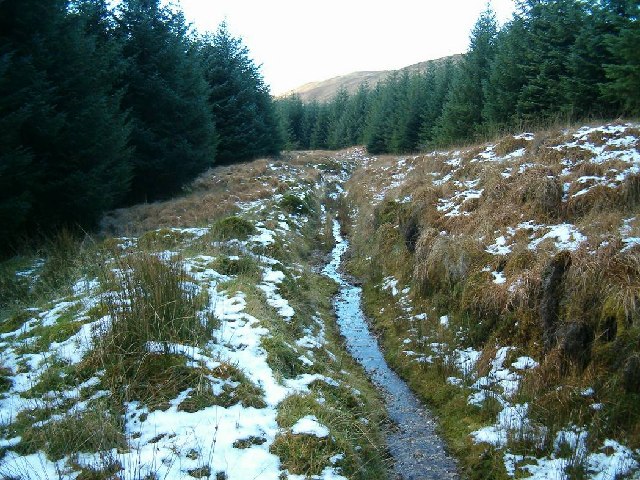
The hill is covered in a variety of vegetation, including heather, grasses, and small shrubs, which provide habitat for a range of wildlife such as red deer, mountain hares, and various bird species. It is also home to a number of rare plant species, adding to its ecological importance.

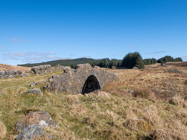
An Croman holds historical significance as it is believed to have been a prominent landmark during medieval times. In addition, remnants of ancient settlements and ruins can be found in the surrounding area, further adding to its historical appeal.

The hill attracts outdoor enthusiasts, hikers, and nature lovers who come to enjoy its natural beauty and explore the numerous walking trails that lead to its summit. It is a popular destination for both locals and tourists seeking a peaceful retreat and an opportunity to connect with nature.

Overall, An Croman is a captivating hill in Argyllshire, offering stunning views, diverse ecosystems, and a rich historical heritage that make it a must-visit destination for those exploring the region.

If you have any feedback on the listing, please let us know in the comments section below.

An Croman Images

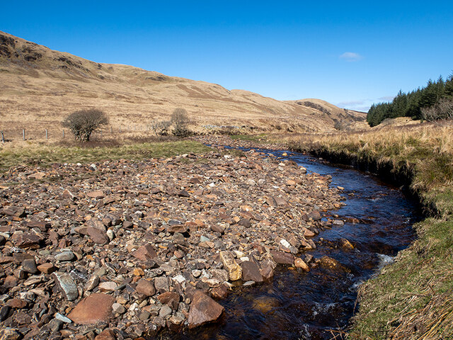
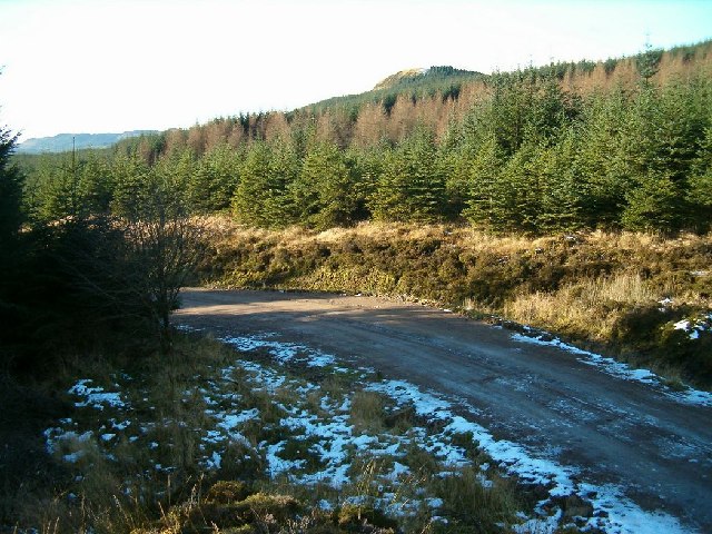
Images are sourced within 2km of 56.142954/-5.2767311 or Grid Reference NR9699. Thanks to Geograph Open Source API. All images are credited.

Rough ground within enclosure beside hill road The enclosure is bounded by a rickety-looking wall.
The hill rising beyond is Beinn Ghlas.
Rough ground within enclosure beside hill road
The enclosure is bounded by a rickety-looking wall. The hill rising beyond is Beinn Ghlas.
Wooded stream grooves on Beinn Ghlas Two streams, the Allt Mealach and the Allt an Aighe merge on the lower south-western slope of Beinn Ghlas.
Wooded stream grooves on Beinn Ghlas
Two streams, the Allt Mealach and the Allt an Aighe merge on the lower south-western slope of Beinn Ghlas.
Farm at Gallanach Gallanach is a remote farm close to the Allt Mealach; it lies to the west of Beinn Ghlas. The dark horizontal band is the low walling of a sheep pen topped with heather.
Farm at Gallanach
Gallanach is a remote farm close to the Allt Mealach; it lies to the west of Beinn Ghlas. The dark horizontal band is the low walling of a sheep pen topped with heather.
Crarae Dam The Crarae Dam impounds a small reservoir on the Allt Mealach which is the main tributary of the Crarae Burn. The mountain rising above is Beinn Ghlas.
Crarae Dam
The Crarae Dam impounds a small reservoir on the Allt Mealach which is the main tributary of the Crarae Burn. The mountain rising above is Beinn Ghlas.
Moorland near Carron Moorland surviving between two big conifer forests.
Moorland near Carron
Moorland surviving between two big conifer forests.
Farm track near Garvachy, Minard
Hillside at Cnoc na Craoibh- fearna Overlooking Loch Fyne
Hillside at Cnoc na Craoibh- fearna
Overlooking Loch Fyne
Sheepfank on the moor below Gallanoch Beinn Ghlas behind the fank
Sheepfank on the moor below Gallanoch
Beinn Ghlas behind the fank
Dam on Allt Mealach Part of the Lochgair hydroelectric scheme
Dam on Allt Mealach
Part of the Lochgair hydroelectric scheme
Bridge over the Abhainn Bheag an Tunns Track runs from the farm at Garvachy to the ruins of Feorlin
Bridge over the Abhainn Bheag an Tunns
Track runs from the farm at Garvachy to the ruins of Feorlin
Gate across the track which runs from Garvachy Farm to Feorlin
Triangulation pillar on Sithean Beag Overlooking Loch Glashan and the windfarm
Triangulation pillar on Sithean Beag
Overlooking Loch Glashan and the windfarm
Flush bracket on the triangulation pillar on Sithean Beag S8759
Flush bracket on the triangulation pillar on Sithean Beag
S8759
River Add looking upstream
Bridge over the River Add at Carron This was once the drove road between Lochaweside and Lochfyneside.
Bridge over the River Add at Carron
This was once the drove road between Lochaweside and Lochfyneside.
Icy Forest Road
Icy Forest Road
Tom Soilleir
Tom Soilleir
Old Drove Road
Old Drove Road
Show me another place!

An Croman is located at Grid Ref: NR9699 (Lat: 56.142954, Lng: -5.2767311)

Unitary Authority: Argyll and Bute

Police Authority: Argyll and West Dunbartonshire

What 3 Words

///secret.cabs.avid. Near Lochgilphead, Argyll & Bute

Nearby Locations

An Croman

Related Wikis

Crarae Reservoir

The Crarae Reservoir is located 2.5 kilometres north west of the village of Crarae, on the west side of Loch Fyne. The concrete dam is 13.7 metres high...

Feorlin

Feorlin is an impounding reservoir located 2 kilometres west of Minard. The loch is part of the Lochgair Hydroelectric Scheme. The rockfill dam is 4.19...

Crarae

Crarae is a settlement in Argyll and Bute, Scotland, on the shore of Loch Fyne. It lies on the A83, north of Lochgilphead. The location is known for the...

Minard, Argyll

Minard is a remote village on the western shore of Loch Fyne, situated between Inveraray and Lochgilphead. Minard is 13+1⁄2 miles (21.7 km) southwest of...

Have you been to An Croman?

Leave your review of An Croman below (or comments, questions and feedback).