Am Fuar-Mheallan

Hill, Mountain in Ross-shire

Scotland

Am Fuar-Mheallan

The roots of mountains
The roots of mountains Credit: Matthew Chadwick

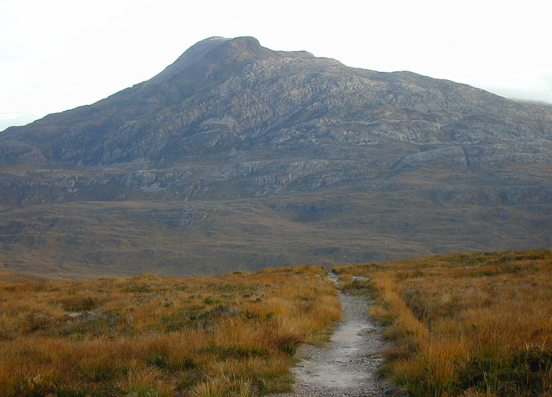
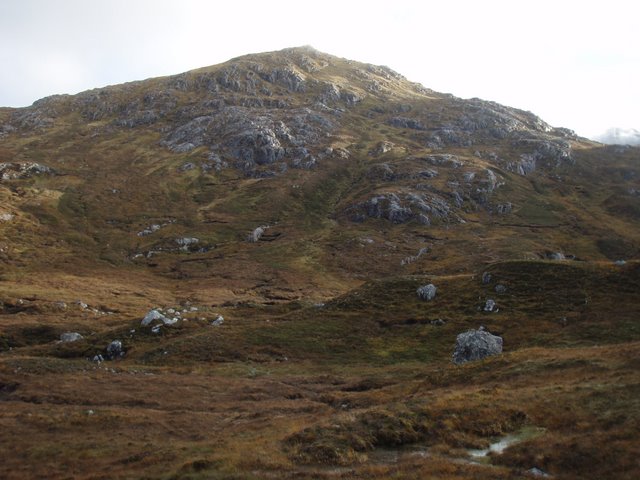
Am Fuar-Mheallan is a prominent hill located in the county of Ross-shire, Scotland. It is situated in the Northwest Highlands, near the village of Ullapool. With an elevation of 806 meters (2,644 feet), it is classified as a Corbett, a Scottish hill between 2,500 and 3,000 feet in height.

The hill is known for its rugged and picturesque landscape, with steep slopes and rocky terrain. It offers breathtaking panoramic views of the surrounding area, including the nearby mountains of Beinn Dearg and Beinn Ghobhlach. On a clear day, it is possible to see as far as the Isle of Skye and the Outer Hebrides.

Am Fuar-Mheallan is a popular destination for hikers and hillwalkers, attracting both experienced mountaineers and casual nature enthusiasts. Several routes can be taken to reach its summit, with varying levels of difficulty. The most common starting point is from the A835 road, where a track leads towards the hill.

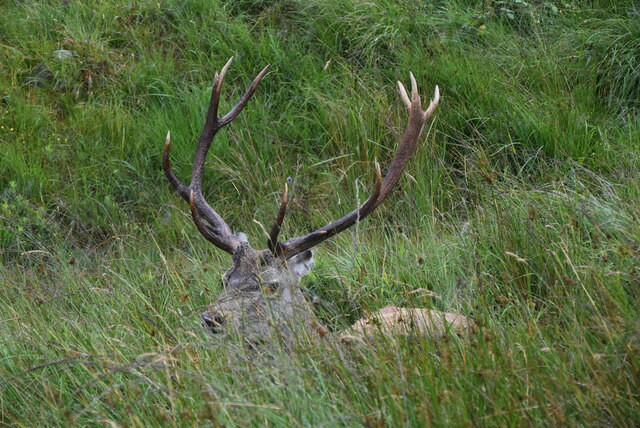
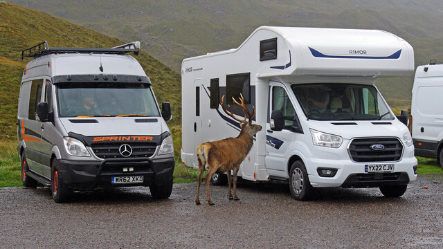
Wildlife is abundant in the area, with sightings of red deer, mountain hares, and various bird species being common. The hill is also home to a diverse range of plant life, including heather, mosses, and lichens.

Due to its remote location and challenging terrain, proper preparation and navigation skills are essential when attempting to climb Am Fuar-Mheallan. Weather conditions can change rapidly, and it is advised to check forecasts and carry appropriate clothing and equipment.

If you have any feedback on the listing, please let us know in the comments section below.

Am Fuar-Mheallan Images

Images are sourced within 2km of 57.56185/-5.4253171 or Grid Reference NG9557. Thanks to Geograph Open Source API. All images are credited.

The roots of mountains
A896, Glen Torridon The A896 runs 32 miles from Strathcarron to Kinlochewe.
<span class="nowrap"><a title="https://www.sabre-roads.org.uk/wiki/index.php?title=A896" rel="nofollow ugc noopener" href="https://www.sabre-roads.org.uk/wiki/index.php?title=A896">Link</a><img style="margin-left:2px;" alt="External link" title="External link - shift click to open in new window" src="https://s1.geograph.org.uk/img/external.png" width="10" height="10"/></span>
A896, Glen Torridon
The A896 runs 32 miles from Strathcarron to Kinlochewe. LinkExternal link
Glen Torridon The A896 runs 32 miles from Strathcarron to Kinlochewe.
<span class="nowrap"><a title="https://www.sabre-roads.org.uk/wiki/index.php?title=A896" rel="nofollow ugc noopener" href="https://www.sabre-roads.org.uk/wiki/index.php?title=A896">Link</a><img style="margin-left:2px;" alt="External link" title="External link - shift click to open in new window" src="https://s1.geograph.org.uk/img/external.png" width="10" height="10"/></span>
Glen Torridon
The A896 runs 32 miles from Strathcarron to Kinlochewe. LinkExternal link
Stag in Glen Torridon
A896, Glen Torridon The A896 runs 32 miles from Strathcarron to Kinlochewe.
<span class="nowrap"><a title="https://www.sabre-roads.org.uk/wiki/index.php?title=A896" rel="nofollow ugc noopener" href="https://www.sabre-roads.org.uk/wiki/index.php?title=A896">Link</a><img style="margin-left:2px;" alt="External link" title="External link - shift click to open in new window" src="https://s1.geograph.org.uk/img/external.png" width="10" height="10"/></span>
A896, Glen Torridon
The A896 runs 32 miles from Strathcarron to Kinlochewe. LinkExternal link
Glen Torridon The A896 runs 32 miles from Strathcarron to Kinlochewe.
<span class="nowrap"><a title="https://www.sabre-roads.org.uk/wiki/index.php?title=A896" rel="nofollow ugc noopener" href="https://www.sabre-roads.org.uk/wiki/index.php?title=A896">Link</a><img style="margin-left:2px;" alt="External link" title="External link - shift click to open in new window" src="https://s1.geograph.org.uk/img/external.png" width="10" height="10"/></span>
Glen Torridon
The A896 runs 32 miles from Strathcarron to Kinlochewe. LinkExternal link
Glen Torridon
Glen Torridon
Ground Moraine
Ground Moraine
Stag in Glen Torridon
A896 The A896 runs 32 miles from Strathcarron to Kinlochewe.
<span class="nowrap"><a title="https://www.sabre-roads.org.uk/wiki/index.php?title=A896" rel="nofollow ugc noopener" href="https://www.sabre-roads.org.uk/wiki/index.php?title=A896">Link</a><img style="margin-left:2px;" alt="External link" title="External link - shift click to open in new window" src="https://s1.geograph.org.uk/img/external.png" width="10" height="10"/></span>
A896
The A896 runs 32 miles from Strathcarron to Kinlochewe. LinkExternal link
Breakfast time The solitary red deer stag is clearly a regular visitor to the car park here, despite a "Please do not feed the deer" notice. I don't know if it will remain through the rutting season.
Breakfast time
The solitary red deer stag is clearly a regular visitor to the car park here, despite a "Please do not feed the deer" notice. I don't know if it will remain through the rutting season.
Red deer stag
Red deer stag
The Ling Hut and Lochan an Iasgair Sgurr Dubh is in the background.
The Ling Hut and Lochan an Iasgair
Sgurr Dubh is in the background.
Moorland beside the Kinlochewe to Torridon road Feith Ghlas (stream) cuts its way across the moor, and the slopes of Sgurr Dubh are beyond
Moorland beside the Kinlochewe to Torridon road
Feith Ghlas (stream) cuts its way across the moor, and the slopes of Sgurr Dubh are beyond
Allt Frianach Near the Beinn Eighe car park on the A896
Allt Frianach
Near the Beinn Eighe car park on the A896
Show me another place!

Am Fuar-Mheallan is located at Grid Ref: NG9557 (Lat: 57.56185, Lng: -5.4253171)

Unitary Authority: Highland

Police Authority: Highlands and Islands

What 3 Words

///irony.trees.dices. Near Kinlochewe, Highland

Nearby Locations

Am Fuar-Mheallan

Related Wikis

Liathach

Liathach (Scottish Gaelic for 'the hoary place'; pronounced [ˈʎiəhəx]) is a mountain in the Torridon Hills, in the Northwest Highlands of Scotland. It...

Sgùrr Dubh

Sgurr Dubh (782 m) is a mountain in the Northwest Highlands, Scotland. It lies southwest of the village of Kinlochewe in Wester Ross. The peak rises steeply...

Beinn Eighe

Beinn Eighe (Scottish Gaelic for 'file mountain') is a mountain massif in the Torridon area of Wester Ross in the Northwest Highlands of Scotland. Lying...

Ruadh-stac Beag

Ruadh-stac Beag (896 m) is a mountain in the Northwest Highlands of Scotland. An outlier of the Munro Beinn Eighe but a mountain in its own right, it is...

Have you been to Am Fuar-Mheallan?

Leave your review of Am Fuar-Mheallan below (or comments, questions and feedback).