Creag Dhubh

Hill, Mountain in Buteshire

Scotland

Creag Dhubh

Post Box on the String Road B880.  Each block has its own carved symbol.
Post Box on the String Road Credit: Steve Partridge

Creag Dhubh is a prominent hill located in the region of Buteshire, Scotland. It is situated in the western part of the Isle of Bute, near the town of Rothesay. The hill stands at an elevation of approximately 449 meters (1,473 feet) above sea level, making it one of the highest points on the island.

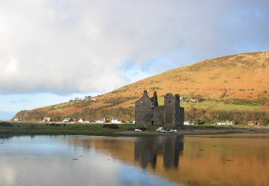
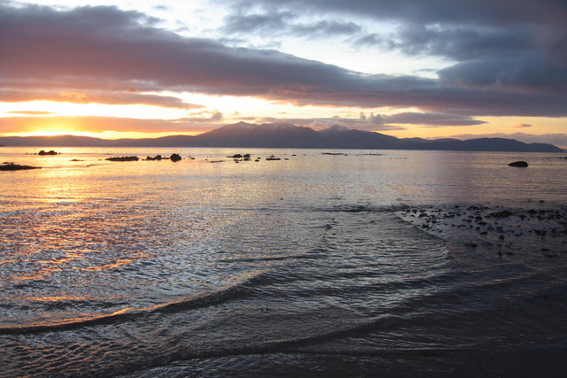
Creag Dhubh is characterized by its distinctive conical shape, with steep slopes covered in grass and heather. The hill offers breathtaking panoramic views of the surrounding landscape, including the Isle of Arran, the Firth of Clyde, and the nearby Cowal Peninsula. On clear days, it is even possible to see the distant peaks of the Scottish mainland.

The hill is a popular destination for hikers and nature enthusiasts, attracting both locals and tourists alike. Several well-marked trails lead to the summit, providing opportunities for various levels of difficulty. The ascent typically takes around two to three hours, depending on the chosen route.

Aside from its natural beauty, Creag Dhubh also holds historical significance. It is home to the remains of an Iron Age hillfort, known as Dunagoil. This ancient fortification is believed to have been occupied by the local population around 2,000 years ago, serving as a defensive stronghold.

In conclusion, Creag Dhubh is a striking hill in Buteshire, Scotland, renowned for its stunning views, challenging hiking trails, and historical significance. It stands as a testament to the natural and cultural heritage of the Isle of Bute.

If you have any feedback on the listing, please let us know in the comments section below.

Creag Dhubh Images

Images are sourced within 2km of 55.555876/-5.2490499 or Grid Reference NR9533. Thanks to Geograph Open Source API. All images are credited.

Post Box on the String Road B880.  Each block has its own carved symbol.
Post Box on the String Road
B880. Each block has its own carved symbol.
Ornate post-box At the roadside on the 'String Road'. The stonework around the post-box is the work of David Wilson, a stonemason from Shiskine, who decorated it with large mason's marks.
Ornate post-box
At the roadside on the 'String Road'. The stonework around the post-box is the work of David Wilson, a stonemason from Shiskine, who decorated it with large mason's marks.
Creag Mhòr Seen from the String Road.
Creag Mhòr
Seen from the String Road.
Old Milestone by the B880, Kilmory Parish, Isle of Arran Arran by the B880, in parish of Kilmory (Arran District), opposite a low stone bridge, in the ditch under a birch tree, top of stone level with road.

Inscription reads:-
4
(To Brodick Old Quay) 

Surveyed

Milestone Society National ID: AYN_ARRS04.
Old Milestone by the B880, Kilmory Parish, Isle of Arran
Arran by the B880, in parish of Kilmory (Arran District), opposite a low stone bridge, in the ditch under a birch tree, top of stone level with road. Inscription reads:- 4 (To Brodick Old Quay) Surveyed Milestone Society National ID: AYN_ARRS04.
Old Milestone by the B880, Glenloig Picnic Place, Kilmory Parish Arran by the B880, in parish of Kilmory (Arran District), just East of Glenloig Picnic Place, on grass verge. 

Inscription reads:-
5
(To Brodick Old Quay)

Surveyed

Milestone Society National ID: AYN_ARRS05.
Old Milestone by the B880, Glenloig Picnic Place, Kilmory Parish
Arran by the B880, in parish of Kilmory (Arran District), just East of Glenloig Picnic Place, on grass verge. Inscription reads:- 5 (To Brodick Old Quay) Surveyed Milestone Society National ID: AYN_ARRS05.
Modern Milestone by the B880, The String, Kilmory Parish Arran by the B880, in parish of Kilmory (Arran District), 200m North of Machrie Moor junction with pillar box, on bank among trees 1m from road. Appears to be a replacement stone.

Inscription reads:-
6
(To Brodick Old Quay)

Surveyed

Milestone Society National ID: AYN_ARRS06
Modern Milestone by the B880, The String, Kilmory Parish
Arran by the B880, in parish of Kilmory (Arran District), 200m North of Machrie Moor junction with pillar box, on bank among trees 1m from road. Appears to be a replacement stone. Inscription reads:- 6 (To Brodick Old Quay) Surveyed Milestone Society National ID: AYN_ARRS06
View of Goatfell from The String Road The String Road (or The String) is the main cross-island route on Arran. The 10-mile road bisects Arran from the island capital of Brodick on the east coast to Blackwaterfoot on the west coast, rising to 233m (768 feet) as it climbs over Gleann an t-Suidhe. It is now designated as the B880.
View of Goatfell from The String Road
The String Road (or The String) is the main cross-island route on Arran. The 10-mile road bisects Arran from the island capital of Brodick on the east coast to Blackwaterfoot on the west coast, rising to 233m (768 feet) as it climbs over Gleann an t-Suidhe. It is now designated as the B880.
The String Road (B880) The String Road (or The String) is the main cross-island route on Arran. The 10-mile road bisects Arran from the island capital of Brodick on the east coast to Blackwaterfoot on the west coast, rising to 233m (768 feet) as it climbs over Gleann an t-Suidhe. It is now designated as the B880.
The String Road (B880)
The String Road (or The String) is the main cross-island route on Arran. The 10-mile road bisects Arran from the island capital of Brodick on the east coast to Blackwaterfoot on the west coast, rising to 233m (768 feet) as it climbs over Gleann an t-Suidhe. It is now designated as the B880.
B880 The String Road The String Road (or The String) is the main cross-island route on Arran. The 10-mile road bisects Arran from the island capital of Brodick on the east coast to Blackwaterfoot on the west coast, rising to 233m (768 feet) as it climbs over Gleann an t-Suidhe. It is now designated as the B880.
B880 The String Road
The String Road (or The String) is the main cross-island route on Arran. The 10-mile road bisects Arran from the island capital of Brodick on the east coast to Blackwaterfoot on the west coast, rising to 233m (768 feet) as it climbs over Gleann an t-Suidhe. It is now designated as the B880.
B880, The String The String Road (or The String) is the main cross-island route on Arran. The 10-mile road bisects Arran from the island capital of Brodick on the east coast to Blackwaterfoot on the west coast, rising to 233m (768 feet) as it climbs over Gleann an t-Suidhe. It is now designated as the B880.
B880, The String
The String Road (or The String) is the main cross-island route on Arran. The 10-mile road bisects Arran from the island capital of Brodick on the east coast to Blackwaterfoot on the west coast, rising to 233m (768 feet) as it climbs over Gleann an t-Suidhe. It is now designated as the B880.
Isle of Arran, The String Road The String Road (or The String) is the main cross-island route on Arran. The 10-mile road bisects Arran from the island capital of Brodick on the east coast to Blackwaterfoot on the west coast, rising to 233m (768 feet) as it climbs over Gleann an t-Suidhe. It is now designated as the B880.
Isle of Arran, The String Road
The String Road (or The String) is the main cross-island route on Arran. The 10-mile road bisects Arran from the island capital of Brodick on the east coast to Blackwaterfoot on the west coast, rising to 233m (768 feet) as it climbs over Gleann an t-Suidhe. It is now designated as the B880.
The B880 on Arran Known as "The String Road" or just "The String".  Here it gently descends towards its junction with the road to Machrie.  On the right are the western slopes of  Binnein na h-Uaimh;  in the centre and in the distance rises the peak of Goatfell (874m).
The B880 on Arran
Known as "The String Road" or just "The String". Here it gently descends towards its junction with the road to Machrie. On the right are the western slopes of Binnein na h-Uaimh; in the centre and in the distance rises the peak of Goatfell (874m).
Glaister roadend
Glaister roadend
Monyquil roadend Leading to another of Arran's self-catering accommodations.
Monyquil roadend
Leading to another of Arran's self-catering accommodations.
Approaching Glenloig Bridge on "The String" The partly wooded slopes of Cnoc Dubh (425m) ahead.
Approaching Glenloig Bridge on "The String"
The partly wooded slopes of Cnoc Dubh (425m) ahead.
The western slopes of An Tunna (361m), above the String Road Between the hill and the road lies Gleann an t-Suidhe.
The western slopes of An Tunna (361m), above the String Road
Between the hill and the road lies Gleann an t-Suidhe.
Old milestone The 5 mile stone on The String is at Glenloig Picnic Place. In 2019 almost covered in yellow gorse.
Old milestone
The 5 mile stone on The String is at Glenloig Picnic Place. In 2019 almost covered in yellow gorse.
Old milestone This stone is opposite a low stone bridge, in the ditch under a birch tree with the top of the stone level with the road.  It is the traditional shape of Arran milestones but the 4 is slightly offset to the right.
Old milestone
This stone is opposite a low stone bridge, in the ditch under a birch tree with the top of the stone level with the road. It is the traditional shape of Arran milestones but the 4 is slightly offset to the right.
Show me another place!

Creag Dhubh is located at Grid Ref: NR9533 (Lat: 55.555876, Lng: -5.2490499)

Unitary Authority: North Ayrshire

Police Authority: Ayrshire

What 3 Words

///nametag.trophy.diplomas. Near Brodick, North Ayrshire

Nearby Locations

Creag Dhubh

Related Wikis

Àrd Bheinn

Àrd Bheinn (meaning "high mountain") is a small mountain of 1678 feet on central Isle of Arran in western Scotland.

Arran Coastal Way

The Arran Coastal Way is a 107 kilometre long-distance trail that goes around the coastline of Arran in Scotland. As the route is circular, following...

Isle of Arran

The Isle of Arran (; Scottish Gaelic: Eilean Arainn) or simply Arran is an island off the west coast of Scotland. It is the largest island in the Firth...

Machrie Moor Stone Circles

Machrie Moor Stone Circles is the collective name for six stone circles visible on Machrie Moor near the settlement of Machrie on the Isle of Arran, Scotland...

Moss Farm Road Stone Circle

Moss Farm Road Stone Circle (or Machrie Moor 10) is the remains of a Bronze Age burial cairn, surrounded by a circle of stones. It is located near Machrie...

Shiskine

Shiskine (Scottish Gaelic: An t-Seasgann) is a small village on the Isle of Arran in the Firth of Clyde, Scotland. The village is within the parish of...

Auchagallon Stone Circle

Auchagallon Stone Circle or Auchengallon cairn is the remains of a Neolithic or Bronze Age burial cairn, surrounded by a circle of fifteen stones. It is...

Machrie

Machrie (Scottish Gaelic: Am Machaire) is a village on the Isle of Arran in the Firth of Clyde, Scotland. Machrie Bay can be found on the West Coast. The...

Have you been to Creag Dhubh?

Leave your review of Creag Dhubh below (or comments, questions and feedback).