Càrn Ruairidh
Hill, Mountain in Ross-shire
Scotland
Càrn Ruairidh

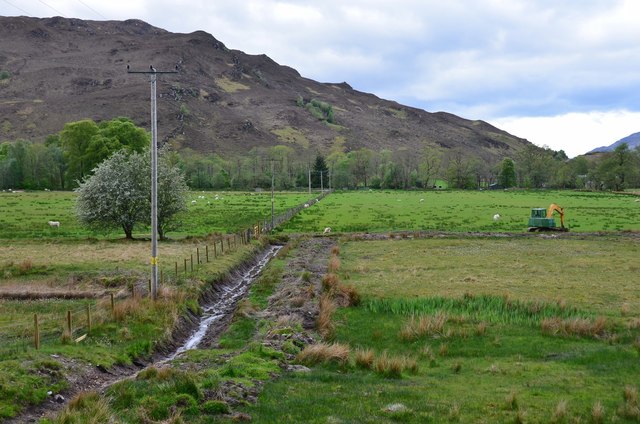
Càrn Ruairidh is a prominent hill located in Ross-shire, a county in the Highlands of Scotland. It stands at an elevation of approximately 502 meters (1,647 feet) above sea level, making it a notable mountainous feature in the region. The hill is situated within the picturesque landscape of the Scottish Highlands, surrounded by rolling hills and scenic vistas.
Càrn Ruairidh is known for its distinctive shape and rugged terrain. It is characterized by steep slopes covered in heather and grass, with scattered rocks and boulders dotting its surface. The hill offers stunning panoramic views of the surrounding countryside, including nearby lochs and glens.
The summit of Càrn Ruairidh is a popular destination for hikers and outdoor enthusiasts. A network of trails and paths allows visitors to explore the hill's slopes and reach the summit, providing an opportunity to immerse oneself in the natural beauty of the Scottish Highlands. The climb to the top can be challenging, but it rewards hikers with breathtaking vistas and a sense of accomplishment.
Wildlife is abundant in the area surrounding Càrn Ruairidh. Red deer, mountain hares, and various bird species can often be spotted amidst the heather and grasses. The hill is also home to a diverse range of plant life, including heather, mosses, and wildflowers.
Overall, Càrn Ruairidh is a stunning natural feature that offers a memorable outdoor experience for those who choose to explore its slopes and summit.
If you have any feedback on the listing, please let us know in the comments section below.
Càrn Ruairidh Images
Images are sourced within 2km of 57.395154/-5.4206391 or Grid Reference NG9439. Thanks to Geograph Open Source API. All images are credited.


Càrn Ruairidh is located at Grid Ref: NG9439 (Lat: 57.395154, Lng: -5.4206391)
Unitary Authority: Highland
Police Authority: Highlands and Islands
What 3 Words
///driving.added.louder. Near Lochcarron, Highland
Nearby Locations
Related Wikis

Attadale, Scotland
Attadale (Gaelic: Attadal ) is a settlement and estate in Wester Ross, in the Highland council area of Scotland. It is on the southern shore of Loch Carron...
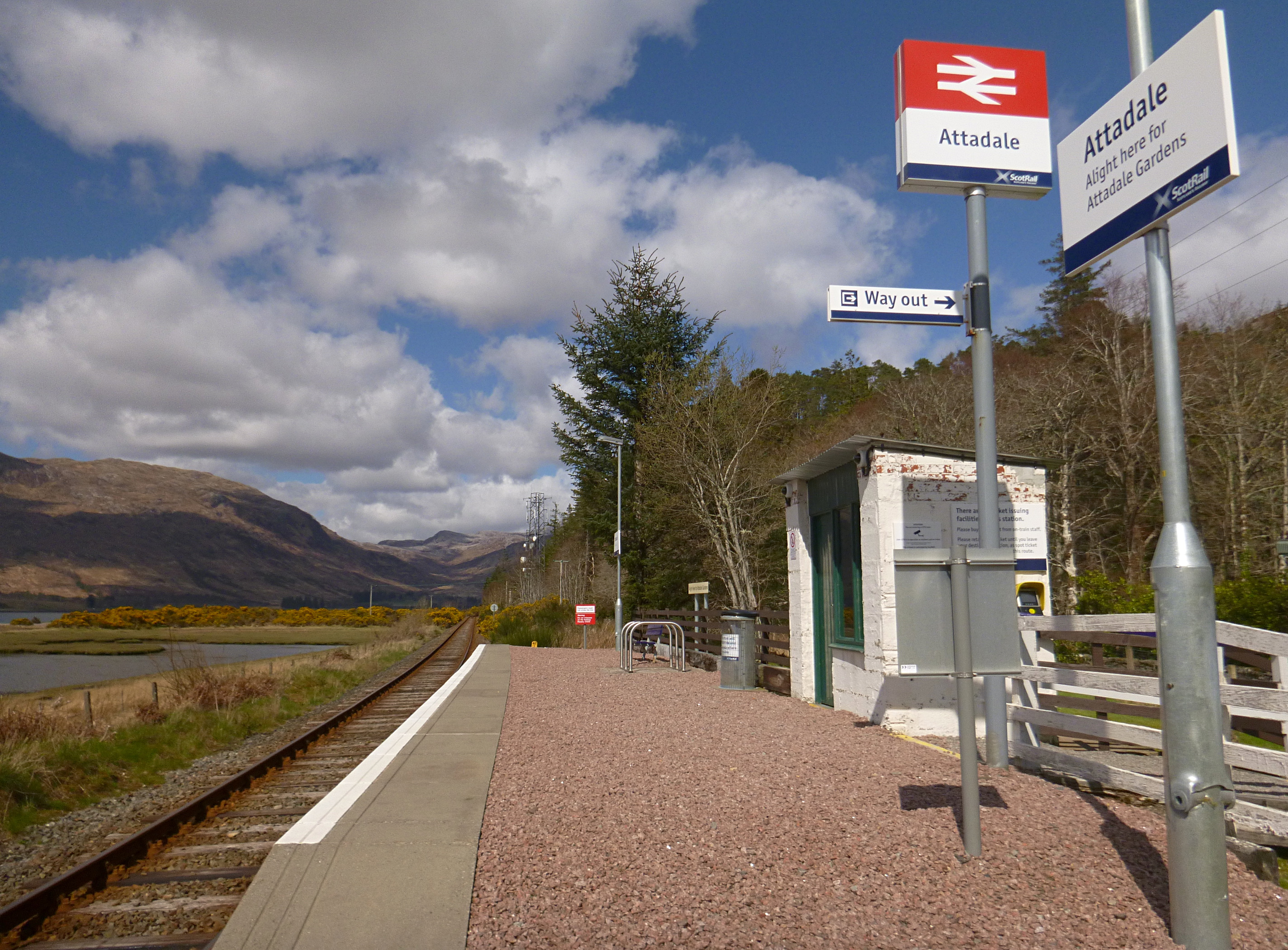
Attadale railway station
Attadale railway station is a remote railway station on the Kyle of Lochalsh Line, serving the village of Attadale on Loch Carron in the Highlands, northern...

Strathcarron railway station
Strathcarron railway station is a remote railway station on the Kyle of Lochalsh Line, serving the small village of Strathcarron and the larger village...

Strathcarron, Highland
Strathcarron (Scottish Gaelic: Srath Carrann) is a hamlet, in the Highland council area of Scotland. == Geography == It is situated at the head of the...
Nearby Amenities
Located within 500m of 57.395154,-5.4206391Have you been to Càrn Ruairidh?
Leave your review of Càrn Ruairidh below (or comments, questions and feedback).