An Eag

Hill, Mountain in Inverness-shire

Scotland

An Eag

Coire Chicheanais The upper part of Coire Chicheanais looking towards the north.
Coire Chicheanais Credit: Jonathan Venn

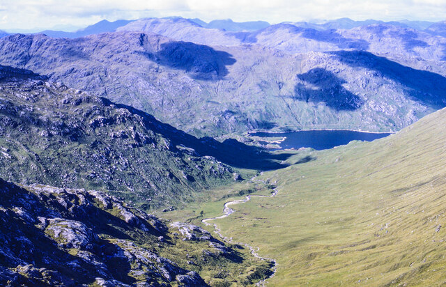
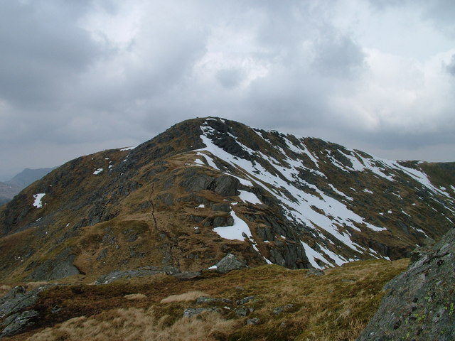
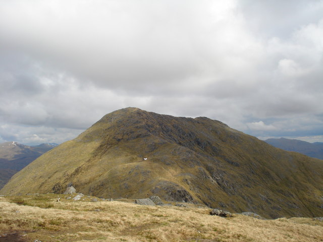
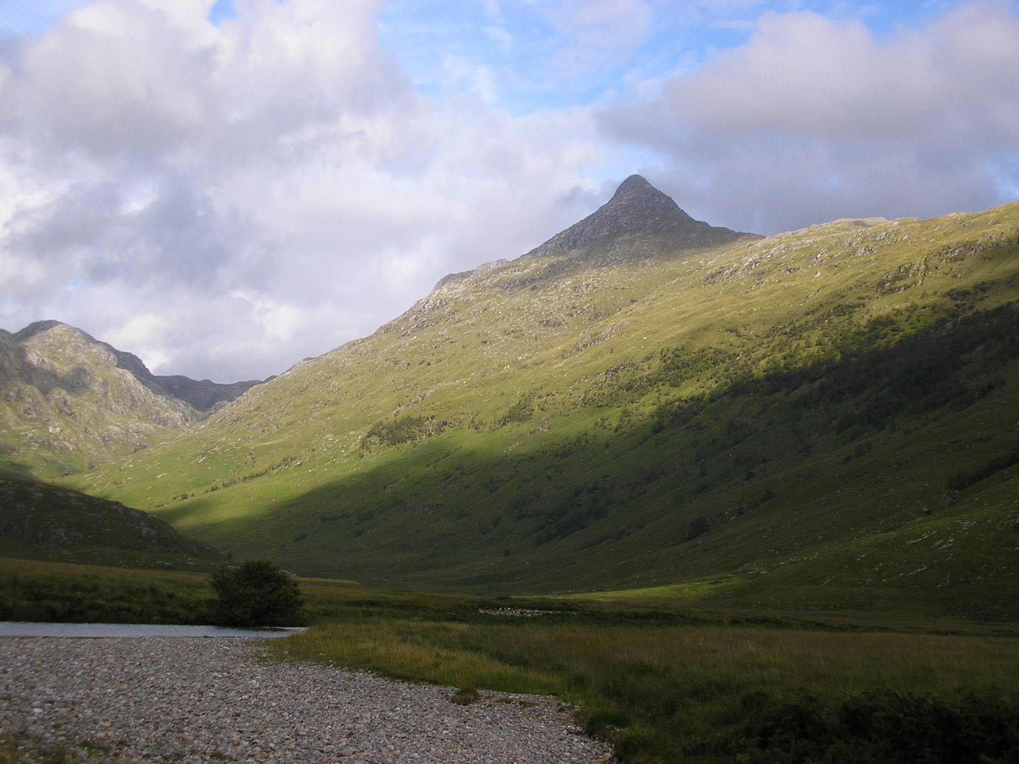
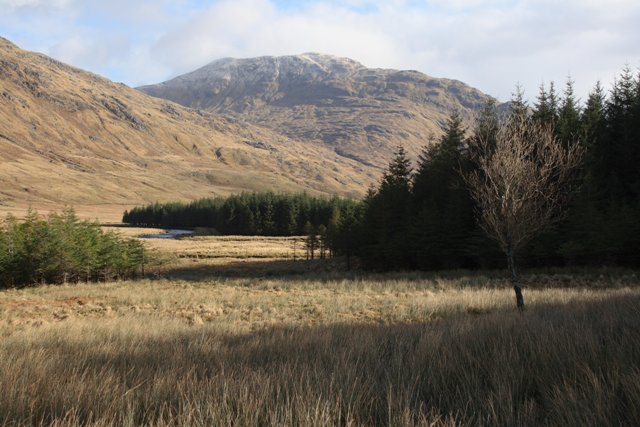
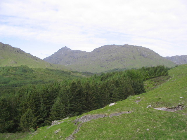
An Eag is a magnificent hill located in the Inverness-shire region of Scotland. Standing at an impressive height of 929 meters (3,048 feet), it is considered one of the prominent mountains in the area. An Eag is part of the famous Mamores mountain range and is situated near the picturesque village of Kinlochleven.

The ascent to the summit of An Eag offers breathtaking panoramic views of the surrounding landscape. On a clear day, hikers are rewarded with stunning vistas of the rugged mountains, deep valleys, and sparkling lochs that characterizes the Scottish Highlands. The mountain is particularly known for its dramatic rocky ridges and steep slopes, making it a challenging but highly rewarding climb for experienced mountaineers.

An Eag is often climbed in conjunction with other peaks in the Mamores range, such as Binnein Mor and Sgurr Eilde Mor, as part of a longer and more demanding mountain traverse. The usual starting point for the ascent is the village of Kinlochleven, where hikers can follow well-marked trails and paths that lead to the mountain.

Nature enthusiasts will find An Eag a haven for wildlife. The mountain is home to various bird species, including golden eagles, peregrine falcons, and ptarmigans. It is also a habitat for deer, mountain hares, and other mammals that thrive in the rugged terrain.

An Eag is a true gem of the Scottish Highlands, drawing outdoor enthusiasts from all over the world to experience its beauty and challenge. Whether you seek a thrilling mountaineering adventure or simply wish to immerse yourself in the awe-inspiring natural scenery, An Eag is a must-visit destination for any lover of the great outdoors.

If you have any feedback on the listing, please let us know in the comments section below.

An Eag Images

Images are sourced within 2km of 57.008017/-5.3883467 or Grid Reference NM9495. Thanks to Geograph Open Source API. All images are credited.

Coire Chicheanais The upper part of Coire Chicheanais looking towards the north.
Coire Chicheanais
The upper part of Coire Chicheanais looking towards the north.
Summit of Sgurr Cos na Breachd-laoidh The summit of Sgurr Cos na Breachd-laoidh. Carn Mor in the background
Summit of Sgurr Cos na Breachd-laoidh
The summit of Sgurr Cos na Breachd-laoidh. Carn Mor in the background
South-east ridge of Sgùrr Còs na Breachd-laoidh A ridge develops from the southern slope of Sgùrr Còs na Breachd-laoidh above the lodge at Glendessarry and climbs north-west before levelling and turning west; it then rises north-westwards again as the mountain's south-east ridge.
South-east ridge of Sgùrr Còs na Breachd-laoidh
A ridge develops from the southern slope of Sgùrr Còs na Breachd-laoidh above the lodge at Glendessarry and climbs north-west before levelling and turning west; it then rises north-westwards again as the mountain's south-east ridge.
Summit ridge of Sgùrr Còs na Breachd-laoidh The rock-strewn summit ridge of Sgùrr Còs na Breachd-laoidh rises northwards to reach the mountain's highest point. The mountain to the right is the Munro, Sgurr Mor.
Summit ridge of Sgùrr Còs na Breachd-laoidh
The rock-strewn summit ridge of Sgùrr Còs na Breachd-laoidh rises northwards to reach the mountain's highest point. The mountain to the right is the Munro, Sgurr Mor.
Druim a' Chuirn with A'Chioch Druim a' Chuirn, a subsidiary top of the Corbett Sgùrr Còs na Breachd-laoidh, is the ridge rising into the distance; nearer, stands the rock tooth of A'Chioch. A walker standing in front of the pinnacle gives the scale.
Druim a' Chuirn with A'Chioch
Druim a' Chuirn, a subsidiary top of the Corbett Sgùrr Còs na Breachd-laoidh, is the ridge rising into the distance; nearer, stands the rock tooth of A'Chioch. A walker standing in front of the pinnacle gives the scale.
Stalkers' track heading up Sgùrr Beag From the saddle between An Eag and Sgùrr Beag.
Stalkers' track heading up Sgùrr Beag
From the saddle between An Eag and Sgùrr Beag.
The stalkers' track above the River Kingie On the way to Sgùrr Beag and Sgùrr Mòr.
The stalkers' track above the River Kingie
On the way to Sgùrr Beag and Sgùrr Mòr.
Rocky ridge descending from Sgùrr nan Coireachan The ridge begins to descend north-east from Sgùrr nan Coireachan before curving around to the right then rising to An Eag which is out of the image.
Beyond, the central peak is Sgùrr Mòr with the lower Sgùrr Beag being nearer, its summit, cloud-shadowed.
Rocky ridge descending from Sgùrr nan Coireachan
The ridge begins to descend north-east from Sgùrr nan Coireachan before curving around to the right then rising to An Eag which is out of the image. Beyond, the central peak is Sgùrr Mòr with the lower Sgùrr Beag being nearer, its summit, cloud-shadowed.
Valley and stream north of Bealach Coire nan Gall Bealach Coire nan Gall is the pass between Garbh Chioch Bheag and Sgùrr nan Coireachan. The stream descending from there feeds into the head of Loch Cuaich, (previously Quoich), which is in view in the distance.
The difference between the smooth, grassy slope to the right of the stream and the ruggedness to the left is striking.
Valley and stream north of Bealach Coire nan Gall
Bealach Coire nan Gall is the pass between Garbh Chioch Bheag and Sgùrr nan Coireachan. The stream descending from there feeds into the head of Loch Cuaich, (previously Quoich), which is in view in the distance. The difference between the smooth, grassy slope to the right of the stream and the ruggedness to the left is striking.
Rocks and sheep at summit area of An Eag Low rocks and a few high altitude sheep at the summit of An Eag.
The peak beyond in the middle distance is the magnificently named Sgùrr Còs na Breachd-laoidh!
Rocks and sheep at summit area of An Eag
Low rocks and a few high altitude sheep at the summit of An Eag. The peak beyond in the middle distance is the magnificently named Sgùrr Còs na Breachd-laoidh!
Rough path on the southern slopes of Sgurr nan Coireachan
Rough path towards the top of Sgurr nan Coireachan
Bealach Coire nan Gall
Sgùrr Beag summit View towards An Eag and Sgùrr nan Coireachan.
Sgùrr Beag summit
View towards An Eag and Sgùrr nan Coireachan.
Summit cairn, Sgùrr Beag A view into Knoydart with Sgùrr na Ciche on the left.
Summit cairn, Sgùrr Beag
A view into Knoydart with Sgùrr na Ciche on the left.
Corrie Chicheanais A boggy hollow favoured as a grazing area by deer.
Corrie Chicheanais
A boggy hollow favoured as a grazing area by deer.
Summit,  Sgurr Cos na Breachd-laoidh Some doubt about the name of this hill, but it's a typical Rough Bounds summit, a series of rocky knolls and pools.
Summit, Sgurr Cos na Breachd-laoidh
Some doubt about the name of this hill, but it's a typical Rough Bounds summit, a series of rocky knolls and pools.
The Cioch A 10m high pinnacle on the ridge of Druim a'Chuirn. It's like the more famous Cobbler, caused by a landslip. 
Failed slopes are a common feature and were probably caused by water lubricating weaker rock layers in glacial times. Some of the slides were huge, whole hills just slid off.
The Cioch
A 10m high pinnacle on the ridge of Druim a'Chuirn. It's like the more famous Cobbler, caused by a landslip. Failed slopes are a common feature and were probably caused by water lubricating weaker rock layers in glacial times. Some of the slides were huge, whole hills just slid off.
Show me another place!

An Eag is located at Grid Ref: NM9495 (Lat: 57.008017, Lng: -5.3883467)

Unitary Authority: Highland

Police Authority: Highlands and Islands

What 3 Words

///replays.intruded.pickup. Near Gairlochy, Highland

Nearby Locations

An Eag

Related Wikis

Sgurr nan Coireachan (Glen Dessarry)

Sgurr nan Coireachan (953 m) is a mountain in the Northwest Highlands of Scotland. It lies in the Lochaber region, near the head of the remote Glen Dessarry...

Sgùrr Mòr (Loch Quoich)

Sgurr Mor (1,003 m) is a mountain in the Northwest Highlands of Scotland, on the southern side of Loch Quoich in Lochaber. A steep and rugged peak, Sgurr...

Garbh Chioch Mhòr

Garbh Chioch Mhor (1013 m) is a mountain in the Northwest Highlands of Scotland. It lies in the Lochaber region, between Loch Nevis and Loch Quoich. A...

Sgùrr na Cìche

Sgùrr na Cìche (Scottish Gaelic for 'rocky peak of the breast') is a mountain in Knoydart, in the Northwest Highlands of Scotland. It lies on the edge...

Fraoch Bheinn

Fraoch Bheinn (858 m) is a remote mountain in the Northwest Highlands, Scotland, located at the head of Loch Arkaig in Lochaber. Glen Dessary lies to...

Ben Aden

Ben Aden (887m) is a mountain in the Northwest Highlands of Scotland. It lies on the Knoydart peninsula in Lochaber. Regarded as one of the finest Corbetts...

Bidein a' Chabair

Bidein a' Chabair (867 m) is a mountain in the Knoydart peninsula, Lochaber, on the west coast of Scotland. It is part of the Northwest Highlands. A conical...

Càrn Mòr

Càrn Mòr is a mountain on the edge of the Rough Bounds of Knoydart in the Northwest Highlands of Scotland. At a height of 829 metres (2,720 ft) it is classified...

Nearby Amenities

Located within 500m of 57.008017,-5.3883467
An Eag
Ele: 873
Natural: peak
Source: Popular Edition (Scotland)
Wikidata: Q20597159
Lat/Long: 57.0077651/-5.3885718
The data included in this document is from www.openstreetmap.org. The data is made available under ODbL.

Have you been to An Eag?

Leave your review of An Eag below (or comments, questions and feedback).