An t-Sàil

Hill, Mountain in Inverness-shire

Scotland

An t-Sàil

Stalkers' track heading up Sgùrr Beag From the saddle between An Eag and Sgùrr Beag.
Stalkers' track heading up Sgùrr Beag Credit: Russel Wills

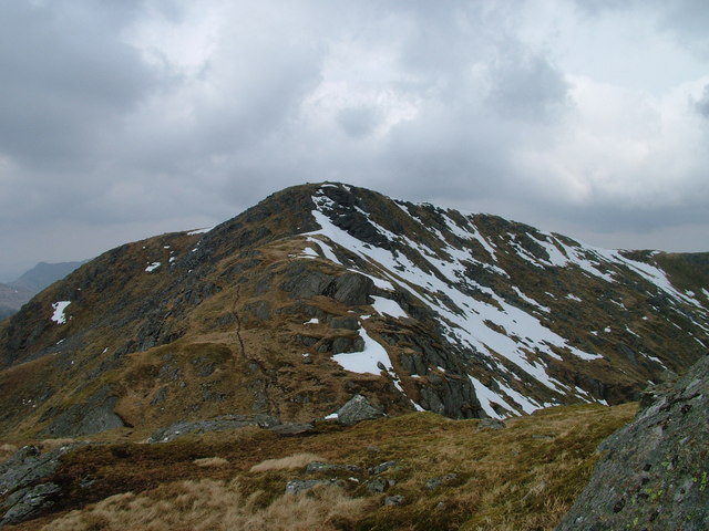
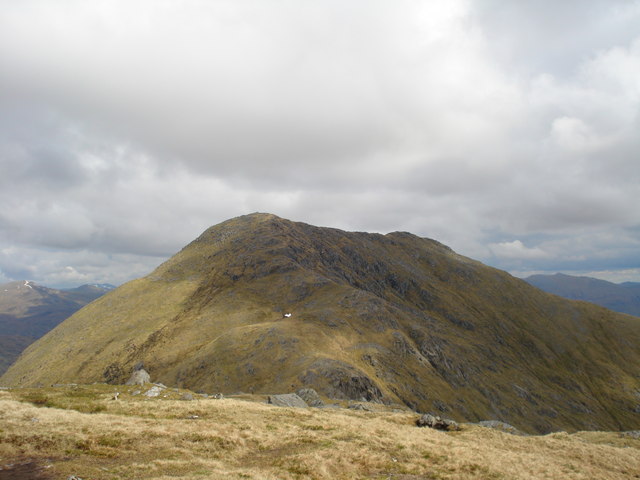
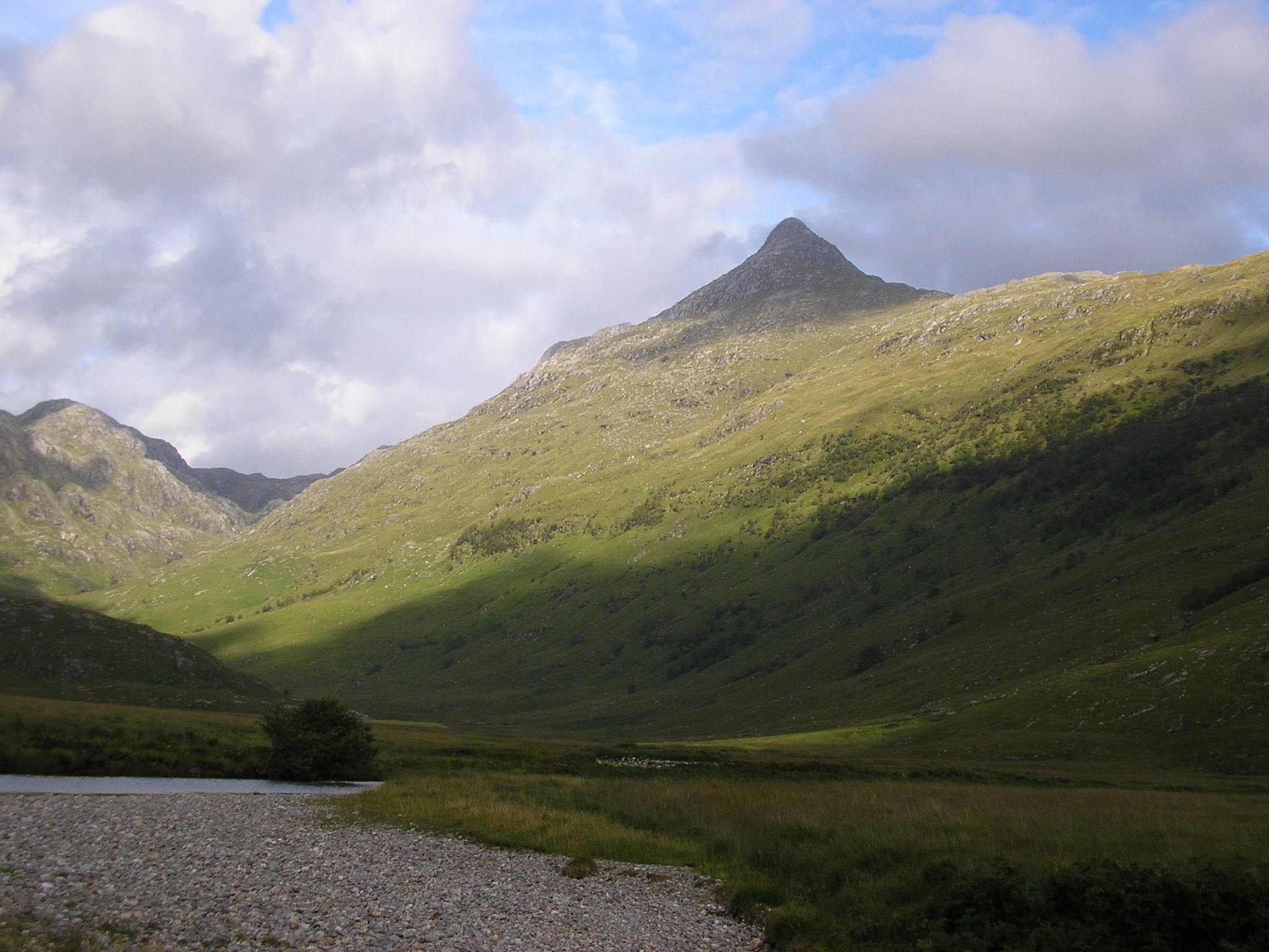
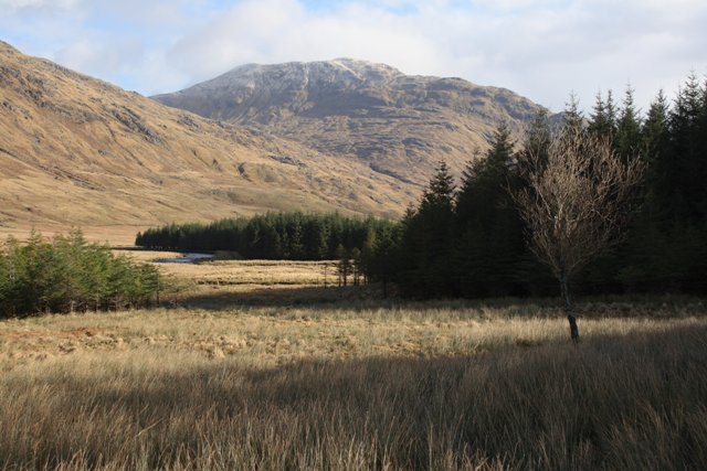
An t-Sàil is a prominent hill located in the heart of Inverness-shire, a county in the Scottish Highlands. Standing at an impressive height of 3,165 feet (965 meters), it is considered one of the major peaks in the region. An t-Sàil is part of the Cairngorms National Park, which is renowned for its stunning natural beauty and diverse wildlife.

The hill is an important landmark for hikers and mountaineers, offering a challenging yet rewarding climb. Its distinctive shape and rugged terrain make it a popular destination for outdoor enthusiasts seeking adventure and breathtaking views. The summit of An t-Sàil provides a panoramic vista of the surrounding landscape, including the nearby Cairngorm Mountains and the vast expanse of Loch Morlich.

The hill is composed of ancient granite, which gives it a unique geological character. Its slopes are covered in heather and grasses, while scattered boulders and rocky outcrops add to its dramatic appearance. An t-Sàil is also home to a variety of flora and fauna, with mountain hares, ptarmigans, and red deer being frequently spotted in the area.

The hill is easily accessible from nearby towns such as Aviemore and Kingussie, with well-marked trails leading to its summit. However, due to its exposed nature, climbers are advised to be well-prepared and equipped for changing weather conditions. Whether you are an experienced mountaineer or a nature lover seeking a memorable hike, An t-Sàil offers a challenging and awe-inspiring adventure in the heart of the Scottish Highlands.

If you have any feedback on the listing, please let us know in the comments section below.

An t-Sàil Images

Images are sourced within 2km of 57.026392/-5.3943062 or Grid Reference NM9497. Thanks to Geograph Open Source API. All images are credited.

Stalkers' track heading up Sgùrr Beag From the saddle between An Eag and Sgùrr Beag.
Stalkers' track heading up Sgùrr Beag
From the saddle between An Eag and Sgùrr Beag.
The summit of An t-Sail An t-Sail, 695m, is at the end of the north ridge of Sgurr nan Coireachan. The prominent hill in the centre of the photo is Sgurr na Ciche, about 4km away. Sgurr na Ciche, 1040m, is one of the finest in the Scottish Highlands: it is also one of the most remote (unless you can get access by boat to the head of Loch Nevis), across quite difficult and tiring ground.
The summit of An t-Sail
An t-Sail, 695m, is at the end of the north ridge of Sgurr nan Coireachan. The prominent hill in the centre of the photo is Sgurr na Ciche, about 4km away. Sgurr na Ciche, 1040m, is one of the finest in the Scottish Highlands: it is also one of the most remote (unless you can get access by boat to the head of Loch Nevis), across quite difficult and tiring ground.
Sgùrr Beag summit View towards An Eag and Sgùrr nan Coireachan.
Sgùrr Beag summit
View towards An Eag and Sgùrr nan Coireachan.
Summit cairn, Sgùrr Beag A view into Knoydart with Sgùrr na Ciche on the left.
Summit cairn, Sgùrr Beag
A view into Knoydart with Sgùrr na Ciche on the left.
West end of Loch Quoich Before it was submerged when the Loch Quoich hydro-electric scheme was built, a rain gauge at the lodge near this spot revealed that this area is one of the wettest places in Britain. Today it is easiest to get there by boat.
West end of Loch Quoich
Before it was submerged when the Loch Quoich hydro-electric scheme was built, a rain gauge at the lodge near this spot revealed that this area is one of the wettest places in Britain. Today it is easiest to get there by boat.
The East Ridge of Sgurr nan Coireachan This rugged, rocky ridge leads eastwards from the col below An Eag
The East Ridge of Sgurr nan Coireachan
This rugged, rocky ridge leads eastwards from the col below An Eag
Down the Glen Looking down Coire nan Gall towards Loch Quoich
Down the Glen
Looking down Coire nan Gall towards Loch Quoich
Garbh Chioch Bheag Garbh Chioch Bheag from the lower slopes of Sgurr nan Coireachan.
Garbh Chioch Bheag
Garbh Chioch Bheag from the lower slopes of Sgurr nan Coireachan.
Steep slope Western slope of Druim Buihde
Steep slope
Western slope of Druim Buihde
An Eag The summit of An Eag appearing out of the mist
An Eag
The summit of An Eag appearing out of the mist
Loch Quoich Looking across the western end of Loch Quoich, the drowned Garbh Abhainn river. As always the shores are rough and waterlogged.
Loch Quoich
Looking across the western end of Loch Quoich, the drowned Garbh Abhainn river. As always the shores are rough and waterlogged.
An t-Sail and Loch Quoich Loch Quoich narrows as the watershed is approached.

If you have a boat, this is the easy way up Sgurr nan Coireachan, a pony path runs all the way up the hill from the lochside.
An t-Sail and Loch Quoich
Loch Quoich narrows as the watershed is approached. If you have a boat, this is the easy way up Sgurr nan Coireachan, a pony path runs all the way up the hill from the lochside.
Lochside track, Loch Quoich The construction track, approaching the west end of Loch Quoich with Meall a' Choire Dhuibh beyond.
Lochside track, Loch Quoich
The construction track, approaching the west end of Loch Quoich with Meall a' Choire Dhuibh beyond.
Meall an Spàrdain Looking up Meall an Spàrdain from Loch Quoich.
Meall an Spàrdain
Looking up Meall an Spàrdain from Loch Quoich.
Beach on Loch Quoich Often the loch is drawn down further than this, leaving the "tide line" effect which disfigures hydroelectric lochs. However the area is so wet, the loch soon fills again.
Beach on Loch Quoich
Often the loch is drawn down further than this, leaving the "tide line" effect which disfigures hydroelectric lochs. However the area is so wet, the loch soon fills again.
West end of Loch Cuaich The west end of the loch with the North Cruadhach Dam which holds the loch above the watershed. Ben Aden beyond
West end of Loch Cuaich
The west end of the loch with the North Cruadhach Dam which holds the loch above the watershed. Ben Aden beyond
South Cruadhach Dam The smaller of the two cut off dams at the west end of Loch Cuaich. Coire nan Gall beyond.
South Cruadhach Dam
The smaller of the two cut off dams at the west end of Loch Cuaich. Coire nan Gall beyond.
North Cruadhach Dam The larger of two cut off dams that allow the level of Loch Cuaich to be raised above a low pass in the East - West watershed of Scotland. The watershed is below 190m here, once an important pass but now cut off from easy use by the raised loch.
North Cruadhach Dam
The larger of two cut off dams that allow the level of Loch Cuaich to be raised above a low pass in the East - West watershed of Scotland. The watershed is below 190m here, once an important pass but now cut off from easy use by the raised loch.
Show me another place!

An t-Sàil is located at Grid Ref: NM9497 (Lat: 57.026392, Lng: -5.3943062)

Unitary Authority: Highland

Police Authority: Highlands and Islands

What 3 Words

///clocking.mooring.songbird. Near Glenelg, Highland

Nearby Locations

An t-Sàil

Related Wikis

Sgurr nan Coireachan (Glen Dessarry)

Sgurr nan Coireachan (953 m) is a mountain in the Northwest Highlands of Scotland. It lies in the Lochaber region, near the head of the remote Glen Dessarry...

Sgùrr Mòr (Loch Quoich)

Sgurr Mor (1,003 m) is a mountain in the Northwest Highlands of Scotland, on the southern side of Loch Quoich in Lochaber. A steep and rugged peak, Sgurr...

Garbh Chioch Mhòr

Garbh Chioch Mhor (1013 m) is a mountain in the Northwest Highlands of Scotland. It lies in the Lochaber region, between Loch Nevis and Loch Quoich. A...

Sgùrr na Cìche

Sgùrr na Cìche (Scottish Gaelic for 'rocky peak of the breast') is a mountain in Knoydart, in the Northwest Highlands of Scotland. It lies on the edge...

Ben Aden

Ben Aden (887m) is a mountain in the Northwest Highlands of Scotland. It lies on the Knoydart peninsula in Lochaber. Regarded as one of the finest Corbetts...

Sgùrr a' Choire-bheithe

Sgùrr a' Choire-bleithe is a 913-m mountain in the remote Knoydart area of Lochaber, Northwest Highlands, Scotland. It is one of highest Corbetts at 913...

Fraoch Bheinn

Fraoch Bheinn (858 m) is a remote mountain in the Northwest Highlands, Scotland, located at the head of Loch Arkaig in Lochaber. Glen Dessary lies to...

Sgùrr nan Eugallt

Sgùrr nan Eugallt is the highest of a well defined group of mountains that lie south of Loch Hourn, stretching from Barrisdale to Loch Quoich. Although...

Have you been to An t-Sàil?

Leave your review of An t-Sàil below (or comments, questions and feedback).