Àirigh Àrd

Hill, Mountain in Argyllshire

Scotland

Àirigh Àrd

A' Chruach Windfarm [under construction] Windfarm above Minard, Argyll under construction
A' Chruach Windfarm [under construction] Credit: Richard Caulfield

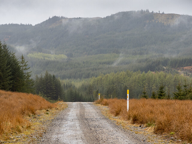
Àirigh Àrd is a prominent hill located in Argyllshire, Scotland. It is situated in the western part of the country, close to the village of Cairndow. Standing at an elevation of approximately 727 meters (2,385 feet), Àirigh Àrd offers stunning panoramic views of the surrounding landscapes.

The hill is characterized by its rugged terrain, rocky outcrops, and heather-covered slopes. It is a popular destination for hikers and outdoor enthusiasts who are drawn to its challenging trails and breathtaking vistas. The ascent to the summit can be quite demanding, requiring a good level of fitness and navigation skills.

At the peak of Àirigh Àrd, visitors are rewarded with awe-inspiring vistas of the neighboring hills, lochs, and vast stretches of moorland. On clear days, it is even possible to see as far as the Isle of Arran and the distant peaks of the Scottish Highlands.

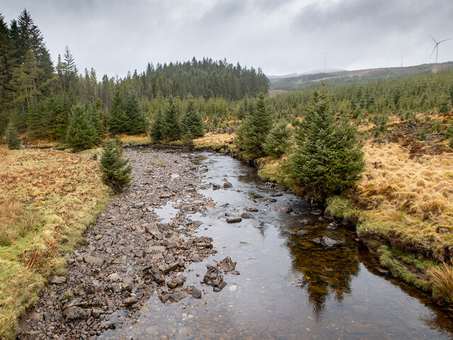
The hill is also known for its rich biodiversity. Its slopes are home to a variety of flora and fauna, including heather, grasses, and various species of birds such as golden eagles and peregrine falcons. The surrounding area is a designated Site of Special Scientific Interest (SSSI), highlighting its ecological significance.

In conclusion, Àirigh Àrd is a magnificent hill in Argyllshire, Scotland, offering challenging hikes and breathtaking vistas. Its rugged beauty and diverse wildlife make it a must-visit destination for nature lovers and outdoor enthusiasts.

If you have any feedback on the listing, please let us know in the comments section below.

Àirigh Àrd Images

Images are sourced within 2km of 56.118117/-5.3310383 or Grid Reference NR9396. Thanks to Geograph Open Source API. All images are credited.

A' Chruach Windfarm [under construction] Windfarm above Minard, Argyll under construction
A' Chruach Windfarm [under construction]
Windfarm above Minard, Argyll under construction
Forestry road in Kilmichael Forest This is also the main access road for the A' Cruach wind farm and is being used for the construction of the new Inveraray-Crossaig transmission line.
Forestry road in Kilmichael Forest
This is also the main access road for the A' Cruach wind farm and is being used for the construction of the new Inveraray-Crossaig transmission line.
In Kilmichael Forest
Entrance to A' Cruach wind farm This is a 21-turbine installation north of Loch Glashan in Kilmichael Forest.
Entrance to A' Cruach wind farm
This is a 21-turbine installation north of Loch Glashan in Kilmichael Forest.
Ruins at Tunns Ruins of a pre-improvement settlement, now in Kilmichael Forest.
Ruins at Tunns
Ruins of a pre-improvement settlement, now in Kilmichael Forest.
Ruins at Tunns Ruins of a pre-improvement settlement, now in Kilmichael Forest.
The new transmission line from Inveraray to Crossaig passes very close by.
Ruins at Tunns
Ruins of a pre-improvement settlement, now in Kilmichael Forest. The new transmission line from Inveraray to Crossaig passes very close by.
Ruins at Auchlech The ruins of a pre-improvement settlement in Kilmichael Forest. The turbines of the A'Cruach wind farm can be seen through the mist.
I was last here - just about on the same spot - 14 years ago. <a href="https://www.geograph.org.uk/photo/341373">NR9296 : Auchlech</a>
Ruins at Auchlech
The ruins of a pre-improvement settlement in Kilmichael Forest. The turbines of the A'Cruach wind farm can be seen through the mist. I was last here - just about on the same spot - 14 years ago. NR9296 : Auchlech
Forest road in Kilmichael Forest Some of the turbines of the A'Cruach wind farm can be seen through the mist and rain.
Forest road in Kilmichael Forest
Some of the turbines of the A'Cruach wind farm can be seen through the mist and rain.
Windfarm access road This road provides access to the northern part of the A'Cruach wind farm. At this point, it's heading down into Gleann Airigh to cross the River Add. The yellow marker posts mark where the transmission cable from the turbines is buried.
Windfarm access road
This road provides access to the northern part of the A'Cruach wind farm. At this point, it's heading down into Gleann Airigh to cross the River Add. The yellow marker posts mark where the transmission cable from the turbines is buried.
Windfarm access road The road provides access to the northern group of turbines of the A'Cruach wind farm. Here is crosses the River Add in the upper part of Gleann Airigh. The yellow posts mark and warn of the transmission cable buried underneath.
Windfarm access road
The road provides access to the northern group of turbines of the A'Cruach wind farm. Here is crosses the River Add in the upper part of Gleann Airigh. The yellow posts mark and warn of the transmission cable buried underneath.
View out of Kilmichael Forest
A' Chruach wind farm The bridge carries the access road across the River Add in Gleann Airigh.
A' Chruach wind farm
The bridge carries the access road across the River Add in Gleann Airigh.
River Add looking upstream
River Add looking downstream
Electricity poles for A' Chruach wind farm
A' Chruach wind farm In Kilmichael Forest.
A' Chruach wind farm
In Kilmichael Forest.
Entrance to A' Chruach wind farm
Show me another place!

Àirigh Àrd is located at Grid Ref: NR9396 (Lat: 56.118117, Lng: -5.3310383)

Unitary Authority: Argyll and Bute

Police Authority: Argyll and West Dunbartonshire

What 3 Words

///launcher.tile.shocks. Near Lochgilphead, Argyll & Bute

Related Wikis

Blackmill Loch

Blackmill Loch is an impounding reservoir, in Argyll and Bute, Scotland. The loch was constructed in 1964 and is one source of freshwater for the Lochgair...

Feorlin

Feorlin is an impounding reservoir located 2 kilometres west of Minard. The loch is part of the Lochgair Hydroelectric Scheme. The rockfill dam is 4.19...

Tullochgorm

Tullochgorm is an old township parish which lies one mile south of Minard in the county of Argyll and Bute in Western Scotland and today comprises only...

Birdfield

Birdfield is a village in Argyll and Bute, Scotland.

Nearby Amenities

Located within 500m of 56.118117,-5.3310383
Generator Method: wind_turbine
Generator Source: wind
Generator Type: horizontal_axis
Power: generator
Lat/Long: 56.1218598/-5.3270966
Generator Method: wind_turbine
Generator Source: wind
Generator Type: horizontal_axis
Power: generator
Lat/Long: 56.1193119/-5.3260452
Generator Method: wind_turbine
Generator Source: wind
Generator Type: horizontal_axis
Power: generator
Lat/Long: 56.1197276/-5.3309268
Generator Method: wind_turbine
Generator Source: wind
Generator Type: horizontal_axis
Power: generator
Lat/Long: 56.1168657/-5.3319139
The data included in this document is from www.openstreetmap.org. The data is made available under ODbL.

Have you been to Àirigh Àrd?

Leave your review of Àirigh Àrd below (or comments, questions and feedback).