Aonach na Dàlach Mòire
Hill, Mountain in Ross-shire
Scotland
Aonach na Dàlach Mòire

Aonach na Dàlach Mòire, located in Ross-shire, Scotland, is a prominent hill/mountain within the Scottish Highlands. Standing at an impressive height of 899 meters (2,949 feet), it offers breathtaking views and exhilarating hiking opportunities for outdoor enthusiasts.
Situated in the western part of Scotland, Aonach na Dàlach Mòire is part of the Northwest Highlands Geopark. The mountain is composed mainly of Torridonian sandstone, a distinctive red-brown rock formation that adds to its visual appeal. It is known for its rugged terrain, steep slopes, and narrow ridges, making it a challenging but rewarding ascent.
Hiking Aonach na Dàlach Mòire offers a chance to immerse oneself in the stunning natural beauty of the Scottish Highlands. The trail to the summit can be accessed from various starting points, such as Loch Carron or the nearby village of Torridon. As one climbs higher, they are treated to panoramic views of the surrounding mountains, lochs, and glens, including the famous Loch Maree.
The region surrounding Aonach na Dàlach Mòire is rich in biodiversity, hosting a variety of plant and animal species. Visitors may spot native wildlife such as red deer, golden eagles, or even the elusive Scottish wildcat during their hike.
Due to its remote location and challenging terrain, it is essential for hikers to be well-prepared with appropriate clothing, navigation tools, and supplies. The weather in the Scottish Highlands can be unpredictable, with strong winds and heavy rainfall, so caution is advised.
Aonach na Dàlach Mòire is an awe-inspiring natural landmark that showcases the raw beauty of the Scottish Highlands. Its towering presence, stunning vistas, and rugged charm make it a must-visit destination for outdoor enthusiasts and nature lovers alike.
If you have any feedback on the listing, please let us know in the comments section below.
Aonach na Dàlach Mòire Images
Images are sourced within 2km of 57.368481/-5.4453735 or Grid Reference NG9236. Thanks to Geograph Open Source API. All images are credited.


Aonach na Dàlach Mòire is located at Grid Ref: NG9236 (Lat: 57.368481, Lng: -5.4453735)
Unitary Authority: Highland
Police Authority: Highlands and Islands
What 3 Words
///smokers.fluctuate.reheat. Near Lochcarron, Highland
Nearby Locations
Related Wikis

Attadale, Scotland
Attadale (Gaelic: Attadal ) is a settlement and estate in Wester Ross, in the Highland council area of Scotland. It is on the southern shore of Loch Carron...
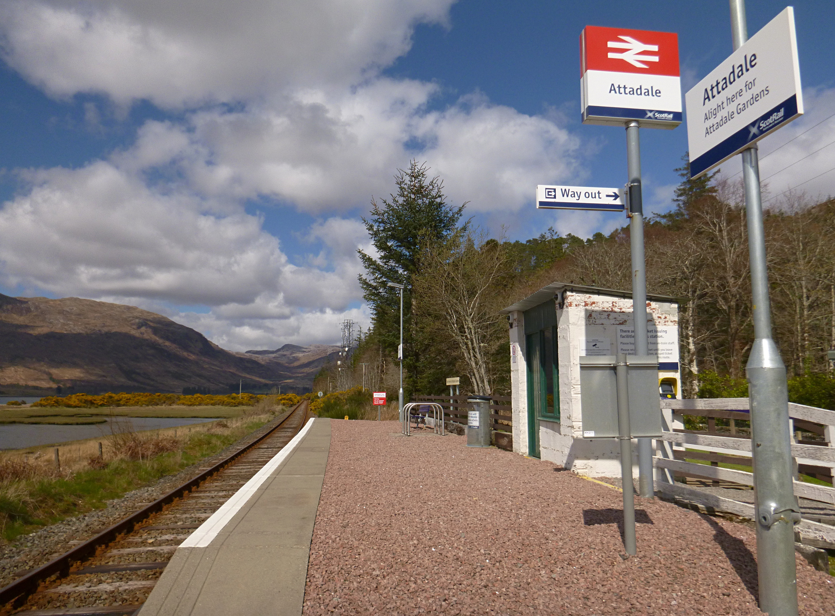
Attadale railway station
Attadale railway station is a remote railway station on the Kyle of Lochalsh Line, serving the village of Attadale on Loch Carron in the Highlands, northern...
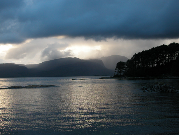
Loch Carron
Loch Carron (Scottish Gaelic: "Loch Carrann") is a sea loch on the west coast of Ross and Cromarty in the Scottish Highlands, which separates the Lochalsh...

Lochcarron
Lochcarron (Scottish Gaelic: Loch Carrann) is a village, community and civil parish in the Wester Ross area of Highland, Scotland. It has a population...

Sallachy
Sallachy (Scottish Gaelic: Salachaidh) is a hamlet on the north shore of Loch Long in the district of Skye and Lochalsh in the Scottish Highlands and is...

Killilan
Killilan (Scottish Gaelic: Cill Fhaolain) is a remote hamlet, at the base of Ben Killilan, at the east end of Loch Long, in Lochalsh in the Highlands of...

Strathcarron railway station
Strathcarron railway station is a remote railway station on the Kyle of Lochalsh Line, serving the small village of Strathcarron and the larger village...

Strathcarron, Highland
Strathcarron (Scottish Gaelic: Srath Carrann) is a hamlet, in the Highland council area of Scotland. == Geography == It is situated at the head of the...
Have you been to Aonach na Dàlach Mòire?
Leave your review of Aonach na Dàlach Mòire below (or comments, questions and feedback).