Carn Gelli

Hill, Mountain in Pembrokeshire

Wales

Carn Gelli

Country Lane near Tre-Howel
Country Lane near Tre-Howel Credit: Sandy Gerrard

Carn Gelli is a prominent hill located in Pembrokeshire, Wales. Standing at an elevation of 198 meters (650 feet), it offers stunning panoramic views of the surrounding countryside and coastline. The hill is characterized by its rugged terrain, with rocky outcrops and steep slopes making it a challenging yet rewarding climb for hikers and outdoor enthusiasts.

Carn Gelli is a popular destination for those seeking a taste of the Welsh wilderness, with its unspoiled natural beauty and diverse flora and fauna. The hill is home to a variety of plant species, including heather, gorse, and wildflowers, as well as a range of birdlife such as buzzards and kestrels.

Visitors to Carn Gelli can enjoy a range of outdoor activities, including hiking, birdwatching, and photography. The hill is also a great spot for picnicking and enjoying a peaceful moment in nature. With its scenic views and tranquil atmosphere, Carn Gelli is a must-visit destination for anyone looking to explore the natural beauty of Pembrokeshire.

If you have any feedback on the listing, please let us know in the comments section below.
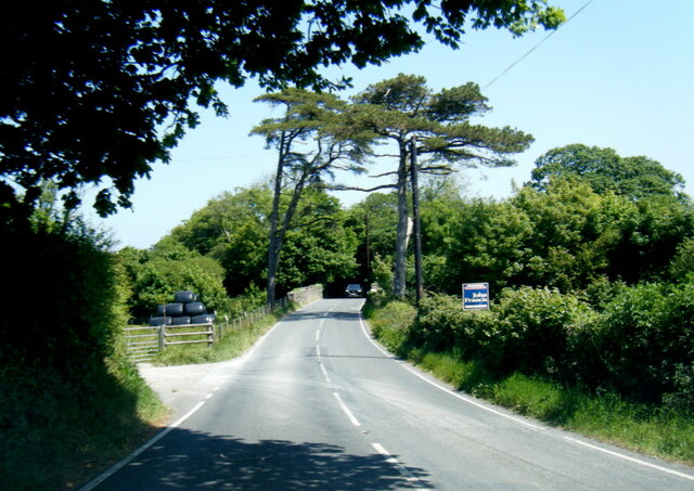
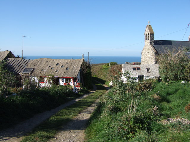
Carn Gelli Images

Images are sourced within 2km of 52.00098/-5.0269475 or Grid Reference SM9237. Thanks to Geograph Open Source API. All images are credited.

Country Lane near Tre-Howel
Green Lane leading from Llanwnda
St Gwyndaf's Church, Llanwnda <span class="nowrap"><a title="https://www.explorechurches.org/church/st-gwyndaf-llanwnda" rel="nofollow ugc noopener" href="https://www.explorechurches.org/church/st-gwyndaf-llanwnda">Link</a><img style="margin-left:2px;" alt="External link" title="External link - shift click to open in new window" src="https://s1.geograph.org.uk/img/external.png" width="10" height="10"/></span>
St Gwyndaf's Church, Llanwnda
Looking towards Llanwnda from Bristgarn A smattering of houses below Garnwnda, a small craggy outcrop of moorland
Looking towards Llanwnda from Bristgarn
A smattering of houses below Garnwnda, a small craggy outcrop of moorland
Garnwnda A small craggy outcrop above the hamlet of Llanwnda
Garnwnda
A small craggy outcrop above the hamlet of Llanwnda
House at Henner Cross
Croeso i Wdig/Goodwick Decorative lighthouse on the approach to Goodwick on the A487
Croeso i Wdig/Goodwick
Decorative lighthouse on the approach to Goodwick on the A487
The A487 bridge over the railway line
Church of St Gywndaf A church with many reused ancient inscribed stones in its fabric
Church of St Gywndaf
A church with many reused ancient inscribed stones in its fabric
Church of St Gywndaf The white rendered stone near the centre of the view is a reused inscribed cross stone, one of many in the fabric of the church walls
Church of St Gywndaf
The white rendered stone near the centre of the view is a reused inscribed cross stone, one of many in the fabric of the church walls
Inscribed Ancient Stone This figurative stone has been reused in the Church of St Gwyndaf
Inscribed Ancient Stone
This figurative stone has been reused in the Church of St Gwyndaf
St Gwyndaf's holy well In an alder glade a short distances south of the church in the village of Llanwnda lies a "holy" well from which a stream issues. Access and appearance has recently been improved following renewed interest in holy wells. It's been speculated that pilgrims rested here on their way to St David's. However there is no historical record of this.

"A stone chamber constructed over a stone lined "leat-like" stream. It appears to be a covered well consisting of a large capping stone, circa 1.5m x 0.8m and 0.35m thick, supported at its northeast corner by a large cubic boulder and elsewhere by a 1.40m high drystone wall. The well is open at its north side where the water flows out, whilst on its east side it is also open where there is a kerb stone or step down into the water filled chamber. Although this monument has a capstone covering a chamber and can also be described as cist-like it is most definitely not prehistoric, at least in its present form."
(Dyfed Archaeology)
St Gwyndaf's holy well
In an alder glade a short distances south of the church in the village of Llanwnda lies a "holy" well from which a stream issues. Access and appearance has recently been improved following renewed interest in holy wells. It's been speculated that pilgrims rested here on their way to St David's. However there is no historical record of this. "A stone chamber constructed over a stone lined "leat-like" stream. It appears to be a covered well consisting of a large capping stone, circa 1.5m x 0.8m and 0.35m thick, supported at its northeast corner by a large cubic boulder and elsewhere by a 1.40m high drystone wall. The well is open at its north side where the water flows out, whilst on its east side it is also open where there is a kerb stone or step down into the water filled chamber. Although this monument has a capstone covering a chamber and can also be described as cist-like it is most definitely not prehistoric, at least in its present form." (Dyfed Archaeology)
A487 at Manorowen
A487 at Manorowen
A487 in Dyffryn, Goodwick
Grave of May Owen (Pearce) in Llanwnda cemetery The gravestone in the centre of the image marks the grave of May Owen who received the George Medal for her bravery in rescuing several passengers when the St Patrick ferry was bombed and sunk by the Luftwaffe on June 13th 1941 a few miles off Strumble Head.
See here for details <span class="nowrap"><a title="https://portspastpresent.eu/items/show/595" rel="nofollow ugc noopener" href="https://portspastpresent.eu/items/show/595">Link</a><img style="margin-left:2px;" alt="External link" title="External link - shift click to open in new window" src="https://s1.geograph.org.uk/img/external.png" width="10" height="10"/></span>
Grave of May Owen (Pearce) in Llanwnda cemetery
The gravestone in the centre of the image marks the grave of May Owen who received the George Medal for her bravery in rescuing several passengers when the St Patrick ferry was bombed and sunk by the Luftwaffe on June 13th 1941 a few miles off Strumble Head. See here for details LinkExternal link
Footpath towards Llanwnda A walled and hedged green lane also carried a footpath back from the coast path.
Footpath towards Llanwnda
A walled and hedged green lane also carried a footpath back from the coast path.
Part of Llanwnda I particularly like the golden pig.
Part of Llanwnda
I particularly like the golden pig.
Manor Road, Dyffryn
Manor Road, Dyffryn
Show me another place!

Carn Gelli is located at Grid Ref: SM9237 (Lat: 52.00098, Lng: -5.0269475)

Unitary Authority: Pembrokeshire

Police Authority: Dyfed Powys

What 3 Words

///blending.basics.copycat. Near Goodwick, Pembrokeshire

Nearby Locations

Carn Gelli

Related Wikis

Llanwnda, Pembrokeshire

Llanwnda is a rural village and parish to the north of the Welsh county of Pembrokeshire and part of the community of Pencaer. It lies some two miles northwest...

Pencaer

Pencaer is a community which covers an area of dispersed settlement in Pembrokeshire, Wales, on the peninsula of Pen Caer and comprises the village of...

Fishguard and Goodwick railway station

Fishguard and Goodwick railway station is a railway station sited 1 mile from Fishguard in the neighbouring town of Goodwick, Pembrokeshire, Wales. It...

Goodwick

Goodwick (; Welsh: Wdig) is a coastal town in Pembrokeshire, Wales, immediately west of its twin town of Fishguard. Fishguard and Goodwick form a community...

Nearby Amenities

Located within 500m of 52.00098,-5.0269475
Fixme: incomplete
Lat/Long: 52.0036516/-5.0250328
Barrier: stile
Stile: ladder
Lat/Long: 52.0036433/-5.0249738
Barrier: stile
Stile: ladder
Lat/Long: 52.0037309/-5.0247887
Barrier: stile
Stile: ladder
Lat/Long: 52.0017536/-5.0263727
Fixme: incomplete
Lat/Long: 52.0001988/-5.0259581
Fixme: incomplete
Lat/Long: 52.0005637/-5.0256309
Barrier: stile
Stile: ladder
Lat/Long: 52.0001955/-5.0277565
The data included in this document is from www.openstreetmap.org. The data is made available under ODbL.

Have you been to Carn Gelli?

Leave your review of Carn Gelli below (or comments, questions and feedback).