An Ruadh-Stac

Hill, Mountain in Ross-shire

Scotland

An Ruadh-Stac

Coire Garbh, Maol Chean-dearg The 'rough corrie' on the E side of the mountain; in the foreground is the path up to the bealach.
Coire Garbh, Maol Chean-dearg Credit: Jim Barton

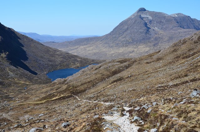
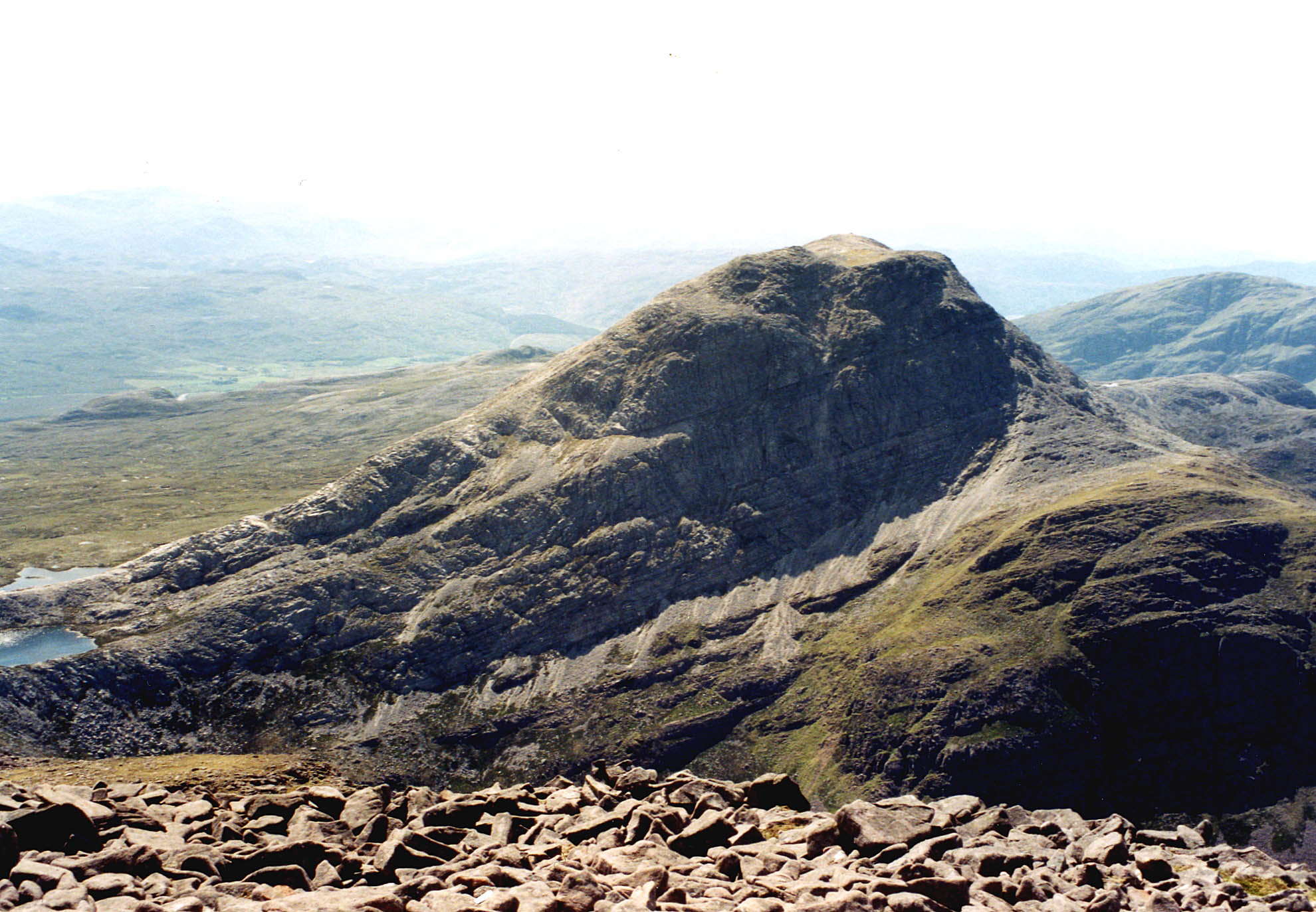
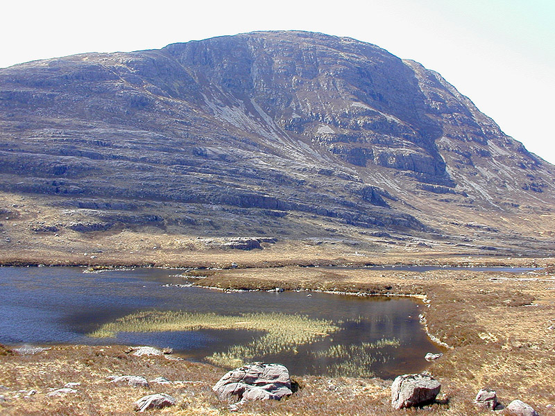
An Ruadh-Stac is a prominent hill located in Ross-shire, Scotland. It is part of the Torridon Hills, a mountain range known for its rugged beauty and challenging terrain. With an elevation of 918 meters (3,012 feet), An Ruadh-Stac offers breathtaking panoramic views of the surrounding landscape.

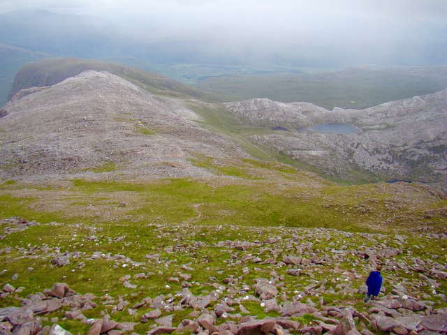
This hill is characterized by its distinctive reddish appearance, which is a result of the Torridonian sandstone that forms its composition. Its steep slopes and rocky terrain make it a popular destination for hikers and mountaineers seeking a challenging climb. The ascent to An Ruadh-Stac requires a good level of fitness and some scrambling skills, as the path becomes steeper and more rugged as you reach the summit.

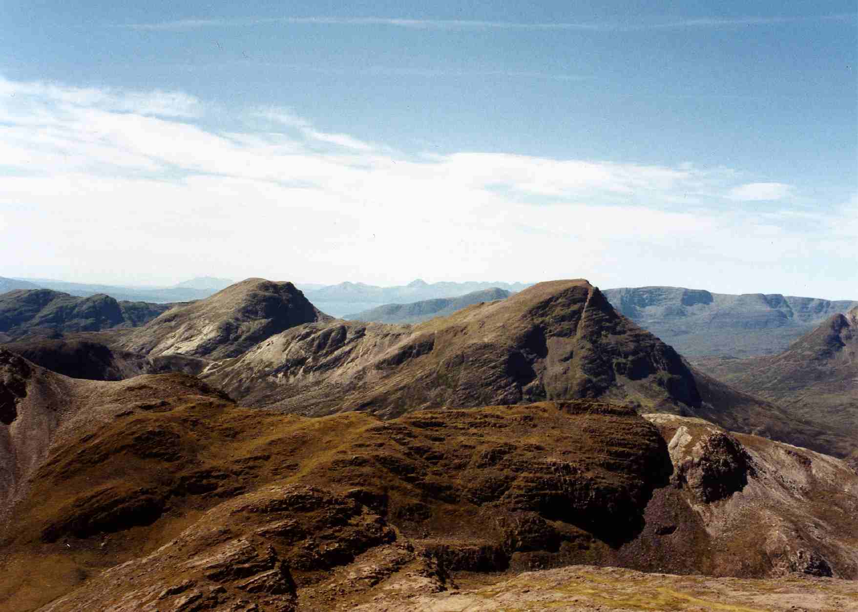
From the top of An Ruadh-Stac, one can enjoy stunning vistas of the surrounding Torridon Hills, including the nearby Loch Torridon and the dramatic peaks of Beinn Eighe and Liathach. On clear days, it is even possible to see as far as the Isle of Skye and the Outer Hebrides.

Due to its remote location and challenging ascent, An Ruadh-Stac is less frequented by tourists compared to other nearby hills. However, for those seeking a true wilderness experience and stunning natural beauty, this mountain is a must-visit. Proper preparation, including appropriate clothing, navigation tools, and knowledge of the area, is essential when venturing to An Ruadh-Stac, as the weather conditions can change rapidly and the terrain can be unforgiving.

If you have any feedback on the listing, please let us know in the comments section below.

An Ruadh-Stac Images

Images are sourced within 2km of 57.475023/-5.4683401 or Grid Reference NG9248. Thanks to Geograph Open Source API. All images are credited.

Coire Garbh, Maol Chean-dearg The 'rough corrie' on the E side of the mountain; in the foreground is the path up to the bealach.
Coire Garbh, Maol Chean-dearg
The 'rough corrie' on the E side of the mountain; in the foreground is the path up to the bealach.
Clear water and quartzite The clear water of the Allt Mnatha Luadhadair where it crosses the path to the Bealach a' Choire Ghairbh.
Clear water and quartzite
The clear water of the Allt Mnatha Luadhadair where it crosses the path to the Bealach a' Choire Ghairbh.
Approaching the Bealach a' Choire Ghairbh A hot day with sun reflecting from the pale quartzite on the path up from Coire Fionnaraich.
Approaching the Bealach a' Choire Ghairbh
A hot day with sun reflecting from the pale quartzite on the path up from Coire Fionnaraich.
At the Bealach a' Choire Ghairbh Crossing the 587m col on a superb sunny day with An Ruadh-Stac coming into view.
At the Bealach a' Choire Ghairbh
Crossing the 587m col on a superb sunny day with An Ruadh-Stac coming into view.
Loch a' Mhadaidh Ruadh The 'loch of the red fox' seen from the bealach below Maol Chean-dearg.
Loch a' Mhadaidh Ruadh
The 'loch of the red fox' seen from the bealach below Maol Chean-dearg.
Path descending to Loch Coire an Ruadh-staic Descending NW from below the Bealach a' Choire Ghairbh with Beinn Damh ahead.
Path descending to Loch Coire an Ruadh-staic
Descending NW from below the Bealach a' Choire Ghairbh with Beinn Damh ahead.
Loch na Cabhaig A lochan on the north side of An Ruadh-Stac.
Loch na Cabhaig
A lochan on the north side of An Ruadh-Stac.
Loch Coire an Ruadh-staic The hill of the stag, Beinn Damh (903m), dominates the skyline from this section of the path by the loch.
Loch Coire an Ruadh-staic
The hill of the stag, Beinn Damh (903m), dominates the skyline from this section of the path by the loch.
Sandstone and quartzite, Maol Chean-dearg A clear transition is visible from Torridonian sandstone to Cambrian quartzite on the SE flank of Maol Chean-dearg.
Sandstone and quartzite, Maol Chean-dearg
A clear transition is visible from Torridonian sandstone to Cambrian quartzite on the SE flank of Maol Chean-dearg.
Path by Loch Coire an Ruadh-staic The path swings north to join the route from Coire Lair to Annat and Torridon. Beinn Damh is ahead.
Path by Loch Coire an Ruadh-staic
The path swings north to join the route from Coire Lair to Annat and Torridon. Beinn Damh is ahead.
Beinn Bhan in view The ever-changing views are a great feature of this path around Maol Chean-dearg. Here the corries of Beinn Bhan in Applecross are in sight from the northern arm of Loch Coire an Ruadh-staic.
Beinn Bhan in view
The ever-changing views are a great feature of this path around Maol Chean-dearg. Here the corries of Beinn Bhan in Applecross are in sight from the northern arm of Loch Coire an Ruadh-staic.
Path from the Bealach a' Choire Ghairbh Looking back to the higher ground between An Ruadh-Stac and Maol Chean-dearg with outcrops of quartzite above the hummocky moraines by the loch.
Path from the Bealach a' Choire Ghairbh
Looking back to the higher ground between An Ruadh-Stac and Maol Chean-dearg with outcrops of quartzite above the hummocky moraines by the loch.
Late sun catches Càrn Cadh an Eididh
An Ruadh-Stac from Attadale The ridge rising to An Ruadh-Stac (892m) seen across Loch Carron from about 150m on the path to Glen Udalain above Attadale. Maol Chean-dearg (933m) is to the right, partly hidden.
An Ruadh-Stac from Attadale
The ridge rising to An Ruadh-Stac (892m) seen across Loch Carron from about 150m on the path to Glen Udalain above Attadale. Maol Chean-dearg (933m) is to the right, partly hidden.
Loch a' Mhadaidh Ruadh, under An Ruadh-stac
Path to the bealach
Path to the bealach
Maol Chean-dearg, descent
View to Maol Chean-dearg from Fuar Tholl
Show me another place!

An Ruadh-Stac is located at Grid Ref: NG9248 (Lat: 57.475023, Lng: -5.4683401)

Unitary Authority: Highland

Police Authority: Highlands and Islands

What 3 Words

///flooding.relaxing.uppermost. Near Lochcarron, Highland

Related Wikis

An Ruadh-stac

An Ruadh-stac is a Scottish mountain situated in the Wester Ross region of the Highland council area. It is located 26 km north east of Kyle of Lochalsh...

Maol Cheann-dearg

Maol Cheann-Dearg is a mountain in the Northwest Highlands of Scotland, between Upper Loch Torridon and Loch Carron, in the Coulags deer forest in Wester...

Beinn Damh

Beinn Damh (or Ben Damph) is a Scottish mountain situated in the wild mountainous area between Upper Loch Torridon and Glen Carron, 25 kilometres north...

Beinn na h-Eaglaise (Graham)

Beinn na h-Eaglaise (736 m) is a mountain in the Northwest Highlands of Scotland. It lies in Wester Ross, south of the village of Torridon. A steep mountain...

Nearby Amenities

Located within 500m of 57.475023,-5.4683401
An Ruadh-stac
Corbett: yes
Ele: 892
Marilyn: yes
Munro: no
Natural: peak
Prominence: 334
Source: OS7
Wikidata: Q3397996
Wikipedia: en:An Ruadh-stac
Lat/Long: 57.4754548/-5.4679313
Ruadh Stac Bheag
Ele: 758
Natural: peak
Lat/Long: 57.4706646/-5.4687885
The data included in this document is from www.openstreetmap.org. The data is made available under ODbL.

Have you been to An Ruadh-Stac?

Leave your review of An Ruadh-Stac below (or comments, questions and feedback).