An Caisteal

Hill, Mountain in Inverness-shire

Scotland

An Caisteal

Glen Barrisdale View through Glen Barrisdale from Sgùrr a' Choire Bheithe
Glen Barrisdale Credit: Richard Webb

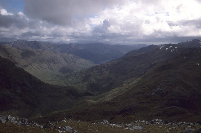
An Caisteal is a prominent hill located in Inverness-shire, Scotland. It is part of the Loch Lomond and The Trossachs National Park, offering stunning views of the surrounding landscape. The hill stands at an elevation of 995 meters (3,264 feet) and is a popular destination for hikers and outdoor enthusiasts.

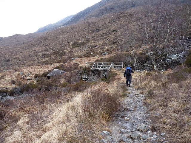
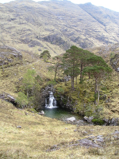
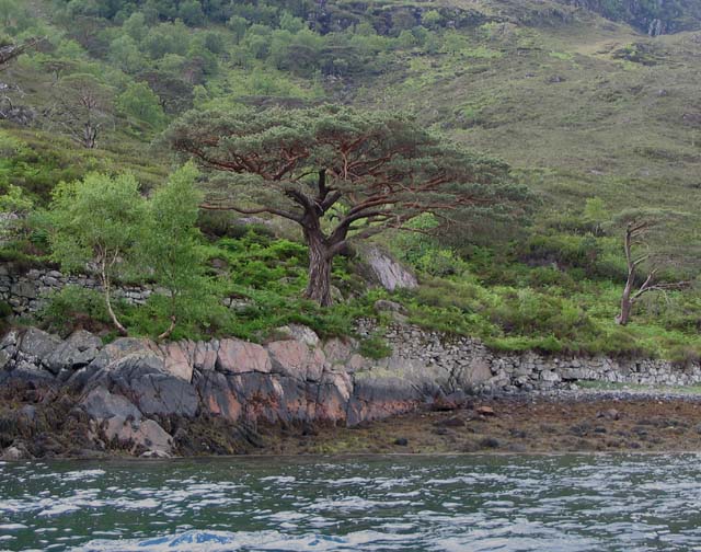
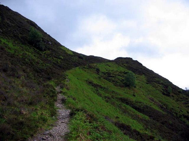
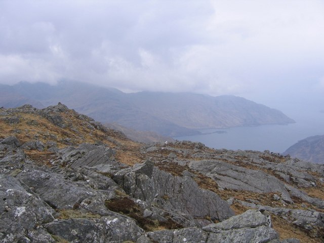
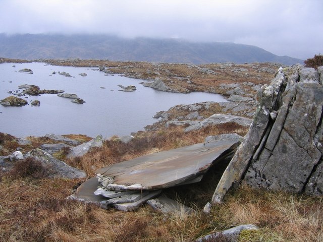
An Caisteal is known for its rugged terrain, with rocky outcrops and steep slopes making it a challenging but rewarding climb. The summit provides panoramic views of the surrounding mountains, lochs, and forests, making it a popular spot for photographers and nature lovers.

The hill is also home to a variety of wildlife, including red deer, mountain hares, and various bird species. The flora and fauna of An Caisteal add to its natural beauty and charm, making it a must-visit destination for those looking to explore the Scottish Highlands.

Overall, An Caisteal offers a unique and unforgettable hiking experience for those willing to take on the challenge of its steep slopes and rocky terrain. Its stunning views and diverse wildlife make it a must-see destination for anyone visiting Inverness-shire.

If you have any feedback on the listing, please let us know in the comments section below.

An Caisteal Images

Images are sourced within 2km of 57.081775/-5.4772273 or Grid Reference NG8904. Thanks to Geograph Open Source API. All images are credited.

Glen Barrisdale View through Glen Barrisdale from Sgùrr a' Choire Bheithe
Glen Barrisdale
View through Glen Barrisdale from Sgùrr a' Choire Bheithe
Stalkers' path above Loch Hourn A narrow and well-drained section on the descent of the hillside approaching Caolas Mòr.
Stalkers' path above Loch Hourn
A narrow and well-drained section on the descent of the hillside approaching Caolas Mòr.
Footbridge over the Allt a' Chaolas Bhig The bridge referred to in <a href="https://www.geograph.org.uk/photo/1044241">NG8806 : Allt a' Chaolas Bhig</a>. On the occasion of our visit, the water was low and slow, making it easy to refill a drink bottle.
Footbridge over the Allt a' Chaolas Bhig
The bridge referred to in NG8806 : Allt a' Chaolas Bhig. On the occasion of our visit, the water was low and slow, making it easy to refill a drink bottle.
Upstream view of the Allt a' Chaolas Bhig Taken on a benign low-water day, certainly by comparison to <a href="https://www.geograph.org.uk/photo/1044241">NG8806 : Allt a' Chaolas Bhig</a>
Upstream view of the Allt a' Chaolas Bhig
Taken on a benign low-water day, certainly by comparison to NG8806 : Allt a' Chaolas Bhig
Ruins by Loch Hourn Unnamed as far as I can see on any of the old maps, this appears to be the remains of a sheepfank (or similar) and a slightly taller building beyond, possibly once roofed.
Ruins by Loch Hourn
Unnamed as far as I can see on any of the old maps, this appears to be the remains of a sheepfank (or similar) and a slightly taller building beyond, possibly once roofed.
Stalkers' path from Barrisdale above Loch Hourn A narrow section of the path, here dropping down a bit of a gully, back towards the shore. The isolated house of <a href="https://www.geograph.org.uk/photo/2419466">NG8906 : Caolasmor Cottage</a>, on the far side of the loch, is just about visible in the murk.
Stalkers' path from Barrisdale above Loch Hourn
A narrow section of the path, here dropping down a bit of a gully, back towards the shore. The isolated house of NG8906 : Caolasmor Cottage, on the far side of the loch, is just about visible in the murk.
Lochside Scots Pine tree One of a number of mature pines scattered along the side of Loch Hourn.
Lochside Scots Pine tree
One of a number of mature pines scattered along the side of Loch Hourn.
Campsite, Barrisdale. Alluvial flats beneath Luinne Bheinn.
Campsite, Barrisdale.
Alluvial flats beneath Luinne Bheinn.
Waterfall in Glen Barrisdale A favourite spot of mine to stop for a snack when walking to Gleann Cosaidh .
Waterfall in Glen Barrisdale
A favourite spot of mine to stop for a snack when walking to Gleann Cosaidh .
Campsite , Barrisdale .
The Path from Kinloch Hourn to Barisdale This is the view across Loch Hourn to Sgurr Mor from the footpath along the south shore of Loch Hourn on a beautifully still morning.
The Path from Kinloch Hourn to Barisdale
This is the view across Loch Hourn to Sgurr Mor from the footpath along the south shore of Loch Hourn on a beautifully still morning.
Historic Lochside Path and Mature Scots Pine Tree The image features the beautifully built "drystane" raised pathway seen on the map running close along the South shore of Loch Hourn to provide access to the settlement of Barrisadale. The other feature is a mature native Scots Pine; wider than it is high and not at all a classic conifer shape.
Historic Lochside Path and Mature Scots Pine Tree
The image features the beautifully built "drystane" raised pathway seen on the map running close along the South shore of Loch Hourn to provide access to the settlement of Barrisadale. The other feature is a mature native Scots Pine; wider than it is high and not at all a classic conifer shape.
Path from Kinloch Hourn to Barrisdale
Summit of Meall nan Eun There are actually two summit cairns of this 666m "Graham". The eastern one, that this photo is taken from, is fractionally higher than the western cairn that can be seen in the photo (despite the impression the photo gives)
Summit of Meall nan Eun
There are actually two summit cairns of this 666m "Graham". The eastern one, that this photo is taken from, is fractionally higher than the western cairn that can be seen in the photo (despite the impression the photo gives)
Rock Slices Looking at Lochanan Meall nan Eun from a nearby large boulder. This boulder is very interesting as due to frost and ice action it has split into amazingly smooth and regular slices, with more in the process of being formed.
Rock Slices
Looking at Lochanan Meall nan Eun from a nearby large boulder. This boulder is very interesting as due to frost and ice action it has split into amazingly smooth and regular slices, with more in the process of being formed.
River Barrisdale in Glen Barrisdale
River Barrisdale Looking down Glen Barrisdale towards Stob a Chearcaill.
River Barrisdale
Looking down Glen Barrisdale towards Stob a Chearcaill.
River Barrisdale Looking towards the pyramid of Stob a Chearcaill.
River Barrisdale
Looking towards the pyramid of Stob a Chearcaill.
Show me another place!

An Caisteal is located at Grid Ref: NG8904 (Lat: 57.081775, Lng: -5.4772273)

Unitary Authority: Highland

Police Authority: Highlands and Islands

What 3 Words

///vote.cloud.goofy. Near Glenelg, Highland

Nearby Locations

An Caisteal

Related Wikis

Sgùrr a' Choire-bheithe

Sgùrr a' Choire-bleithe is a 913-m mountain in the remote Knoydart area of Lochaber, Northwest Highlands, Scotland. It is one of highest Corbetts at 913...

Sgùrr nan Eugallt

Sgùrr nan Eugallt is the highest of a well defined group of mountains that lie south of Loch Hourn, stretching from Barrisdale to Loch Quoich. Although...

Druim Fada (Loch Hourn)

Druim Fada (711 m) is a mountain in the Northwest Highlands of Scotland. Located on the northern shore of Loch Hourn in Ross and Cromarty. A long, craggy...

Luinne Bheinn

Luinne Bheinn (939 m) is a mountain in the Northwest Highlands of Scotland, on the Knoydart Peninsula in Lochaber. The mountain is rough and rocky. The...

Nearby Amenities

Located within 500m of 57.081775,-5.4772273
An Caisteal
Natural: peak
Source: Scottish Popular Edition
Wikidata: Q13125499
Lat/Long: 57.0818884/-5.4773739
The data included in this document is from www.openstreetmap.org. The data is made available under ODbL.

Have you been to An Caisteal?

Leave your review of An Caisteal below (or comments, questions and feedback).