Hill, High

Settlement in Cumberland Allerdale

England

Hill, High

Greta in Fitz Park Looking along the River Greta.
Greta in Fitz Park Credit: DS Pugh

Hill, High, Cumberland is a small town located in the northern region of England, specifically within the county of Cumbria. Situated amidst the picturesque landscapes of the Lake District National Park, Hill, High, Cumberland offers its residents and visitors a charming and idyllic setting.

With a population of around 2,500 inhabitants, this quaint town embodies a close-knit community feel, where neighbors know each other and a sense of camaraderie is evident. The town's economy is primarily centered around agriculture and tourism, with many locals engaged in farming and the provision of services to cater to visitors exploring the nearby natural attractions.

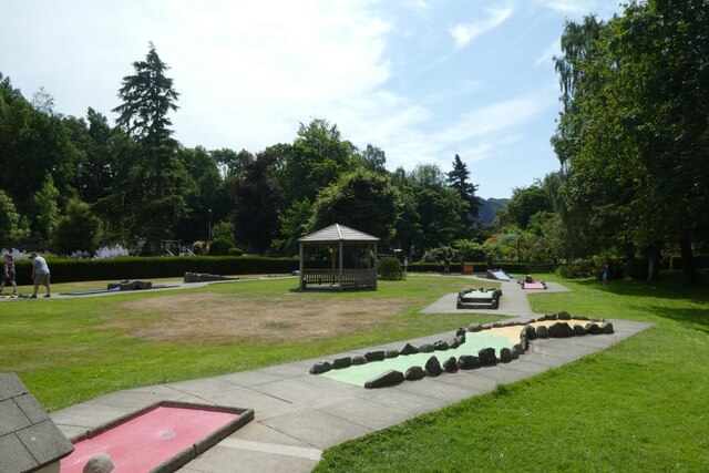
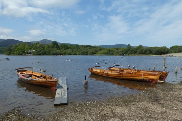
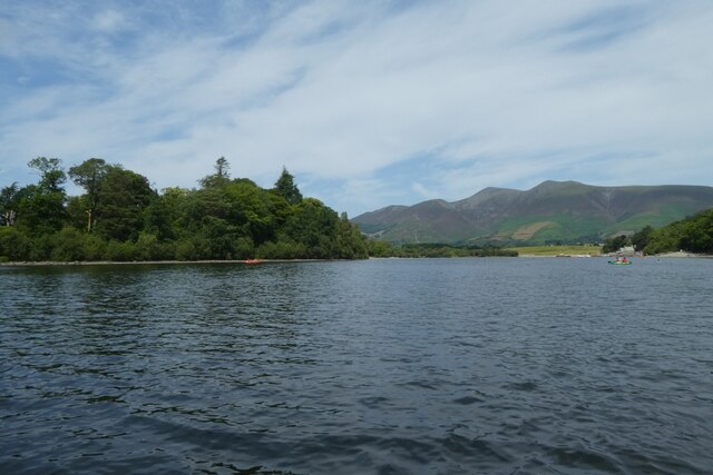
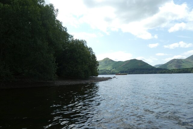
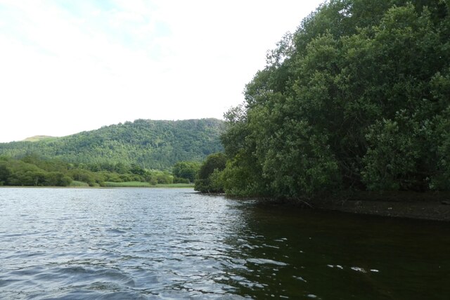
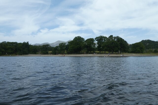
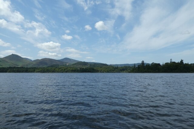
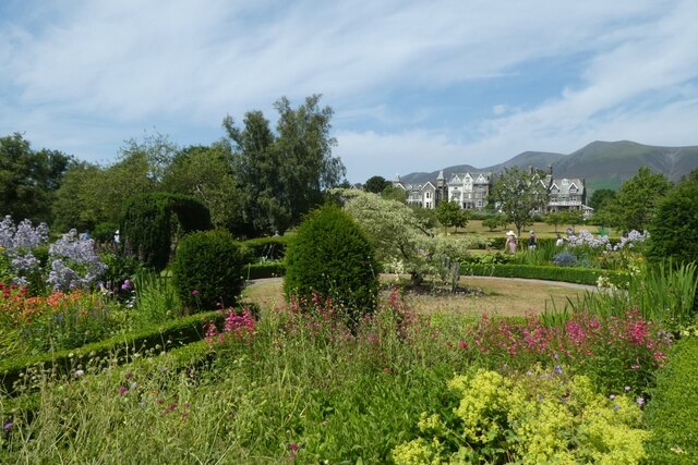
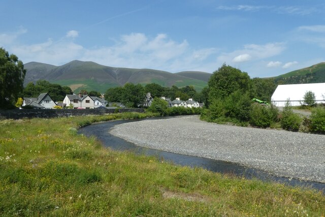
The natural beauty of the area is undoubtedly one of Hill, High, Cumberland's main draws. Surrounded by rolling hills, lush green fields, and crystal-clear lakes, outdoor enthusiasts are spoilt for choice when it comes to recreational activities. Hiking, cycling, fishing, and boating are just some of the popular pastimes enjoyed by both locals and tourists.

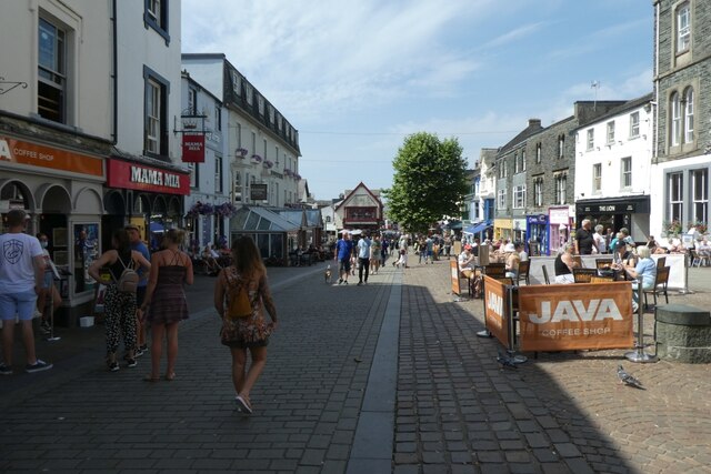
In terms of amenities, Hill, High, Cumberland provides essential facilities such as schools, medical centers, and a small selection of shops and restaurants. While the town may not boast an extensive range of entertainment venues or shopping malls, its proximity to larger towns and cities allows residents to access a broader array of options when desired.

Overall, Hill, High, Cumberland offers a tranquil and picturesque lifestyle, making it an attractive destination for those seeking to embrace the beauty of nature while enjoying the warmth and charm of a close community.

If you have any feedback on the listing, please let us know in the comments section below.
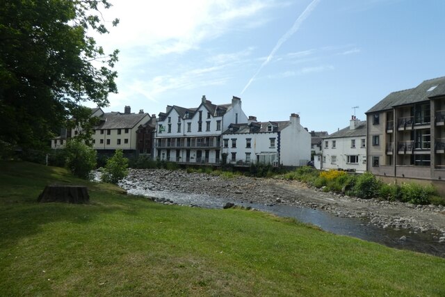
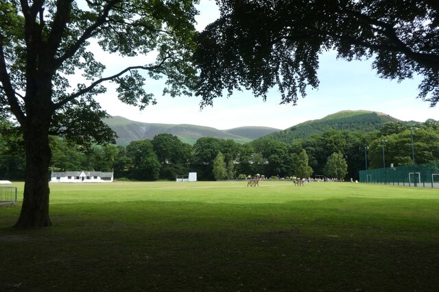
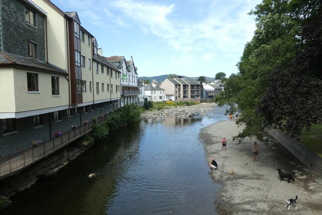
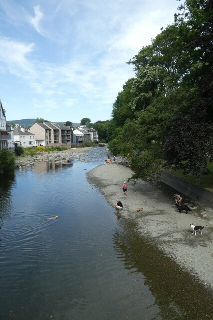
Hill, High Images

Images are sourced within 2km of 54.604864/-3.144795 or Grid Reference NY2623. Thanks to Geograph Open Source API. All images are credited.

Greta in Fitz Park Looking along the River Greta.
Greta in Fitz Park
Looking along the River Greta.
Sports pitches in Fitz Park Looking across the top of the cricket field in Fitz Park.
Sports pitches in Fitz Park
Looking across the top of the cricket field in Fitz Park.
Downstream along the Greta Looking down the river from Station Street.
Downstream along the Greta
Looking down the river from Station Street.
Greta from Station Street Looking downstream along the River Greta.
Greta from Station Street
Looking downstream along the River Greta.
Crazy golf in Hope Park Looking across some of the holes on the crazy golf course.
Crazy golf in Hope Park
Looking across some of the holes on the crazy golf course.
Rowing boats for hire A couple of rowing boats moored for hire near Keswick on Derwent Water.
Rowing boats for hire
A couple of rowing boats moored for hire near Keswick on Derwent Water.
Towards Derwent Isle Looking across to Derwent Isle from a rowing boat on Derwent Water.
Towards Derwent Isle
Looking across to Derwent Isle from a rowing boat on Derwent Water.
Exposed island This island, and the next just visible between here and St. Herbert's are usually hidden below the lake. They both have marker buoys to warn boats.
Exposed island
This island, and the next just visible between here and St. Herbert's are usually hidden below the lake. They both have marker buoys to warn boats.
Exposed island on Derwent Water Normally hidden under the lake, the low levels have exposed this shallow part of the lake as an island. Looking towards Derwent Isle.
Exposed island on Derwent Water
Normally hidden under the lake, the low levels have exposed this shallow part of the lake as an island. Looking towards Derwent Isle.
Island on Derwent Water This island, and the next just visible on the right between here and Rampsholme Island are usually hidden below the lake. They both have marker buoys to warn boats.
Island on Derwent Water
This island, and the next just visible on the right between here and Rampsholme Island are usually hidden below the lake. They both have marker buoys to warn boats.
Islet and buoy This island is usually hidden below the lake with a marker buoy to warn boats of the shallow water. On the right is Derwent Isle.
Islet and buoy
This island is usually hidden below the lake with a marker buoy to warn boats of the shallow water. On the right is Derwent Isle.
Northern edge of Lord's Island Looking towards Lord's Island from a rowing boat. The lake was very low, and I scraped the rowing boat along the mud from here and along the whole of the eastern side of Lord's Island until the boat refloated around here. A Derwent Water launch can be seen in the distance.
Northern edge of Lord's Island
Looking towards Lord's Island from a rowing boat. The lake was very low, and I scraped the rowing boat along the mud from here and along the whole of the eastern side of Lord's Island until the boat refloated around here. A Derwent Water launch can be seen in the distance.
Lord's Island On the right is Lord's Island viewed from a rowing boat. The lake was very low, and I scraped the rowing boat along the mud from here and along the whole of the eastern side of Lord's Island until the boat refloated around here.
Lord's Island
On the right is Lord's Island viewed from a rowing boat. The lake was very low, and I scraped the rowing boat along the mud from here and along the whole of the eastern side of Lord's Island until the boat refloated around here.
Strandshag Bay Looking towards the shore of Derwent Water from a rowing boat near Lord's Island.
Strandshag Bay
Looking towards the shore of Derwent Water from a rowing boat near Lord's Island.
Looking across Derwent Water A view over Derwent Water from a rowing boat near Lord's Island.
Looking across Derwent Water
A view over Derwent Water from a rowing boat near Lord's Island.
Hope Park Looking across some of the gardens in Hope Park.
Hope Park
Looking across some of the gardens in Hope Park.
Market Square Looking across Market Square in Keswick from beside the Moot Hall.
Market Square
Looking across Market Square in Keswick from beside the Moot Hall.
Bend in the Greta Looking upstream along the River Greta.
Bend in the Greta
Looking upstream along the River Greta.
Show me another place!

Hill, High is located at Grid Ref: NY2623 (Lat: 54.604864, Lng: -3.144795)

Administrative County: Cumbria

District: Allerdale

Police Authority: Cumbria

What 3 Words

///sang.unrated.eats. Near Keswick, Cumbria

Related Wikis

Keswick School of Industrial Art

Keswick School of Industrial Art (KSIA) (sometimes Keswick School of Industrial Arts) was founded in 1884 by Canon Hardwicke Rawnsley and his wife Edith...

Derwent Pencil Museum

The Derwent Pencil Museum is in Keswick, in the north-west of England. == History == The first pencil factory in Keswick opened in 1832. The second and...

Great Crosthwaite

Great Crosthwaite is a suburb of the tourist town of Keswick in the Lake District, in the English county of Cumbria. == History == It was the original...

Keswick School

Keswick School is a coeducational 11–18 academy in Cumbria, UK with 1360 pupils on roll. There are 309 students in the sixth form and 40 boarders.The school...

Greta Hall

Greta Hall is a house in Keswick in the Lake District of England. It is best known as the home of the poets Samuel Taylor Coleridge and Robert Southey...

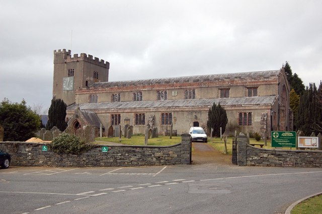
St Kentigern's Church, Crosthwaite

Crosthwaite Parish Church is a church at Great Crosthwaite on the outskirts of Keswick in Cumbria, England. It is dedicated to St Kentigern and is the...

River Greta, Cumbria

The River Greta is a river in Cumbria, England. It is a tributary of the River Derwent and flows through the town of Keswick. "Greta" derives from the...

Applethwaite

Applethwaite is a village in the foothills of Skiddaw near Keswick in the English Lake District. It is in the county of Cumbria, and forms part of the...

Nearby Amenities

Located within 500m of 54.604864,-3.144795
Mini Roundabout
Direction: clockwise
Lat/Long: 54.6021459/-3.140373
Lairbeck Hotel
Tourism: hotel
Lat/Long: 54.6081411/-3.1454469
Post Box
Brand: Royal Mail
Brand Wikidata: Q638098
Brand Wikipedia: en:Royal Mail
Collection Times: Mo-Fr 09:00; Sa 07:00
Ele: 81.8372803
Operator: Royal Mail
Operator Wikidata: Q638098
Post Box Type: wall
Ref: CA12 136D
Royal Cypher: GVIR
Royal Cypher Wikidata: Q33102169
Source: survey
Lat/Long: 54.6027825/-3.1416019
Bus Stop
High Hill Garage (W bound)
Bus: yes
Naptan AtcoCode: 090002370645
Naptan Bearing: W
Naptan CommonName: High Hill Garage (W bound)
Naptan Indicator: w/bound
Naptan Landmark: Petrol Station
Naptan NaptanCode: cumadwta
Naptan Street: B5289
Naptan Verified: no
Public Transport: platform
Source: naptan_import
Lat/Long: 54.6054183/-3.1463707
Bus Stop
High Hill Garage (E bound)
Bus: yes
Naptan AtcoCode: 090002370646
Naptan Bearing: E
Naptan CommonName: High Hill Garage (E bound)
Naptan Indicator: opp
Naptan Landmark: Esso Garage
Naptan NaptanCode: cumadwtd
Naptan Street: B5289
Naptan Verified: no
Public Transport: platform
Source: naptan_import
Lat/Long: 54.6055361/-3.1462656
Bus Stop
Crosthwaite Road
Bench: no
Bin: no
Bus: yes
Lit: yes
Naptan AtcoCode: 090002370651
Naptan Bearing: W
Naptan CommonName: Crosthwaite Road
Naptan Indicator: opp
Naptan Landmark: Hazelmere B&B
Naptan NaptanCode: cumadwtg
Naptan Street: A591
Naptan Verified: no
Public Transport: platform
Shelter: no
Source: naptan_import
Tactile Paving: no
Lat/Long: 54.6053754/-3.143304
Bus Stop
Vicarage Hill Junction
Bus: yes
Naptan AtcoCode: 090002370652
Naptan Bearing: N
Naptan CommonName: Vicarage Hill Junction
Naptan Indicator: n/bound
Naptan Landmark: Vicarage Hill Junction
Naptan NaptanCode: cumadwtj
Naptan Street: A591
Naptan Verified: yes
Public Transport: platform
Source: naptan_import
Lat/Long: 54.6084669/-3.1412249
Bus Stop
The Pheasant
Bus: yes
Naptan AtcoCode: 090002370654
Naptan Bearing: S
Naptan CommonName: The Pheasant
Naptan Indicator: opp
Naptan Landmark: The Pheasant PH
Naptan NaptanCode: cumadwtm
Naptan Street: A591
Naptan Verified: yes
Public Transport: platform
Source: naptan_import
Lat/Long: 54.6084521/-3.1411046
Bus Stop
Keswick Bus Stn Stand 1
Bench: yes
Bin: yes
Bus: yes
Departures Board: timetable
Lit: yes
Naptan AtcoCode: 090002372827
Naptan CommonName: Keswick Bus Stn Stand 1
Naptan Indicator: o/s
Naptan Landmark: The Lakes Supermarket
Naptan NaptanCode: cumagajp
Naptan Street: The Headlands
Naptan Verified: no
Public Transport: platform
Shelter: no
Source: naptan_import
Tactile Paving: no
Lat/Long: 54.6016735/-3.1416347
Bus Stop
Keswick Bus Stn Stand 2
Bench: no
Bin: yes
Bus: yes
Departures Board: timetable
Lit: yes
Local Ref: 2
Naptan AtcoCode: 090002372828
Naptan CommonName: Keswick Bus Stn Stand 2
Naptan Indicator: Stand 2
Naptan Landmark: Booths Supermarket
Naptan LocalityCode: E0055490
Naptan NaptanCode: cumagajt
Naptan Street: The Headlands
Naptan Verified: no
Public Transport: platform
Ref: cumagajt
Shelter: no
Source: naptan_import
Tactile Paving: no
Lat/Long: 54.6016566/-3.1418446
Bus Stop
Keswick Bus Stn Stand 4
Bench: no
Bin: yes
Bus: yes
Departures Board: timetable
Lit: yes
Naptan AtcoCode: 090002372829
Naptan CommonName: Keswick Bus Stn Stand 4
Naptan Indicator: o/s
Naptan Landmark: The Lakes Supermarket
Naptan NaptanCode: cumagajw
Naptan Street: The Headlands
Naptan Verified: no
Public Transport: platform
Shelter: no
Source: naptan_import
Tactile Paving: no
Lat/Long: 54.6016008/-3.1420332
Bus Stop
Keswick Bus Stn Stand 3
Bench: no
Bin: yes
Bus: yes
Departures Board: timetable
Lit: yes
Naptan AtcoCode: 090002372830
Naptan CommonName: Keswick Bus Stn Stand 3
Naptan Indicator: o/s
Naptan Landmark: The Lakes Supermarket
Naptan NaptanCode: cumagama
Naptan Street: The Headlands
Naptan Verified: no
Public Transport: platform
Shelter: no
Source: naptan_import
Tactile Paving: no
Lat/Long: 54.6016271/-3.1419291
Bus Stop
Keswick School
Bus: yes
Local Ref: AT
Naptan AtcoCode: 090002373123
Naptan Bearing: N
Naptan CommonName: Keswick School
Naptan Indicator: at
Naptan Landmark: Keswick School turning circle
Naptan NaptanCode: cumagapd
Naptan Street: B5289
Naptan Verified: no
Public Transport: platform
Source: naptan_import
Lat/Long: 54.6080423/-3.1501913
Crossing
Crossing: unmarked
Crossing Island: yes
Crossing Markings: no
Tactile Paving: yes
Lat/Long: 54.6050625/-3.1453294
Post Box
Collection Times: Mo-Fr 16:30; Sa 11:00
Operator: Royal Mail
Operator Wikidata: Q638098
Post Box Type: lamp
Ref: CA12 140
Royal Cypher: EIIR
Royal Cypher Wikidata: Q33102113
Source: survey
Lat/Long: 54.6086433/-3.1417595
Barrier: bollard
Lat/Long: 54.6026544/-3.1425592
Keswick Bus Stn Stand 1
Bus: yes
Public Transport: stop_position
Lat/Long: 54.6016316/-3.1416829
Bus Station
Keswick Bus Station
Bus: yes
Public Transport: station
Wheelchair: no
Lat/Long: 54.6015566/-3.1418401
Defibrillator
Booth: KX100
Covered: booth
Defibrillator Location: In former BT phone kiosk
Disused Amenity: telephone
Emergency: defibrillator
Man Made: telephone_box
Lat/Long: 54.60201/-3.1403288
Restaurant
Lakeland Spice Cusine
Addr City: Keswick
Addr Housenumber: 81
Addr Postcode: CA12 5DT
Addr Street: Main Street
Cuisine: indian
Lat/Long: 54.6018256/-3.1397241
Restaurant
Star of Siam
Addr City: Keswick
Addr Housenumber: 89
Addr Postcode: CA12 5DT
Addr Street: Main Street
Cuisine: thai
Phone: +44 17687 71444
Website: https://www.starofsiam.co.uk/
Lat/Long: 54.6019382/-3.1400445
Post Box
Collection Times: Mo-Fr 17:00; Sa 11:00
Note: "From 15th September 2014, the final collection will be made no earlier than 9:00am Monday to Friday and 07:00am on Saturday."
Operator: Royal Mail
Operator Wikidata: Q638098
Post Box Type: wall
Ref: CA12 134
Royal Cypher: GVIR
Royal Cypher Wikidata: Q33102169
Source: survey
Lat/Long: 54.6047352/-3.1445737
Post Box
Collection Times: Mo-Fr 17:00; Sa 11:00
Note: "From 15th September 2014, the final collection will be made no earlier than 9:00am Monday to Friday and 07:00am on Saturday."
Operator: Royal Mail
Operator Wikidata: Q638098
Post Box Type: wall
Ref: CA12 228
Royal Cypher: GR
Royal Cypher Wikidata: Q33102273
Source: survey
Lat/Long: 54.6078925/-3.1454385
Trespass
Addr City: Keswick
Addr Postcode: CA12 5ED
Addr Street: Tithebarn Street
Brand: Trespass
Brand Wikidata: Q17035733
Brand Wikipedia: en:Trespass (clothing)
Phone: +44 17687 74952
Shop: outdoor
Website: https://www.trespass.com/storelocator/index/view/id/172
Lat/Long: 54.6021725/-3.1405671
Ice Cream
Luchinis
Addr City: Keswick
Addr Housenumber: 1
Addr Postcode: CA12 5ED
Addr Street: Tithebarn Street
Phone: +44 17687 73668
Lat/Long: 54.601955/-3.1404146
Winfields
Addr City: Keswick
Addr Housenumber: 9
Addr Postcode: CA12 5ED
Addr Street: Tithebarn Street
Shop: outdoor
Website: https://www.winfieldsoutdoors.co.uk/
Lat/Long: 54.6017002/-3.1407553
Podgy Paws
Addr City: Keswick
Addr Housenumber: 4-6
Addr Postcode: CA12 5ED
Addr Street: Tithebarn Street
Shop: pet
Lat/Long: 54.6019106/-3.1409257
Fast Food
Pizzeria Italia
Addr City: Keswick
Addr Housenumber: 5A
Addr Postcode: CA12 5ED
Addr Street: Tithebarn Street
Cuisine: italian
Phone: +44 17687 71378
Takeaway: only
Lat/Long: 54.6018437/-3.1405667
Whinlatter Bikes
Addr City: Keswick
Addr Housenumber: 82
Addr Postcode: CA12 5DX
Addr Street: Main Street
Email: whinlatterbikes@gmail.com
Opening Hours: Mo-Su 09:00-17:00
Phone: +44 17687 73940
Shop: bicycle
Website: https://www.whinlatterbikes.com/
Lat/Long: 54.6021905/-3.140176
Cafe
Main Street Keller
Addr City: Keswick
Addr Housenumber: 91
Addr Postcode: CA12 5DT
Addr Street: Main Street
Lat/Long: 54.6019846/-3.1401708
Lakeland View
Addr City: Keswick
Addr Postcode: CA12 5NY
Addr Street: High Hill
Phone: +44 17687 72555
Tourism: guest_house
Website: https://www.lakelandview.net/
Lat/Long: 54.6044432/-3.1445031
Riverside Guest House
Addr City: Keswick
Addr Postcode: CA12 5PG
Addr Street: Crosthwaite Road
Phone: +44 17687 73439
Tourism: guest_house
Lat/Long: 54.6054717/-3.1439479
Hazelmere
Addr City: Keswick
Addr Postcode: CA12 5PG
Addr Street: Crosthwaite Road
Phone: +44 17687 72445
Tourism: guest_house
Website: https://hazelmerekeswick.co.uk/
Lat/Long: 54.6056094/-3.1431239
Lake District Florist
Addr City: Keswick
Addr Street: Main Street
Shop: florist
Lat/Long: 54.6021485/-3.1401164
Needles & Pins
Addr City: Keswick
Addr Street: Main Street
Shop: craft
Lat/Long: 54.6021285/-3.1400749
Leah Lou’s Beauty
Addr City: Keswick
Addr Housenumber: 76
Addr Postcode: CA12 5DX
Addr Street: Main Street
Phone: +44 17687 75713
Shop: beauty
Website: https://www.leahlousbeauty.com/
Lat/Long: 54.6021065/-3.1400301
Cafe
Mrs F's Fine Food Emporium
Addr City: Keswick
Addr Street: Main Street
Lat/Long: 54.6020837/-3.1399809
Restaurant
Golden Hills
Addr City: Keswick
Addr Street: Main Street
Cuisine: chinese
Lat/Long: 54.6020462/-3.1398296
Cafe
Tea Rooms
Addr City: Keswick
Addr Street: Main Street
Lat/Long: 54.6022138/-3.1406592
Herdy
Shop: gift
Lat/Long: 54.6018353/-3.1410692
Songbird
Addr City: Keswick
Addr Street: Tithebarn Street
Shop: clothes
Lat/Long: 54.6017671/-3.1406887
The Necessary Angel
Addr City: Keswick
Addr Street: Tithebarn Street
Shop: gift
Lat/Long: 54.6018967/-3.1404915
Hiking: yes
Information: guidepost
Tourism: information
Lat/Long: 54.6034931/-3.1426549
Cafe
Booths
Internet Access: wlan
Lat/Long: 54.6018008/-3.1414381
Barrier: kissing_gate
Lat/Long: 54.6068175/-3.1458361
Crosthwaite
Place: locality
Lat/Long: 54.6079969/-3.1431148
Greta
Place: locality
Lat/Long: 54.604399/-3.140572
Bicycle Parking
Lat/Long: 54.6039631/-3.1420643
Toilets
Access: customers
Lat/Long: 54.6039933/-3.1419626
Keswick Bus Stn Stand 2
Bus: yes
Public Transport: stop_position
Lat/Long: 54.6016188/-3.1417867
Cafe
Panino Italiano Sandwich Bar
Addr City: Keswick
Addr Housenumber: 75
Addr Postcode: CA12 5DS
Addr Street: Main Street
Lat/Long: 54.6016864/-3.1393088
Youdale's
Shop: gift
Lat/Long: 54.6018566/-3.1398237
Waste Basket
Lat/Long: 54.6022204/-3.1403115
Recycling
Recycling Clothes: yes
Recycling Type: container
Lat/Long: 54.6022599/-3.1402607
Keswick Scaffolding
Craft: scaffolder
Lat/Long: 54.604063/-3.1447981
Crossing
Crossing: uncontrolled
Crossing Island: yes
Tactile Paving: yes
Lat/Long: 54.6038691/-3.1431222
Grit Bin
Lat/Long: 54.6016893/-3.1426519
Charging Station
Access: yes
Charge: 0.35
Fee: yes
Operator: InstaVolt
Operator Wikidata: Q111173904
Payment Contactless: yes
Website: https://instavolt.co.uk/for-drivers/
Lat/Long: 54.6018624/-3.1428921
Entrance: main
Wheelchair: yes
Lat/Long: 54.6019144/-3.1420134
Crossing
Crossing: unmarked
Crossing Markings: no
Tactile Paving: yes
Lat/Long: 54.6015263/-3.1422717
Vending Machine
Vending: parking_tickets
Lat/Long: 54.6021353/-3.142701
Vending Machine
Check Date: 2023-12-27
Vending: parking_tickets
Lat/Long: 54.6018733/-3.1420674
Charging Station
Access: yes
Charge: 0.35
Fee: yes
Operator: InstaVolt
Operator Wikidata: Q111173904
Payment Contactless: yes
Website: https://instavolt.co.uk/for-drivers/
Lat/Long: 54.6018559/-3.1428821
Charging Station
Access: yes
Charge: 0.35
Fee: yes
Operator: InstaVolt
Operator Wikidata: Q111173904
Payment Contactless: yes
Website: https://instavolt.co.uk/for-drivers/
Lat/Long: 54.6018503/-3.1428724
Charging Station
Access: yes
Charge: 0.35
Fee: yes
Operator: InstaVolt
Operator Wikidata: Q111173904
Payment Contactless: yes
Website: https://instavolt.co.uk/for-drivers/
Lat/Long: 54.6018457/-3.1428638
Addr Housename: Green Garth
Lat/Long: 54.6062174/-3.1459514
Addr Housename: Peel Green
Lat/Long: 54.6057031/-3.1463025
Addr Housenumber: 2
Lat/Long: 54.6060201/-3.1451655
Addr Housenumber: 3
Lat/Long: 54.6060402/-3.1453774
Addr Housename: Brooklyn
Lat/Long: 54.605484/-3.1459005
Addr Housename: Wray How
Lat/Long: 54.6056674/-3.1462357
Addr Housename: Newlands
Lat/Long: 54.6055711/-3.1460909
Addr Housename: Cranford
Lat/Long: 54.6057761/-3.1464637
Addr Housename: The Sheiling
Lat/Long: 54.6062671/-3.1450877
Addr Housenumber: 4
Lat/Long: 54.6060511/-3.1454713
Addr Housenumber: 6
Lat/Long: 54.6060822/-3.1457556
Addr Housenumber: 5
Lat/Long: 54.6060697/-3.1456644
Addr Housename: Alverna
Lat/Long: 54.6054468/-3.1458173
Addr Housenumber: 1
Lat/Long: 54.6060045/-3.1450395
Addr Housenumber: 15
Lat/Long: 54.6065946/-3.1469121
Addr Housenumber: 11
Lat/Long: 54.6064765/-3.1461235
Addr Housenumber: 12
Lat/Long: 54.6065107/-3.1463139
Addr Housenumber: 17
Lat/Long: 54.6067825/-3.1472715
Addr Housenumber: 14
Lat/Long: 54.6065356/-3.1467189
Addr Housename: Ulva
Lat/Long: 54.6060944/-3.1470408
Addr Housename: Beechwood
Lat/Long: 54.6062342/-3.147301
Addr Housename: Stonethwaite
Lat/Long: 54.6058178/-3.1465365
Addr Housename: Lemhus Maymyo
Lat/Long: 54.605908/-3.1467377
Addr Housename: Lemhus Cottage
Lat/Long: 54.6060385/-3.1468262
Addr Housenumber: 7
Lat/Long: 54.6064207/-3.1453054
Addr Housenumber: 3
Lat/Long: 54.6067717/-3.1464507
Addr Housenumber: 5
Lat/Long: 54.606691/-3.1460162
Addr Housenumber: 8
Lat/Long: 54.6063817/-3.1455119
Addr Housenumber: 6
Lat/Long: 54.6066739/-3.145807
Addr Housenumber: 9
Lat/Long: 54.6063974/-3.1457265
Addr Housenumber: 2
Lat/Long: 54.606809/-3.1466492
Addr Housenumber: 1
Lat/Long: 54.6068727/-3.1468021
Addr Housenumber: 4
Lat/Long: 54.6067468/-3.1462361
Addr Housename: Crossfield
Lat/Long: 54.6064999/-3.1476282
Addr Housename: Polperro
Lat/Long: 54.6063554/-3.1474646
Addr Housename: Kentigern Wall
Lat/Long: 54.6066335/-3.1478374
Addr Housenumber: 13
Lat/Long: 54.6065185/-3.1465446
Addr Housenumber: 16
Lat/Long: 54.6066801/-3.147073
Addr Housenumber: 10
Lat/Long: 54.6064641/-3.1458901
Addr Housename: Solway
Lat/Long: 54.6052063/-3.1438042
Addr Housename: Quaker Cottage
Lat/Long: 54.6051349/-3.1443084
Addr Housename: River Cottage
Lat/Long: 54.6051582/-3.1440509
Addr Housenumber: 9
Lat/Long: 54.6061882/-3.1437157
Addr Housenumber: 26
Lat/Long: 54.6060094/-3.1443351
Addr Housenumber: 12
Lat/Long: 54.6060468/-3.1436861
Addr Housenumber: 8
Lat/Long: 54.6062285/-3.1436941
Addr Housenumber: 10
Lat/Long: 54.6061462/-3.143713
Addr Housename: Carabara
Addr Street: Limepots Road
Lat/Long: 54.6062845/-3.1447
Addr Housenumber: 13
Lat/Long: 54.6059659/-3.1436109
Addr Housename: Elmcot
Lat/Long: 54.6061337/-3.1447242
Addr Housenumber: 21
Lat/Long: 54.605795/-3.1442198
Addr Housenumber: 20
Lat/Long: 54.6058634/-3.1441474
Addr Housenumber: 11
Lat/Long: 54.6060934/-3.1436808
Addr Housenumber: 1
Lat/Long: 54.6062347/-3.1442251
Addr Housenumber: 24
Lat/Long: 54.6050359/-3.1455913
Addr Housenumber: 19
Lat/Long: 54.6047853/-3.1450916
Addr Housenumber: 5
Lat/Long: 54.6057532/-3.1447027
Addr Housenumber: 4
Lat/Long: 54.6056506/-3.1447
Addr Housenumber: 2
Lat/Long: 54.6054937/-3.1446973
Addr Housenumber: 3
Lat/Long: 54.6055946/-3.1446947
Addr Housenumber: 1
Lat/Long: 54.6054439/-3.1447027
Addr Housenumber: 6
Lat/Long: 54.605809/-3.1447054
Addr Housenumber: 8
Lat/Long: 54.6059722/-3.1447134
Addr Housenumber: 7
Lat/Long: 54.6059163/-3.1447027
Addr Housename: Howkeld
Lat/Long: 54.6058207/-3.1421849
Addr Housename: Tynedale
Lat/Long: 54.6059216/-3.1417423
Addr Housename: Brantfell
Lat/Long: 54.6061204/-3.1412595
Addr Housename: Raves
Lat/Long: 54.6055784/-3.1433893
Addr Housename: Wasdale
Lat/Long: 54.6056544/-3.1429466
Addr Housename: Headfield
Addr Street: Crosthwaite Road
Lat/Long: 54.6057539/-3.1424692
Addr Housename: Linder
Lat/Long: 54.6056064/-3.143502
Addr Housename: Amberley
Addr Street: Crosthwaite Road
Lat/Long: 54.6057756/-3.1423807
Addr Housename: Dunbar
Lat/Long: 54.6057088/-3.1427052
Addr Housename: Riverdale
Lat/Long: 54.6062851/-3.1411093
Addr Housename: Monks Croft
Lat/Long: 54.6056715/-3.1428501
Addr Housename: Park Field
Lat/Long: 54.6057289/-3.1426114
Addr Housename: Langstrath
Lat/Long: 54.6058502/-3.1419971
Addr Housename: Aysgarth
Lat/Long: 54.6060163/-3.1414741
Addr Housename: Skiddaw Lodge
Lat/Long: 54.6083481/-3.1424504
Addr Housename: High Bield
Lat/Long: 54.6081664/-3.1433999
Skiddaw Grove
Tourism: guest_house
Lat/Long: 54.6085501/-3.1429599
Addr Housename: Glentarn
Addr Street: Crosthwaite Road
Lat/Long: 54.605398/-3.1442798
Addr Housename: Riverside Escape
Lat/Long: 54.6053608/-3.1445266
Addr Housename: The Birches
Lat/Long: 54.6056592/-3.1432391
Addr Housename: Rosehaugh
Lat/Long: 54.6055318/-3.1435986
Addr Housename: Briargarth
Lat/Long: 54.6055099/-3.1437219
Addr Housename: Kirkstile
Lat/Long: 54.6089321/-3.1424826
Addr Housename: Green Croft
Lat/Long: 54.6088607/-3.1428394
Addr Housename: Leefield
Lat/Long: 54.6088669/-3.1431827
Addr Housename: Carl Side
Lat/Long: 54.60894/-3.1423512
Addr Housename: High Croft
Lat/Long: 54.6088063/-3.143534
Addr Housename: Down Bank
Lat/Long: 54.6086231/-3.1442395
Addr Housename: Brackenfells
Lat/Long: 54.6084864/-3.144513
Addr Housename: Ben Doran
Lat/Long: 54.6087224/-3.1439364
Addr Housename: Fern Acre
Lat/Long: 54.6084025/-3.1447518
Addr Housename: Tandarra
Lat/Long: 54.6082548/-3.1450307
Cafe
Filling Station Cafe
Lat/Long: 54.6077454/-3.1404789
Addr Housename: Applemere
Lat/Long: 54.6081989/-3.1406829
Addr Housename: Knott House Farm
Lat/Long: 54.6081291/-3.1404468
Addr Housename: Applecroft
Lat/Long: 54.6081664/-3.1405809
Addr Housename: Appletree
Lat/Long: 54.6080995/-3.1403261
Addr Housename: Poachers Cottage
Lat/Long: 54.6080783/-3.141052
Addr Housename: Breckon Cottage
Lat/Long: 54.6081259/-3.1410852
Addr Housename: Rivington
Lat/Long: 54.6079302/-3.1445855
Addr Housename: The Old Vicarage
Lat/Long: 54.6077003/-3.1455108
Addr Housenumber: 16
Lat/Long: 54.6064654/-3.1442636
Addr Housenumber: 6
Lat/Long: 54.6066503/-3.1453392
Addr Housenumber: 17
Lat/Long: 54.6063566/-3.1437084
Addr Housenumber: 8
Lat/Long: 54.6065788/-3.1450602
Addr Housenumber: 1
Lat/Long: 54.6071472/-3.1461787
Addr Housenumber: 9
Lat/Long: 54.6065679/-3.1449905
Addr Housenumber: 7
Lat/Long: 54.6065911/-3.1451326
Addr Housenumber: 18
Lat/Long: 54.6064125/-3.1436977
Addr Housename: The Stables
Lat/Long: 54.6077204/-3.1451916
Addr Housenumber: 10
Lat/Long: 54.606557/-3.1449315
Addr Housename: The Vicarage
Lat/Long: 54.6072607/-3.1450414
Addr Housename: The Mews
Lat/Long: 54.6079131/-3.1450307
Addr Housenumber: 11
Addr Street: Glebe Close
Lat/Long: 54.6065788/-3.1447571
Addr Housename: Greenoyd Court
Lat/Long: 54.6072995/-3.1459051
Addr Housenumber: 12
Addr Street: Glebe Close
Lat/Long: 54.6065275/-3.1447518
Addr Housenumber: 15
Lat/Long: 54.6064809/-3.1443682
Addr Housenumber: 4
Lat/Long: 54.6069468/-3.145087
Addr Housenumber: 2
Lat/Long: 54.6070229/-3.14583
Addr Housenumber: 13
Addr Street: Glebe Close
Lat/Long: 54.6064902/-3.1447732
Addr Housenumber: 14
Lat/Long: 54.6064948/-3.144454
Addr Housenumber: 3
Lat/Long: 54.6070307/-3.1453767
Addr Housenumber: 5
Lat/Long: 54.6066952/-3.1453097
Present Moment
Addr City: Keswick
Addr Street: Main Street
Shop: gift
Lat/Long: 54.6017039/-3.1393613
Bench
Lat/Long: 54.604907/-3.13786
Keswick Bus Stn Stand 3
Bus: yes
Public Transport: stop_position
Lat/Long: 54.6015875/-3.1418831
Keswick Bus Stn Stand 4
Bus: yes
Public Transport: stop_position
Lat/Long: 54.6015524/-3.1419897
Nevis Sport
Addr City: Keswick
Addr Housenumber: 7a
Addr Postcode: CA12 5ED
Addr Street: Tithebarn Street
Email: Keswick@nevisport.com
Phone: +44 1768 774 952
Shop: outdoor
Website: https://www.nevisport.com/
Lat/Long: 54.602139/-3.1405948
Crossing
Crossing: unmarked
Crossing Island: no
Crossing Markings: no
Tactile Paving: no
Lat/Long: 54.6083867/-3.1413825
Give Way
Direction: forward
Lat/Long: 54.608642/-3.1413332
Screwfix
Addr City: Keswick
Addr Street: Main Street
Brand: Screwfix
Brand Wikidata: Q7439115
Brand Wikipedia: en:Screwfix
Shop: doityourself
Website: https://www.screwfix.com/stores/OC7/keswick
Lat/Long: 54.6018904/-3.1399166
Kong Adventure
Addr City: Keswick
Addr Postcode: CA12 5EZ
Addr Street: Heads Road
Climbing Boulder: yes
Climbing Sport: yes
Climbing Toprope: yes
Fee: yes
Indoor: yes
Leisure: sports_centre
Phone: +44 17687 75907
Sport: climbing
Website: https://www.kongadventure.com/
Lat/Long: 54.6015256/-3.1397721
Crossing
Crossing: marked
Crossing Markings: yes
Lat/Long: 54.6021699/-3.1426452
Information: guidepost
Tourism: information
Lat/Long: 54.6020362/-3.1402941
Crossing
Lat/Long: 54.6060635/-3.1476398
Crossing
Crossing: unmarked
Crossing Markings: no
Lat/Long: 54.6018859/-3.1407094
Crossing
Lat/Long: 54.6048061/-3.144991
Crossing
Lat/Long: 54.6050969/-3.1456018
Crossing
Lat/Long: 54.6051859/-3.1458212
Crossing
Lat/Long: 54.605222/-3.1459021
Crossing
Lat/Long: 54.6060379/-3.1475855
Crossing
Lat/Long: 54.6051954/-3.1454392
Give Way
Direction: backward
Lat/Long: 54.6018196/-3.13928
Bench
Backrest: yes
Lat/Long: 54.6067093/-3.1483381
Lucy Pittaway Art Gallery
Addr City: Keswick
Addr Housenumber: 79
Addr Postcode: CA12 5DS
Addr Street: Main Street
Phone: +44 1768 392 160
Tourism: gallery
Website: https://www.lucypittaway.co.uk/gallery-addresses-i37
Lat/Long: 54.6017916/-3.1395822
Entrance: yes
Lat/Long: 54.6019438/-3.1402639
Street Lamp
Lamp Mount: straight_mast
Lamp Type: electric
Lat/Long: 54.6020327/-3.1403196
Crossing
Crossing: unmarked
Crossing Markings: no
Lat/Long: 54.6013138/-3.1423875
Crossing
Crossing: unmarked
Crossing Markings: no
Lat/Long: 54.6006047/-3.1432697
Charging Station
Access: customers
Bicycle: yes
Fee: yes
Motorcar: no
Operator: Keswick Bikes
Website: https://www.visitlakedistrict.com/explore/travel/electric-bike-charging-point-rydal-hall-tea-room-p1414501
Lat/Long: 54.6029943/-3.1421142
Entrance: main
Lat/Long: 54.6025006/-3.139558
Street Lamp
Lamp Mount: straight_mast
Lamp Type: electric
Lat/Long: 54.6019927/-3.1389916
Street Lamp
Lamp Mount: straight_mast
Lamp Type: electric
Lat/Long: 54.6021728/-3.1405322
Street Lamp
Lamp Mount: bent_mast
Lamp Type: electric
Lat/Long: 54.6022388/-3.138697
Street Lamp
Lamp Mount: bent_mast
Lamp Type: electric
Ref: 491
Lat/Long: 54.60299/-3.1378718
Bench
Backrest: yes
Material: wood
Seats: 3
Lat/Long: 54.6046251/-3.1385937
Bench
Backrest: yes
Material: wood
Seats: 3
Lat/Long: 54.6047191/-3.1380168
Bench
Backrest: yes
Material: wood
Seats: 3
Lat/Long: 54.6046938/-3.1381853
The Howrahs
Board Type: history
Description: Area of land owned by a governor of Bengal. Land named after suburb of Calcutta.
Information: board
Tourism: information
Lat/Long: 54.6036179/-3.1451363
The Howrahs
Place: locality
Lat/Long: 54.6036868/-3.1451234
Crossing
Lat/Long: 54.6038737/-3.1413735
Crossing
Lat/Long: 54.6039987/-3.1414494
Crossing
Lat/Long: 54.6044096/-3.1417162
Give Way
Direction: forward
Lat/Long: 54.6051361/-3.1450956
Give Way
Direction: forward
Lat/Long: 54.6050249/-3.1450826
Give Way
Direction: backward
Lat/Long: 54.6026013/-3.138448
The data included in this document is from www.openstreetmap.org. The data is made available under ODbL.

Have you been to Hill, High?

Leave your review of Hill, High below (or comments, questions and feedback).