An Sgùrr

Hill, Mountain in Ross-shire

Scotland

An Sgùrr

Old Milestone by the A896, Lochcarron parish Stone post by the A896, in parish of Lochcarron (Highland District), below Creag a' Chadha, on high banking, North side of road.

Inscription once read:-
(SHIELDAIG)
(17)
(LOCHCARRON)
(4)

Surveyed

Milestone Society National ID: HI_LCTR03
Old Milestone by the A896, Lochcarron parish Credit: Milestone Society

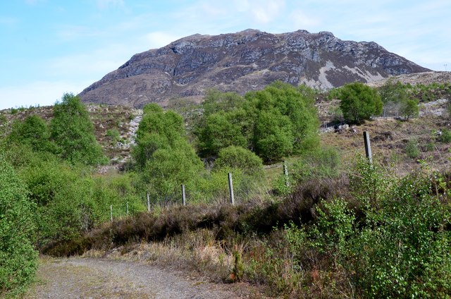
An Sgùrr, located in Ross-shire, Scotland, is a prominent hill/mountain that stands majestically in the heart of the Isle of Eigg. It is part of the Small Isles archipelago and is renowned for its distinctive shape and stunning panoramic views.

Standing at an elevation of 393 meters (1,289 feet), An Sgùrr is a volcanic pitchstone ridge that was formed around 58 million years ago during a volcanic eruption. Its unique geological composition gives it a dark, rugged appearance, contrasting beautifully with the surrounding green landscapes.

The hill/mountain is accessible to hikers and climbers, although the ascent can be challenging due to its steep slopes and rocky terrain. However, the effort is rewarded with breathtaking vistas at the summit. On a clear day, one can enjoy unobstructed views of the Inner Hebrides, including the neighboring islands of Rum, Muck, and Skye. The Isle of Eigg itself is also revealed in all its natural glory, with its pristine beaches, dramatic cliffs, and lush moorlands.

An Sgùrr holds great cultural significance as well. It has been a gathering place for the island's residents throughout history, and its name translates to "The Rocky Peak" in Scottish Gaelic. The hill/mountain has also inspired artists and writers, with its captivating beauty often depicted in various forms of art.

Whether admired from afar or conquered by adventurous individuals, An Sgùrr is undoubtedly a natural wonder that captivates all who behold it, offering a true Scottish Highland experience.

If you have any feedback on the listing, please let us know in the comments section below.

An Sgùrr Images

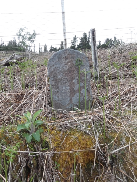
Images are sourced within 2km of 57.388458/-5.5675298 or Grid Reference NG8538. Thanks to Geograph Open Source API. All images are credited.

Old Milestone by the A896, Lochcarron parish Stone post by the A896, in parish of Lochcarron (Highland District), below Creag a' Chadha, on high banking, North side of road.

Inscription once read:-
(SHIELDAIG)
(17)
(LOCHCARRON)
(4)

Surveyed

Milestone Society National ID: HI_LCTR03
Old Milestone by the A896, Lochcarron parish
Stone post by the A896, in parish of Lochcarron (Highland District), below Creag a' Chadha, on high banking, North side of road. Inscription once read:- (SHIELDAIG) (17) (LOCHCARRON) (4) Surveyed Milestone Society National ID: HI_LCTR03
Old Milestone by the A896, east of Sanachan, Lochcarron parish Stone post by the A896, in parish of Lochcarron (Highland District), East of Sanachan, on high banking in felled forestry.

Inscription once read:-
(Shieldaig)
(11)
(Lochcarron)
(5)

Surveyed

Milestone Society National ID: HI_LCTR04
Old Milestone by the A896, east of Sanachan, Lochcarron parish
Stone post by the A896, in parish of Lochcarron (Highland District), East of Sanachan, on high banking in felled forestry. Inscription once read:- (Shieldaig) (11) (Lochcarron) (5) Surveyed Milestone Society National ID: HI_LCTR04
Hillside track to the north of Glenbeg Looking north-westward.
Hillside track to the north of Glenbeg
Looking north-westward.
Abhainn Cumhang a' Ghlinne In Glen Mor.
Abhainn Cumhang a' Ghlinne
In Glen Mor.
Driveway to Glen Mor Farm The farm itself is in the south eastern corner of the square.
Driveway to Glen Mor Farm
The farm itself is in the south eastern corner of the square.
Glen Mor Farm Planting of both coniferous and deciduous trees has taken place recently.
Glen Mor Farm
Planting of both coniferous and deciduous trees has taken place recently.
New Gate At Sanachan forestry plantation
New Gate
At Sanachan forestry plantation
Watchful buzzard
Watchful buzzard
Entrance to Glen Mor Farm The gates have been repainted and the mailbox removed since <a href="https://www.geograph.org.uk/photo/181763">NG8540 : Driveway to Glen Mor Farm</a> was taken in 2006.
Entrance to Glen Mor Farm
The gates have been repainted and the mailbox removed since NG8540 : Driveway to Glen Mor Farm was taken in 2006.
Glen Mòr Improved farmland beneath An Sgùrr.
Glen Mòr
Improved farmland beneath An Sgùrr.
Inviting iron gates open to Glen Mor Photographer is standing close to the gate entrance.
Inviting iron gates open to Glen Mor
Photographer is standing close to the gate entrance.
Track leading to Sanachan forestry plantation
A896 by Glen Mòr
A896 by Glen Mòr
Hillside near Sanachan
Entrance to Glen Mor
The village of Achintraid
Achintraid to Reraig track passing through woodland This is an excellent track and well worth the effort of a walk or run between Achintraid and Reraig
Achintraid to Reraig track passing through woodland
This is an excellent track and well worth the effort of a walk or run between Achintraid and Reraig
An Sgurr from Achintraid A steep little hill (391m) seen from the top edge of the crofting land above the village.
An Sgurr from Achintraid
A steep little hill (391m) seen from the top edge of the crofting land above the village.
Show me another place!

An Sgùrr is located at Grid Ref: NG8538 (Lat: 57.388458, Lng: -5.5675298)

Unitary Authority: Highland

Police Authority: Highlands and Islands

What 3 Words

///crouching.stylist.ranks. Near Lochcarron, Highland

Nearby Locations

An Sgùrr

Related Wikis

An Sgùrr (Lochcarron)

An Sgùrr is a hill in Scotland, occupying the broad peninsula between Loch Carron and Loch Kishorn. It has the appearance of a rough knoll, with small...

Achintraid

Achintraid (Scottish Gaelic: Achadh na Tràghad) is a small one-time crofting township, situated at the north-eastern end of the sea loch Loch Kishorn,...

Bad a' Chreamha

Bad a' Chreamha is a small hill in Scotland, occupying the broad peninsula between Loch Carron and Loch Kishorn. It consists of a long low ridge; the northwestern...

Ardarroch

Ardarroch is a small hamlet, located in what is commonly known as the Kishorn area, on the north east shore of Loch Kishorn, within the Strathcarron...

Nearby Amenities

Located within 500m of 57.388458,-5.5675298
An Sgùrr
Corbett: no
Ele: 391
Graham: no
Marilyn: yes
Munro: no
Natural: peak
Prominence: 205
Wikidata: Q4750217
Wikipedia: en:An Sgùrr (Lochcarron)
Lat/Long: 57.3884242/-5.5676009
The data included in this document is from www.openstreetmap.org. The data is made available under ODbL.

Have you been to An Sgùrr?

Leave your review of An Sgùrr below (or comments, questions and feedback).