An Groban

Hill, Mountain in Ross-shire

Scotland

An Groban

An Groban
An Groban Credit: David Brown

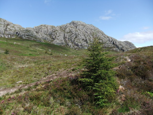
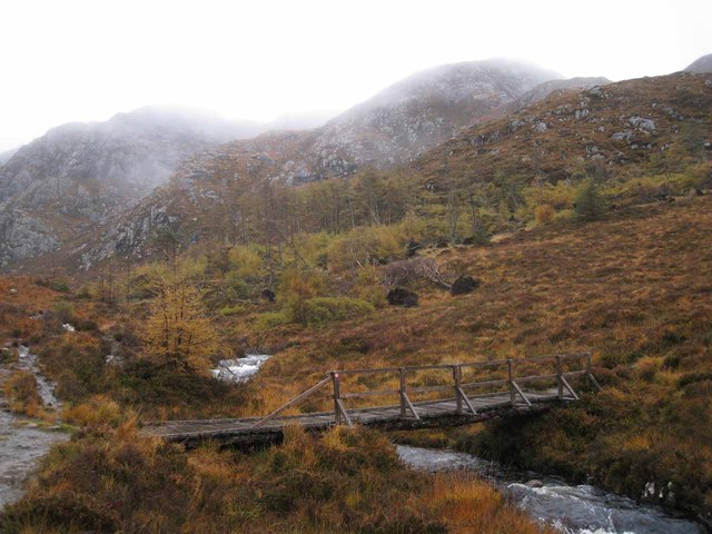
An Groban is a prominent hill located in Ross-shire, Scotland. It is situated in the Northwest Highlands, near the village of Achnasheen, and forms part of the Torridon mountain range. Standing at an impressive height of 918 meters (3,012 feet), An Groban is known for its rugged beauty and challenging hiking trails.

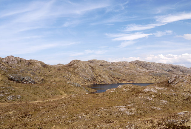
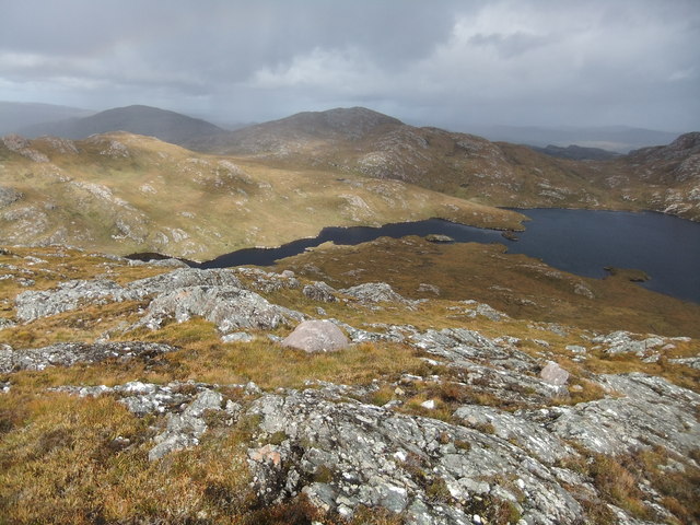
The hill offers breathtaking panoramic views of the surrounding landscape, including the nearby Loch a' Bhraoin and the magnificent Beinn Dearg mountain. Its steep slopes and rocky terrain make it a popular destination for experienced hikers and mountaineers seeking a thrilling adventure.

An Groban is rich in wildlife and provides a habitat for various bird species, including eagles, ptarmigans, and peregrine falcons. The hillside is also dotted with heather and grasses, adding to its picturesque allure.

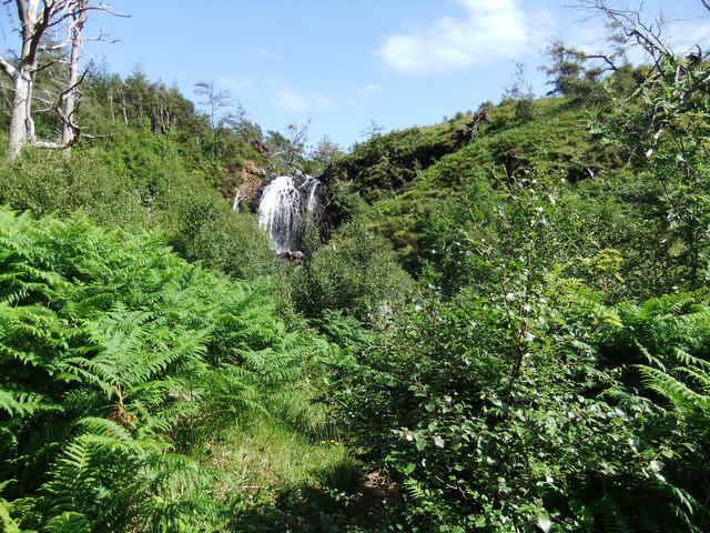
To reach the summit of An Groban, hikers can follow various routes that cater to different levels of difficulty. The most common starting point is near Loch a' Bhraoin, where a well-marked path leads up the hill. The ascent can be challenging, with steep sections and uneven terrain, but the reward of reaching the summit and taking in the breathtaking views is well worth the effort.

An Groban is a must-visit destination for outdoor enthusiasts and nature lovers looking to immerse themselves in the rugged beauty of the Scottish Highlands. Its impressive stature, stunning vistas, and diverse wildlife make it an ideal spot for those seeking an unforgettable mountain adventure.

If you have any feedback on the listing, please let us know in the comments section below.

An Groban Images

Images are sourced within 2km of 57.712251/-5.6305037 or Grid Reference NG8374. Thanks to Geograph Open Source API. All images are credited.

An Groban
An Groban
Flowerdale waterfall
Loch na Fèithe Mùgaig The view across Loch na Fèithe Mùgaig in near perfect conditions.
The whole area of land between Loch Gairloch and the head of Loch Maree despite its relatively low altitude is a splendid complex of rough hill country and lochans; this must be one of the best views available there.
Slioch is the distant mountain; a Munro.
Loch na Fèithe Mùgaig
The view across Loch na Fèithe Mùgaig in near perfect conditions. The whole area of land between Loch Gairloch and the head of Loch Maree despite its relatively low altitude is a splendid complex of rough hill country and lochans; this must be one of the best views available there. Slioch is the distant mountain; a Munro.
Moorland west of Loch nam Buainichean Loch nam Buainichean and the moorland west of it sit in a hollow enclosed by a number of low but very rocky hills; Meall Aundrary, from which the image was recorded, is one of them.
Moorland west of Loch nam Buainichean
Loch nam Buainichean and the moorland west of it sit in a hollow enclosed by a number of low but very rocky hills; Meall Aundrary, from which the image was recorded, is one of them.
Loch Airigh a Phuil
Loch Airigh a Phuil
Waterfall on Easan Bàna The Easan Bàna ("White Waterfalls") flow into Flowerdale and down to Loch Gairloch. Oddly, on OS maps, the waterfall is given the same name as the stream which lower down has the name Abhainn Ghlas. On the shelf below the main fall sandstone boulders are perched; clearly a different rock type; they have presumably been carried down by the stream in spate.
Waterfall on Easan Bàna
The Easan Bàna ("White Waterfalls") flow into Flowerdale and down to Loch Gairloch. Oddly, on OS maps, the waterfall is given the same name as the stream which lower down has the name Abhainn Ghlas. On the shelf below the main fall sandstone boulders are perched; clearly a different rock type; they have presumably been carried down by the stream in spate.
An Groban The block of hill country east of Loch Gairloch, bounded on three sides by the A832 and to the east by Loch Maree may contain hills of just modest height but the whole area is a wonderful chaos of rock and lochan. No hill exemplifies the nature of the peaks there better than An Groban, the south face of which is seen here.
An Groban
The block of hill country east of Loch Gairloch, bounded on three sides by the A832 and to the east by Loch Maree may contain hills of just modest height but the whole area is a wonderful chaos of rock and lochan. No hill exemplifies the nature of the peaks there better than An Groban, the south face of which is seen here.
Reedy lochan north-west of An Groban The lochan is unnamed on OS maps at any scale but lies to the west of the larger Loch Airigh a' Phuill. The rocky hill in the distance has two tops,  Meall an Spardain and Meall an Doirein; the last named is the higher and is a 'Marilyn'.
Reedy lochan north-west of An Groban
The lochan is unnamed on OS maps at any scale but lies to the west of the larger Loch Airigh a' Phuill. The rocky hill in the distance has two tops, Meall an Spardain and Meall an Doirein; the last named is the higher and is a 'Marilyn'.
Abhainn Ghlas Autumn rain has swollen the river, which is crossed by a footbridge at this point.
Abhainn Ghlas
Autumn rain has swollen the river, which is crossed by a footbridge at this point.
Abhainn Ghlas A footpath provides reasonably easy access through Flowerdale to the Easan Bàna and Eas Dubh waterfalls. Wet weather, as today, guarantees a good flow in the river.
Abhainn Ghlas
A footpath provides reasonably easy access through Flowerdale to the Easan Bàna and Eas Dubh waterfalls. Wet weather, as today, guarantees a good flow in the river.
Eas Dubh An impressive waterfall in the Abhainn Ghlas, reasonably accessible via a scenic footpath through Flowerdale.
Eas Dubh
An impressive waterfall in the Abhainn Ghlas, reasonably accessible via a scenic footpath through Flowerdale.
Eas Dubh It only takes a little struggle through the undergrowth off the path to get a good view of the impressive waterfall in the Abhainn Ghlas.
Eas Dubh
It only takes a little struggle through the undergrowth off the path to get a good view of the impressive waterfall in the Abhainn Ghlas.
Over the top of the waterfall This view looks over the top of the Eas Dubh waterfall in the Abhainn Ghlas. (See also <a href="https://www.geograph.org.uk/photo/3267063">NG8274 : Eas Dubh</a> ). A sometimes rocky footpath provides access through Flowerdale to this point, and loops back to Gairloch through the woods.
Over the top of the waterfall
This view looks over the top of the Eas Dubh waterfall in the Abhainn Ghlas. (See also NG8274 : Eas Dubh ). A sometimes rocky footpath provides access through Flowerdale to this point, and loops back to Gairloch through the woods.
Footbridge over Allt a' Ghlinne A footpath leads from Gairloch village through Flowerdale providing access to the impressive Eas Dubh waterfall. There are several footbridges along the path. This bridge is above the waterfall, and permits an alternative route back to Gairloch.
Footbridge over Allt a' Ghlinne
A footpath leads from Gairloch village through Flowerdale providing access to the impressive Eas Dubh waterfall. There are several footbridges along the path. This bridge is above the waterfall, and permits an alternative route back to Gairloch.
Gleann a' Ghrobain A view up the Glen from a path from Gairloch which provides access to the nearby Eas Dubh waterfall.
Gleann a' Ghrobain
A view up the Glen from a path from Gairloch which provides access to the nearby Eas Dubh waterfall.
Path towards Gairloch The path provides a circular route from Gairloch and through Flowerdale, taking in the impressive Eas Dubh waterfall.
Path towards Gairloch
The path provides a circular route from Gairloch and through Flowerdale, taking in the impressive Eas Dubh waterfall.
Memorial to Iain Dall MacKay The memorial stands close to a footpath through the woods south of the Abhainn Ghlas. The inscription is in English and Gaelic, and reads (in English) 'Iain Dall MacKay, 1656 - 1754, Blind Piper of Gairloch'. Detail: <a href="https://www.geograph.org.uk/photo/3267162">NG8274 : Detail of Iain Dall MacKay memorial</a> .
Memorial to Iain Dall MacKay
The memorial stands close to a footpath through the woods south of the Abhainn Ghlas. The inscription is in English and Gaelic, and reads (in English) 'Iain Dall MacKay, 1656 - 1754, Blind Piper of Gairloch'. Detail: NG8274 : Detail of Iain Dall MacKay memorial .
Detail of Iain Dall MacKay memorial Close-up of the plaque mounted within the woodland memorial to the Blind Piper of Gairloch. Wider view: <a href="https://www.geograph.org.uk/photo/3267157">NG8274 : Memorial to Iain Dall MacKay</a>.
Detail of Iain Dall MacKay memorial
Close-up of the plaque mounted within the woodland memorial to the Blind Piper of Gairloch. Wider view: NG8274 : Memorial to Iain Dall MacKay.
Show me another place!

An Groban is located at Grid Ref: NG8374 (Lat: 57.712251, Lng: -5.6305037)

Unitary Authority: Highland

Police Authority: Highlands and Islands

What 3 Words

///page.configure.adjusting. Near Gairloch, Highland

Related Wikis

Charlestown, Wester Ross

Charlestown is a small hamlet, making up one of the settlements which are collectively called Gairloch, and located directly south of the main village...

An Ard

An Ard (Scottish Gaelic: ) is a collection of small settlements on the A832 road, close to Charlestown, in Gairloch, Ross-shire, on the east shore of Gair...

Gairloch Museum

Gairloch Museum (Scottish Gaelic: Taigh-tasgaidh Gheàrrloch) is an independent museum in the Wester Ross region of Scotland. The museum is located in the...
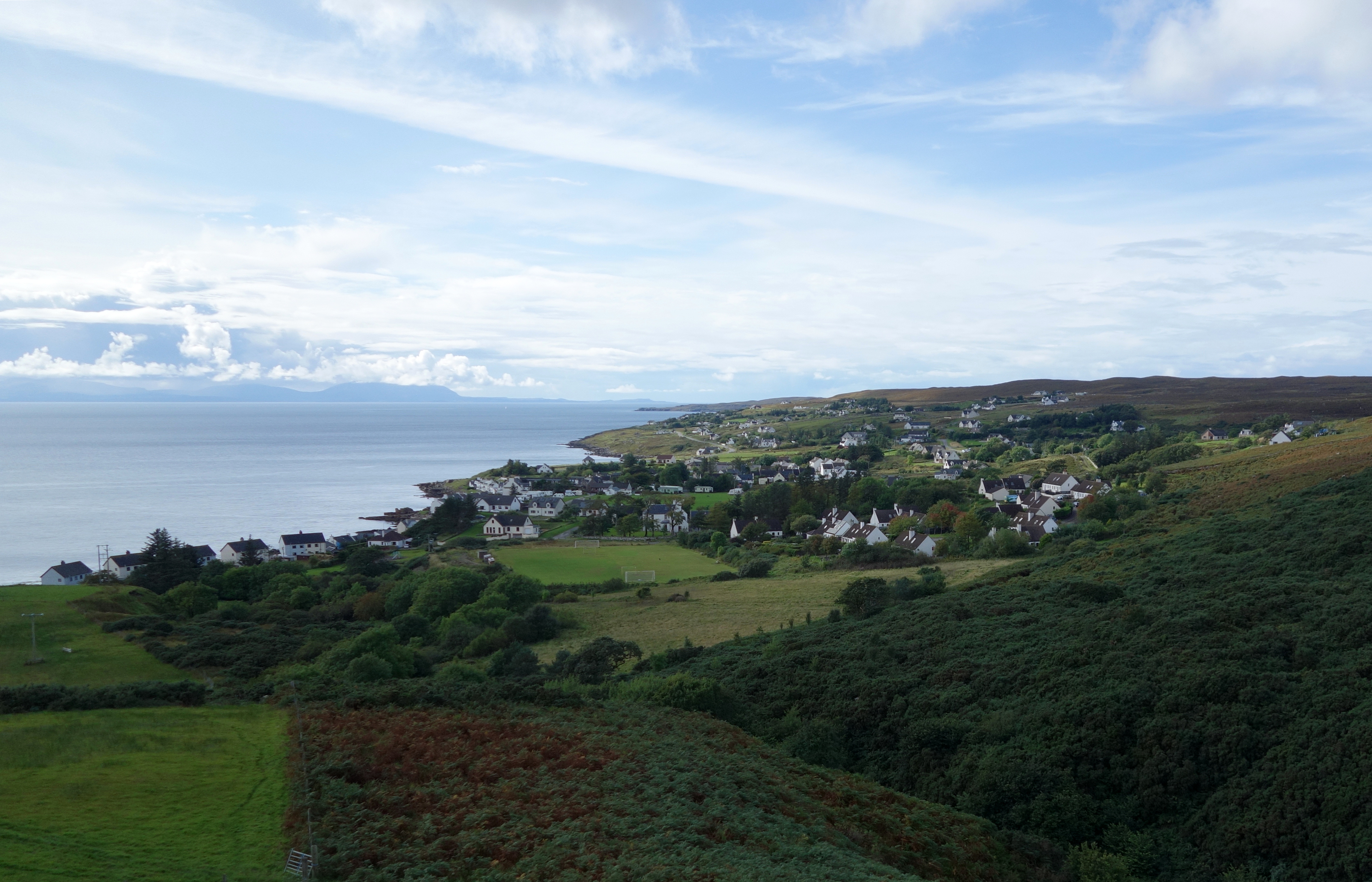
Gairloch

Gairloch ( GAIR-lokh; Scottish Gaelic: Geàrrloch [ˈkʲaːrˠl̪ˠɔx], meaning "Short Loch") is a village, civil parish and community on the shores of Loch Gairloch...

Gairloch High School

Gairloch High School (Gaelic: Àrd-Sgoil Gheàrrloch) is a six-year secondary school in Gairloch, Scotland. Being situated in a remote area of the Highlands...
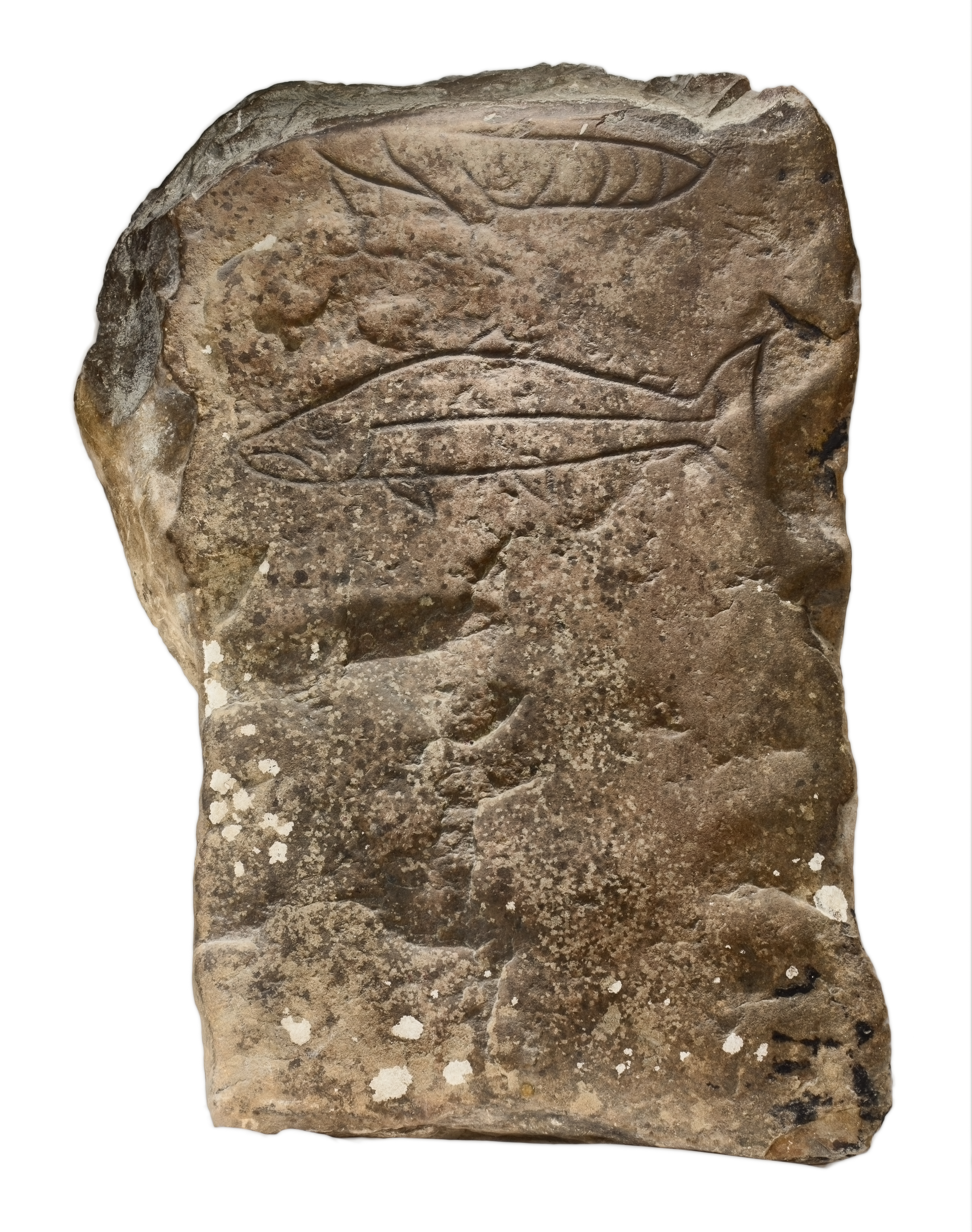
Gairloch Stone

The Gairloch Stone is a Class-I Pictish stone which was discovered at Achtercairn in Wester Ross around 1880. Subsequently, the stone was used as masonry...

Broadford Beds Formation

The Broadford Beds Formation is a Sinemurian geologic formation in western Scotland. An indeterminate partial tibia of a theropod dinosaur are among the...

Two Lochs Radio

Two Lochs Radio is Britain's smallest commercial radio station. It broadcasts a music-led service to the communities of Gairloch, Loch Ewe and Loch Maree...

Nearby Amenities

Located within 500m of 57.712251,-5.6305037
An Groban
Corbett: no
Ele: 383
Graham: no
Munro: no
Natural: peak
Lat/Long: 57.712517/-5.6312564
The data included in this document is from www.openstreetmap.org. The data is made available under ODbL.

Have you been to An Groban?

Leave your review of An Groban below (or comments, questions and feedback).