An Ruadh-Mheallan

Hill, Mountain in Ross-shire

Scotland

An Ruadh-Mheallan

A boggy bealach north west of An Ruadh-Mheallan
A boggy bealach north west of An Ruadh-Mheallan Credit: David Brown

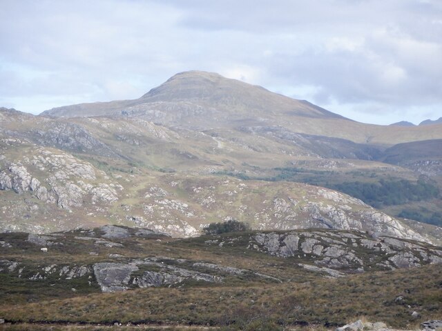
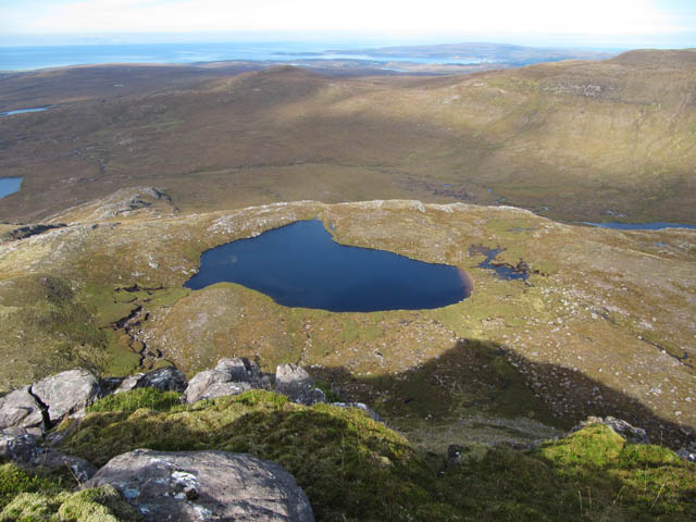
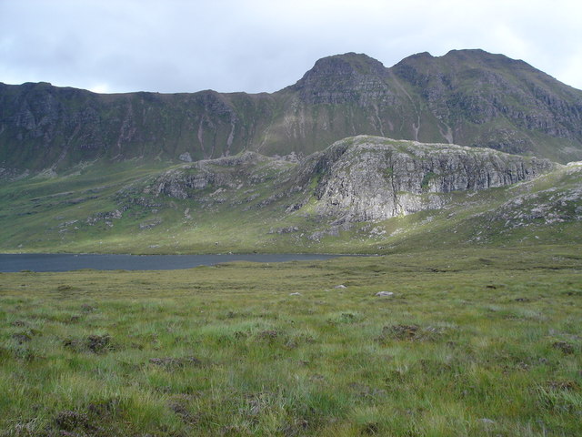
An Ruadh-Mheallan is a prominent hill/mountain located in the county of Ross-shire, in the Highlands of Scotland. With an elevation of 766 meters (2,513 feet), it is part of the Torridon mountain range, renowned for its rugged beauty and impressive peaks.

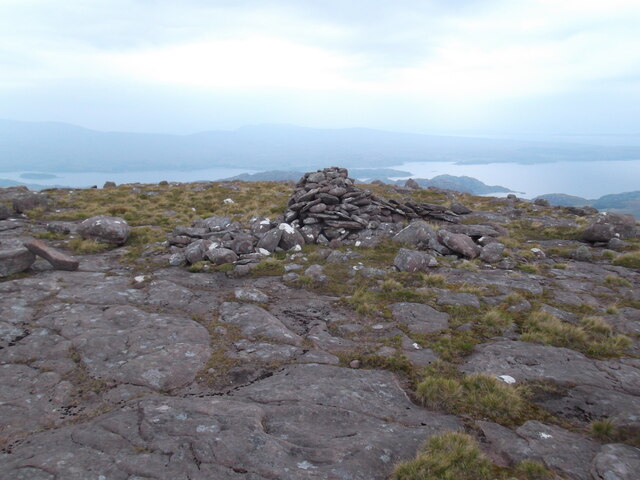
An Ruadh-Mheallan is characterized by its distinctive shape, with a steep and rocky summit that offers breathtaking panoramic views of the surrounding landscape. Its name translates to "The Red Round Hill" in Gaelic, which refers to the reddish color of the rock formations found on its slopes.

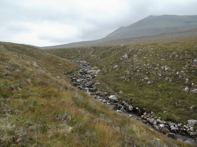
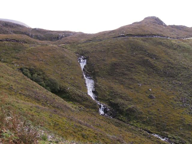
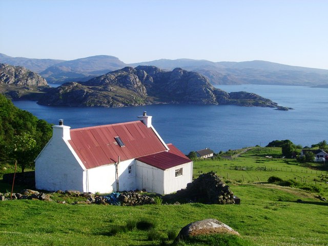
The mountain is a popular destination for hikers and mountaineers, attracting outdoor enthusiasts from all over the world. It can be accessed via various routes, with the most common starting point being the village of Torridon. From there, a well-defined path leads climbers through moorland and heather-covered slopes, gradually ascending towards the summit.

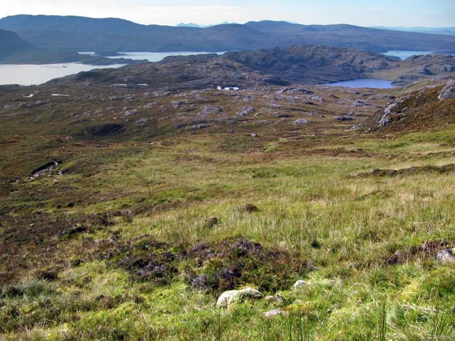
The ascent can be challenging, particularly in adverse weather conditions, as the terrain becomes steeper and more exposed closer to the top. However, those who persevere are rewarded with spectacular views of Loch Torridon, the surrounding Munros (Scottish mountains over 3,000 feet), and the vast wilderness of the Scottish Highlands.

An Ruadh-Mheallan is also home to a diverse range of wildlife, including red deer, mountain hares, and golden eagles. The surrounding area offers opportunities for further exploration, with nearby attractions such as Beinn Alligin and Liathach adding to the allure of the region.

Overall, An Ruadh-Mheallan is a captivating and challenging mountain that showcases the natural beauty and ruggedness of the Scottish Highlands.

If you have any feedback on the listing, please let us know in the comments section below.

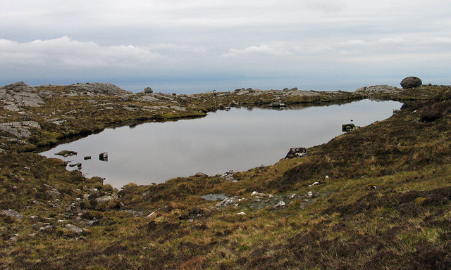
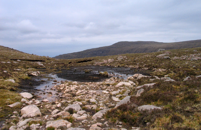
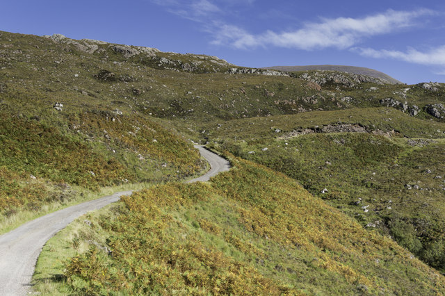
An Ruadh-Mheallan Images

Images are sourced within 2km of 57.591366/-5.6222196 or Grid Reference NG8361. Thanks to Geograph Open Source API. All images are credited.

A boggy bealach north west of An Ruadh-Mheallan
Cairn on Meall na h-Odhar-aghaidh
The choire west of Loch Gaineamhach Beag Looking to Beinn Bhreac with Baosbheinn in the distance
The choire west of Loch Gaineamhach Beag
Looking to Beinn Bhreac with Baosbheinn in the distance
Summit cairn, An Ruadh-Mheallan
Abhainn Alligin in An Rèidh-choire
Waterfall on the Abhainn Alligin by the old shieling
An Ruadh Mheallan View across Loch Torridon.
An Ruadh Mheallan
View across Loch Torridon.
Water Rushing down to Loch Diabaigas Airde Taken from the Diabaig road near the passage over Allt Airigh Eachainn which forms the waterfall. On the right rises Sithean Mor.
Water Rushing down to Loch Diabaigas Airde
Taken from the Diabaig road near the passage over Allt Airigh Eachainn which forms the waterfall. On the right rises Sithean Mor.
Undulating ground with rock outcrops The hill country seen in the image lies to the north of Loch nan Tri-eileanan. In the distance Ben Shieldaig lies to the left, (beyond the unseen Upper Loch Torridon), with Applecross to the right.
Undulating ground with rock outcrops
The hill country seen in the image lies to the north of Loch nan Tri-eileanan. In the distance Ben Shieldaig lies to the left, (beyond the unseen Upper Loch Torridon), with Applecross to the right.
Lochan below An Ruadh-Mheallan The lochan lies south-west of the Graham, An Ruadh-Mheallan.
Lochan below An Ruadh-Mheallan
The lochan lies south-west of the Graham, An Ruadh-Mheallan.
Boulderfield below Ben Alligin These large sandstone boulders lie below Sgùrr Mhòr, the highest top of  Beinn Alligin, the left side peak on the skyline.
Boulderfield below Ben Alligin
These large sandstone boulders lie below Sgùrr Mhòr, the highest top of Beinn Alligin, the left side peak on the skyline.
Bealach between An Ruadh-Mheallan and Meall na h-Odhar-aghaidh An Ruadh-Mheallan, a Graham, lies to the east of Ben Alligin; this low point is north-east of the mountain. The distant hill is the western top of Beinn Bhreac.
Bealach between An Ruadh-Mheallan and Meall na h-Odhar-aghaidh
An Ruadh-Mheallan, a Graham, lies to the east of Ben Alligin; this low point is north-east of the mountain. The distant hill is the western top of Beinn Bhreac.
Western side of the Mad wee road to Diabaig
Moorland south of An Ruadh-mheallan, Torridon
Looking down on Loch a' Mheallain
An Reidh-choire, Torridon A boggy corrie between An Ruadh-mheallan and Beinn Alligin
An Reidh-choire, Torridon
A boggy corrie between An Ruadh-mheallan and Beinn Alligin
Rocky moorland and an old fence post in Torridon A line of old fence posts head off to the right. Creag a' Chinn Duibh is the hill to the left.
Rocky moorland and an old fence post in Torridon
A line of old fence posts head off to the right. Creag a' Chinn Duibh is the hill to the left.
Moorland near Loch Gaineamhach Beag, Torridon The loch is on the right. Loch Gaineamhach is 4kM north from here.
Moorland near Loch Gaineamhach Beag, Torridon
The loch is on the right. Loch Gaineamhach is 4kM north from here.
Show me another place!

An Ruadh-Mheallan is located at Grid Ref: NG8361 (Lat: 57.591366, Lng: -5.6222196)

Unitary Authority: Highland

Police Authority: Highlands and Islands

What 3 Words

///repelled.encounter.neatly. Near Gairloch, Highland

Related Wikis

Beinn Alligin

Beinn Alligin (Scottish Gaelic: Beinn Àilleagan) is one of the classic mountains of the Torridon region of Scotland, lying to the north of Loch Torridon...

Diabaig

Diabaig (Scottish Gaelic: Dìobaig) is a remote coastal fishing and crofting township in Wester Ross, in the Northwest Highlands of Scotland. Diabaig lies...

Inveralligin

Inveralligin (Scottish Gaelic: Inbhir Àiliginn) is a remote crofting township which lies on the north shore of Loch Torridon in Wester Ross and is in the...

Loch a' Ghobhainn

Loch a' Ghobhainn is an upland freshwater loch lying inland and south west of the village of Shieldaig in the Scottish Highlands. The loch has an irregular...

Nearby Amenities

Located within 500m of 57.591366,-5.6222196
An Ruadh-mheallan
Corbett: no
Ele: 672
Graham: yes
Marilyn: yes
Munro: no
Natural: peak
Prominence: 201
Wikidata: Q20577783
Lat/Long: 57.5912984/-5.6217345
The data included in this document is from www.openstreetmap.org. The data is made available under ODbL.

Have you been to An Ruadh-Mheallan?

Leave your review of An Ruadh-Mheallan below (or comments, questions and feedback).