Auchtertyre Hill

Hill, Mountain in Ross-shire

Scotland

Auchtertyre Hill

A87 at Kirkton
A87 at Kirkton Credit: Steven Brown

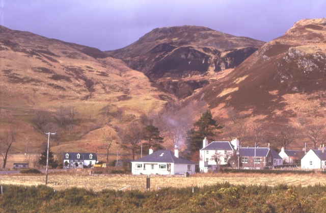
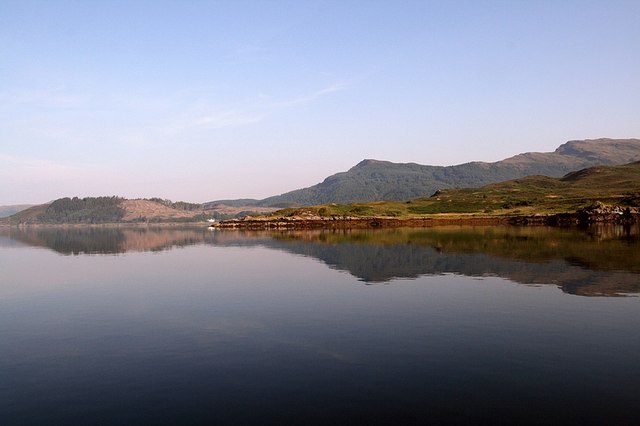
Auchtertyre Hill is a prominent hill located in the county of Ross-shire, in the Scottish Highlands. It stands at an elevation of 373 meters (1,224 feet) above sea level, making it a notable feature in the surrounding landscape. The hill is situated near the small village of Auchtertyre, which lies approximately 3 kilometers (1.9 miles) to the southwest.

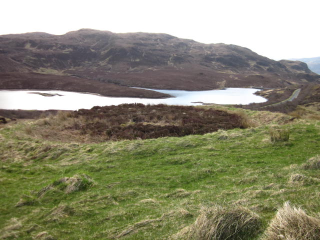
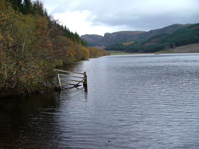
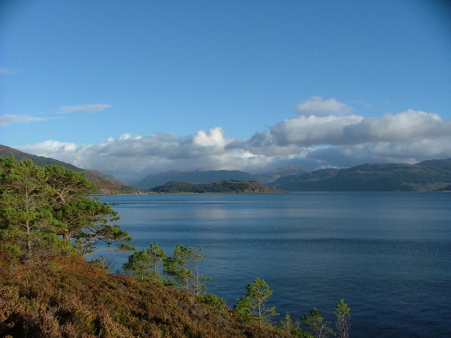
Auchtertyre Hill offers stunning panoramic views of the surrounding countryside, with vistas extending over the nearby hills, valleys, and lochs. Its location within the Highlands provides visitors with an opportunity to appreciate the natural beauty and ruggedness of the Scottish landscape.

The hill is covered with a mixture of heather, grasses, and scattered rocks, creating an undulating terrain. It is a popular destination for hikers and outdoor enthusiasts who enjoy exploring the area's network of walking trails. An ascent to the summit of Auchtertyre Hill rewards visitors with breathtaking views and a sense of tranquility.

Wildlife is abundant in the area, with birdwatchers often spotting birds of prey such as golden eagles and buzzards soaring above the hill. Red deer, mountain hares, and other small mammals can also be found in the surrounding habitat.

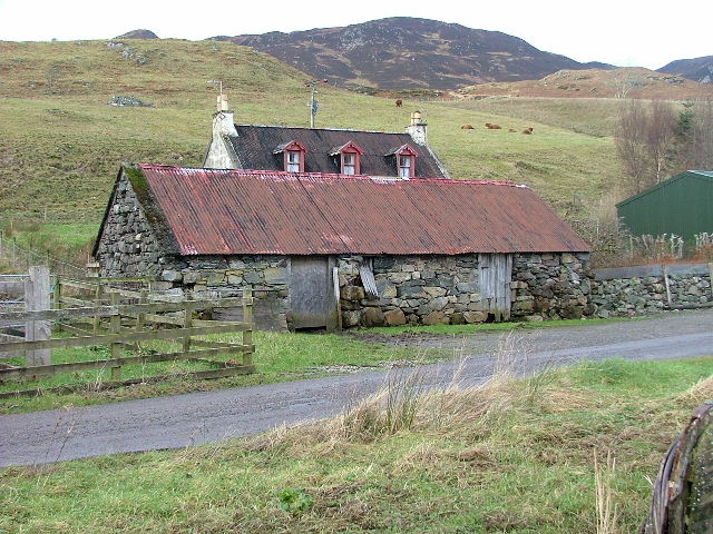
Auchtertyre Hill is easily accessible, with a car park located at the base of the hill, providing a convenient starting point for those wishing to explore its slopes. Its proximity to other notable landmarks and attractions in Ross-shire makes it a popular stop for tourists and locals alike.

If you have any feedback on the listing, please let us know in the comments section below.

Auchtertyre Hill Images

Images are sourced within 2km of 57.299499/-5.5997918 or Grid Reference NG8328. Thanks to Geograph Open Source API. All images are credited.

A87 at Kirkton
A87 at Kirkton
Lichens on Old Oak In amongst the small pocket of Atlantic Oakwoods above Reraig and this old dead oak has an array of lichens - probably Beard or Horsehair Lichen - growing on it.
A lovely walk to do on a wet summer's day. Some information here:-
<span class="nowrap"><a title="https://forestryandland.gov.scot/visit/balmacara-woods" rel="nofollow ugc noopener" href="https://forestryandland.gov.scot/visit/balmacara-woods">Link</a><img style="margin-left:2px;" alt="External link" title="External link - shift click to open in new window" src="https://s1.geograph.org.uk/img/external.png" width="10" height="10"/></span>
Lichens on Old Oak
In amongst the small pocket of Atlantic Oakwoods above Reraig and this old dead oak has an array of lichens - probably Beard or Horsehair Lichen - growing on it. A lovely walk to do on a wet summer's day. Some information here:- LinkExternal link
Mighty Larch Trunks These big mature Larch Trees are at the bottom of one of the woodland walks above Reraig and Balmacara. You can see evidence of the damage from last winter's storms.
Mighty Larch Trunks
These big mature Larch Trees are at the bottom of one of the woodland walks above Reraig and Balmacara. You can see evidence of the damage from last winter's storms.
No Hill Too Steep 'No Hill Too Steep' appears to be the motto of Munro Plant Hire of Kyle and it is quite a steep track to get to this point. The track is not marked on 1:50,000 maps which has this point as being forested so obviously has recently been felled.
The rocky peak is Auchtertyre Hill.
No Hill Too Steep
'No Hill Too Steep' appears to be the motto of Munro Plant Hire of Kyle and it is quite a steep track to get to this point. The track is not marked on 1:50,000 maps which has this point as being forested so obviously has recently been felled. The rocky peak is Auchtertyre Hill.
A87, Auchtertyre The A87 is a primary route  in the Highland region of Scotland. It runs west for 99 miles from its junction with the A82 at Invergarry, along the north shores of Loch Garry and Loch Cluanie, then through Glen Shiel and along Loch Duich to Kyle of Lochalsh before crossing the Skye Bridge to Kyleakin, Broadford, and Portree, before terminating at Uig in the north of the Isle of Skye.
A87, Auchtertyre
The A87 is a primary route in the Highland region of Scotland. It runs west for 99 miles from its junction with the A82 at Invergarry, along the north shores of Loch Garry and Loch Cluanie, then through Glen Shiel and along Loch Duich to Kyle of Lochalsh before crossing the Skye Bridge to Kyleakin, Broadford, and Portree, before terminating at Uig in the north of the Isle of Skye.
Eastbound A87 near Kirkton The A87 is a primary route  in the Highland region of Scotland. It runs west for 99 miles from its junction with the A82 at Invergarry, along the north shores of Loch Garry and Loch Cluanie, then through Glen Shiel and along Loch Duich to Kyle of Lochalsh before crossing the Skye Bridge to Kyleakin, Broadford, and Portree, before terminating at Uig in the north of the Isle of Skye.
Eastbound A87 near Kirkton
The A87 is a primary route in the Highland region of Scotland. It runs west for 99 miles from its junction with the A82 at Invergarry, along the north shores of Loch Garry and Loch Cluanie, then through Glen Shiel and along Loch Duich to Kyle of Lochalsh before crossing the Skye Bridge to Kyleakin, Broadford, and Portree, before terminating at Uig in the north of the Isle of Skye.
A87 at Kirkton The A87 is a primary route  in the Highland region of Scotland. It runs west for 99 miles from its junction with the A82 at Invergarry, along the north shores of Loch Garry and Loch Cluanie, then through Glen Shiel and along Loch Duich to Kyle of Lochalsh before crossing the Skye Bridge to Kyleakin, Broadford, and Portree, before terminating at Uig in the north of the Isle of Skye.
A87 at Kirkton
The A87 is a primary route in the Highland region of Scotland. It runs west for 99 miles from its junction with the A82 at Invergarry, along the north shores of Loch Garry and Loch Cluanie, then through Glen Shiel and along Loch Duich to Kyle of Lochalsh before crossing the Skye Bridge to Kyleakin, Broadford, and Portree, before terminating at Uig in the north of the Isle of Skye.
A87 at Auchtertyre
A87 at Auchtertyre
General view of square Looking SW.
Loch na Smeoraich in centre of photo.
General view of square
Looking SW. Loch na Smeoraich in centre of photo.
General view NG 8230 Looking NW.  Loch Kishorn & the Applecross hills beyond.
In 2013 this area was swept by fire, but did not set fire to the forestry plantation just beyond the loch.  Up till then the vegetation was mainly heather and blueberries, not the rough grass as in the photo.
General view NG 8230
Looking NW. Loch Kishorn & the Applecross hills beyond. In 2013 this area was swept by fire, but did not set fire to the forestry plantation just beyond the loch. Up till then the vegetation was mainly heather and blueberries, not the rough grass as in the photo.
General view of NG 8330 Looking east over Lochan Dubha.
In 2013 this area was swept by fire.  Up till then the vegetation was mainly heather and blueberries, not the rough grass as in the photo.  When the photo was taken shoots of heather were starting to regrow midst the grass – much to the delight of the local grouse.
General view of NG 8330
Looking east over Lochan Dubha. In 2013 this area was swept by fire. Up till then the vegetation was mainly heather and blueberries, not the rough grass as in the photo. When the photo was taken shoots of heather were starting to regrow midst the grass – much to the delight of the local grouse.
General view of NG 8330 Looking south east over Loch nam Breac Mora. 
In 2013 this area was swept by fire.  Up till then the vegetation was mainly heather and blueberries, not the rough grass as in the photo.  When the photo was taken shoots of heather were starting to regrow midst the grass – much to the delight of the local grouse.
General view of NG 8330
Looking south east over Loch nam Breac Mora. In 2013 this area was swept by fire. Up till then the vegetation was mainly heather and blueberries, not the rough grass as in the photo. When the photo was taken shoots of heather were starting to regrow midst the grass – much to the delight of the local grouse.
Reservoir (disused) Believed to be the reservoir that supplied the WWII gun emplacement/camp above Reraig in the area of the view point shown on the OS map (NG810276).
When the "Red Trail" was constructed it was filled in by the Forestry Commission.
Reservoir (disused)
Believed to be the reservoir that supplied the WWII gun emplacement/camp above Reraig in the area of the view point shown on the OS map (NG810276). When the "Red Trail" was constructed it was filled in by the Forestry Commission.
Dun NW of Kirkton, Lochalsh "A kind of hill fort and also a kind of Atlantic roundhouse."
In this case all that remains are a moss covered circle of stones.
See also <span class="nowrap"><a title="http://canmore.org.uk/site/11859/kirkton" rel="nofollow ugc noopener" href="http://canmore.org.uk/site/11859/kirkton">Link</a><img style="margin-left:2px;" alt="External link" title="External link - shift click to open in new window" src="https://s1.geograph.org.uk/img/external.png" width="10" height="10"/></span>
Dun NW of Kirkton, Lochalsh
"A kind of hill fort and also a kind of Atlantic roundhouse." In this case all that remains are a moss covered circle of stones. See also LinkExternal link
Footpath - the Red Trail Part of the Forestry Commission walks network starting from Balmacara Square.
This is the steep(-er than it looks) section in the oak wood above the path between Reraig and Kirkton.
Footpath - the Red Trail
Part of the Forestry Commission walks network starting from Balmacara Square. This is the steep(-er than it looks) section in the oak wood above the path between Reraig and Kirkton.
Tumulus at NG851 294 Tumulus to the NW of the hydro electric reservoir (in background).
Tumulus at NG851 294
Tumulus to the NW of the hydro electric reservoir (in background).
Tumulus (detail) at NG 851 294 South west embankment of tumulus.
Tumulus (detail) at NG 851 294
South west embankment of tumulus.
NG 8428 & 29 general view General view of NG8428 & 29 taken from the flank of Maol Beag.
Traces of the old track from Auchtertyre north, shown on the estate map of 1805, can be found in the valley.
NG 8428 & 29 general view
General view of NG8428 & 29 taken from the flank of Maol Beag. Traces of the old track from Auchtertyre north, shown on the estate map of 1805, can be found in the valley.
Show me another place!

Auchtertyre Hill is located at Grid Ref: NG8328 (Lat: 57.299499, Lng: -5.5997918)

Unitary Authority: Highland

Police Authority: Highlands and Islands

What 3 Words

///flitting.backward.officers. Near Kyleakin, Highland

Nearby Locations

Auchtertyre Hill

Related Wikis

Auchtertyre

Auchtertyre (Scottish Gaelic: Uachdar Thìre, "Upper Land") is a village, lying half a mile from the north shore of Loch Alsh near Kyle of Lochalsh, in...

Balmacara Square

Balmacara Square (Scottish Gaelic: Ceàrnag Bhaile Mac Carra) is a small village, close to Balmacara, in Lochlash, Scottish Highlands and is in the council...

Balmacara

Balmacara (Scottish Gaelic: Baile MacRath) is a scattered village on the north shore of Loch Alsh near Kyle of Lochalsh, Ross-shire, Highland and is in...

Loch Achaidh na h-Inich

Loch Achaidh na h-Inich is a freshwater loch in Scotland, located around 3 kilometres (1.9 mi) south-south-east of Plockton, 2 kilometres (1.2 mi) east...

Balmacara Bay

Balmacara Bay is a remote wide mouthed embayment on a 193° orientation, located on the north shore of the Lochalsh peninsula, on the north coast of sea...

Nostie

Nostie (Scottish Gaelic: Ceann na Mòna) is a small remote hamlet, lying on Nostie Bay, an inlet at the northeastern end of the sea loch, Loch Alsh in the...

Avernish

Avernish (Scottish Gaelic: Abhairnis) is a small, scenic, rural community located in the Highlands of Scotland. Nearby attractions include The Eilean...

Ardelve

Ardelve (Scottish Gaelic: Àird Eilbh) is a village in Highland, Scotland, on Loch Alsh. It overlooks the Eilean Donan Castle, which is in Dornie, also...

Nearby Amenities

Located within 500m of 57.299499,-5.5997918
Auchtertyre Hill
Corbett: no
Ele: 452
Graham: no
Man Made: survey_point
Marilyn: yes
Munro: no
Natural: peak
Prominence: 244
Source: GPS Survey
Lat/Long: 57.2995374/-5.5999153
The data included in this document is from www.openstreetmap.org. The data is made available under ODbL.

Have you been to Auchtertyre Hill?

Leave your review of Auchtertyre Hill below (or comments, questions and feedback).