Sgùrr Mòr

Hill, Mountain in Inverness-shire

Scotland

Sgùrr Mòr

The view from Sgurr Mor A splendid view of the apparent peninsula between Loch Morar (left) and Loch Nevis (right). Actually there is a narrow and low-lying strip of land at the far end of Loch Morar which connects Mallaig (NM6796) to Arisaig (NM6686).  Loch Morar is actually a freshwater loch, though only about 10m above sea level: Loch Nevis (no connection with Ben Nevis except for the name) is a true sea loch.

In the far distance, slightly left of centre, the island of Rum can just be seen.
The view from Sgurr Mor Credit: Michael Earnshaw

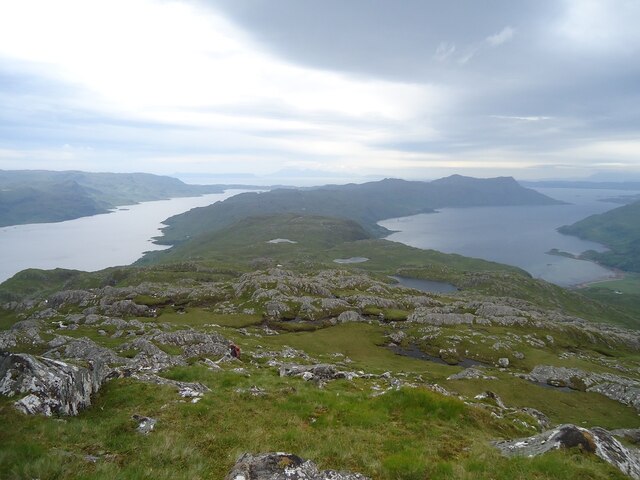
Sgùrr Mòr is a prominent hill located in Inverness-shire, Scotland. It is part of the Northwest Highlands and forms a striking feature in the landscape. The hill is known for its rugged beauty and offers breathtaking views of the surrounding area.

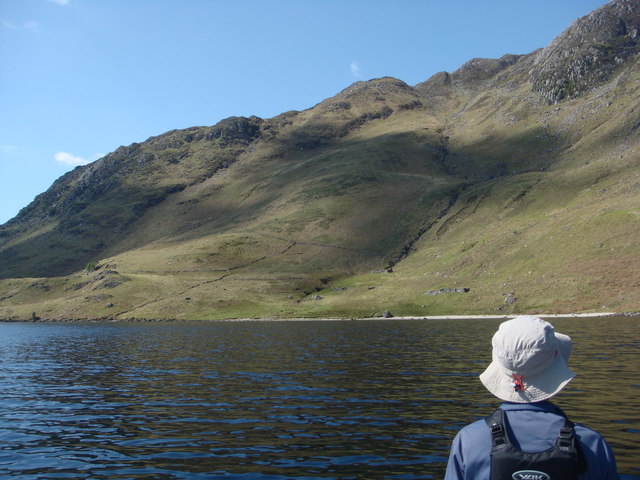
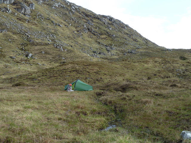
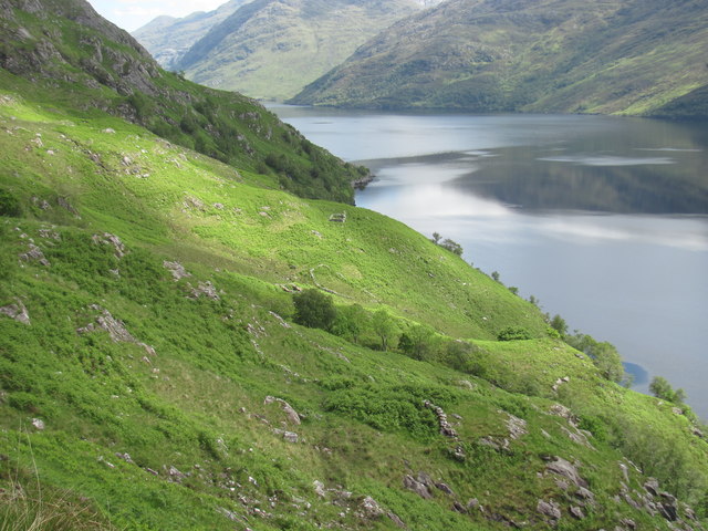
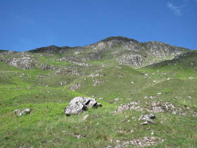
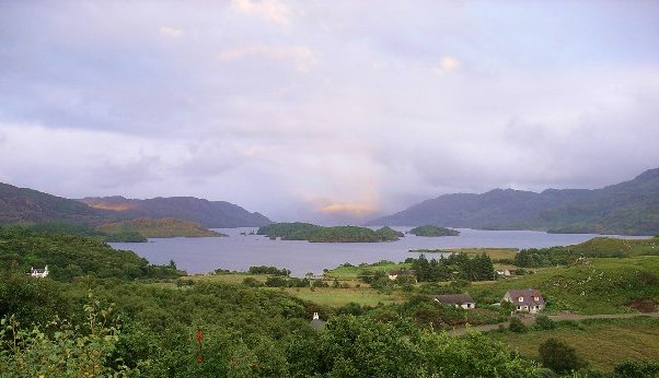
With an elevation of 1,011 meters (3,317 feet), Sgùrr Mòr is classified as a Munro, a Scottish mountain over 3,000 feet high. It is situated in the remote and wild region of Knoydart, which adds to its allure and appeal for outdoor enthusiasts and hillwalkers. The hill is often climbed as part of a longer hike, along with its neighboring peaks.

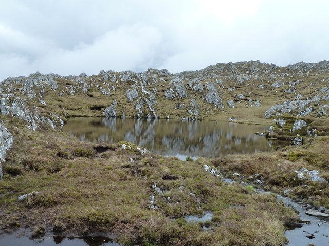
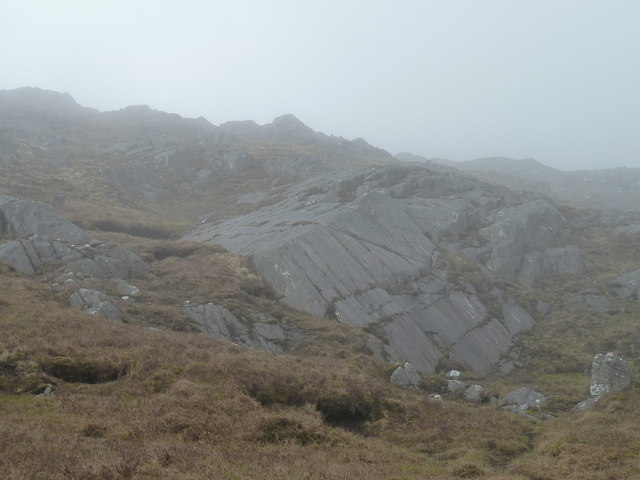
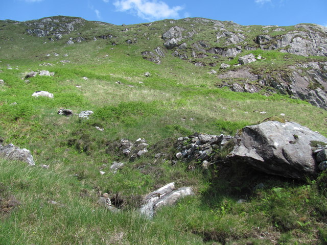
Sgùrr Mòr is characterized by its steep slopes and rocky terrain, making it a challenging climb. However, the reward for reaching its summit is the stunning panorama it offers, showcasing the surrounding peaks, lochs, and the vast expanse of rugged wilderness.

The hill is home to a diverse range of flora and fauna, including rare alpine plants and birds of prey like golden eagles. The surrounding area is also popular for its abundance of wildlife, including red deer and otters.

Visitors to Sgùrr Mòr should be well-prepared and equipped for the climb, as the weather conditions can change rapidly, and navigation can be challenging. However, for those seeking a rewarding and unforgettable experience in the Scottish Highlands, Sgùrr Mòr is a must-visit destination.

If you have any feedback on the listing, please let us know in the comments section below.

Sgùrr Mòr Images

Images are sourced within 2km of 56.96873/-5.5796234 or Grid Reference NM8292. Thanks to Geograph Open Source API. All images are credited.

The view from Sgurr Mor A splendid view of the apparent peninsula between Loch Morar (left) and Loch Nevis (right). Actually there is a narrow and low-lying strip of land at the far end of Loch Morar which connects Mallaig (NM6796) to Arisaig (NM6686).  Loch Morar is actually a freshwater loch, though only about 10m above sea level: Loch Nevis (no connection with Ben Nevis except for the name) is a true sea loch.

In the far distance, slightly left of centre, the island of Rum can just be seen.
The view from Sgurr Mor
A splendid view of the apparent peninsula between Loch Morar (left) and Loch Nevis (right). Actually there is a narrow and low-lying strip of land at the far end of Loch Morar which connects Mallaig (NM6796) to Arisaig (NM6686). Loch Morar is actually a freshwater loch, though only about 10m above sea level: Loch Nevis (no connection with Ben Nevis except for the name) is a true sea loch. In the far distance, slightly left of centre, the island of Rum can just be seen.
An Romasaig
An Romasaig
Ardnamurach Ruins Remote spot on the south shore of inner Loch Nevis
Ardnamurach Ruins
Remote spot on the south shore of inner Loch Nevis
Near to Cnoc a Mhadaidh-ruaidh A flatter, drier area amongst the bogs and crags just north of Cnoc a Mhadaidh-ruaidh.  A good overnight camp after the climb up from Kylesmorar before the ridge walk in the morning.  Although boggy, there is also clean running water for drinking.
Near to Cnoc a Mhadaidh-ruaidh
A flatter, drier area amongst the bogs and crags just north of Cnoc a Mhadaidh-ruaidh. A good overnight camp after the climb up from Kylesmorar before the ridge walk in the morning. Although boggy, there is also clean running water for drinking.
Lochan near Sgurr Mor One of several unnamed lochans north of Sgurr Mor.
Lochan near Sgurr Mor
One of several unnamed lochans north of Sgurr Mor.
Slabs and crags east of Sgurr Mor Slabs and crags on the ridge between Sgurr Mor and Sgurr Breac.  The ground is boggy between the rocks but the walking is easy and there were good views down to Loch Morar to the south before the cloud came down.
Slabs and crags east of Sgurr Mor
Slabs and crags on the ridge between Sgurr Mor and Sgurr Breac. The ground is boggy between the rocks but the walking is easy and there were good views down to Loch Morar to the south before the cloud came down.
Remote settlement This settlement was probably for summer use only. There is a good supply of stream water and plenty of grazing available. Several ruins were here including shielings and walls. The big scale OS map shows these clearly.
Remote settlement
This settlement was probably for summer use only. There is a good supply of stream water and plenty of grazing available. Several ruins were here including shielings and walls. The big scale OS map shows these clearly.
Stream providing water to a former settlement Whoever lived at the ruined settlement here would have used this stream for water in preference to scrambling steeply down to the loch.
Stream providing water to a former settlement
Whoever lived at the ruined settlement here would have used this stream for water in preference to scrambling steeply down to the loch.
A shieling; farming settlement This was one of several ruins here and is probably the main dwelling of a summer farmstead, known as a shieling in Scotland.
A shieling; farming settlement
This was one of several ruins here and is probably the main dwelling of a summer farmstead, known as a shieling in Scotland.
A stream giving shelter for trees The streams on this mountainside were invariably host to trees whereas the surrounding areas were mostly without trees.
A stream giving shelter for trees
The streams on this mountainside were invariably host to trees whereas the surrounding areas were mostly without trees.
Drystone wall This is one of the ruined walls of a farming settlement in an open and well-watered area where people farmed in the past.
Drystone wall
This is one of the ruined walls of a farming settlement in an open and well-watered area where people farmed in the past.
Ruined wall of old farm Several walls in this area were largely hidden by the bracken which grew on them. There are several ruins of former buildings here, presumably shielings.
Ruined wall of old farm
Several walls in this area were largely hidden by the bracken which grew on them. There are several ruins of former buildings here, presumably shielings.
A natural home for deer This less steep terrain provided pasture for farm animals in the past, at least in summer months. The top cliffs had four deer sentinels visible when I arrived but when they saw me the herd was encouraged to leave.
A natural home for deer
This less steep terrain provided pasture for farm animals in the past, at least in summer months. The top cliffs had four deer sentinels visible when I arrived but when they saw me the herd was encouraged to leave.
Drystone wall This is one of several remnants of walls at this location which has become partly hidden by bracken and other vegetation growing on it.
Drystone wall
This is one of several remnants of walls at this location which has become partly hidden by bracken and other vegetation growing on it.
Overview of old shielings This may have been a productive place for farming but the access was difficult. By land the going was very tough and arriving by water entailed a steep climb up the mountainside.
Overview of old shielings
This may have been a productive place for farming but the access was difficult. By land the going was very tough and arriving by water entailed a steep climb up the mountainside.
Sròn an Drutain from Loch Morar
Sròn an Drutain from Loch Morar It took a fair bit of manoeuvring to find the postage stamp of water in the corner of this grid square!
Sròn an Drutain from Loch Morar
It took a fair bit of manoeuvring to find the postage stamp of water in the corner of this grid square!
Show me another place!

Sgùrr Mòr is located at Grid Ref: NM8292 (Lat: 56.96873, Lng: -5.5796234)

Unitary Authority: Highland

Police Authority: Highlands and Islands

What 3 Words

///deals.goggles.replenish. Near Arisaig, Highland

Nearby Locations

Sgùrr Mòr Coille Bheag

Related Wikis

Tarbet, Loch Nevis

Tarbet (Scottish Gaelic: An Tairbeart or Tairbeart Loch Nibheis) is a place on the south shore of Loch Nevis in Scotland, about 6 miles (10 kilometres...

Beinn Bhuidhe (Knoydart)

Beinn Bhuidhe (855m) is a mountain in the Northwest Highlands of Scotland. It lies in a very remote area of Knoydart, Lochaber. Lying on the north side...

Loch Morar

Loch Morar (Scottish Gaelic: Loch Mòrair) is a freshwater loch in Lochaber, Highland, Scotland. It is the fifth-largest loch by surface area in Scotland...

Bidein a' Chabair

Bidein a' Chabair (867 m) is a mountain in the Knoydart peninsula, Lochaber, on the west coast of Scotland. It is part of the Northwest Highlands. A conical...

Nearby Amenities

Located within 500m of 56.96873,-5.5796234
Sgurr Mòr
Ele: 612
Natural: peak
Source: Scottish Popular Edition
Wikidata: Q13131340
Lat/Long: 56.9686068/-5.5794056
The data included in this document is from www.openstreetmap.org. The data is made available under ODbL.

Have you been to Sgùrr Mòr?

Leave your review of Sgùrr Mòr below (or comments, questions and feedback).