An Dìollaid

Hill, Mountain in Inverness-shire

Scotland

An Dìollaid

The summit area of Mullach Li, Knoydart Mullach Li, 668m, is a minor summit on the north of the Knoydart peninsula. It is a Simm, but I don't think it features on any other hill list. The highest hill seen is the Corbett, Beinn na Caillich, 785m in NG7906, with its northern ridge to the right. In the distance is part of the Sleat peninsula on Skye.
The summit area of Mullach Li, Knoydart Credit: Michael Earnshaw

An Dìollaid, located in Inverness-shire, Scotland, is a prominent hill/mountain that offers stunning views and attracts outdoor enthusiasts from all over the world. Standing at an impressive height of 1,067 meters (3,501 feet), it is considered one of the most challenging and rewarding climbs in the region.

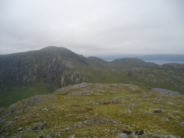
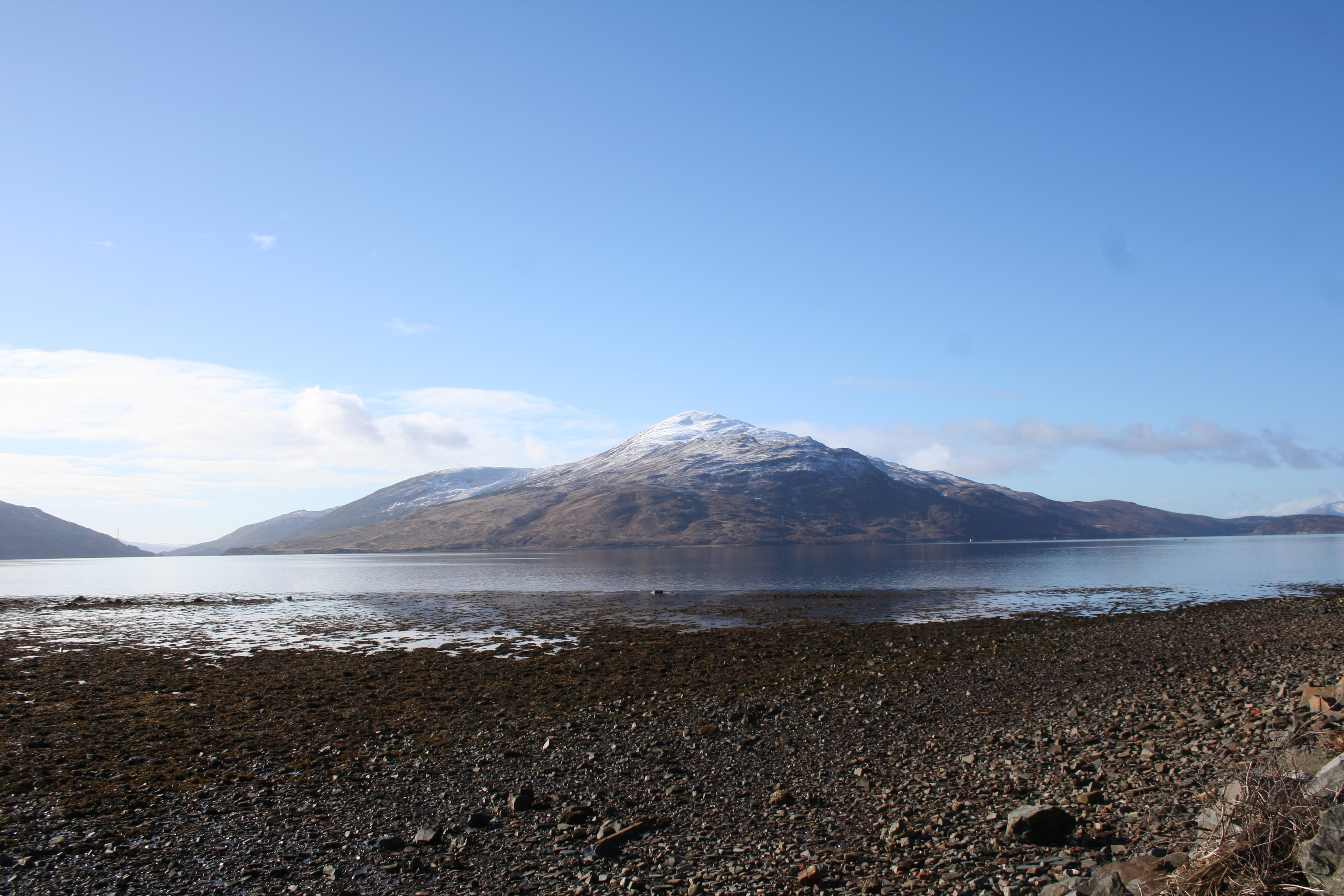
An Dìollaid is part of the Scottish Highlands, a region known for its rugged and picturesque landscapes. It is located in the northwest of Scotland, near the town of Ullapool. The mountain is characterized by its steep slopes, rocky terrain, and a distinctive peak that provides a sense of grandeur.

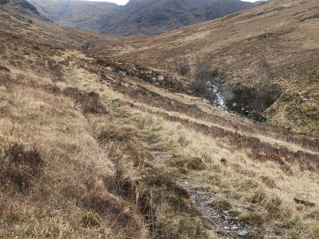
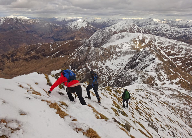
Climbing An Dìollaid requires a moderate to high level of fitness and experience in mountaineering. The ascent can be demanding, especially in adverse weather conditions, but the exhilarating views from the top make it all worthwhile. On a clear day, climbers are rewarded with panoramic vistas of the surrounding mountains, lochs, and glens, including the iconic Loch Broom.

The hill/mountain is also home to a variety of wildlife and plant species. Mountain hares, red deer, and golden eagles are often spotted in the area, adding to the sense of natural beauty and wilderness. The rugged landscape of An Dìollaid provides a unique opportunity for nature lovers and photographers to capture the essence of the Scottish Highlands.

While An Dìollaid presents a thrilling challenge for mountaineers, it is essential to plan and prepare adequately before attempting the climb. Local hiking guides and equipment rental services are available to ensure a safe and enjoyable experience.

If you have any feedback on the listing, please let us know in the comments section below.
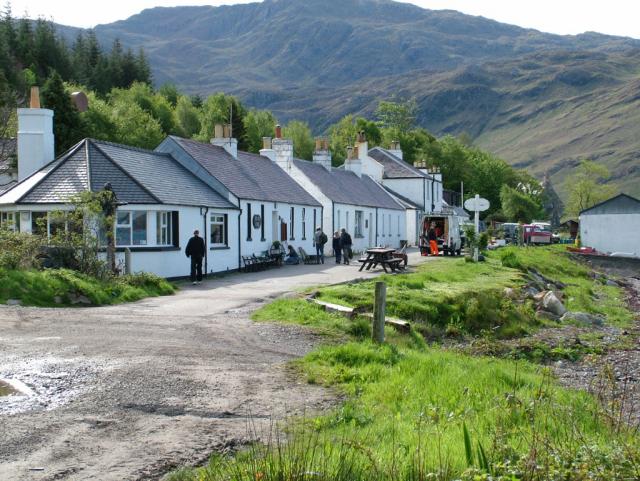
An Dìollaid Images

Images are sourced within 2km of 57.081581/-5.614226 or Grid Reference NG8104. Thanks to Geograph Open Source API. All images are credited.

The summit area of Mullach Li, Knoydart Mullach Li, 668m, is a minor summit on the north of the Knoydart peninsula. It is a Simm, but I don't think it features on any other hill list. The highest hill seen is the Corbett, Beinn na Caillich, 785m in NG7906, with its northern ridge to the right. In the distance is part of the Sleat peninsula on Skye.
The summit area of Mullach Li, Knoydart
Mullach Li, 668m, is a minor summit on the north of the Knoydart peninsula. It is a Simm, but I don't think it features on any other hill list. The highest hill seen is the Corbett, Beinn na Caillich, 785m in NG7906, with its northern ridge to the right. In the distance is part of the Sleat peninsula on Skye.
Ridge continuing westwards from summit of Ladhar Bheinn The ridge crest leaves Ladhar Bheinn's summit continuing at a high level to reach the mountain's trig point which unusually is not at the highest point. A path heading that way can be seen leaving the summit.
The distant mountains are the Black and Red Cuillins of Skye.
Ridge continuing westwards from summit of Ladhar Bheinn
The ridge crest leaves Ladhar Bheinn's summit continuing at a high level to reach the mountain's trig point which unusually is not at the highest point. A path heading that way can be seen leaving the summit. The distant mountains are the Black and Red Cuillins of Skye.
Path following the Allt Coire Torr an Asgaill
Path beside the Allt Coire Torr an Asgaill
Allt Coire Torr an Asgaill
Abhainn Beag "The wee river" Abhainn Beag drops into Glen Geuserein in a series of attractive waterfalls.  The slabby face of Beinn na Caillich in the background.
Abhainn Beag
"The wee river" Abhainn Beag drops into Glen Geuserein in a series of attractive waterfalls. The slabby face of Beinn na Caillich in the background.
Gleann na Guiserein View down from the crags above Garsley. There is a new plantation above the ruined Folach and a fine view of Beinn na Caillich.
Gleann na Guiserein
View down from the crags above Garsley. There is a new plantation above the ruined Folach and a fine view of Beinn na Caillich.
Abhainn Bheag On the bank of the Abhainn Bheag meaning small river heading north on a bitterly cold spring day.
Abhainn Bheag
On the bank of the Abhainn Bheag meaning small river heading north on a bitterly cold spring day.
Windy day on Ladhar Bheinn Looking down on Barrisdale Bay, Loch Hourn.
Windy day on Ladhar Bheinn
Looking down on Barrisdale Bay, Loch Hourn.
The summit ridge of Ladhar Bheinn
Stob a'Choire Odhair from Ladhar Bheinn ridge
Coire Gorm on the north face of Ladhar Bheinn
View WNW along summit ridge of Ladhar Bheinn The reward of the summit ridge
View WNW along summit ridge of Ladhar Bheinn
The reward of the summit ridge
Stob a Chiore Odhair from Ladhar Bheinn summit ridge
On Ladhar Bheinn summit ridge - View WNW towards trig point The trig point is some ten metres below the highest point on the ridge.
On Ladhar Bheinn summit ridge - View WNW towards trig point
The trig point is some ten metres below the highest point on the ridge.
On Ladhar Bheinn summit ridge - The trig point I can only imagine that the trig point has been shattered by a lightning strike.
On Ladhar Bheinn summit ridge - The trig point
I can only imagine that the trig point has been shattered by a lightning strike.
Ladhair Bheinn - South East Ridge Starting the descent of the south east ridge of Ladhair Bheinn.
Tricky conditions of hard snow and patches of frozen grass on one of the finest mountains in Scotland.
Ladhair Bheinn - South East Ridge
Starting the descent of the south east ridge of Ladhair Bheinn. Tricky conditions of hard snow and patches of frozen grass on one of the finest mountains in Scotland.
Ladhair Bheinn - View North East From the east summit of Ladhair Bheinn looking over the airy summit of Stob a' Choire Odhair to the fjiord like Loch Hourn and the distant mountains of Glen Shiel.
A grand place to be on Easter Sunday.
Ladhair Bheinn - View North East
From the east summit of Ladhair Bheinn looking over the airy summit of Stob a' Choire Odhair to the fjiord like Loch Hourn and the distant mountains of Glen Shiel. A grand place to be on Easter Sunday.
Show me another place!

An Dìollaid is located at Grid Ref: NG8104 (Lat: 57.081581, Lng: -5.614226)

Unitary Authority: Highland

Police Authority: Highlands and Islands

What 3 Words

///safari.puppets.downfield. Near Glenelg, Highland

Related Wikis

Ladhar Bheinn

Ladhar Bheinn is the highest mountain in the Knoydart region of the Highlands of Scotland. It is the most westerly Munro on the Scottish mainland. The...

Beinn na Caillich (Knoydart)

Beinn na Caillich (Scottish Gaelic for 'mountain of the old woman or Cailleach') is a mountain with a height of 732 metres (2,402 ft) in Knoydart, in the...

Knoydart

Knoydart (Scottish Gaelic: Cnòideart) is a peninsula in Lochaber, Highland, on the west coast of Scotland. Knoydart is sandwiched between Lochs Nevis...

The Rough Bounds

The Rough Bounds (Scottish Gaelic: Na Garbh Chriochan), in the Scottish Highlands, is the area of West Inverness-shire bounded by Loch Hourn, Loch Shiel...

Have you been to An Dìollaid?

Leave your review of An Dìollaid below (or comments, questions and feedback).