Creag a' Bhanan

Hill, Mountain in Argyllshire

Scotland

Creag a' Bhanan

Eilean Gabhar Eilean Gabhar. Eilean Righ in background.
Eilean Gabhar Credit: derek lockhart

Creag a' Bhanan is a prominent hill located in the region of Argyllshire, Scotland. Rising to an elevation of approximately 600 meters (1,969 feet), this mountain offers stunning panoramic views of the surrounding landscape.

Situated in a remote and rugged area, Creag a' Bhanan is characterized by its rocky terrain, heather-covered slopes, and scattered boulders. It forms part of the wider mountainous landscape of Argyllshire, which is renowned for its natural beauty and diverse wildlife.

The hill provides a challenging but rewarding hiking experience for outdoor enthusiasts. Its steep ascent, particularly on the eastern side, requires a moderate level of fitness and hiking experience. However, once at the summit, hikers are rewarded with breathtaking vistas of the surrounding glens, lochs, and mountains, including the iconic Ben Cruachan.

Creag a' Bhanan is also a haven for birdwatchers, with various avian species inhabiting the area. Golden eagles, peregrine falcons, and kestrels can often be spotted soaring above the hill, while the surrounding moorland attracts ground-nesting birds such as curlews and lapwings.

The hill is accessible from several starting points, with the most common being a car park situated to the south. From there, a well-defined trail leads hikers through a mixture of grassy slopes and rocky paths, gradually ascending towards the summit.

Overall, Creag a' Bhanan offers a challenging yet rewarding outdoor experience, allowing visitors to immerse themselves in the stunning natural beauty of Argyllshire while enjoying breathtaking views from its summit.

If you have any feedback on the listing, please let us know in the comments section below.

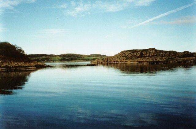
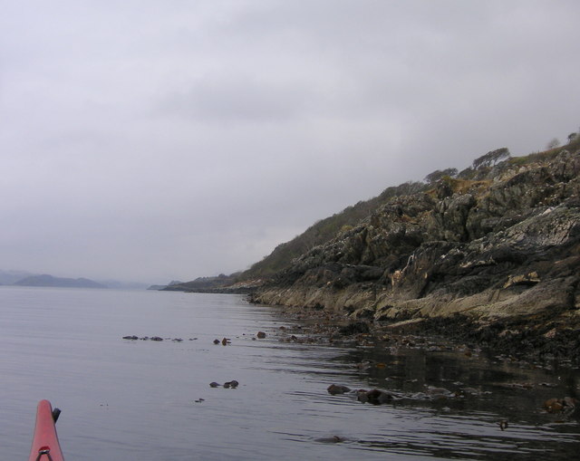
Creag a' Bhanan Images

Images are sourced within 2km of 56.135597/-5.5461286 or Grid Reference NR7999. Thanks to Geograph Open Source API. All images are credited.

Eilean Gabhar Eilean Gabhar. Eilean Righ in background.
Eilean Gabhar
Eilean Gabhar. Eilean Righ in background.
Shore of Loch Craignish A small bay on the eastern shore of Loch Craignish.
Shore of Loch Craignish
A small bay on the eastern shore of Loch Craignish.
Loch Craignish A view south-west down the loch looking towards the Sound of Jura.
Loch Craignish
A view south-west down the loch looking towards the Sound of Jura.
Loch Craignish Loch Craignish showing the reef between Eilean Righ (Royal Island - right) and Eilean Nan Gabhar (Island of Goats - left)
Loch Craignish
Loch Craignish showing the reef between Eilean Righ (Royal Island - right) and Eilean Nan Gabhar (Island of Goats - left)
Eilean Righ and Loch Craignish
Islands in Loch Craignish
Eileann nan Gbhar Island off the eastern shore of Loch Craignish. Craig a Bhanan <a href="https://www.geograph.org.uk/gridref/NR7899">NR7899</a> on the mainland beyond.
Eileann nan Gbhar
Island off the eastern shore of Loch Craignish. Craig a Bhanan NR7899 on the mainland beyond.
South East corner of Island Macaskin South East corner of Island Macaskin by Sea Kayak
South East corner of Island Macaskin
South East corner of Island Macaskin by Sea Kayak
West side of Island Macaskin. Looking Northwest up Loch Craignish.
West side of Island Macaskin.
Looking Northwest up Loch Craignish.
South East corner of Island Macaskin. The buildings are just inside the square.
South East corner of Island Macaskin.
The buildings are just inside the square.
Creag a' Bhanan View taken from a remote shore of Loch Craignish. Access by foot involves walking across the hills from Slockavulin and descending the 180m from the notch in the hill to the left of Creag a' Bhanan.
Creag a' Bhanan
View taken from a remote shore of Loch Craignish. Access by foot involves walking across the hills from Slockavulin and descending the 180m from the notch in the hill to the left of Creag a' Bhanan.
Loch Craignish A view from a remote part of the shore looking down the loch. The island on the right is Island Macaskin.
Loch Craignish
A view from a remote part of the shore looking down the loch. The island on the right is Island Macaskin.
Boundary wall The wall at this point starts its descent to the shore of Loch Craignish, some 180m below and behind the photographer.
Boundary wall
The wall at this point starts its descent to the shore of Loch Craignish, some 180m below and behind the photographer.
Moorland and wall This wall is clearly shown on the 1:25000 map. Four deer were grazing in the open, grassed area below the crag at the time the picture was taken.
Moorland and wall
This wall is clearly shown on the 1:25000 map. Four deer were grazing in the open, grassed area below the crag at the time the picture was taken.
A window in the wall Looking south towards the slopes, on the left, of Creag na h-Earbaige and, in the distance, the North Knapdale hills beyond Loch Crinan.
A window in the wall
Looking south towards the slopes, on the left, of Creag na h-Earbaige and, in the distance, the North Knapdale hills beyond Loch Crinan.
Creagan nam Buachaillean Creagan nam Buachaillean is the green hill in the left middle distance. Loch Craignish is visible further left. The central hill is Creag a'Bhanan and the one in the right distance is Garbh Shròn.
Creagan nam Buachaillean
Creagan nam Buachaillean is the green hill in the left middle distance. Loch Craignish is visible further left. The central hill is Creag a'Bhanan and the one in the right distance is Garbh Shròn.
Loch Craignish A view looking down the slopes of Creagan nam Buachaillean with Island Macaskin in  between this shore and the Craignish peninsula.
Loch Craignish
A view looking down the slopes of Creagan nam Buachaillean with Island Macaskin in between this shore and the Craignish peninsula.
North eastern coast of Macaskin
Show me another place!

Creag a' Bhanan is located at Grid Ref: NR7999 (Lat: 56.135597, Lng: -5.5461286)

Unitary Authority: Argyll and Bute

Police Authority: Argyll and West Dunbartonshire

What 3 Words

///spot.licks.swimsuits. Near Lochgilphead, Argyll & Bute

Nearby Locations

Creag a' Bhanan

Related Wikis

Island Macaskin

Island Macaskin or MacAskin (Scottish Gaelic: Eilean MhicAsgain) is an island in Loch Craignish, in the Inner Hebrides of Scotland. It is owned by the...

Loch Craignish

Loch Craignish is a sea loch on the mid-Argyll coast. == Geography == Loch Craignish lies between Oban and the Crinan Canal. Its opens into the Sound of...

Eilean Rìgh

Eilean Rìgh is an island in the Inner Hebrides of the west coast of Scotland. It lies in Loch Craignish, about 300 metres (1⁄8 mile) off the Argyll coastline...
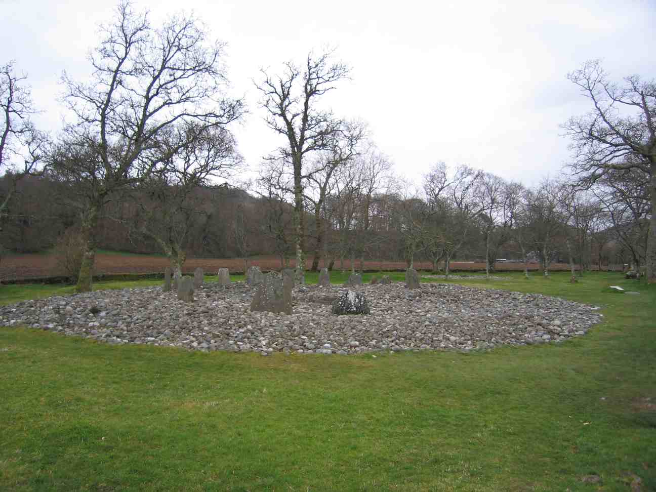
Temple Wood

Temple Wood (or Half Moon Wood) is an ancient site located in Kilmartin Glen, near Kintyre, Argyll, Scotland. The site includes two circles (north and...

Nearby Amenities

Located within 500m of 56.135597,-5.5461286
Source: PGS
Lat/Long: 56.1396243/-5.5489297
Source: PGS
Lat/Long: 56.1389932/-5.5490076
Source: PGS
Lat/Long: 56.1389429/-5.5487978
Source: PGS
Lat/Long: 56.1386937/-5.5487289
Source: PGS
Lat/Long: 56.1384168/-5.5486416
Source: PGS
Lat/Long: 56.1382619/-5.5489674
Created By: dmgroom_coastlines
Source: PGS
Lat/Long: 56.137916/-5.549617
Source: PGS
Lat/Long: 56.1377153/-5.5500518
Source: PGS
Lat/Long: 56.1374835/-5.5505654
Source: PGS
Lat/Long: 56.1371932/-5.5507497
Source: PGS
Lat/Long: 56.1370133/-5.5509573
Source: PGS
Lat/Long: 56.136874/-5.5510985
Source: PGS
Lat/Long: 56.1354789/-5.5516666
Source: PGS
Lat/Long: 56.1347374/-5.5518876
Source: PGS
Lat/Long: 56.1344719/-5.5520806
Source: PGS
Lat/Long: 56.1341212/-5.5522155
Source: PGS
Lat/Long: 56.1338582/-5.5535564
Creag a'Bhanan
Corbett: no
Ele: 202
Graham: no
Marilyn: no
Munro: no
Natural: peak
Lat/Long: 56.1354125/-5.5462977
The data included in this document is from www.openstreetmap.org. The data is made available under ODbL.

Have you been to Creag a' Bhanan?

Leave your review of Creag a' Bhanan below (or comments, questions and feedback).