Ballochan

Settlement in Aberdeenshire

Scotland

Ballochan

Night navigation The end of a very long day's walking in hectad NO59 - a view over the screen of my GPS in near darkness at Auchabrack farm, and a little over 2km remaining for me.
Night navigation Credit: William Starkey

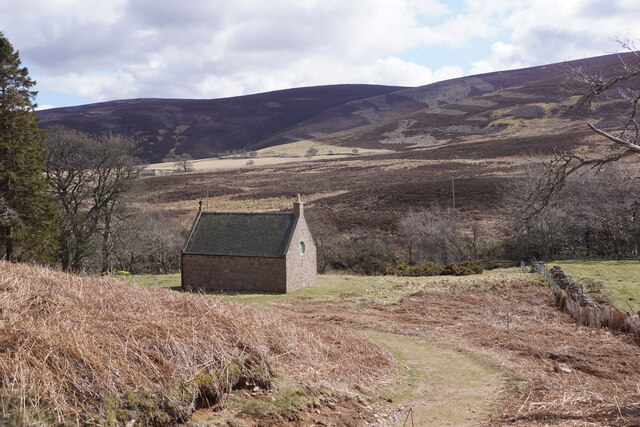
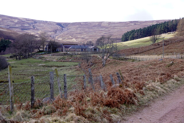
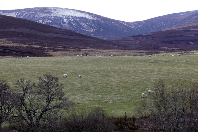
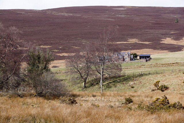
Ballochan is a small village located in Aberdeenshire, Scotland. Situated in the Deeside region, it is nestled between the towns of Aboyne and Ballater. The village is surrounded by picturesque landscapes, with rolling hills, lush green fields, and the stunning River Dee flowing nearby.

Ballochan has a charming and tranquil atmosphere, making it an ideal destination for those seeking a peaceful retreat. The village is home to a close-knit community, and its residents are known for their warm hospitality and friendly nature.

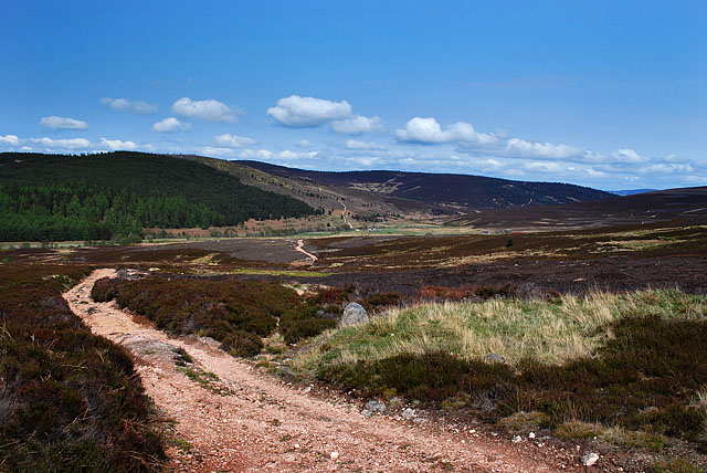
One of the notable features of Ballochan is its proximity to the Cairngorms National Park, which is a haven for outdoor enthusiasts. Visitors can indulge in various activities such as hiking, mountain biking, fishing, and wildlife spotting in the park. The area is also renowned for its breathtaking viewpoints, offering panoramic vistas of the surrounding mountains and valleys.

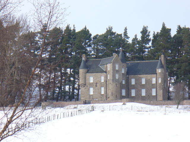
Despite its modest size, Ballochan has a rich history. The village boasts several historic buildings, including Ballochan House, a grand mansion that dates back to the 18th century. This architectural gem adds to the village's charm and serves as a reminder of its past.

Ballochan is also conveniently located near amenities and facilities. The nearby towns of Aboyne and Ballater offer a range of shops, restaurants, and leisure facilities that cater to both residents and visitors.

Overall, Ballochan is a tranquil and scenic village that offers a peaceful escape in the heart of Aberdeenshire. Its natural beauty, rich history, and friendly community make it a delightful place to visit or call home.

If you have any feedback on the listing, please let us know in the comments section below.

Ballochan Images

Images are sourced within 2km of 56.998656/-2.7917373 or Grid Reference NO5290. Thanks to Geograph Open Source API. All images are credited.

Night navigation The end of a very long day's walking in hectad NO59 - a view over the screen of my GPS in near darkness at Auchabrack farm, and a little over 2km remaining for me.
Night navigation
The end of a very long day's walking in hectad NO59 - a view over the screen of my GPS in near darkness at Auchabrack farm, and a little over 2km remaining for me.
Forest of Birse Kirk
Ballochan, Forest of Birse
Fields at Ballochan, Forest of Birse
Wester Floors, Forest of Birse
Heather Moor Afire, Feughside. Scotland can be dry even in spring. Here a man attempts to beat out some of the flames. Later, a helicopter dropped water bombs on the fire to extinguish it. Burning is used as a controlled method to regenerate the heather which is a valuable asset for grouse shooting.
Heather Moor Afire, Feughside.
Scotland can be dry even in spring. Here a man attempts to beat out some of the flames. Later, a helicopter dropped water bombs on the fire to extinguish it. Burning is used as a controlled method to regenerate the heather which is a valuable asset for grouse shooting.
Fungle Road South of Ballochan Taken during a light snow flurry. The wide track, about six feet across, follows a former drove road between Deeside and Tarfside. Snow is lying about 2 inches deep here at elevation of some 255 metres. Along the skyline hills is the watershed between Aberdeenshire and Angus.
Fungle Road South of Ballochan
Taken during a light snow flurry. The wide track, about six feet across, follows a former drove road between Deeside and Tarfside. Snow is lying about 2 inches deep here at elevation of some 255 metres. Along the skyline hills is the watershed between Aberdeenshire and Angus.
The Fungle, East of Auchnashinn Taken during a short and sharp blizzard which obliterated footsteps in the snow after 10 minutes. Looking south along the former drove road between Deeside and Tarfside. The track is about 6 feet wide and crosses heathery Feughside moors here. Elevation is some 265 metres and snow on the track is about 2 inches deep. The blizzards from the north lasted about 15 minutes, soon replaced by long clear spells - on that day!
The Fungle, East of Auchnashinn
Taken during a short and sharp blizzard which obliterated footsteps in the snow after 10 minutes. Looking south along the former drove road between Deeside and Tarfside. The track is about 6 feet wide and crosses heathery Feughside moors here. Elevation is some 265 metres and snow on the track is about 2 inches deep. The blizzards from the north lasted about 15 minutes, soon replaced by long clear spells - on that day!
White Hill A white White Hill on Upper Feughside, near Ballochan, clearly showing strips where heather has been peeled off.
White Hill
A white White Hill on Upper Feughside, near Ballochan, clearly showing strips where heather has been peeled off.
Track to White Hill
Track to White Hill
Forest of Birse near Knockie Birse Castle is in the distance.
Forest of Birse near Knockie
Birse Castle is in the distance.
Langderick Burn The burn drains the west side of White Hill
Langderick Burn
The burn drains the west side of White Hill
Track to White Hill climbing from the Forest of Birse
Track approaching the summit of White Hill
Spaghetti Junction
Spaghetti Junction
View north to Birse Castle from Burn of Allanstank
Burn of Auldmad
Burn of Auldmad
The Water of Feugh above Ballochan
Show me another place!

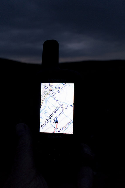
Ballochan is located at Grid Ref: NO5290 (Lat: 56.998656, Lng: -2.7917373)

Unitary Authority: Aberdeenshire

Police Authority: North East

What 3 Words

///absorbing.tingled.gobblers. Near Aboyne, Aberdeenshire

Nearby Locations

Ballochan

Related Wikis

Birse Castle

Birse Castle is located in the Forest of Birse, Aberdeenshire, Scotland. Originally a square tower house, it was rebuilt in the first decade of the 20th...

Forest of Birse

The Forest of Birse is a remote upland area in the upper catchment of the Water of Feugh, which forms the south-western portion of the Parish of Birse...

Mount Battock

Mount Battock (778 m) is a mountain in the Mounth on the eastern edge of the Scottish Highlands, on the border between Aberdeenshire and Angus. A rounded...

Glen Tanar

Glen Tanar (Scottish Gaelic: Gleann Tanar) is a glen in Aberdeenshire, eastern Scotland, through which the Water of Tanar flows. Near the mouth of the...

Nearby Amenities

Located within 500m of 56.998656,-2.7917373
Ford: yes
Lat/Long: 56.9946793/-2.7923575
Cronach
Place: locality
Lat/Long: 56.9997866/-2.7842296
Bruntland
Place: locality
Lat/Long: 56.9994681/-2.7892024
Ford: yes
Lat/Long: 56.9950035/-2.7899975
Ford: yes
Lat/Long: 57.0012201/-2.7884982
The data included in this document is from www.openstreetmap.org. The data is made available under ODbL.

Have you been to Ballochan?

Leave your review of Ballochan below (or comments, questions and feedback).