Airigh Achadh dà Mhaoilein
Hill, Mountain in Argyllshire
Scotland
Airigh Achadh dà Mhaoilein

Airigh Achadh dà Mhaoilein, located in Argyllshire, Scotland, is a prominent hill/mountain that offers breathtaking views and a variety of natural features. Standing at an impressive height of 702 meters (2303 feet), it is a popular destination for hikers and outdoor enthusiasts.
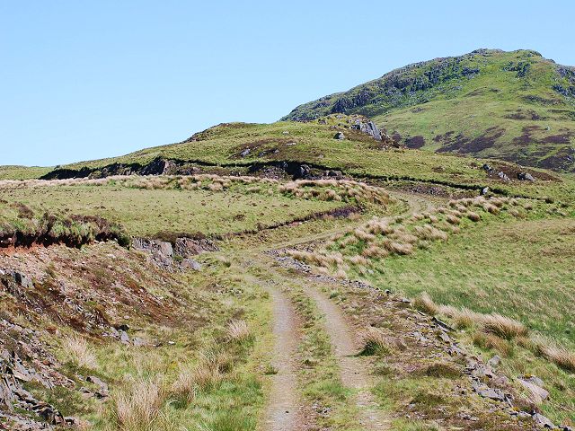
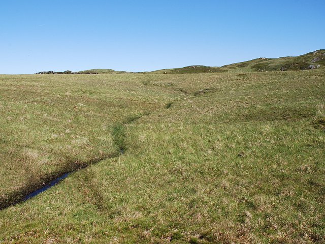
The landscape of Airigh Achadh dà Mhaoilein is characterized by rugged terrain, with steep slopes and rocky outcrops. The hill/mountain is part of the Arrochar Alps, a range known for its dramatic peaks and glens. From the summit, visitors are rewarded with panoramic vistas of Loch Long and the surrounding mountains, including the iconic Cobbler.
The ascent to Airigh Achadh dà Mhaoilein can be challenging, with some sections requiring scrambling and a good level of fitness. However, the effort is well worth it, as the views from the top are truly awe-inspiring. On a clear day, the Isle of Arran and even the distant peaks of the Scottish Highlands can be seen.
The hill/mountain is also home to a diverse range of flora and fauna. Rare alpine plants, such as saxifrages and moss campion, can be found on its slopes, adding to its natural beauty. Wildlife enthusiasts may spot golden eagles soaring above, or red deer grazing in the lower valleys.
Overall, Airigh Achadh dà Mhaoilein is a magnificent hill/mountain that offers a challenging yet rewarding hiking experience. Its striking landscapes, breathtaking views, and rich biodiversity make it a must-visit destination for nature lovers and adventure seekers in Argyllshire.
If you have any feedback on the listing, please let us know in the comments section below.
Airigh Achadh dà Mhaoilein Images
Images are sourced within 2km of 55.908729/-5.5540716 or Grid Reference NR7774. Thanks to Geograph Open Source API. All images are credited.


Airigh Achadh dà Mhaoilein is located at Grid Ref: NR7774 (Lat: 55.908729, Lng: -5.5540716)
Unitary Authority: Argyll and Bute
Police Authority: Argyll and West Dunbartonshire
What 3 Words
///labs.bronzer.newlywed. Near Tarbert, Argyll & Bute
Nearby Locations
Related Wikis
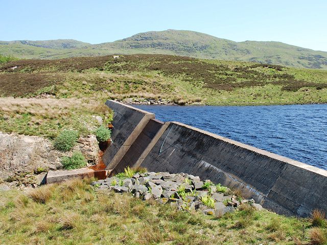
Loch A' Chaorainn
Loch A' Chaorainn (Loch of the Rowan) is an impounding reservoir which lies 9 kilometres (5.6 mi) north west of Tarbert. The concrete dam is 8.2 metres...
Achahoish
Achahoish (Scottish Gaelic: Achadh a’ Chòis) is a village on the west coast of Knapdale in the Scottish council area of Argyll and Bute. In 1882, Wilson...

Ormsary
Ormsary (Scottish Gaelic: Ormsaraidh) is a hamlet in Knapdale, Argyll and Bute, Scotland. == References ==
Baile Boidheach
Baile Boidheach (Scottish Gaelic: Am Baile Bòidheach) is a hamlet in Argyll and Bute, Scotland.
Have you been to Airigh Achadh dà Mhaoilein?
Leave your review of Airigh Achadh dà Mhaoilein below (or comments, questions and feedback).