An Cuaidh

Hill, Mountain in Ross-shire

Scotland

An Cuaidh

Moorland above Loch nan Eun Typical of the area, peat hags and scattered rock outcrops bring variety to the moorland scene. The mountains of Letterewe Forest are on the left.
Moorland above Loch nan Eun Credit: Alan Reid

An Cuaidh is a prominent hill located in Ross-shire, Scotland. Rising to a height of 764 meters (2,507 feet), it is classified as a Corbett, which means it falls just short of being classified as a Munro, the higher category of Scottish mountains.

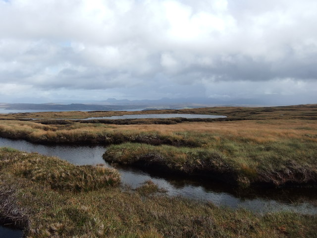
Situated in the picturesque region of Wester Ross, An Cuaidh is known for its rugged and steep slopes, offering stunning panoramic views of the surrounding landscapes. Its location near the coast allows for breathtaking vistas of the nearby Loch Broom and the vast expanse of the Atlantic Ocean.

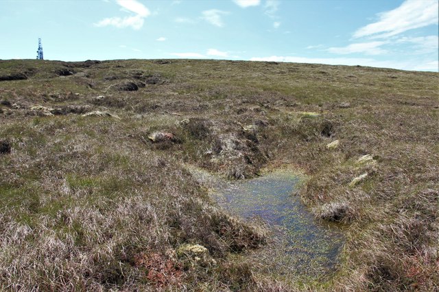
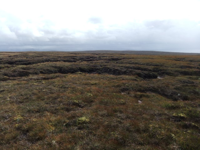
The hill is renowned for its diverse flora and fauna, attracting nature enthusiasts and hikers alike. The lower slopes are covered in lush, green vegetation, while the higher elevations are characterized by rocky outcrops and heather moorland. This varied terrain provides a habitat for a wide range of plant species, including purple saxifrage, mountain avens, and dwarf juniper.

An Cuaidh is a popular destination for outdoor activities such as hillwalking, scrambling, and climbing. Its challenging ascent offers a rewarding experience for experienced hikers, who can enjoy the stunning vistas once they reach the summit. The hill is also a great spot for birdwatching, with species such as golden eagles, peregrine falcons, and buzzards frequently spotted in the area.

Overall, An Cuaidh is a magnificent hill in Ross-shire, offering a blend of rugged beauty, diverse wildlife, and breathtaking views, making it a must-visit location for nature enthusiasts and adventurers.

If you have any feedback on the listing, please let us know in the comments section below.

An Cuaidh Images

Images are sourced within 2km of 57.835646/-5.7666419 or Grid Reference NG7689. Thanks to Geograph Open Source API. All images are credited.

Moorland above Loch nan Eun Typical of the area, peat hags and scattered rock outcrops bring variety to the moorland scene. The mountains of Letterewe Forest are on the left.
Moorland above Loch nan Eun
Typical of the area, peat hags and scattered rock outcrops bring variety to the moorland scene. The mountains of Letterewe Forest are on the left.
Bogbean emerging from a moorland pool Loch Ewe and the remote Fisherfield Forest mountains on the left.
Bogbean emerging from a moorland pool
Loch Ewe and the remote Fisherfield Forest mountains on the left.
Bog on Maol Breac Communication mast on the top.
Bog on Maol Breac
Communication mast on the top.
Tree over the track This section of the track is somewhat more solid underfoot than the rest of this track which in many places seems to be somewhat more lake than ground.
Tree over the track
This section of the track is somewhat more solid underfoot than the rest of this track which in many places seems to be somewhat more lake than ground.
Crossing the bog towards the masts
Track at the base of Maol Breac This track runs from <a href="https://www.geograph.org.uk/photo/3671524">NG7691 : Ivors Bothy</a> and <a href="https://www.geograph.org.uk/photo/79957">NG7690 : Shed and ruin at Loch an Draing</a> to Midtown.
Track at the base of Maol Breac
This track runs from NG7691 : Ivors Bothy and NG7690 : Shed and ruin at Loch an Draing to Midtown.
More grassy bog
More grassy bog
Fiorloch
Fiorloch
Trig pillar, An Cuaidh
Masts, Maol Breac
Masts, Maol Breac
Track towards the northernmost mast
Mast on Maol Breac One of the telecommunications masts on the low summit of Maol Breac is seen here. The picture looks west and the north end of Skye is on the horizon.
Mast on Maol Breac
One of the telecommunications masts on the low summit of Maol Breac is seen here. The picture looks west and the north end of Skye is on the horizon.
Summit area of An Cuaidh An Cuaidh is moorland hill on a peninsula between Loch Ewe and The Minch. The distant masts lie to the north and are on Maol Breac.
Summit area of An Cuaidh
An Cuaidh is moorland hill on a peninsula between Loch Ewe and The Minch. The distant masts lie to the north and are on Maol Breac.
Peat bog on An Cuaidh
A fresh breeze ruffles a moorland pool on Maol Breac Red Hills and Cuillins on Skye make a distant horizon.
A fresh breeze ruffles a moorland pool on Maol Breac
Red Hills and Cuillins on Skye make a distant horizon.
Moorland north of Allt a' Bhùtha Rough, desolate moorland north of the minor stream, Allt a' Bhùtha, en route for the trig point at An Cuaidh.
The Trotternish peninsula of Skye is visible out to sea.
Moorland north of Allt a' Bhùtha
Rough, desolate moorland north of the minor stream, Allt a' Bhùtha, en route for the trig point at An Cuaidh. The Trotternish peninsula of Skye is visible out to sea.
Loch an Draing The Loch occupies most of the grid square.  The views to the distant mountains were really excellent today the snowy peaks catching the sun the whole time.  One for the stylists as well!
Loch an Draing
The Loch occupies most of the grid square. The views to the distant mountains were really excellent today the snowy peaks catching the sun the whole time. One for the stylists as well!
Shed and ruin at Loch an Draing There are a number of ruins here, the one shown looks like it was a reasonable house.  The shed looks like it's used by a shepherd for temporary shelter.
Shed and ruin at Loch an Draing
There are a number of ruins here, the one shown looks like it was a reasonable house. The shed looks like it's used by a shepherd for temporary shelter.
Show me another place!

An Cuaidh is located at Grid Ref: NG7689 (Lat: 57.835646, Lng: -5.7666419)

Unitary Authority: Highland

Police Authority: Highlands and Islands

What 3 Words

///files.undertook.brick. Near Gairloch, Highland

Nearby Locations

Fiorloch An Cuaidh

Related Wikis

Melvaig

Melvaig is a remote village on the coast of western Ross-shire, Scottish Highlands and is in the Scottish council area of Highland. It is a cliff top...

Rua Reidh Lighthouse

Rua Reidh Lighthouse stands close to the entrance to Loch Ewe in Wester Ross, Scotland. == History == The name "Rua Reidh" is a semi-anglicisation of...

Aultgrishan

Aultgrishan (Gaelic: ) is a small crofting community near Gairloch, Ross-shire. It adjoins Melvaig, within Highland region and is in the Scottish council...

Cove, Highland

Cove is a remote hamlet located on the northwestern shore of the sea loch Loch Ewe, and 8 mi (13 km) northwest of Poolewe in Ross-shire, Scottish Highlands...

Nearby Amenities

Located within 500m of 57.835646,-5.7666419
An Cuaidh
Corbett: no
Ele: 296
Graham: no
Marilyn: yes
Munro: no
Natural: peak
Prominence: 161
Lat/Long: 57.8354732/-5.7672176
The data included in this document is from www.openstreetmap.org. The data is made available under ODbL.

Have you been to An Cuaidh?

Leave your review of An Cuaidh below (or comments, questions and feedback).