A' Mhaol Odhar

Hill, Mountain in Argyllshire

Scotland

A' Mhaol Odhar

Rough ground at Ceann Loch Caolisport Rough ground at Ceann Loch Caolisport.
Rough ground at Ceann Loch Caolisport Credit: Colin Kinnear

A' Mhaol Odhar, located in Argyllshire, Scotland, is a prominent hill/mountain that offers breathtaking views and a captivating landscape. Standing at an impressive height of approximately 708 meters (2,323 feet), A' Mhaol Odhar is a popular destination for outdoor enthusiasts and nature lovers.

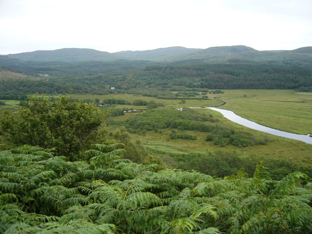
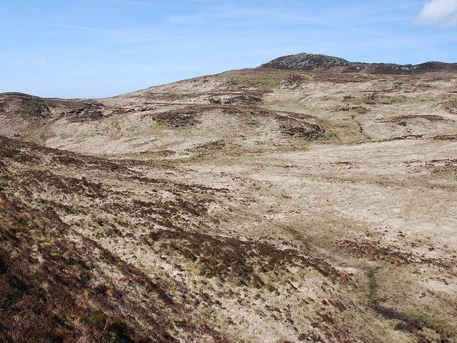
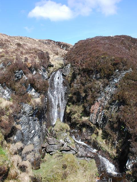
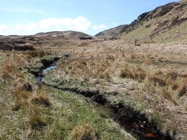
The hill/mountain is situated in a rural area, surrounded by verdant valleys, rolling hills, and sparkling lochs, which add to its charm and allure. Its distinctive shape and rugged terrain make it a distinctive landmark in the region.

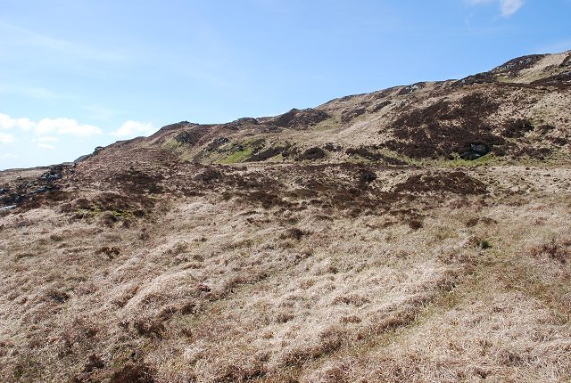
The ascent to the summit of A' Mhaol Odhar is relatively challenging, requiring hikers to navigate steep inclines and rocky paths. However, the rewards for reaching the top are well worth the effort. On a clear day, visitors are treated to breathtaking panoramic views of the surrounding landscape, including the vast expanse of Loch Awe and the nearby Munros.

The hill/mountain also boasts a rich natural heritage, with a variety of flora and fauna residing in its slopes. Rare plant species, such as the mountain avens and alpine meadowsweet, can be found dotting the hillside. The area is also home to a diverse range of wildlife, including red deer, mountain hares, and golden eagles.

Whether it be for hiking, nature photography, or simply immersing oneself in the tranquil beauty of the Scottish Highlands, A' Mhaol Odhar is a must-visit destination for those seeking an unforgettable outdoor experience.

If you have any feedback on the listing, please let us know in the comments section below.

A' Mhaol Odhar Images

Images are sourced within 2km of 55.956176/-5.5878648 or Grid Reference NR7679. Thanks to Geograph Open Source API. All images are credited.

Rough ground at Ceann Loch Caolisport Rough ground at Ceann Loch Caolisport.
Rough ground at Ceann Loch Caolisport
Rough ground at Ceann Loch Caolisport.
Country near Achahoish
The Lochead Chalets on Loch Caolisport
Looking down on Linne Mhic Chairn
Corr Bhan trig point The Ordnance Survey flush bracket benchmark embedded in this triangulation pillar has serial number 10376. More details at <span class="nowrap"><a title="http://www.trigpointinguk.com/trigs/trig-details.php?t=2420" rel="nofollow ugc noopener" href="http://www.trigpointinguk.com/trigs/trig-details.php?t=2420">Link</a><img style="margin-left:2px;" alt="External link" title="External link - shift click to open in new window" src="https://s1.geograph.org.uk/img/external.png" width="10" height="10"/></span>
The local geology is shown with hard ridges separated by loch-filled troughs.
The view includes NW Knapdale, Sound of Jura, Jura, Scarba and Craignish.
Corr Bhan trig point
The Ordnance Survey flush bracket benchmark embedded in this triangulation pillar has serial number 10376. More details at LinkExternal link The local geology is shown with hard ridges separated by loch-filled troughs. The view includes NW Knapdale, Sound of Jura, Jura, Scarba and Craignish.
Minor road to Lochead at Linne Mhic Chairn Looking south-eastward.
Minor road to Lochead at Linne Mhic Chairn
Looking south-eastward.
Meadow and river bluff Looking up the valley of Allt Cinn-locha towards Creag Raonuill. The river runs behind the trees to the right.
Meadow and river bluff
Looking up the valley of Allt Cinn-locha towards Creag Raonuill. The river runs behind the trees to the right.
Allt Creag Raonuill A view up the lovely valley of the Allt Creag Raonuill from across Gleann Cinn-locha. A sheepfold can be seen in the right-hand field.
Allt Creag Raonuill
A view up the lovely valley of the Allt Creag Raonuill from across Gleann Cinn-locha. A sheepfold can be seen in the right-hand field.
North Knapdale Moorland Typical moorland on North Knapdale, looking north towards Cruach Lusach.
North Knapdale Moorland
Typical moorland on North Knapdale, looking north towards Cruach Lusach.
Old electric fence The legend on the plate reads "Warning. Norman permanent electric fence". No trace of the fence now remains, apart from these posts.
Old electric fence
The legend on the plate reads "Warning. Norman permanent electric fence". No trace of the fence now remains, apart from these posts.
Gleann Tarsuinn A view down Gleann Tarsuinn from the flank of the ridge that runs on its western side.
Gleann Tarsuinn
A view down Gleann Tarsuinn from the flank of the ridge that runs on its western side.
Corr Bhan-Mor A view across moorland to Corr Bhan-Mor.
Corr Bhan-Mor
A view across moorland to Corr Bhan-Mor.
Stream confluence A confluence of two small burns, marked on the map.
Stream confluence
A confluence of two small burns, marked on the map.
North Knapdale moorland Typical moorland above Achahoish. There were several deer grazing in the area at the time of the visit.
North Knapdale moorland
Typical moorland above Achahoish. There were several deer grazing in the area at the time of the visit.
Waterfall in Gleann Tarsuinn This waterfall makes the last of the descent for a burn running down from moorland to the west as it runs into Gleann Tarsuinn.
Waterfall in Gleann Tarsuinn
This waterfall makes the last of the descent for a burn running down from moorland to the west as it runs into Gleann Tarsuinn.
Gleann Tarsuinn Looking north-east up this moorland glen.
Gleann Tarsuinn
Looking north-east up this moorland glen.
Gleann Tarsuinn A view down the glen. The post on the right is the remains of an electric fence that once enclosed a large area around Gleann Cinn-locha.
Gleann Tarsuinn
A view down the glen. The post on the right is the remains of an electric fence that once enclosed a large area around Gleann Cinn-locha.
Allt Creag Raonuill The upper reaches of the Allt Creag Raonuill, looking down into Gleann Cinn-locha.
Allt Creag Raonuill
The upper reaches of the Allt Creag Raonuill, looking down into Gleann Cinn-locha.
Show me another place!

A' Mhaol Odhar is located at Grid Ref: NR7679 (Lat: 55.956176, Lng: -5.5878648)

Unitary Authority: Argyll and Bute

Police Authority: Argyll and West Dunbartonshire

What 3 Words

///gear.innovator.caps. Near Ardrishaig, Argyll & Bute

Related Wikis

Achahoish

Achahoish (Scottish Gaelic: Achadh a’ Chòis) is a village on the west coast of Knapdale in the Scottish council area of Argyll and Bute. In 1882, Wilson...
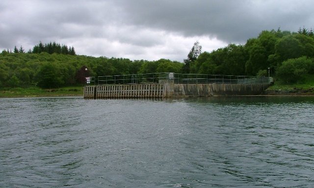
Loch Sween

Loch Sween (Scottish Gaelic: Loch Suain or Loch Suibhne) is a sea loch located near Lochgilphead, Argyll and Bute, Scotland. Castle Sween is located on...
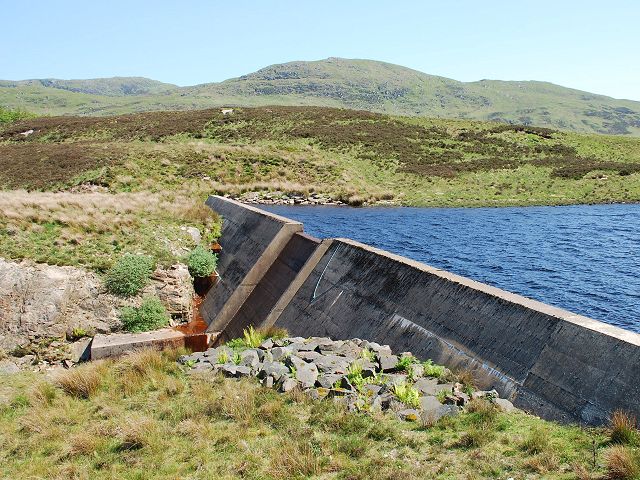
Loch A' Chaorainn

Loch A' Chaorainn (Loch of the Rowan) is an impounding reservoir which lies 9 kilometres (5.6 mi) north west of Tarbert. The concrete dam is 8.2 metres...

Eilean Loain

Eilean Loain is a small island in Loch Sween and one of the Inner Hebrides of Scotland. It is about 2 kilometres (1 mi) west of the settlement of Kilmichael...

Have you been to A' Mhaol Odhar?

Leave your review of A' Mhaol Odhar below (or comments, questions and feedback).