Àird Luing
Hill, Mountain in Argyllshire
Scotland
Àird Luing
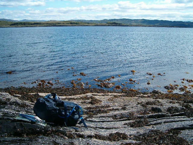
![Sound of Luing The view westwards from a minor headland on the west coast of Luing, overlooking the Sound of Luing with the islands of Scarba [left] and Lunga [right]. The gap between the two is named as Bealach a Choin Ghlais and is often referred to as 'Little Corryvreckan' due to the strong tides and narrowness of the channel. Few yachtsmen would risk passing through this gap under sail, a motor being necessary to control a boat in 8 knot tides.](https://s3.geograph.org.uk/geophotos/02/54/79/2547923_1d573159.jpg)
Àird Luing is a prominent hill located in Argyllshire, Scotland. Situated on the Isle of Luing, it is a notable landmark in the region. Rising to a height of approximately 313 meters (1,027 feet), it offers stunning panoramic views of the surrounding landscape.
The hill is characterized by its rugged terrain, with steep slopes and rocky outcrops. Its distinctive shape and prominent position make it easily recognizable from afar. The summit of Àird Luing is marked by a trig point and is accessible via various walking trails that wind their way up the hillside.
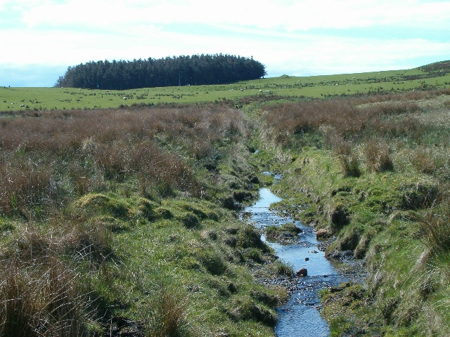
The area surrounding Àird Luing is rich in natural beauty. The hill overlooks the picturesque Sound of Luing, offering breathtaking vistas of the sea and neighboring islands. The diverse flora and fauna found in the region add to its appeal, with heather, gorse, and wildflowers dotting the landscape.
The hill is also of historical significance, with evidence of ancient settlements and structures in the vicinity. Archaeological remains, such as standing stones and burial cairns, hint at the hill's past as a site of human activity and possibly ritual significance.
Àird Luing is a popular destination for outdoor enthusiasts and nature lovers. Hiking and hillwalking are common activities, as visitors are drawn to the challenge of reaching the summit and the rewarding views that await them. The hill's accessibility and proximity to other attractions in Argyllshire make it a must-visit location for those exploring the area.
If you have any feedback on the listing, please let us know in the comments section below.
Àird Luing Images
Images are sourced within 2km of 56.194893/-5.6394782 or Grid Reference NM7406. Thanks to Geograph Open Source API. All images are credited.


Àird Luing is located at Grid Ref: NM7406 (Lat: 56.194893, Lng: -5.6394782)
Unitary Authority: Argyll and Bute
Police Authority: Argyll and West Dunbartonshire
What 3 Words
///scout.recital.series. Near Lochgilphead, Argyll & Bute
Nearby Locations
Related Wikis

Shuna, Slate Islands
Shuna (Scottish Gaelic: Siuna) is one of the Slate Islands lying east of Luing on the west coast of Scotland. == History == In 1815, James Yates, a Glasgow...

Luing
Luing ( LING; Scottish Gaelic: Luinn) is one of the Slate Islands, Firth of Lorn, in the west of Argyll in Scotland, about 16 miles (26 km) south of Oban...

Ardinamir
Ardinamir is an anchorage and small settlement on the island of Luing in Argyll and Bute, Scotland. == References ==

Lunga, Firth of Lorn
Lunga is one of the Slate Islands in the Firth of Lorn in Argyll and Bute, Scotland. The "Grey Dog" tidal race, which runs in the sea channel to the south...

Scarba, Lunga and the Garvellachs National Scenic Area
Scarba, Lunga and the Garvellachs is the name of one of the 40 national scenic areas of Scotland. The designated area covers the islands of Scarba, Lunga...
Craobh Haven
Craobh Haven Scottish Gaelic pronunciation: [kɾɯːv] is a small purpose-built village and sailing port on the west coast of Argyll and Bute, Scotland. It...

Craignish Castle
Craignish Castle is located on the Craignish peninsula in Argyll, western Scotland and is a category B listed building. The present castle includes a 16th...

Craignish
Craignish (Scottish Gaelic, Creiginis) is a peninsula in Argyll, on the west coast of Scotland. It lies around 25 miles (40 km) south of Oban, and 10 miles...
Nearby Amenities
Located within 500m of 56.194893,-5.6394782Have you been to Àird Luing?
Leave your review of Àird Luing below (or comments, questions and feedback).