Achinhoan Hill
Hill, Mountain in Argyllshire
Scotland
Achinhoan Hill

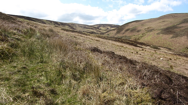
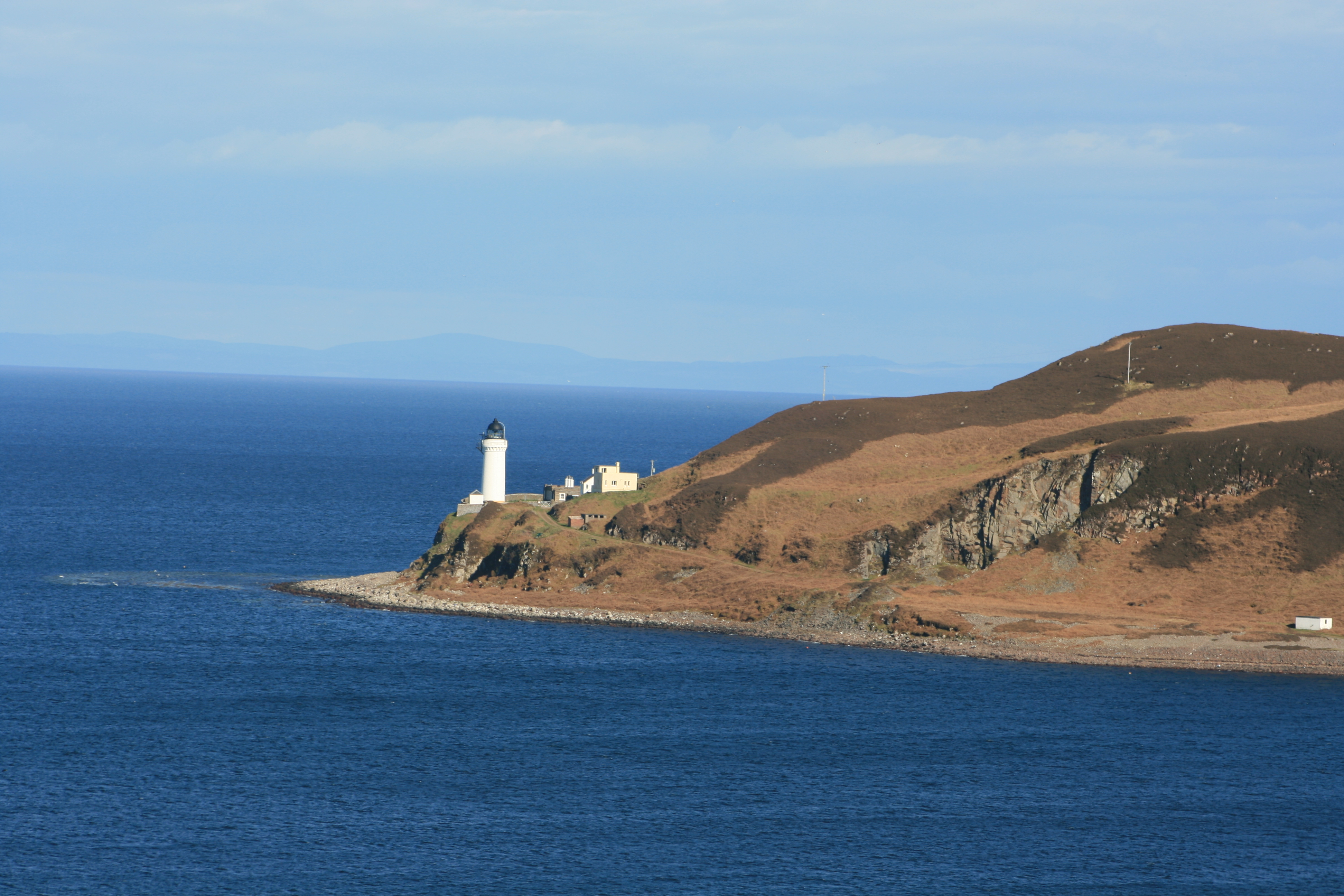
Achinhoan Hill is a prominent landmark located in Argyllshire, Scotland. Situated in the picturesque countryside, this hill stands tall at an approximate height of 476 meters (1,562 feet) above sea level. It is part of the larger mountain range known as the Argyll Forest Park, which covers a vast area of the western Highlands.
The hill offers stunning panoramic views of the surrounding landscape, making it a popular destination for hikers and outdoor enthusiasts. Its distinctive shape and rugged terrain add to its appeal, providing a challenging yet rewarding experience for those who venture to its summit.
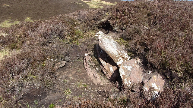
The ascent to Achinhoan Hill presents a variety of natural features, including grassy slopes, rocky outcrops, and heather-covered moorland. The path leading to the top is well-marked, ensuring a safe and enjoyable journey for visitors. Along the way, one can encounter an abundance of wildlife, such as red deer, golden eagles, and various species of birds.
Upon reaching the summit, visitors are rewarded with breathtaking views of the surrounding Argyllshire countryside, including the nearby Loch Eck and the distant peaks of the Arrochar Alps. On clear days, it is even possible to catch a glimpse of the Isle of Arran and the Kintyre Peninsula.
Achinhoan Hill is a true gem of Argyllshire, offering a unique blend of natural beauty, tranquility, and adventure for those who choose to explore its slopes. Whether for a leisurely hike or a challenging climb, this majestic hill is sure to leave a lasting impression on all who visit.
If you have any feedback on the listing, please let us know in the comments section below.
Achinhoan Hill Images
Images are sourced within 2km of 55.392027/-5.5712596 or Grid Reference NR7316. Thanks to Geograph Open Source API. All images are credited.


Achinhoan Hill is located at Grid Ref: NR7316 (Lat: 55.392027, Lng: -5.5712596)
Unitary Authority: Argyll and Bute
Police Authority: Argyll and West Dunbartonshire
What 3 Words
///walls.resold.lads. Near Campbeltown, Argyll & Bute
Nearby Locations
Related Wikis

Achinhoan
Achinhoan is a settlement on the Kintyre peninsula in Argyll and Bute, Scotland. It consists of a handful of buildings, half a mile (one km) west of Achinhoan...
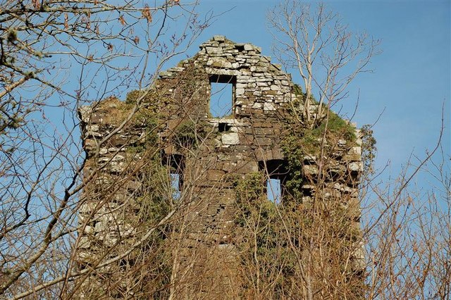
Kilkerran Castle
Kilkerran Castle is a ruined castle, near Campbeltown, Kintyre, Argyll and Bute, Scotland. == History == A keep was built in 1490 by King James IV, for...

Crosshill Loch
Crosshill Loch is an impounding reservoir, located 1 kilometre south of the centre of Campbeltown, and is the source of water for the town's Whisky Distilleries...
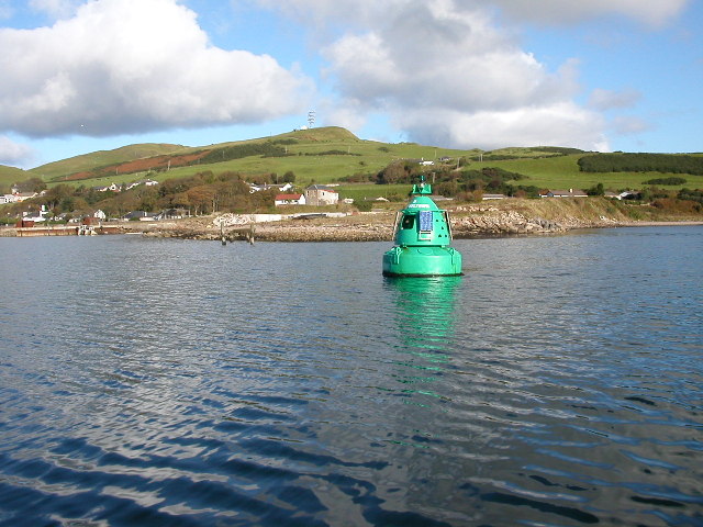
Campbeltown Loch
Campbeltown Loch (Scottish Gaelic: Loch Chille Chiarain) is a small sea loch near the south of the Kintyre Peninsula facing eastwards towards the Firth...

Campbeltown Hospital
Campbeltown Hospital is a community hospital in Ralston Road, Campbeltown, Scotland. It is managed by NHS Highland. == History == The facility has its...
Island Davaar
Island Davaar or Davaar Island (Scottish Gaelic: Eilean Dà Bhàrr) is located at the mouth of Campbeltown Loch off the east coast of Kintyre, in Argyll...
Lochend Castle, Campbeltown
Lochend Castle (Scottish Gaelic: Caislen Cean Loch, Anglicised Castle of the loch end), was a castle located at Campbeltown, Argyll and Bute. The castle...
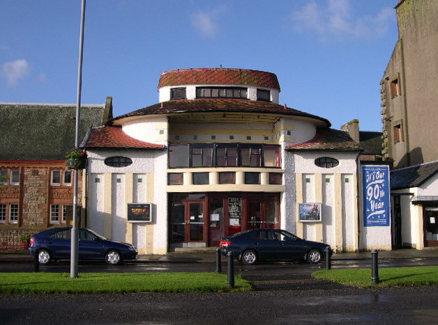
Campbeltown Picture House
The Campbeltown Picture House is a theatre located in Campbeltown, Scotland. Opened in 1913, it was one of the first purpose-built cinemas in Scotland...
Nearby Amenities
Located within 500m of 55.392027,-5.5712596Have you been to Achinhoan Hill?
Leave your review of Achinhoan Hill below (or comments, questions and feedback).