Carn Llidi

Hill, Mountain in Pembrokeshire

Wales

Carn Llidi

Carnedd Lleithr A view of Carnedd Lleithr which forms part of the headland of St David's Head, the headland is in the care of the National Trust.
Carnedd Lleithr Credit: Chris McAuley

Carn Llidi is a prominent hill located in the county of Pembrokeshire, Wales. Standing at an elevation of 181 meters (594 feet), it is situated near the popular coastal town of St Davids. The name "Carn Llidi" translates to "Llidi's cairn" in Welsh, which suggests the presence of an ancient burial mound or a significant historical connection.

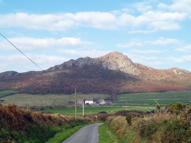
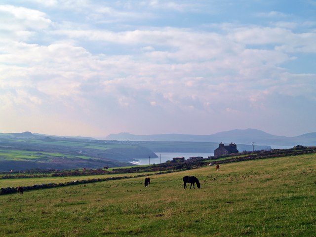
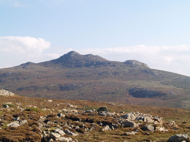
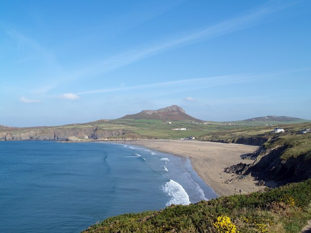
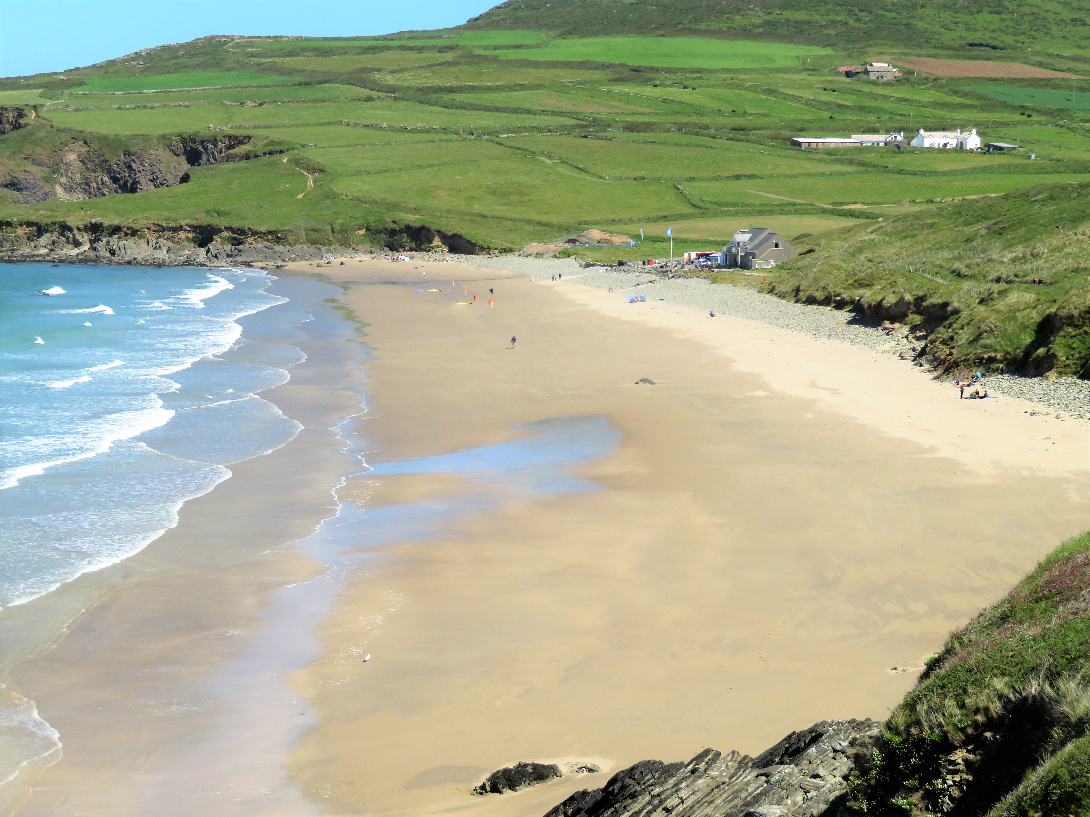
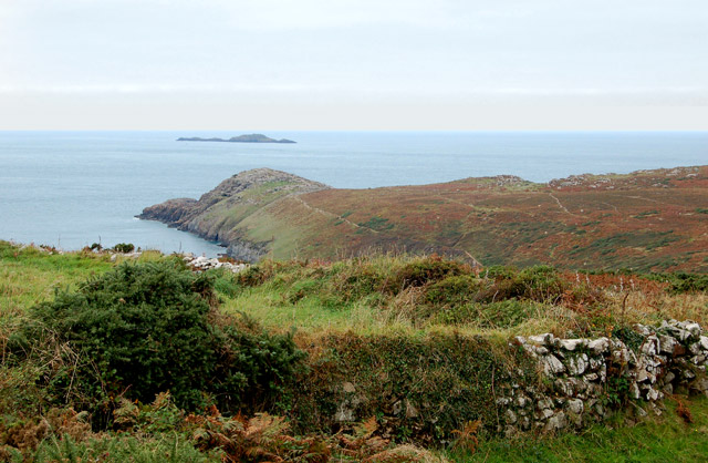
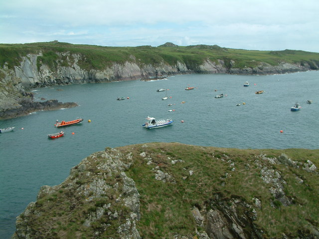
The hill is composed of rugged, rocky terrain, characterized by a distinctive tor formation that dominates its summit. Its distinctive shape and prominent location make it a significant landmark in the area. Carn Llidi offers stunning panoramic views of the surrounding landscape, including the picturesque St David's Head to the west and the vast expanse of the Irish Sea to the north.

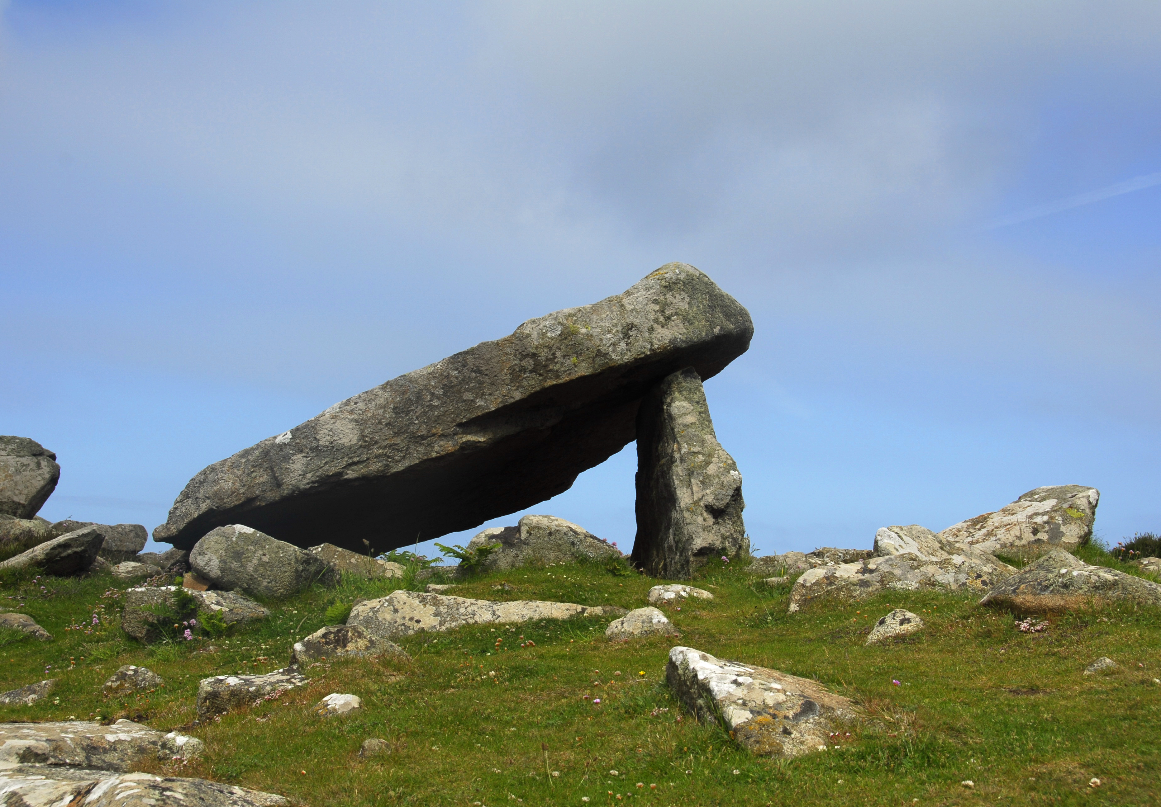
The hill is of great geological and archaeological interest due to its unique features. It is made up of volcanic rocks, including rhyolite, which were formed over 450 million years ago during the volcanic activity of the Ordovician period. The tor at the summit is a result of the differential erosion of the surrounding softer rocks, leaving behind a harder core.

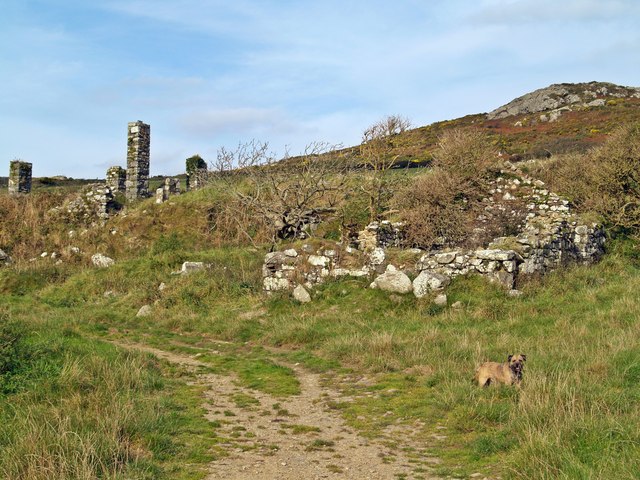
Carn Llidi is also known for its rich historical and cultural heritage. It is believed to have been the site of an Iron Age hillfort, with evidence of ancient settlements and enclosures still visible. Furthermore, the hill is associated with St David, the patron saint of Wales, who is said to have spent time in meditation and prayer in a cave located on its slopes.

Today, Carn Llidi attracts numerous visitors who come to enjoy its natural beauty, hiking opportunities, and historical significance. It is a popular destination for walkers, with several well-marked trails leading to the summit. The hill offers a unique blend of natural and cultural attractions, making it a significant landmark in the region.

If you have any feedback on the listing, please let us know in the comments section below.

Carn Llidi Images

Images are sourced within 2km of 51.904552/-5.2896573 or Grid Reference SM7328. Thanks to Geograph Open Source API. All images are credited.

Carnedd Lleithr A view of Carnedd Lleithr which forms part of the headland of St David's Head, the headland is in the care of the National Trust.
Carnedd Lleithr
A view of Carnedd Lleithr which forms part of the headland of St David's Head, the headland is in the care of the National Trust.
Llaethdy A view from the footpath to Carnedd lleithr in the foreground Llaethdy and Whitesands Bay in the background.
Llaethdy
A view from the footpath to Carnedd lleithr in the foreground Llaethdy and Whitesands Bay in the background.
Ponies Grazing Welsh Mountain ponies graze on the edge of Penrhyn Halen.
<span class="nowrap"><a title="http://www.nationaltrust.org.uk/main/w-stdavids_head-coastal_walk-2.pdf" rel="nofollow ugc noopener" href="http://www.nationaltrust.org.uk/main/w-stdavids_head-coastal_walk-2.pdf">Link</a><img style="margin-left:2px;" alt="External link" title="External link - shift click to open in new window" src="https://s1.geograph.org.uk/img/external.png" width="10" height="10"/></span>
Ponies Grazing
Welsh Mountain ponies graze on the edge of Penrhyn Halen. LinkExternal link
A View Of Carn Llidi Carn Llidi from the Pembrokeshire Coast Path.
A View Of Carn Llidi
Carn Llidi from the Pembrokeshire Coast Path.
Penmaen Dewi  (St David's Head) The grassy coastal slopes leading to the rockey outcrop of Penmaen Dewi (St Davids Head).
Penmaen Dewi (St David's Head)
The grassy coastal slopes leading to the rockey outcrop of Penmaen Dewi (St Davids Head).
Porth-mawr (Whitesands Bay) A view of Whitesands from Penlledwen, over looking Trwynhwrddyn.
Porth-mawr (Whitesands Bay)
A view of Whitesands from Penlledwen, over looking Trwynhwrddyn.
Derelict Building beside footpath to Carneed-lleithr.
Derelict Building
beside footpath to Carneed-lleithr.
Bay View Whitesands Bay and Beach (Porth-mawr) with a view of Carn Llidi at 181 metres on St Davids Head.
Bay View
Whitesands Bay and Beach (Porth-mawr) with a view of Carn Llidi at 181 metres on St Davids Head.
Whitesands Bay - 1984 Whitesands Bay aka Whitesand Bay on some maps, is a wide sandy beach in St Brides Bay in the Pembrokeshire Coast National Park, United Kingdom. The beach is located about 3 km west of the small city of St. Davids and about 1.5 km south of St Davids Head and has been described as the best surfing beach in Pembrokeshire and one of the best tourist beaches in the world.
Whitesands Bay - 1984
Whitesands Bay aka Whitesand Bay on some maps, is a wide sandy beach in St Brides Bay in the Pembrokeshire Coast National Park, United Kingdom. The beach is located about 3 km west of the small city of St. Davids and about 1.5 km south of St Davids Head and has been described as the best surfing beach in Pembrokeshire and one of the best tourist beaches in the world.
Hut Circles, St David's Head Situated within the promontory fort. Porthmeigan in upper right of picture.
Hut Circles, St David's Head
Situated within the promontory fort. Porthmeigan in upper right of picture.
Coetan Arthur
Coetan Arthur
Trwynhwrddyn Here at Whitesands Bay a storm has washed all the vowels away from this headland.
Trwynhwrddyn
Here at Whitesands Bay a storm has washed all the vowels away from this headland.
Barn near Croeswdig
Barn near Croeswdig
Thistles & Buttercups
Buttercups & Thistles
Porth Lleuog
Porth Lleuog
St David's Head
St David's Head
Porthmelgan
Porthmelgan
Show me another place!

Carn Llidi is located at Grid Ref: SM7328 (Lat: 51.904552, Lng: -5.2896573)

Unitary Authority: Pembrokeshire

Police Authority: Dyfed Powys

What 3 Words

///inkjet.fewer.foster. Near St Davids, Pembrokeshire

Related Wikis

Nearby Amenities

Located within 500m of 51.904552,-5.2896573
Carn Llidi
Ele: 181
Natural: peak
Wikidata: Q20588062
Wikipedia: en:Carn Llidi
Lat/Long: 51.9045528/-5.289642
Carn Llidi Chambered Tomb
Historic: archaeological_site
Lat/Long: 51.9034598/-5.2936692
Power: pole
Lat/Long: 51.9005793/-5.2927628
Power: pole
Lat/Long: 51.9000886/-5.2898687
Power: pole
Lat/Long: 51.9002111/-5.2889125
The data included in this document is from www.openstreetmap.org. The data is made available under ODbL.

Have you been to Carn Llidi?

Leave your review of Carn Llidi below (or comments, questions and feedback).