An Sgùlan

Hill, Mountain in Inverness-shire

Scotland

An Sgùlan

Looking East up Beinn na Seamraig The burn is a tributary of the Allt nam Criopag.
Looking East up Beinn na Seamraig Credit: Chris and Meg Mellish

An Sgùlan is a prominent hill located in Inverness-shire, a historic county in the Scottish Highlands. It is situated near the picturesque village of Glenfinnan, renowned for its stunning landscapes and rich history. An Sgùlan stands at an elevation of approximately 454 meters (1,490 feet) above sea level, making it a popular destination for hikers, mountaineers, and nature enthusiasts.

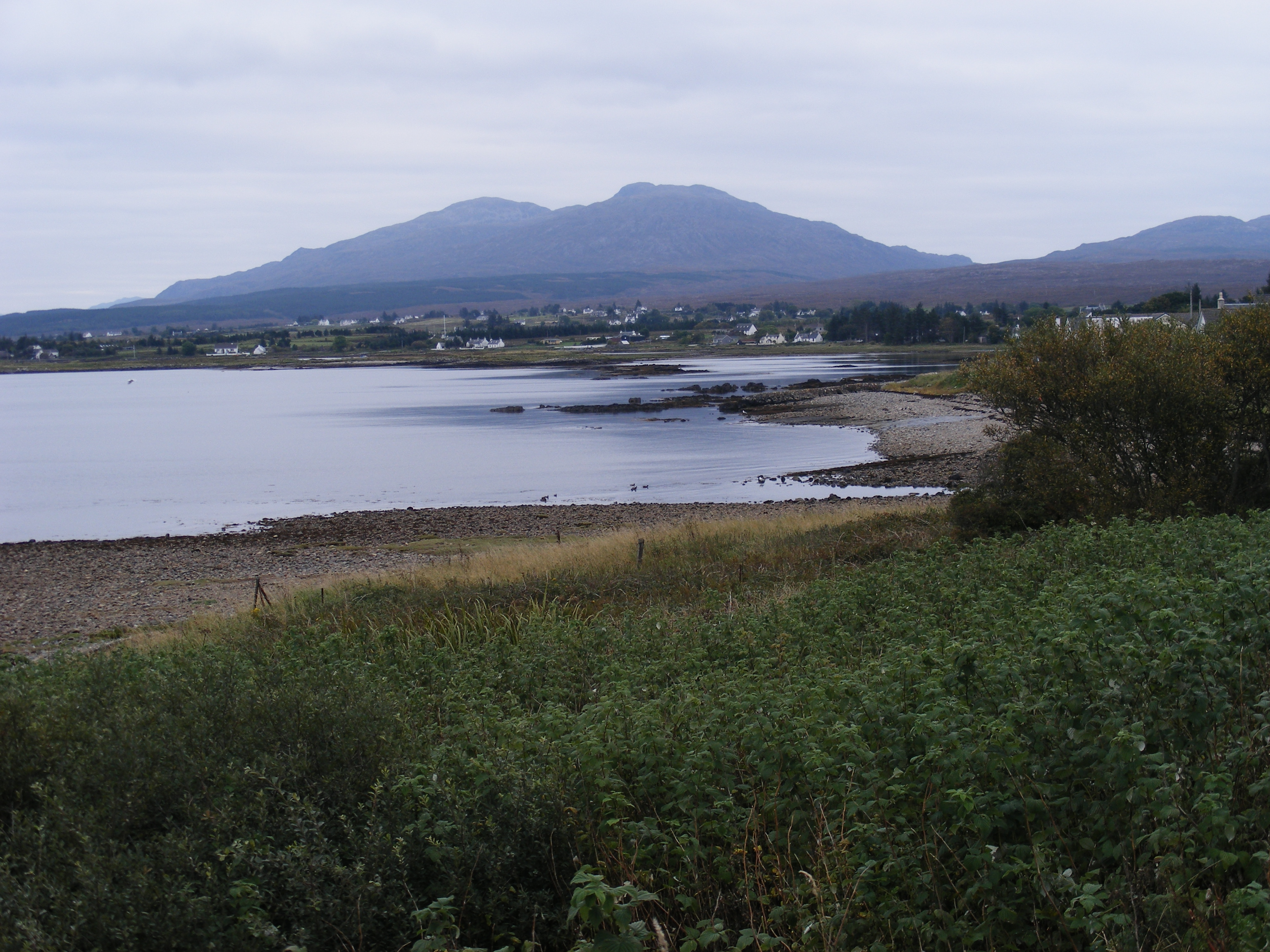
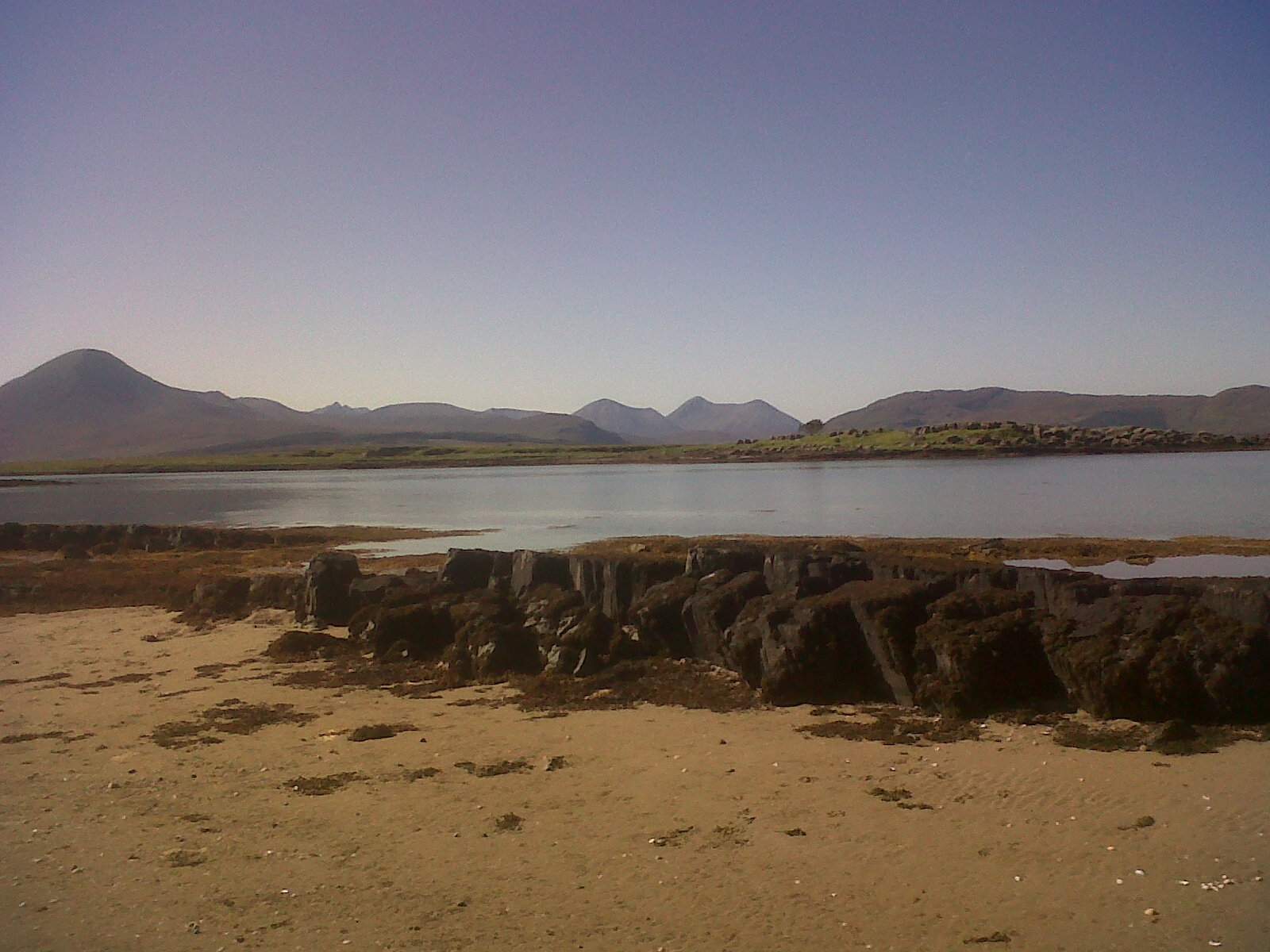
The hill offers breathtaking panoramic views of the surrounding area, including the famous Glenfinnan Viaduct, which features in the Harry Potter movies. On clear days, visitors can enjoy vistas of Loch Shiel, a freshwater loch that stretches for over 28 kilometers (17 miles) through the glen.

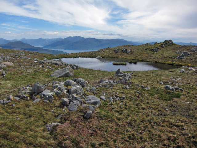
An Sgùlan is known for its rugged terrain, comprising rocky slopes and grassy slopes with patches of heather. The ascent to the summit can be challenging, but the rewarding views make it worthwhile. The hill is often part of longer hikes or walks, and there are various routes to reach the top, catering to different levels of fitness and experience.

The surrounding area is rich in flora and fauna, with a diverse range of plant species, including heather, mosses, and wildflowers. Wildlife such as deer, red squirrels, and numerous bird species can also be spotted during the climb.

Overall, An Sgùlan offers an unforgettable outdoor experience for those seeking adventure and natural beauty. Its accessibility from Glenfinnan and the stunning views it provides make it a must-visit destination for anyone exploring Inverness-shire.

If you have any feedback on the listing, please let us know in the comments section below.
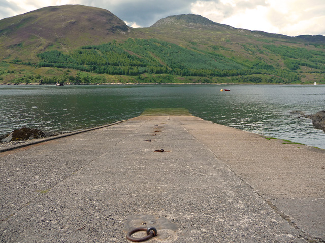
An Sgùlan Images

Images are sourced within 2km of 57.207393/-5.7702346 or Grid Reference NG7219. Thanks to Geograph Open Source API. All images are credited.

Looking East up Beinn na Seamraig The burn is a tributary of the Allt nam Criopag.
Looking East up Beinn na Seamraig
The burn is a tributary of the Allt nam Criopag.
Allt a' Choin The "stream of the dog" goes through some steep gullies in this area and one has to select a crossing point with care.
Allt a' Choin
The "stream of the dog" goes through some steep gullies in this area and one has to select a crossing point with care.
Southern Slopes of An Sgulan Grassy moorland with rocky outcrops. The Cuillins and Broadford can be seen in the background.
Southern Slopes of An Sgulan
Grassy moorland with rocky outcrops. The Cuillins and Broadford can be seen in the background.
Rocks on the NW Slopes of Beinn na Seamraig Rough grass moorland with rocks, fairly dry. Looking towards Loch Eishort, Rum and Canna.
Rocks on the NW Slopes of Beinn na Seamraig
Rough grass moorland with rocks, fairly dry. Looking towards Loch Eishort, Rum and Canna.
Lower NW Slopes of Beinn na Seamraig Rough grass and heather with some pleasant rocky outcrops. Looking towards the forest above Kinloch and, in the distance, the Cuillins and Broadford.
Lower NW Slopes of Beinn na Seamraig
Rough grass and heather with some pleasant rocky outcrops. Looking towards the forest above Kinloch and, in the distance, the Cuillins and Broadford.
Track towards the communications mast The track starts a mile or so behind the photographer at a gateway off the A851 Armadale road, and leads through part of Kinloch Forest. The communications mast ahead is in grid square <a href="https://www.geograph.org.uk/gridref/NG7019">NG7019</a>, and is marked on the OS map as a Radio Station.
Track towards the communications mast
The track starts a mile or so behind the photographer at a gateway off the A851 Armadale road, and leads through part of Kinloch Forest. The communications mast ahead is in grid square NG7019, and is marked on the OS map as a Radio Station.
Drumfearn Radio Station The installation stands amid the trees within Kinloch Forest, and is approached by a track leading a mile or so east from the A851 Armadale road.
Drumfearn Radio Station
The installation stands amid the trees within Kinloch Forest, and is approached by a track leading a mile or so east from the A851 Armadale road.
Turning point A track into Kinloch Forest, which starts from the A851 a mile or so to the east, ends here.
Turning point
A track into Kinloch Forest, which starts from the A851 a mile or so to the east, ends here.
Back down the track Looking west from the end of a forest track in Kinloch Forest. A little of the track itself is visible. Also visible above the trees is the top of the communications mast in grid square <a href="https://www.geograph.org.uk/gridref/NG7019">NG7019</a>.
Back down the track
Looking west from the end of a forest track in Kinloch Forest. A little of the track itself is visible. Also visible above the trees is the top of the communications mast in grid square NG7019.
Above Kinloch Forest The steeper slopes of Beinn na Seamraig are not forested. The summit of the hill is in grid square <a href="https://www.geograph.org.uk/gridref/NG7217">NG7217</a>.
Above Kinloch Forest
The steeper slopes of Beinn na Seamraig are not forested. The summit of the hill is in grid square NG7217.
Former forest boundary This deer fence was probably erected when the forest was planted. The trees have now grown plenty big enough to no longer be seriously damaged by foraging deer, and the fence has been allowed to fall into disrepair.
Former forest boundary
This deer fence was probably erected when the forest was planted. The trees have now grown plenty big enough to no longer be seriously damaged by foraging deer, and the fence has been allowed to fall into disrepair.
Coire nan Cuilean The track on which the photographer is standing ends suddenly half a mile or so further up the hillside towards Ben Aslak. However, it provides an easy walk over what, without the track, would be hard going through deep heather moorland.
Coire nan Cuilean
The track on which the photographer is standing ends suddenly half a mile or so further up the hillside towards Ben Aslak. However, it provides an easy walk over what, without the track, would be hard going through deep heather moorland.
Coire nan Cuilean Looking north over the moorland valley, with the island-dotted Inner Sound in the distance.
Coire nan Cuilean
Looking north over the moorland valley, with the island-dotted Inner Sound in the distance.
Peat hags below Ben Aslak The moorland below the hill is very boggy, though the hillside itself is rocky.
Peat hags below Ben Aslak
The moorland below the hill is very boggy, though the hillside itself is rocky.
East facing slopes of Beinn Dubh a' Bhealaich Moorland hillside below a rocky hill.
East facing slopes of Beinn Dubh a' Bhealaich
Moorland hillside below a rocky hill.
Bealach na Cruinn-leum A very boggy bealach between two rocky hills.
Bealach na Cruinn-leum
A very boggy bealach between two rocky hills.
Overlooking the Bealach na Cruinn-leum Looking down from the east facing slope of Beinn Dubh a' Bhealaich, with the foot of Ben Aslak on the left and mainland mountain tops in the distance.
Overlooking the Bealach na Cruinn-leum
Looking down from the east facing slope of Beinn Dubh a' Bhealaich, with the foot of Ben Aslak on the left and mainland mountain tops in the distance.
Summit lochan on Beinn Dubh a' Bhealaich One of several small lochans close to the summit of the hill.
Summit lochan on Beinn Dubh a' Bhealaich
One of several small lochans close to the summit of the hill.
Show me another place!

An Sgùlan is located at Grid Ref: NG7219 (Lat: 57.207393, Lng: -5.7702346)

Unitary Authority: Highland

Police Authority: Highlands and Islands

What 3 Words

///cooks.overheard.inclines. Near Kyleakin, Highland

Nearby Locations

An Sgùlan

Related Wikis

Loch na Dal

Loch na Dal (Scottish Gaelic: Loch na Dalach) is a sea loch on the Sleat Peninsula on the Isle of Skye in the Inner Hebrides of Scotland. Kinloch Lodge...

Sgùrr na Coinnich

Sgùrr na Coinnich is the highest peak on the Sleat peninsula at the east end of the Isle of Skye. Together with its slightly lower neighbour, Beinn na...

Ashaig

Ashaig (Scottish Gaelic: Aiseag, referring to a ferry) is a small township, situated adjacent to Upper Breakish and Lower Breakish near Broadford on the...

Lower Breakish

Lower Breakish (Scottish Gaelic: Breacais Ìosal) is a village on the Isle of Skye in Scotland. == Gallery... ==

Upper Breakish

Upper Breakish (Scottish Gaelic: Breacais Àrd) is a village on the Isle of Skye in Scotland in the United Kingdom. == References == The geographic coordinates...

Beinn na Caillich (Kyle Rhea)

Beinn na Caillich (Scottish Gaelic for 'mountain of the old woman or Cailleach') is a mountain with a height of 732 metres (2,402 ft), overlooking Kyle...

Broadford Airfield

Isle of Skye (Broadford) Airfield (also known as Ashaig Airstrip or Broadford Aerodrome) is a small airfield on the Isle of Skye, Scotland, with a single...

Kylerhea

Kylerhea (Scottish Gaelic: Caol Reatha) is a village on the east coast of the Isle of Skye, in the Scottish Highlands, overlooking Kyle Rhea, a strait...

Have you been to An Sgùlan?

Leave your review of An Sgùlan below (or comments, questions and feedback).