Achadh Beithe
Hill, Mountain in Argyllshire
Scotland
Achadh Beithe
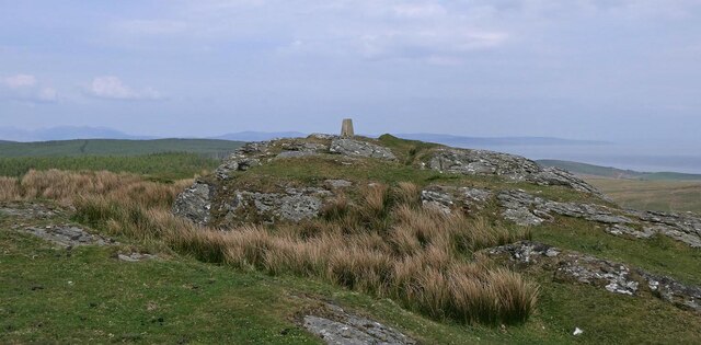
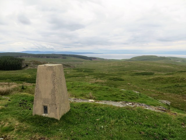
Achadh Beithe is a prominent hill located in Argyllshire, Scotland. Standing at an elevation of 689 meters (2,260 feet), it is considered one of the more accessible peaks in the area, attracting both experienced hikers and nature enthusiasts. The hill is situated within the vast expanse of the Loch Lomond and The Trossachs National Park, offering breathtaking panoramic views of the surrounding landscapes.
Covered in a mix of heather moorland and scattered patches of woodland, Achadh Beithe provides a diverse habitat for a range of flora and fauna. Hikers can expect to encounter various species of birdlife, including golden eagles and peregrine falcons, as well as red deer and mountain hares. The hill is particularly picturesque during the spring and summer months when the heather is in full bloom, creating a vibrant purple carpet across its slopes.
The ascent to the summit of Achadh Beithe is relatively straightforward, with well-marked trails leading to the top. From the peak, visitors are rewarded with stunning views over Loch Awe and the surrounding glens. On a clear day, the vista stretches as far as the Isle of Mull and the Paps of Jura. It is recommended to bring appropriate hiking gear and be prepared for changing weather conditions, as the hill can be exposed to strong winds and sudden rain showers.
Overall, Achadh Beithe offers a fantastic opportunity to experience the natural beauty and tranquility of the Scottish Highlands while enjoying a moderate hillwalking experience.
If you have any feedback on the listing, please let us know in the comments section below.
Achadh Beithe Images
Images are sourced within 2km of 55.472863/-5.611975 or Grid Reference NR7125. Thanks to Geograph Open Source API. All images are credited.


![Drumgarve, Kintyre Crescent shaped erosion caused by the presence of Glenlussa Water which flows from mid-left, round the curve before going off to the right immediately beyond the field in the foreground. The pipeline visible to the right of Drumgarve farm, top middle, is carrying water from Lussa Loch [NR7028], approximately 2 miles to the North West.](https://s3.geograph.org.uk/geophotos/02/56/91/2569103_87bf40eb.jpg)
![Calliburn. Kintyre Grazing land with forest in the background. The March Burn flows from right to left (South to North) in front of the forest, to join Glenlussa Water in [NR7226].](https://s3.geograph.org.uk/geophotos/02/56/91/2569151_0dce9ac0.jpg)

Achadh Beithe is located at Grid Ref: NR7125 (Lat: 55.472863, Lng: -5.611975)
Unitary Authority: Argyll and Bute
Police Authority: Argyll and West Dunbartonshire
What 3 Words
///wallet.revolting.ladder. Near Campbeltown, Argyll & Bute
Nearby Locations
Related Wikis

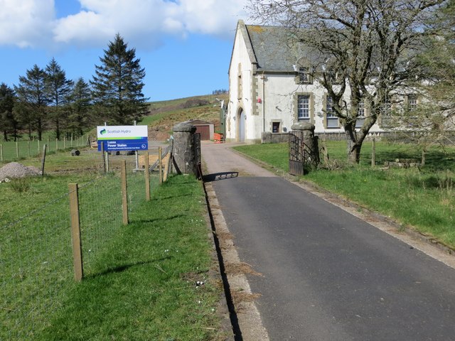
Lussa Hydro-Electric Scheme
Lussa Hydro-Electric Scheme is a small-scale hydro-electric power station, built by the North of Scotland Hydro-Electric Board and commissioned in 1956...

Tangy Loch Castle
Tangy Loch Castle is a ruined fortified dwelling on an islet in Tangy Loch, Kintyre, Scotland. It is about 5 miles/8 km north of Campbeltown. It was formerly...
Tangy Loch
Tangy Loch, Kintyre, Scotland, is a small loch (lake) located in the centre of the peninsula. It is a Site of Special Scientific Interest. Tangy Loch Castle...
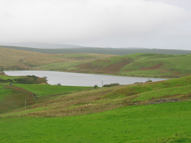
Aucha Lochy
National grid reference NR72532231 Aucha Lochy is an impounding reservoir, situated 1 km to the north/north east of Campbeltown and is the main source...
Nearby Amenities
Located within 500m of 55.472863,-5.611975Have you been to Achadh Beithe?
Leave your review of Achadh Beithe below (or comments, questions and feedback).