Àird Molach

Hill, Mountain in Inverness-shire

Scotland

Àird Molach

Kinlochmoidart House A winter view of Kinlochmoidart House on the vast Kinlochmoidart Estate.
Kinlochmoidart House Credit: Mr S Mudgey

Àird Molach is a prominent hill located in the Inverness-shire region of Scotland. Situated in the Scottish Highlands, it forms part of the larger Monadhliath mountain range. Standing at an elevation of 806 meters (2,644 feet), it offers breathtaking panoramic views of the surrounding landscape.

The hill is characterized by its rugged terrain, featuring steep slopes and rocky outcrops. Its summit is marked by a large cairn, providing a focal point for hikers and mountaineers. The ascent to the top can be challenging, requiring a moderate level of fitness and navigation skills.

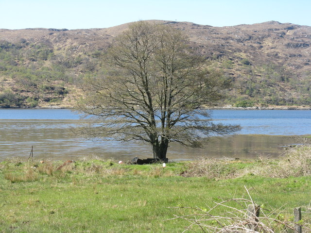
The surrounding area is rich in natural beauty, with vast moorlands and lochans dotting the landscape. The hill is home to a diverse range of flora and fauna, including heather, mosses, and various species of birds such as ptarmigans and peregrine falcons. The hillside is also known for its wild deer population, often spotted grazing in the lower slopes.

Àird Molach is a popular destination for outdoor enthusiasts, attracting hikers, climbers, and nature lovers throughout the year. The hill offers a variety of routes, catering to different levels of experience and ability. It is advisable to check weather conditions and be properly equipped before embarking on a hike.

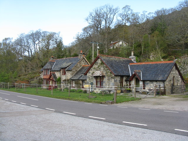
In addition to its natural attractions, Àird Molach holds historical significance. It was once a site of ancient settlements, and remnants of old stone structures can still be found in the vicinity. These remnants serve as a reminder of the area's rich cultural heritage.

Overall, Àird Molach is a captivating hill that offers a challenging yet rewarding outdoor experience, with its stunning views, diverse wildlife, and historical significance.

If you have any feedback on the listing, please let us know in the comments section below.

Àird Molach Images

Images are sourced within 2km of 56.776204/-5.7538678 or Grid Reference NM7071. Thanks to Geograph Open Source API. All images are credited.

Kinlochmoidart House A winter view of Kinlochmoidart House on the vast Kinlochmoidart Estate.
Kinlochmoidart House
A winter view of Kinlochmoidart House on the vast Kinlochmoidart Estate.
Captain Robertson's Cairn (1868) Three prominent cairns, generally known as Captain Robertson's cairns, although it appears that the cairn that originally bore his name has been destroyed.

Captain Robertson's cairns. <span class="nowrap"><a title="https://her.highland.gov.uk/monument/MHG53547" rel="nofollow ugc noopener" href="https://her.highland.gov.uk/monument/MHG53547">Link</a><img style="margin-left:2px;" alt="External link" title="External link - shift click to open in new window" src="https://s1.geograph.org.uk/img/external.png" width="10" height="10"/></span>
Captain Robertson's Cairn (1868)
Three prominent cairns, generally known as Captain Robertson's cairns, although it appears that the cairn that originally bore his name has been destroyed. Captain Robertson's cairns. LinkExternal link
Limekiln Burn
Limekiln Burn
A861 near  Captain Robertson's cairns
A861 near Captain Robertson's cairns
Road junction at Ardmolich
Path through Ardmolich Wood
A861 and Captain Robertson's Cairn
A861 near Langal
A861 near Langal
 Alder at Kinlochmoidart/Ceann Loch Muideirt A magnificent specimen on the shores of Loch Moidart.
Alder at Kinlochmoidart/Ceann Loch Muideirt
A magnificent specimen on the shores of Loch Moidart.
Kinlochmoidart/Ceann Loch Muideirt A view from Kinnacarra over the head of the loch to Ardmolich Wood and Beinn Resipol, 10km to the southeast.
Kinlochmoidart/Ceann Loch Muideirt
A view from Kinnacarra over the head of the loch to Ardmolich Wood and Beinn Resipol, 10km to the southeast.
Houses at Kinnacarra The one by the road was originally a school.
Houses at Kinnacarra
The one by the road was originally a school.
Approaching Drynie Hill - don't go too fast! What seems to be a rather alarmist sign as one heads uphill from Kinlochmoidart Bridge after road improvements.
Approaching Drynie Hill - don't go too fast!
What seems to be a rather alarmist sign as one heads uphill from Kinlochmoidart Bridge after road improvements.
Ardmolich Wood at Kinlochmoidart The A861 heading towards Drynie Hill.
Ardmolich Wood at Kinlochmoidart
The A861 heading towards Drynie Hill.
Birch woodland at Kinlochmoidart On a rocky outcrop at the head of the loch.
Birch woodland at Kinlochmoidart
On a rocky outcrop at the head of the loch.
Kinlochmoidart Bridge A new Bailey bridge carrying the A861 over the River Moidart.
Kinlochmoidart Bridge
A new Bailey bridge carrying the A861 over the River Moidart.
The original Kinlochmoidart Bridge Parallel to, and 40m upstream of, the new bridge <a href="https://www.geograph.org.uk/photo/3489694">NM7172 : Kinlochmoidart Bridge</a>.
The original Kinlochmoidart Bridge
Parallel to, and 40m upstream of, the new bridge NM7172 : Kinlochmoidart Bridge.
The River Moidart Looking downstream from Kinlochmoidart Bridge.
The River Moidart
Looking downstream from Kinlochmoidart Bridge.
Woodland above Loch Shiel Looking south over Austinscroft from a layby on the A861.
Woodland above Loch Shiel
Looking south over Austinscroft from a layby on the A861.
Show me another place!

Àird Molach is located at Grid Ref: NM7071 (Lat: 56.776204, Lng: -5.7538678)

Unitary Authority: Highland

Police Authority: Highlands and Islands

What 3 Words

///watch.narrow.performed. Near Arisaig, Highland

Related Wikis

Morar, Moidart and Ardnamurchan National Scenic Area

Morar, Moidart and Ardnamurchan is a national scenic area (NSA) covering the coastal scenery of three peninsulas in the western Highlands of Scotland...

Ardmolich

Ardmolich (Scottish Gaelic: An Àird Mholach) and Kinlochmoidart (Ceann Loch Mùideart) are settlements at the east head of Loch Moidart in the Moidart region...

Dalnabreck

Dalnabreck (Scottish Gaelic: Dail nam Breac) is a small village, lying at the southwest end of Loch Shiel in Sunart, Lochaber, Scottish Highlands and is...

Claish Moss

Claish Moss is an upland blanket bog on the south side of Loch Shiel, in the Sunart district of the west highlands of Scotland The Moss is designated as...

Nearby Amenities

Located within 500m of 56.776204,-5.7538678
Bench
Backrest: yes
Material: wood
Lat/Long: 56.780344/-5.7522467
The data included in this document is from www.openstreetmap.org. The data is made available under ODbL.

Have you been to Àird Molach?

Leave your review of Àird Molach below (or comments, questions and feedback).