An Eiligeir

Hill, Mountain in Argyllshire

Scotland

An Eiligeir

Red deer near Loch Spelve
Red deer near Loch Spelve Credit: Eirian Evans

An Eiligeir, located in Argyllshire, Scotland, is a prominent hill/mountain in the region. Standing at an elevation of approximately 909 meters (2,982 feet), it forms part of the expansive and picturesque landscape that characterizes the Scottish Highlands.

An Eiligeir is known for its rugged and challenging terrain, making it a popular destination for hikers, mountaineers, and outdoor enthusiasts seeking a thrilling experience. The peak provides breathtaking panoramic views of the surrounding area, including the picturesque Loch Awe and the nearby mountains of the Argyll Forest Park.

The hill/mountain is covered in a combination of heather, grasses, and scattered rocks, with patches of woodland present in certain areas. Its slopes are steep and can be treacherous, particularly during inclement weather conditions, which hikers need to be aware of.

An Eiligeir is home to a diverse range of flora and fauna, including species such as red deer, golden eagles, and various plant varieties that thrive in the highland environment. The hill/mountain also holds significant historical and cultural value, with remnants of ancient settlements and landmarks scattered throughout the area.

While the ascent of An Eiligeir can be demanding, it offers a rewarding challenge and a chance to immerse oneself in the breathtaking natural beauty of the Scottish Highlands. Whether it be for the thrill of conquering its summit or for simply enjoying the tranquility of the surrounding landscape, An Eiligeir is a must-visit destination for those seeking an authentic Scottish outdoor experience.

If you have any feedback on the listing, please let us know in the comments section below.
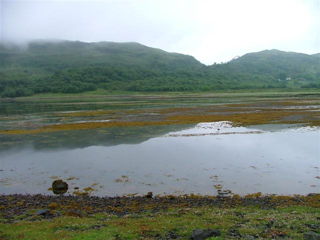
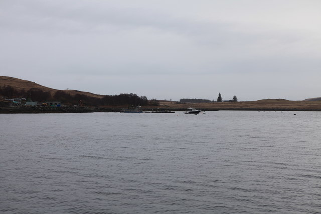
An Eiligeir Images

Images are sourced within 2km of 56.425356/-5.7241992 or Grid Reference NM7032. Thanks to Geograph Open Source API. All images are credited.

Red deer near Loch Spelve
Loch Spelve Small catamaran moored on the opposite shore
Loch Spelve
Small catamaran moored on the opposite shore
The A849 Near Strathcoil
The A849
Near Strathcoil
View from Connel Bridge - January 2016 (3) Clouds build over a snow-covered Isle of Mull.
View from Connel Bridge - January 2016 (3)
Clouds build over a snow-covered Isle of Mull.
Abandoned boat This is one of many boats abandoned on the coast of Mull.
Abandoned boat
This is one of many boats abandoned on the coast of Mull.
Abhainn Barr Chailleach below Beinn Bheag
Abhainn Lirein
Abhainn Lirein
Looking down on Loch Bearnach from Beinn Bheag Loch Spelve beyond
Looking down on Loch Bearnach from Beinn Bheag
Loch Spelve beyond
Outflow from Loch Bearnach flows into the Abhainn Bhearnach
Sàilean nan Each Tidal shoreline and mussel farming lines at  Sàilean nan Each at Loch Spelve.
Sàilean nan Each
Tidal shoreline and mussel farming lines at Sàilean nan Each at Loch Spelve.
Lussa Meander The winding route of the Lussa River as it reaches its estuary by Loch Spelve.
Lussa Meander
The winding route of the Lussa River as it reaches its estuary by Loch Spelve.
Access Road by the Lussa A field access road with the Lussa flowing behind.
Access Road by the Lussa
A field access road with the Lussa flowing behind.
Loch Spelve Viewed from A849 to the small jetty at Ardura
Loch Spelve
Viewed from A849 to the small jetty at Ardura
Head of Loch Spelve Mix of saltmarsh and shingle areas.
Head of Loch Spelve
Mix of saltmarsh and shingle areas.
Inverlussa House Inverlussa House, the only building in the grid square.
Inverlussa House
Inverlussa House, the only building in the grid square.
Road near Loch Spelve mussel farm For more details about mussel farming in Loch Spelve see:
<span class="nowrap"><a title="http://inverlussa.com/mussel-farm.htm" rel="nofollow ugc noopener" href="http://inverlussa.com/mussel-farm.htm">Link</a><img style="margin-left:2px;" alt="External link" title="External link - shift click to open in new window" src="https://s1.geograph.org.uk/img/external.png" width="10" height="10"/></span>
Road near Loch Spelve mussel farm
For more details about mussel farming in Loch Spelve see: LinkExternal link
View over Sailean nan Each, Loch Spelve The blue line at the far left of the picture is a string of buoys which are supporting ropes for Mussel farming, for more details see:

<span class="nowrap"><a title="http://inverlussa.com/mussel-farm.htm" rel="nofollow ugc noopener" href="http://inverlussa.com/mussel-farm.htm">Link</a><img style="margin-left:2px;" alt="External link" title="External link - shift click to open in new window" src="https://s1.geograph.org.uk/img/external.png" width="10" height="10"/></span>

Sailean is Gaelic for a small creek.
View over Sailean nan Each, Loch Spelve
The blue line at the far left of the picture is a string of buoys which are supporting ropes for Mussel farming, for more details see: LinkExternal link Sailean is Gaelic for a small creek.
Inverlussa Mussel Farm, Loch Spelve, Isle of Mull For more details about the mussel farm see:
<span class="nowrap"><a title="http://inverlussa.com/mussel-farm.htm" rel="nofollow ugc noopener" href="http://inverlussa.com/mussel-farm.htm">Link</a><img style="margin-left:2px;" alt="External link" title="External link - shift click to open in new window" src="https://s1.geograph.org.uk/img/external.png" width="10" height="10"/></span>
Inverlussa Mussel Farm, Loch Spelve, Isle of Mull
For more details about the mussel farm see: LinkExternal link
Show me another place!

An Eiligeir is located at Grid Ref: NM7032 (Lat: 56.425356, Lng: -5.7241992)

Unitary Authority: Argyll and Bute

Police Authority: Argyll and West Dunbartonshire

What 3 Words

///visual.husky.artist. Near Craignure, Argyll & Bute

Nearby Locations

An Eiligeir

Related Wikis

Lochdon Free Church

The Lochdon Free Church is a place of worship of the Free Church of Scotland in Lochdon on the Isle of Mull, Scotland. The church was built in 1852....

Lochdon

Lochdon or Lochdonhead (Scottish Gaelic: Loch Dona or Scottish Gaelic: Cheann Loch Dona) is a small village on the Isle of Mull, in the council area of...

Gruline

Gruline (Scottish Gaelic: Grùilinn) is a small settlement on the Isle of Mull, in Argyll and Bute, off the west coast of Scotland. The hamlet is located...

Loch Don

Loch Don is a sea loch on the east coast of the Isle of Mull, off the west coast of Scotland. It is an intricately shaped loch opening onto the Firth of...

Have you been to An Eiligeir?

Leave your review of An Eiligeir below (or comments, questions and feedback).