Casterton, High

Settlement in Westmorland South Lakeland

England

Casterton, High

Roadside laithe between Barbon and Casterton Kept in better condition than most, it even has a proper rainwater drainage system.
Roadside laithe between Barbon and Casterton Credit: Stephen Craven

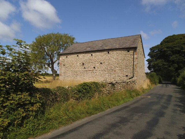
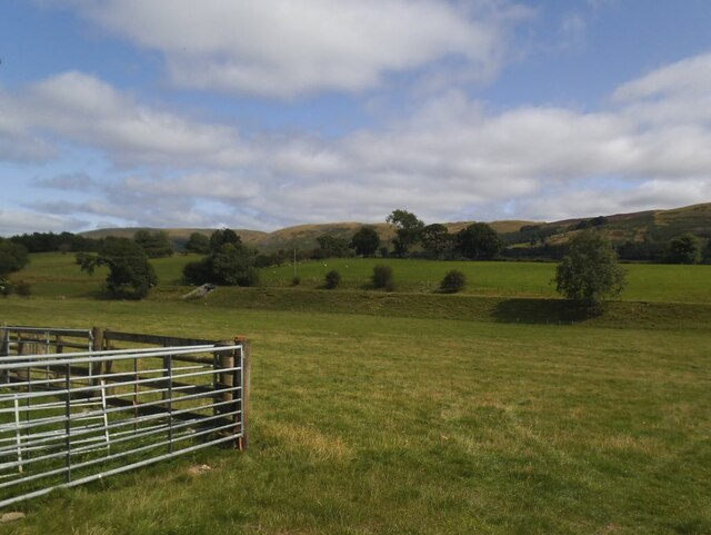
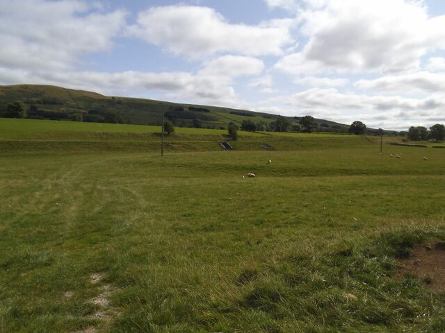
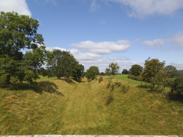
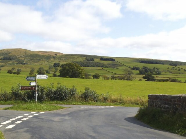
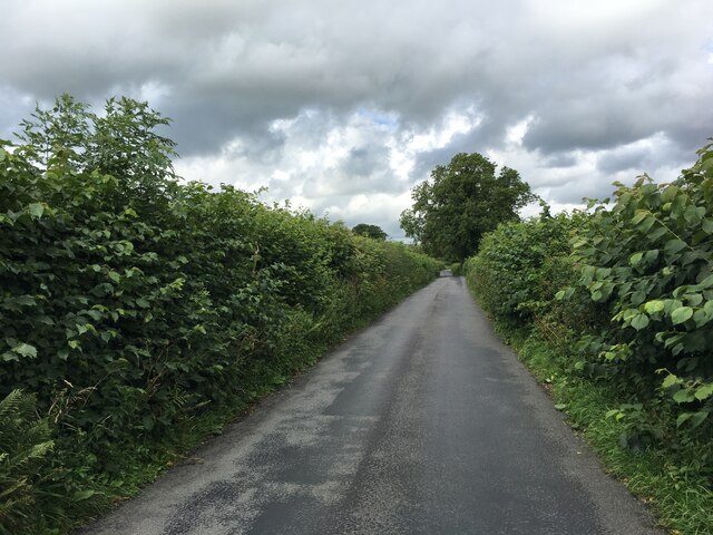
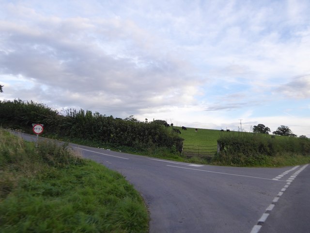
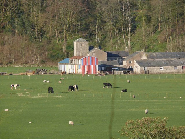
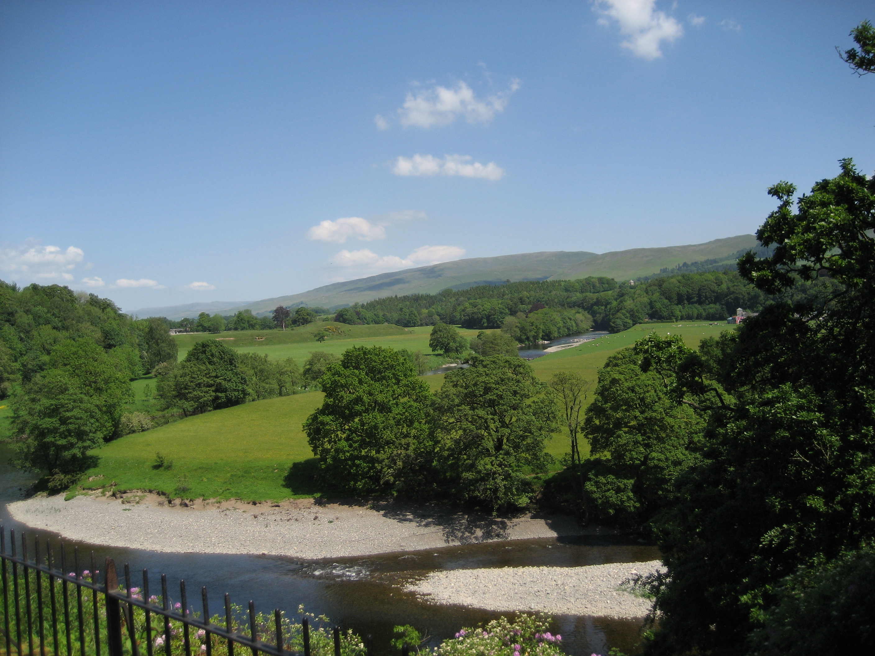
Casterton is a small village located in the southern part of Cumbria, England. Situated in the historic county of Westmorland, it lies on the edge of the picturesque Lune Valley. Casterton is surrounded by stunning countryside, offering residents and visitors alike the opportunity to explore the natural beauty of the area.

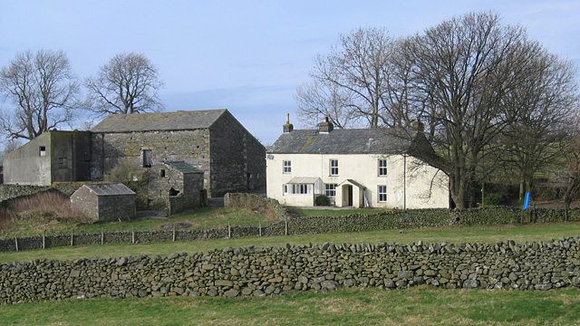
The village itself is quaint and charming, with a population of around 200 people. Casterton is known for its peaceful atmosphere and close-knit community. The village is centered around St. Swithin’s Church, a beautiful medieval structure that dates back to the 12th century. The church is a prominent landmark and provides a glimpse into the area's rich history.

Besides its historical significance, Casterton is also home to Casterton School, an independent co-educational boarding and day school. The school, founded in 1823, is renowned for its academic excellence and offers a wide range of educational opportunities for students.

The surrounding area offers numerous outdoor activities, including hiking, cycling, and fishing, thanks to its proximity to the Yorkshire Dales National Park and the Lake District National Park. The nearby market town of Kirkby Lonsdale provides residents with a range of amenities, including shops, restaurants, and pubs.

Overall, Casterton, High, Westmorland is a tranquil village that offers a peaceful and scenic lifestyle, making it an ideal place for those seeking a retreat from the hustle and bustle of city life.

If you have any feedback on the listing, please let us know in the comments section below.

Casterton, High Images

Images are sourced within 2km of 54.205843/-2.571824 or Grid Reference SD6279. Thanks to Geograph Open Source API. All images are credited.

Roadside laithe between Barbon and Casterton Kept in better condition than most, it even has a proper rainwater drainage system.
Roadside laithe between Barbon and Casterton
Kept in better condition than most, it even has a proper rainwater drainage system.
Disused railway embankment between Barbon and Casterton (1) The railway was the LMS route one between the 'Little North Western' line at Clapham and their main line to Scotland at Lowgill, via Ingleton. It last saw regular trains in 1954 and the track was lifted in 1967.
Disused railway embankment between Barbon and Casterton (1)
The railway was the LMS route one between the 'Little North Western' line at Clapham and their main line to Scotland at Lowgill, via Ingleton. It last saw regular trains in 1954 and the track was lifted in 1967.
Disused railway embankment between Barbon and Casterton (2) The railway was the LMS route one between the 'Little North Western' line at Clapham and their main line to Scotland at Lowgill, via Ingleton. It last saw regular trains in 1954 and the track was lifted in 1967. Note the underpass for farm traffic.
Disused railway embankment between Barbon and Casterton (2)
The railway was the LMS route one between the 'Little North Western' line at Clapham and their main line to Scotland at Lowgill, via Ingleton. It last saw regular trains in 1954 and the track was lifted in 1967. Note the underpass for farm traffic.
Disused railway cutting north of Greenber Lane The railway was the LMS route one between the 'Little North Western' line at Clapham and their main line to Scotland at Lowgill, via Ingleton. It last saw regular trains in 1954 and the track was lifted in 1967. Photo taken from the road bridge <a href="https://www.geograph.org.uk/photo/4523003">SD6280 : Casterton</a>.
Disused railway cutting north of Greenber Lane
The railway was the LMS route one between the 'Little North Western' line at Clapham and their main line to Scotland at Lowgill, via Ingleton. It last saw regular trains in 1954 and the track was lifted in 1967. Photo taken from the road bridge SD6280 : Casterton.
Signpost on Bents Lane Left to Barbon and Sedbergh, right to Sown Bridge and Settle.
Signpost on Bents Lane
Left to Barbon and Sedbergh, right to Sown Bridge and Settle.
Minor road towards Barbon
Minor road junction north of Casterton
Fell Garth
Fell Garth
Andy Goldsworthy sheepfold on Fellfoot Road, Barbon One of a number beside the lane, all containing boulders (and no sheep).
Andy Goldsworthy sheepfold on Fellfoot Road, Barbon
One of a number beside the lane, all containing boulders (and no sheep).
Andy Goldsworthy sheepfold on Fellfoot Road, Barbon One of a number beside the lane, all containing boulders (and no sheep).
Andy Goldsworthy sheepfold on Fellfoot Road, Barbon
One of a number beside the lane, all containing boulders (and no sheep).
Old Milestone by the A683, Casterton Grange, Casterton Carved stone post by the A683, in parish of CASTERTON (SOUTH LAKELAND District), by entrance to Casterton Grange, on verge, on West side of road. Sedbergh SKL stone, erected by the Sedbergh turnpike trust in the 19th century. 

Inscription reads:-
: S / 9 : : CASTERTON : : K.L. / 1¾ :
(To Sedbergh and Kirkby Lonsdale)
 
Grade II listed.  
List Entry Number: 1086896 <span class="nowrap"><a title="https://historicengland.org.uk/listing/the-list/list-entry/1086896" rel="nofollow ugc noopener" href="https://historicengland.org.uk/listing/the-list/list-entry/1086896">Link</a><img style="margin-left:2px;" alt="External link" title="External link - shift click to open in new window" src="https://s1.geograph.org.uk/img/external.png" width="10" height="10"/></span>

Milestone Society National ID: WE_SBKL09.
Old Milestone by the A683, Casterton Grange, Casterton
Carved stone post by the A683, in parish of CASTERTON (SOUTH LAKELAND District), by entrance to Casterton Grange, on verge, on West side of road. Sedbergh SKL stone, erected by the Sedbergh turnpike trust in the 19th century. Inscription reads:- : S / 9 : : CASTERTON : : K.L. / 1¾ : (To Sedbergh and Kirkby Lonsdale) Grade II listed. List Entry Number: 1086896 LinkExternal link Milestone Society National ID: WE_SBKL09.
Low January Sun over fields near Casterton
A683 north of Casterton
Old railway bridge Used by the old branch line to Sedbergh.
Old railway bridge
Used by the old branch line to Sedbergh.
Sheep grazing towards the old branch line to Sedbergh
A683 towards Sedbergh At the junction with the road to Barbon.
A683 towards Sedbergh
At the junction with the road to Barbon.
The Devil's Bridge over the River Lune
Hayfield above High Casterton Taken from the lane that follows the route of a Roman road. The hay had been cut, baled and removed.
Hayfield above High Casterton
Taken from the lane that follows the route of a Roman road. The hay had been cut, baled and removed.
Show me another place!

Casterton, High is located at Grid Ref: SD6279 (Lat: 54.205843, Lng: -2.571824)

Administrative County: Cumbria

District: South Lakeland

Police Authority: Cumbria

What 3 Words

///soonest.invent.visual. Near Kirkby Lonsdale, Cumbria

Related Wikis

Casterton, Cumbria

Casterton is a small village and civil parish close to Kirkby Lonsdale on the River Lune in the south east corner of Cumbria, England. In the 2001 census...

Casterton School

Casterton School was an independent boarding and day school for girls aged 3 to 18 years in the village of Casterton in rural Cumbria. In its final years...

Holy Trinity Church, Casterton

Holy Trinity Church is in the village of Casterton, Cumbria, England. It is an active Anglican parish church in the deanery of Kendal, the archdeaconry...

Barbon

Barbon is a village and civil parish in Westmorland and Furness, England. According to the 2001 census it had a population of 263, reducing to 236 at...

Kirkby Lonsdale railway station

Kirkby Lonsdale railway station was located in Lancashire, England, on the Ingleton Branch Line, 2 miles (3 km) from the town of Kirkby Lonsdale in Westmorland...

St Mary's Church, Kirkby Lonsdale

St Mary's Church is in the town of Kirkby Lonsdale, Cumbria, England. It is an active Anglican parish church in the deanery of Kendal, the archdeaconry...

Underley Hall

Underley Hall is a large country house near Kirkby Lonsdale in Cumbria. It was designed in a Jacobean Revival style by the architect George Webster for...

Kirkby Lonsdale

Kirkby Lonsdale () is a town and civil parish in the Westmorland and Furness district of Cumbria, England, on the River Lune. Historically in Westmorland...

Nearby Amenities

Located within 500m of 54.205843,-2.571824
Post Box
Post Box Type: wall
Postal Code: LA6
Ref: LA6 162
Lat/Long: 54.2067547/-2.5749166
Barrier: kissing_gate
Source: survey;gps
Lat/Long: 54.2074605/-2.5762165
Barrier: kissing_gate
Source: survey;gps
Lat/Long: 54.2079824/-2.5771195
Barrier: kissing_gate
Source: survey;gps
Lat/Long: 54.2083215/-2.5773744
Barrier: kissing_gate
Source: survey;gps
Lat/Long: 54.2085667/-2.5778011
Give Way
Direction: forward
Lat/Long: 54.2073308/-2.569987
Give Way
Direction: forward
Lat/Long: 54.2075287/-2.5701104
Give Way
Direction: backward
Lat/Long: 54.2028626/-2.5695735
Power: pole
Lat/Long: 54.2029204/-2.5675031
Power: pole
Lat/Long: 54.2028758/-2.5691913
Power: pole
Lat/Long: 54.2028638/-2.5698637
Power: pole
Lat/Long: 54.2028672/-2.5709911
Power: pole
Lat/Long: 54.2028517/-2.5729142
Power: pole
Lat/Long: 54.20285/-2.5752219
Power: pole
Lat/Long: 54.2077924/-2.5784164
Power: pole
Lat/Long: 54.2085226/-2.5774073
Power: pole
Lat/Long: 54.2092996/-2.5762801
The data included in this document is from www.openstreetmap.org. The data is made available under ODbL.

Have you been to Casterton, High?

Leave your review of Casterton, High below (or comments, questions and feedback).